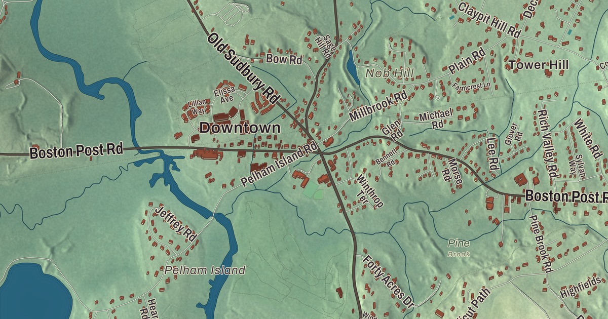
This aerial map of Wayland, Massachusetts was created in 2026 using real geographic data to bring the town’s streets, buildings, neighborhoods, ponds and waterways, mountains and ridgelines, and terrain together in one highly detailed view. Look closer and you can pick out the familiar places that make Wayland feel like home. Start with the street you know, then see how it connects to the rest of the Wayland you call home. Click here to purchase a print of this map for your wall.
Explore an aerial view of Wayland, Massachusetts
Start with Downtown and Cochituate. Follow Cochituate Road, Old Sudbury Road, Old Connecticut Path, Main Street, Concord Road, and Boston Post Road across town. Then look outward toward Tower Hill.
Farrar Pond, Folsom Pond, Lake Cochituate, Dudley Pond, Hathaway Hill, Nob Hill, Overthrough Hill, and Pelham Island are all labeled on the map. Every one of those names is printed directly on the artwork, giving you plenty to explore.
The Town of Wayland’s recorded history dates European settlement to 1638. Wayland was incorporated as a town in 1780. The town remains part of Middlesex County today. Click the image below to see the area as it looked in 2026.
Take a closer look at the Wayland map
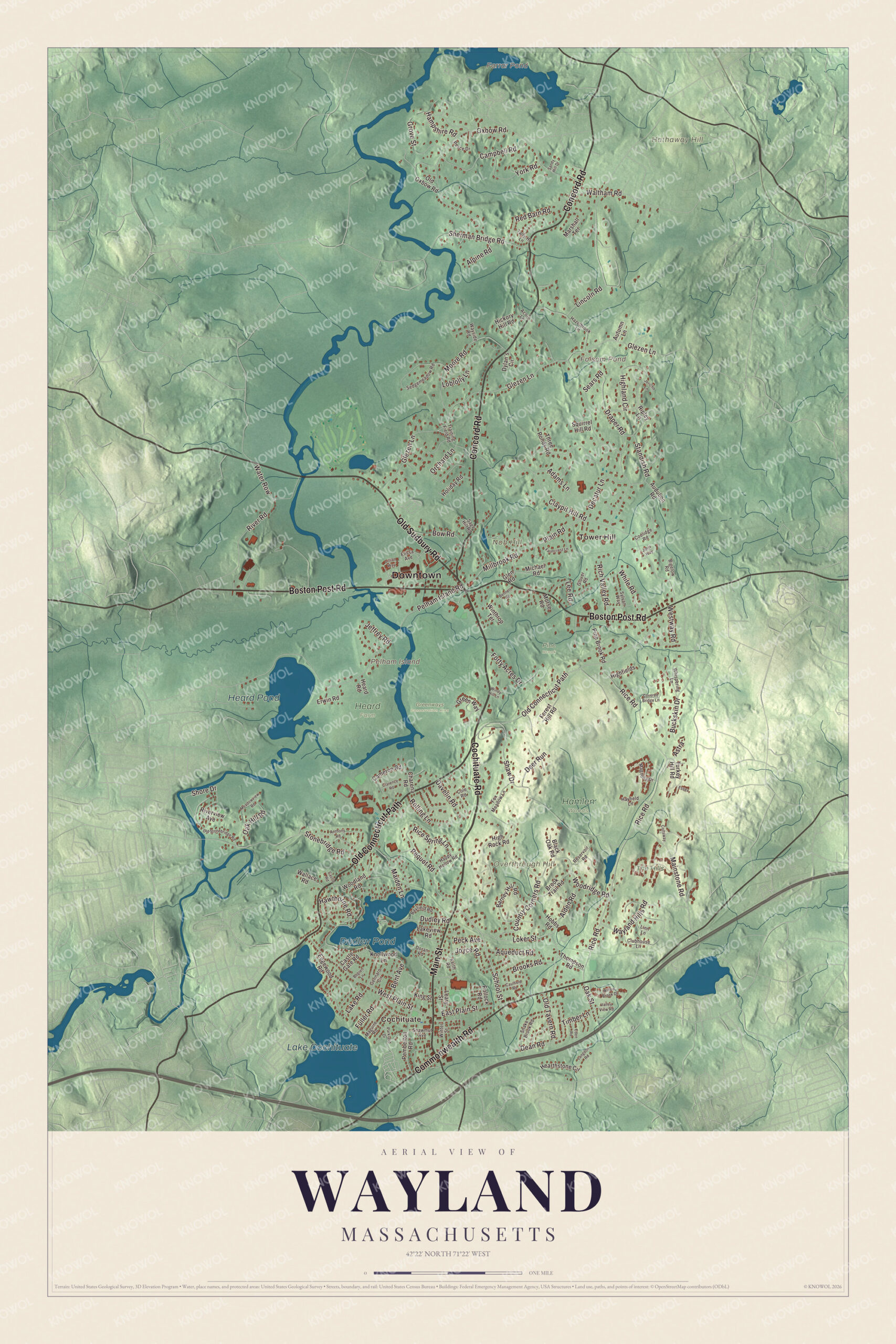
Click to explore a larger preview. The digital watermark does not appear on printed maps.
Names on this map
These names are printed on this map.
Places: Downtown, Cochituate, Tower Hill, Hathaway Hill, Nob Hill, Overthrough Hill, Pelham Island, Farrar Pond, Folsom Pond, Lake Cochituate, Dudley Pond, Heard Pond, Greenways Conservation Area, Hamlen Woods, Heard Farm, Pine Brook and The Hills.
Streets and roads: Cochituate Road, Old Sudbury Road, Old Connecticut Path, Main Street, Concord Road, Boston Post Road, Commonwealth Road, School Street, Glezen Lane, Stonebridge Road, Shore Drive, Rice Road.
More street names, A to Z
Acorn Lane, Adams Lane, Alden Road, Alpine Road, Anthony Road, Aqueduct Road, Astra, Audubon Road, Autumn Lane, Barney Hill Road, Bayfield Road, Bennett Road, Bent Avenue, Bigelow Road, Black Oak Road, Bogren Lane, Bow Road, Brooks Road, Brook Trail Road, Buckskin Drive, Cameron Road, Campbell Road, Castle Gate Road, Castle Road, Caulfield Road, Charena Road, Clarence Road, Claypit Hill Road, Clubhouse Lane, Cole Road, Coltsway, Coolidge Road, Country Corners Road, Covered Bridge Lane, Davelin Road, Dean Road, Decatur Lane, Deer Run, Doran Road, Draper Road, Dudley Road, Dylan's Circle, East Plain Street, Eden Road, Edgewood Road, Elissa Avenue, Erwin Road, Essex, Farmcrest Lane, Forest Hill Road, Forty Acres Drive, Fox Meadow Lane, Fuller Road, Gennaro Circle, Glen Road, Glover Road, Green Way, Grove Street, Hampshire Road, Happy Hollow Road, Hawthorne Road, Hayfield Lane, Hazelbrook Lane, Heard Road, Hearthstone Circle, Hickory Hill Road, Highfields, Highland Circle, High Rock Road, Hobbs Road, Holiday Road, Jeffrey Road, Jericho Lane, Joels Way, Joyce Road, Keith Road, King Street, Knollwood Lane, Lake Road, Lakeview Road, Langdon Road, Leary Street, Lee Road, Lillian Way, Lincoln Road, Linn Lane, Loblolly Lane, Loker Street, Magnolia Drive, Maguire Road, Maiden Lane, Mainstone Road, Marshall Terrace, Meadowview Road, Michael Road, Millbrook Road, Moore Road, Morse Road, Oak Hill Road, Oak Street, Old Oxbow Road, Old Stonebridge Road, Old Tavern Road, Orchard Lane, Oxbow Road, Parkland Drive, Peck Avenue, Pelham Island Road, Pemberton Road, Pequot Road, Pesce Drive, Pine Brook Road, Plain Road, Pollock Road, Red Barn Road, Reservoir Road, Rice Spring Lane, Rich Valley Road, Ripley Lane, River Road, Riverview Avenue, Rolling Lane, Sage Hill Road, Sandy Hill Drive, Sears Road, Sedgemeadow Road, Shaw Drive, Shawmut Avenue, Sherman Bridge Road, Snake Brook Road, Squirrel Hill Road, Standish Road, Sylvan Way, Tally-Ho Lane, Thompson Road, Three Ponds Road, Timber Lane, Training Field Road, Turkey Hill Road, Valley View Road, Wallace Road, Waltham Road, Water Row, Wayland Hills Road, Wayside Road, West Plain Street, Westway Road, Whispering Lane, White Road, Willow Brook Drive, Windy Hill Lane, Winter Street, Winthrop Terrace, Woodland Road, Woodridge Road, York Road.
See it on a wall
The Wayland map as a framed print. Swipe for more.


We designed the artwork at KNOWOL using Wayland’s real streets, buildings, neighborhoods, ponds and waterways, mountains and ridgelines, and terrain, the town boundary, and the way buildings spread across the town. Then we chose the color, relief, lettering, and layout that make the map look great on the wall.
This beautifully detailed map of Wayland makes an attractive addition to your office, library, or den and can even be used to teach children the geography and history of the area. When you’re done exploring, click here to get your copy of the Wayland, Massachusetts map.