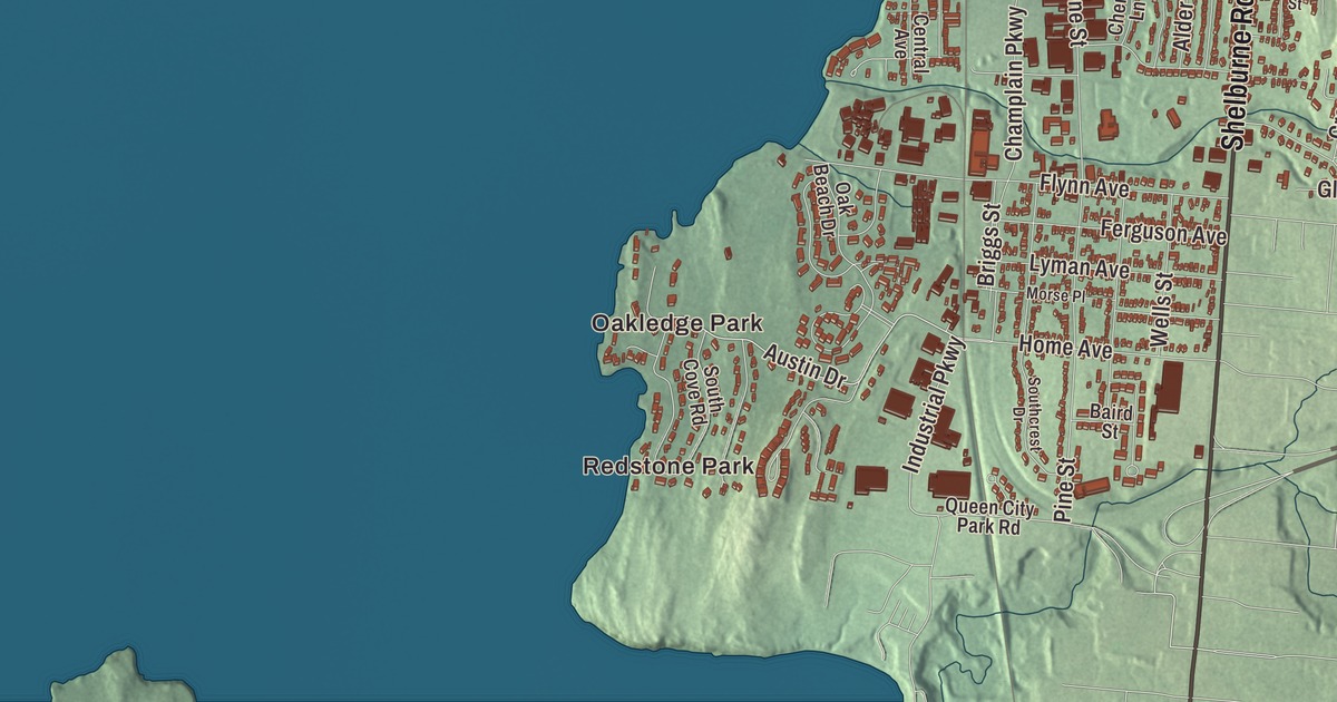
If you grew up in Burlington, you measured the city in blocks of Main Street and Willard Street, in bike rides out from Oakledge Park, and in sunsets over Lake Champlain. This map prints Lake Champlain, Oakledge Park, Redstone Park and Starr Farm Beach, and Main Street, Park Street, Riverside Avenue, North Willard Street, South Willard Street and North Champlain Street.
Burlington is a city in Chittenden County, Vermont, and the county seat.
KNOWOL made this map in 2026 from public survey data, working from Burlington’s real streets, buildings, waterways, terrain and city line, then choosing the color, relief, lettering and layout to give it the look of an old atlas. The shaded terrain comes from United States Geological Survey elevation data: the city is built on a strip of land running about six miles south from the mouth of the Winooski River, and it rises from the water’s edge to a height of 300 feet. The streets and the city line come from the Census Bureau. Burlington had 44,743 people at the 2020 census, the most of any city or town in Vermont. Click here to purchase a print of this map for your wall.
A lake port
New Hampshire’s governor, Benning Wentworth, granted Burlington on June 7, 1763, to Samuel Willis and 63 others. Nobody is sure where the name came from: the two candidates are the Burling family of New York, who held land in nearby towns, and Richard Boyle, 3rd Earl of Burlington. Settlers built a few log huts in 1775, but the Revolution held things up, and the town was settled for good in 1783. In 1791, the year Vermont became a state, Burlington was chosen for the state’s university, and the University of Vermont, founded that year, is the oldest university in Vermont.
Its place on Lake Champlain helped Burlington grow into a port of entry and a center of trade, especially once the Champlain, Erie and Chambly canals opened between 1823 and 1843 and steamboats met the railroads at its wharves. In 1808, by its city page’s account, the world’s first lake-going steamboat was built here. Between 1836 and 1890 the federal government built the Burlington Breakwater, a stone-filled timber crib wall that still shelters the harbor. The city also became a busy lumbering and manufacturing center, for a time the third largest lumber market in the world, and it was incorporated as a city in 1865. Those prosperous years left behind buildings by Ammi B. Young, H. H. Richardson and McKim, Mead and White. Along Main Street, between downtown and the university, the Main Street and College Street Historic District keeps the fine houses the lumber trade built, beginning in the 1820s.
Firsts
Burlington’s history is full of beginnings. The Fletcher Free Library, founded in 1873 with an endowment from Mary Martha Fletcher, moved into a new Beaux-Arts building paid for by Andrew Carnegie, the first of Vermont’s four Carnegie libraries, and it’s the largest public library in the state. Ohavi Zedek, founded in 1876, is Vermont’s oldest Jewish congregation, and its brick synagogue of 1885 is among the oldest synagogue buildings still standing in the United States. During the 1886 Burlington Winter Carnival, the Montreal Crystals played a team from the Van Ness House hotel the first known international ice hockey match. The philosopher and educator John Dewey was born in Burlington in 1859.
The newer firsts are just as local. In 1978 Ben Cohen and Jerry Greenfield opened their first ice cream scoop shop in an old gas station in Burlington, and Ben & Jerry’s went on to sell around the world. Phish formed in the city in 1983. The Church Street Marketplace, four blocks of Church Street given over to people on foot, was built in 1980 and 1981 after summer street fairs on the street showed it could work. And by its city page’s account, Burlington became the first city in the United States to run entirely on renewable energy, drawing on the Winooski One hydro plant, wind turbines, solar panels and the wood-burning McNeil Generating Station.
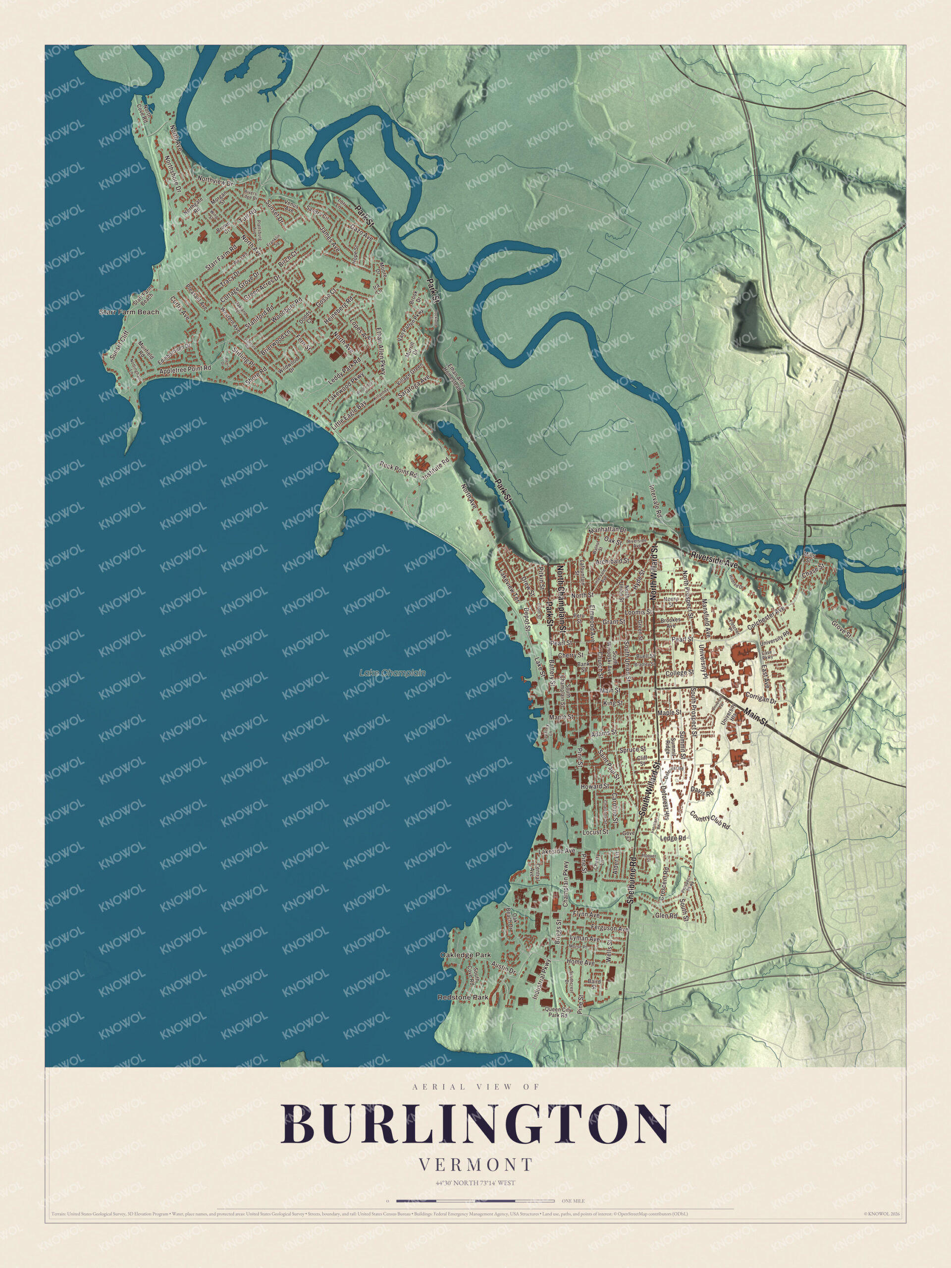
Click to explore a larger preview. The digital watermark does not appear on printed maps.
Names on this map
These names are printed on this map.
Places: Redstone Park, Oakledge Park, Starr Farm Beach and Lake Champlain.
Streets and roads: Park Street, Main Street, Riverside Avenue, North Willard Street, South Willard Street, North Champlain Street, Shelburne Road, Colchester Avenue, Pearl Street, North Prospect Street, Lake Street, South Union Street.
More street names, A to Z
Adams Street, Alder Lane, Alexis Drive, Appletree Point Road, Archibald Street, Austin Drive, Baird Street, Bank Street, Battery Street, Birch Court, Bradley Street, Brierwood Lane, Briggs Street, Brook Drive, Brookes Avenue, Browe Court, Buell Street, Caroline Street, Case Parkway, Central Avenue, Champlain Parkway, Charlotte Street, Chase Street, Cherry Lane, Cherry Street, Church Street, Cliff Street, College Street, Corrigan Drive, Cottage Grove Drive, Country Club Road, Crescent Road, Curtis Avenue, Davis Road, Deforest Heights, Deforest Road, Depot Street, Dodds Court, Drew Street, East Avenue, Edinborough Drive, Elmwood Avenue, Ethan Allen Homestead, Ethan Allen Parkway, Ferguson Avenue, Fern Street, Fletcher Place, Flynn Avenue, Franklin Square, Front Street, Gazo Avenue, Glen Road, Gosse Court, Gove Court, Grant Street, Green Acres Drive, Green Street, Grove Street, Heineberg Road, Henry Street, Hildred Drive, Home Avenue, Hoover Street, Hope Street, Howard Street, Hyde Street, Industrial Parkway, Institute Road, Intervale Avenue, Intervale Road, Ira Lane, Iranistan Road, James Avenue, Killarney Drive, King Street, Lafountain Street, Lakeside Avenue, Lakeview Terrace, Lakewood Parkway, Lavalley Lane, Leddy Park Road, Ledge Road, Little Eagle Bay, Locust Street, Loomis Street, Lopes Avenue, Lori Lane, Lyman Avenue, Manhattan Drive, Mansfield Avenue, Maple Street, Mills Street, Moore Drive, Morgan Street, Morrill Drive, Morse Place, Muirfield Road, North Avenue, North Cove Road, Northgate Road, Northshore Drive, North Street, North Union Street, Northview Drive, Nottingham Lane, Oak Beach Drive, Oakland Terrace, Oak Street, Peru Street, Pine Street, Pitkin Street, Plattsburg Avenue, Pleasant Avenue, Prospect Parkway, Queen City Park Road, Rivers Edge Drive, Rockland Street, Rock Point Road, Saint Paul Street, Sandra Circle, Saratoga Avenue, Shore Road, South Champlain Street, South Cove Road, Southcrest Drive, South Prospect Street, South Street, South Winooski Avenue, Spruce Street, Stanbury Road, Staniford Road, Starr Farm Road, Stirling Place, Summit Ridge, Summit Street, Sunset Cliff, Sunset Drive, Tracy Drive, Turf Road, University Heights, University Place, University Road, University Terrace, Van Patten Parkway, Venus Avenue, Village Green, Walnut Street, Wells Street, Western Avenue, West Road, Wildwood Drive, Wing Street, Woodbury Road, Woodridge Drive.
See it on a wall
The Burlington map as a framed print. Swipe for more.


From Oakledge Park to the lake
Oakledge Park, on the waterfront in the South End, is where the Burlington Bike Path begins. After a 1980 plan for two 18-story condominium towers on the waterfront, citizens organized to ask for a bike path along the shore instead, and by 1990 the path ran from Oakledge Park north to the Winooski River. It follows the old Island Line railroad, and beyond the river the trail now goes four miles out into the lake on the railroad causeway toward the Champlain Islands, with a summer bike ferry across the gap. High above the harbor, Battery Park is named for the American guns that stood there in the War of 1812, and Rudyard Kipling, by the park page’s account, counted its sunset among the two finest in the world.
Downtown lies west of South Willard Street, and Main Street runs on east between downtown and the University of Vermont. On the Winooski River floodplain, beside Route 127, stands the house Ethan Allen built around 1787, the only one of his homes left in Vermont and now the Ethan Allen Homestead museum. At the southwest end of the university campus, the old Redstone estate, built in 1889 for the lumberman Andrew Buell, became part of the campus in 1921. Redstone Park, Starr Farm Beach, Park Street, Riverside Avenue and North Champlain Street are printed on the map too.
This map of Burlington would make a handsome piece for an office, library or den, and it can even help teach children the geography and history of Vermont’s lake city. It’s made for everyone who calls Burlington home and shows the city as it looks today, from Oakledge Park to the Winooski River. KNOWOL created it in 2026, and it’s printed on museum quality archival paper. Zoom in on the preview above to explore the details, then click here to get your copy of the Burlington, Vermont map.

Sources
- Burlington, Vermont, Wikipedia
- Town histories and representatives, B towns, Vermont Legislature
- University of Vermont, Wikipedia
- Burlington Breakwater, Wikipedia
- Main Street and College Street Historic District, Wikipedia
- Fletcher Free Library, Wikipedia
- Ohavi Zedek, Wikipedia
- John Dewey, Wikipedia
- Ben & Jerry’s, Wikipedia
- Phish, Wikipedia
- Church Street Marketplace, Wikipedia
- Island Line Trail, Wikipedia
- Battery Park (Burlington, Vermont), Wikipedia
- Ethan Allen Homestead, Wikipedia
- Redstone (Burlington, Vermont), Wikipedia