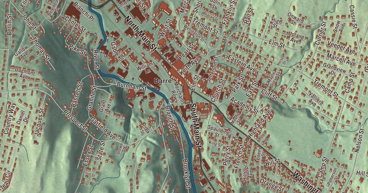
If you grew up in Barre, you know the walk along North Main Street past the brick and granite blocks to City Park and the Opera House. This map prints North Main Street and South Main Street, with Maple Avenue, Washington Street, Prospect Street and Warren Street, and the name Barre.
Barre is in Washington County, almost entirely surrounded by the separate Town of Barre.
KNOWOL made this map in 2026 from public survey data and gave it the look of an old atlas. The shaded terrain comes from United States Geological Survey elevation data, and the streets and the city line come from the Census Bureau. The city covers 4.0 square miles, drained by the Stevens Branch and the Jail Branch, both tributaries of the Winooski River, and it had 8,491 people at the 2020 census. The Barre Downtown Historic District, along North Main Street, is on the National Register of Historic Places. Click here to purchase a print of this map for your wall.
From Wildersburgh to the Granite City
The land was granted on November 6, 1780, to William Williams and others, under the name Wildersburgh, and the grant took in both today’s town and city. John Goldsbury and Samuel Rodgers settled it with their families in 1788. The settlers didn’t care for the name, and the city’s page gives two accounts of the new one: that it honors Isaac Barré, a member of Parliament who championed the American colonies and coined the phrase “Sons of Liberty,” and, in an older account it quotes, that at a 1793 town meeting Ezekiel Dodge Wheeler bid £62 toward a meeting house for the right to name the town, and chose Barre after Barre, Massachusetts, where some of the settlers came from.
Granite made the city. Quarrying began at Millstone Hill soon after the War of 1812, and the industry boomed when the railroad arrived. Large numbers of people came from Italy, Scotland, Spain, Scandinavia, Greece, Lebanon, Canada and beyond, and the population jumped from 2,060 in 1880 to 6,790 in 1890 and 10,000 in 1894; by the turn of the century Barre was noted as the state’s most diverse city. In 1895, 4.0 square miles of the town were set off and incorporated as the City of Barre. “Barre Gray” granite is prized worldwide for its fine grain and its resistance to weather, and Hope Cemetery shows off the carvers’ art.
A city of workers
The Italian immigrants in particular brought a radical labor movement to Barre. In 1900, volunteers from the Italian community built the Socialist Labor Party Hall at 46 Granite Street, trimmed in Barre granite and carved with the party’s arm and hammer. It held debates, dances and boxing matches, a cooperative store opened in its basement in 1901, and from 1900 to 1936 it housed the Granite Cutters’ International Association. During the 1912 textile strike in Lawrence, Massachusetts, Barre’s Italian families took in 35 of the strikers’ children, all of them received at the hall. The Barre Historical Society bought it in 1995 to restore it, and it was named a National Historic Landmark in 2000. In 2006 the hall saw the first rehearsals and performances of the musical Hadestown, years before it reached Broadway.
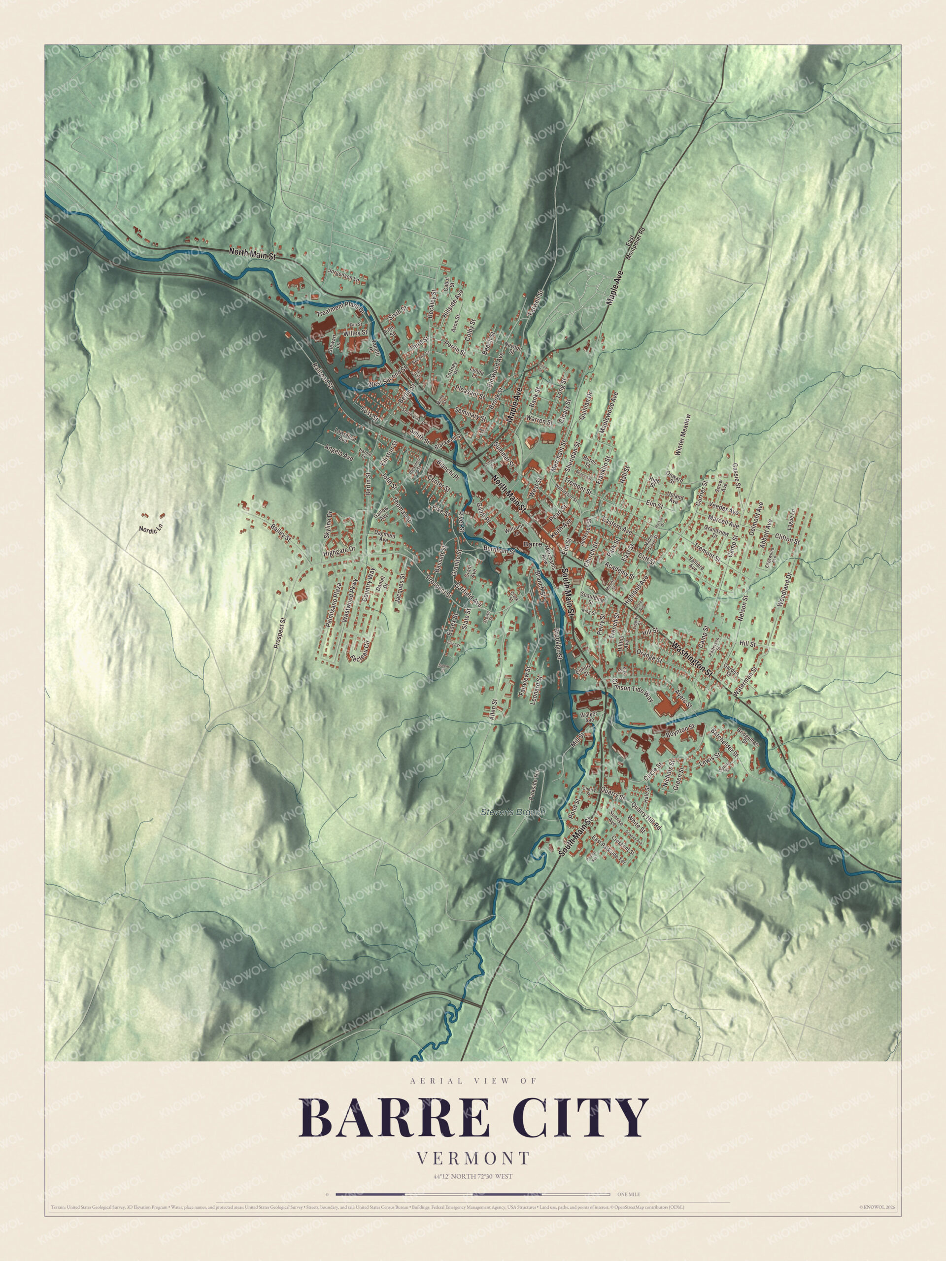
Click to explore a larger preview. The digital watermark does not appear on printed maps.
Names on this map
These names are printed on this map.
Places: Stevens Branch and Barre.
Streets and roads: South Main Street, North Main Street, Maple Avenue, Washington Street, Prospect Street, Warren Street, Batchelder Street, White Street, Pike Street, Berlin Street, Westwood Parkway, Ayers Street.
More street names, A to Z
Abbott Avenue, Academy Street, Allen Street, Angela Avenue, Avon Street, Bailey Street, Bank Street, Bassett Street, Beacon Street, Beckley Street, Beech Street, Belvidere Street, Bianchi Place, Blackwell Street, Bolster Avenue, Boynton Street, Branch Street, Bridgeman Street, Brooklyn Street, Brook Street, Burnham Street, Burns Street, Cabot Street, Camp Street, Cassie Street, Center Street, Cherry Street, Church Street, Circle Street, Clark Street, Cleary Street, Cliff Street, Clifton Street, Colby Street, Cottage Street, Country Way, Crescent Street, Crimson Tide Way, Currier Street, Dagmont Avenue, Daniel Drive, Delmont Avenue, Downes Avenue, Eastern Avenue, East Montpelier Road, East Parkside Terrace, East Street, Edgewood Avenue, Elliot Street, Elliston Street, Elmore Street, Elm Street, Elmwood Avenue, Essex Street, Fairview Street, Farwell Street, Fecteau Circle, Fifth Street, First Street, Fortney Place, Foss Street, Franklin Street, French Street, Gable Place, Gallow Avenue, Garden Street, Garfield Avenue, Grandview Drive, Granite Street, Grant Avenue, Green Street, Hale Street, Hall Street, Harold Street, Hersey Drive, Highgate Drive, Highland Avenue, High Street, Hillside Avenue, Hill Street, Hilltop Avenue, Jacques Street, Jefferson Street, John Street, Jorgenson Lane, Keith Avenue, King Street, Kirk Street, Lague Lane, Laurel Street, Lawrence Avenue, Leonard Street, Lewis Street, Liberty Street, Long Street, Lunde Lane, Maple Grove Street, Maplewood Avenue, Marcell Avenue, Merchants Row, Merchant Street, Mill Street, Milne Street, Mount Street, Nelson Street, Newton Street, Nichols Street, Nordic Lane, Onward Street, Orange Street, Palmisano Plaza, Parkside Terrace, Park Street, Patterson Street, Pearl Street, Perrin Street, Perry Street, Pleasant Street, Pond Street, Pouliot Avenue, Quarry Hill Road, Quarry Street, Quinlan Drive, Railroad Street, River Street, Salem Street, Second Street, Seminary Street, Sheridan Street, Sixth Street, Skyline Drive, Smith Street, Snow Avenue, South Vine Street, Spaulding Street, Spring Street, State Street, Stewart Lane, Stowe Street, Summer Street, Sunrise Avenue, Third Street, Thomas Street, Treatment Plant Drive, Tremont Street, Union Street, Upland Avenue, Valliere Avenue, Vanetti Place, Veeder Avenue, Walker Avenue, Waterman Street, Wellington Street, West Second Street, West Street, Willey Street, Williams Lane, Winter Meadow, Woodland Drive, Zan Street.
See it on a wall
The Barre City map as a framed print. Swipe for more.


Along North Main Street
The downtown historic district runs along North Main Street from Depot Square to City Park, the triangle formed by Washington, Church and North Main streets, and most of its buildings went up between 1880 and 1925. Barre City Hall and Opera House stands on the west side of the park at 6 North Main Street. It was finished in 1899, designed by George G. Adams, to replace a city hall that burned the year before. The city offices are on the ground floor and the theater fills the floors above. Helen Keller, Eugene V. Debs, John Philip Sousa and George M. Cohan took its stage, and in 1912 William Howard Taft and Theodore Roosevelt both spoke from its balcony. Northwest of downtown, between North Main Street and the Stevens Branch, the Vermont Granite Museum fills the 1895 Jones Brothers Granite Shed, where granite blocks were once finished into cemetery markers.
Alfred Hitchcock’s The Trouble with Harry had its premiere at the Paramount Theater in Barre on September 27, 1955. The city’s list of notable people includes Governor Phil Scott, Governor Deane C. Davis and Governor Charles Poletti of New York, and the artist Gayleen Aiken. Maple Avenue, Prospect Street and Warren Street are printed on the map too.
This Barre map makes a handsome addition to an office, library or den, and it can even help teach children the geography and history of a granite city built by people from around the world. It’s made for anyone who calls Barre City home, from North Main Street to South Main Street. KNOWOL created it in 2026, and it’s printed on museum quality archival paper. Zoom in on the preview above to explore the details, then click here to get your copy of the Barre City, Vermont map.

Sources