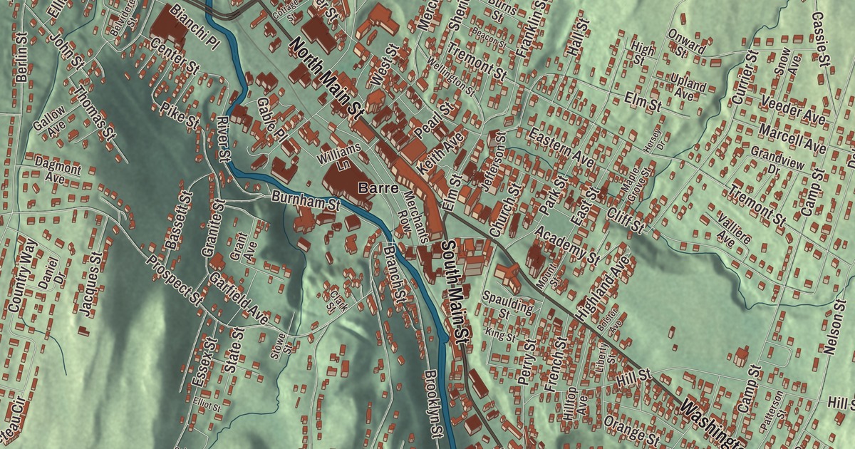
Barre Town wraps almost all the way around Barre City, and its own villages are East Barre, Graniteville, South Barre and Websterville. This map prints the name Barre with North Main Street, South Main Street, Maple Avenue, Washington Street, Prospect Street and Warren Street.
Barre Town is in Washington County, and it’s a separate municipality from the city it surrounds.
KNOWOL made this map in 2026 from public survey data and gave it the look of an old atlas. The shaded terrain comes from United States Geological Survey elevation data, and the roads and the town line come from the Census Bureau. The town covers 30.7 square miles, and it had 7,923 people at the 2020 census, which its page says makes it the third largest municipality in Washington County and the 16th largest in Vermont. Click here to purchase a print of this map for your wall.
One Barre, then two
The town began as Wildersburgh, granted on November 6, 1780, and taking in all of today’s town and city. The inhabitants didn’t like the name, and in 1793 they changed it to Barre. Over time much of the town’s population settled in its lower valley, and in 1895 just under four square miles of that more populated part were set off as the City of Barre, and since then the town and the city have gone on as separate governments. Barre Town runs itself by town meeting and a five-member selectboard, with a town manager appointed by the board.
Granite drove the growth. Large deposits were found at Millstone Hill soon after the War of 1812, and when the railroad came, the industry boomed and drew workers from Italy, Scotland, Spain, Scandinavia, Greece, Lebanon, Canada and other countries. Today Millstone Hill and the nearby Barre Town Forest hold a wooded trail network, with old mining holes and grout piles still scattered through the woods.
The quarry villages
Graniteville, near the town’s southern border, is home to the Rock of Ages granite company, founded in 1885, and its E. L. Smith Quarry, which its pages call the world’s largest deep hole granite quarry. Quarriers there now cut the stone with diamond-tipped wire saws and water jets, and visitors can watch them work from the company’s factory and gift shop. The quarry served as a backdrop in Batman & Robin and Star Trek, and Barre Granite from Rock of Ages was carved by Frank Gaylord into the United States Korean War Memorial at the United Nations Memorial Cemetery in Busan, South Korea. East Barre sits near the eastern border where U.S. Route 302 meets Route 110, beside the Jail Branch of the Winooski River. South Barre lies south of the city along Route 14 and the Stevens Branch, and Websterville is the fourth village.
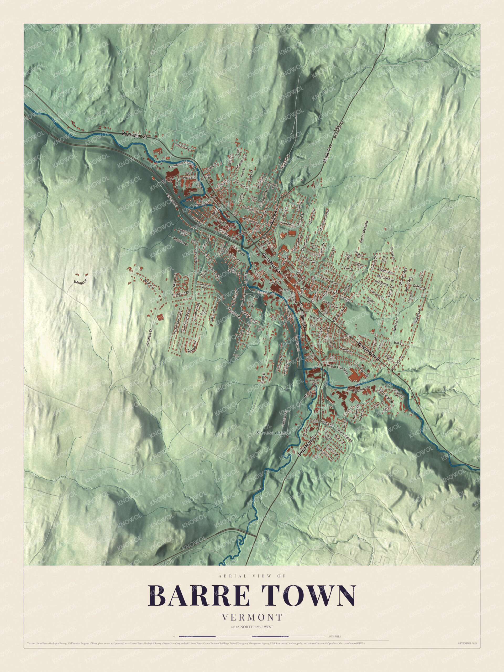
Click to explore a larger preview. The digital watermark does not appear on printed maps.
Names on this map
These names are printed on this map.
Places: Stevens Branch and Barre.
Streets and roads: South Main Street, North Main Street, Maple Avenue, Washington Street, Prospect Street, Warren Street, Batchelder Street, White Street, Pike Street, Berlin Street, Westwood Parkway, Ayers Street.
More street names, A to Z
Abbott Avenue, Academy Street, Allen Street, Angela Avenue, Avon Street, Bailey Street, Bank Street, Bassett Street, Beacon Street, Beckley Street, Beech Street, Belvidere Street, Bianchi Place, Blackwell Street, Bolster Avenue, Boynton Street, Branch Street, Bridgeman Street, Brooklyn Street, Brook Street, Burnham Street, Burns Street, Cabot Street, Camp Street, Cassie Street, Center Street, Cherry Street, Church Street, Circle Street, Clark Street, Cleary Street, Cliff Street, Clifton Street, Colby Street, Cottage Street, Country Way, Crescent Street, Crimson Tide Way, Currier Street, Dagmont Avenue, Daniel Drive, Delmont Avenue, Downes Avenue, Eastern Avenue, East Montpelier Road, East Parkside Terrace, East Street, Edgewood Avenue, Elliot Street, Elliston Street, Elmore Street, Elm Street, Elmwood Avenue, Essex Street, Fairview Street, Farwell Street, Fecteau Circle, Fifth Street, First Street, Fortney Place, Foss Street, Franklin Street, French Street, Gable Place, Gallow Avenue, Garden Street, Garfield Avenue, Grandview Drive, Granite Street, Grant Avenue, Green Street, Hale Street, Hall Street, Harold Street, Hersey Drive, Highgate Drive, Highland Avenue, High Street, Hillside Avenue, Hill Street, Hilltop Avenue, Jacques Street, Jefferson Street, John Street, Jorgenson Lane, Keith Avenue, King Street, Kirk Street, Lague Lane, Laurel Street, Lawrence Avenue, Leonard Street, Lewis Street, Liberty Street, Long Street, Lunde Lane, Maple Grove Street, Maplewood Avenue, Marcell Avenue, Merchants Row, Merchant Street, Mill Street, Milne Street, Mount Street, Nelson Street, Newton Street, Nichols Street, Nordic Lane, Onward Street, Orange Street, Palmisano Plaza, Parkside Terrace, Park Street, Patterson Street, Pearl Street, Perrin Street, Perry Street, Pleasant Street, Pond Street, Pouliot Avenue, Quarry Hill Road, Quarry Street, Quinlan Drive, Railroad Street, River Street, Salem Street, Second Street, Seminary Street, Sheridan Street, Sixth Street, Skyline Drive, Smith Street, Snow Avenue, South Vine Street, Spaulding Street, Spring Street, State Street, Stewart Lane, Stowe Street, Summer Street, Sunrise Avenue, Third Street, Thomas Street, Treatment Plant Drive, Tremont Street, Union Street, Upland Avenue, Valliere Avenue, Vanetti Place, Veeder Avenue, Walker Avenue, Waterman Street, Wellington Street, West Second Street, West Street, Willey Street, Williams Lane, Winter Meadow, Woodland Drive, Zan Street.
See it on a wall
The Barre Town map as a framed print. Swipe for more.


Thunder Road and the town’s people
Thunder Road, a quarter-mile, high-banked paved track in Barre Town, was founded by Ken Squier, built with paving contractor Reginald Cooley, and has run since 1960. In its 50th season, in 2009, NASCAR legends Richard Petty and Bobby Allison paid it a visit, and the city’s page says Governor Phil Scott often takes part in its “Governor’s Cup 150.” The children’s author Katherine Paterson, winner of the Newbery Award, the poet Norman Dubie and the folk singers Lui Collins and Helen Bonchek Schneyer are on the town’s list of notable people. Barre Town Middle and Elementary School teaches students from preschool through eighth grade.
The streets printed by name on this map are North Main Street, South Main Street, Maple Avenue, Washington Street, Prospect Street and Warren Street. North Main Street and Washington Street meet at City Park in Barre City, the separate city the town surrounds.
This Barre Town map is a fine addition to an office, library or den, and it can even help teach children the geography and history of a granite town with deep quarries. It’s made for anyone who calls Barre Town home, from Graniteville to East Barre. KNOWOL created it in 2026, and it’s printed on museum quality archival paper. Zoom in on the preview above to explore the details, then click here to get your copy of the Barre Town, Vermont map.

Sources