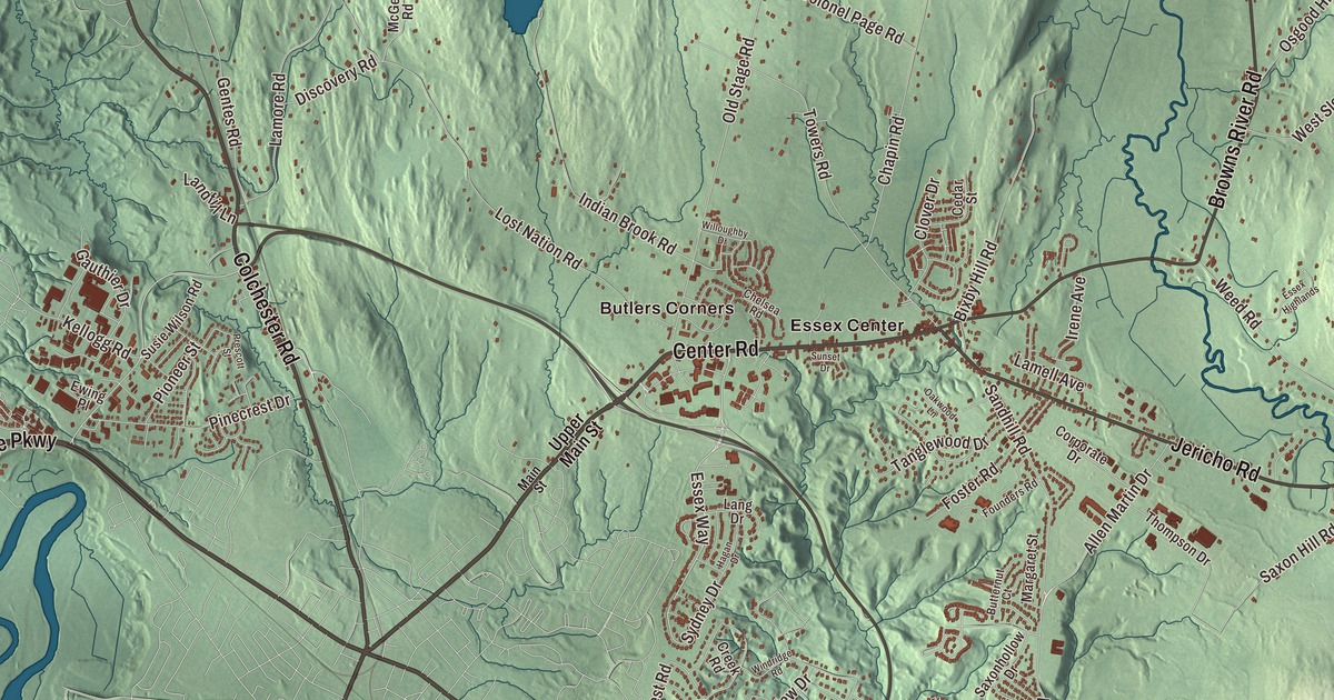
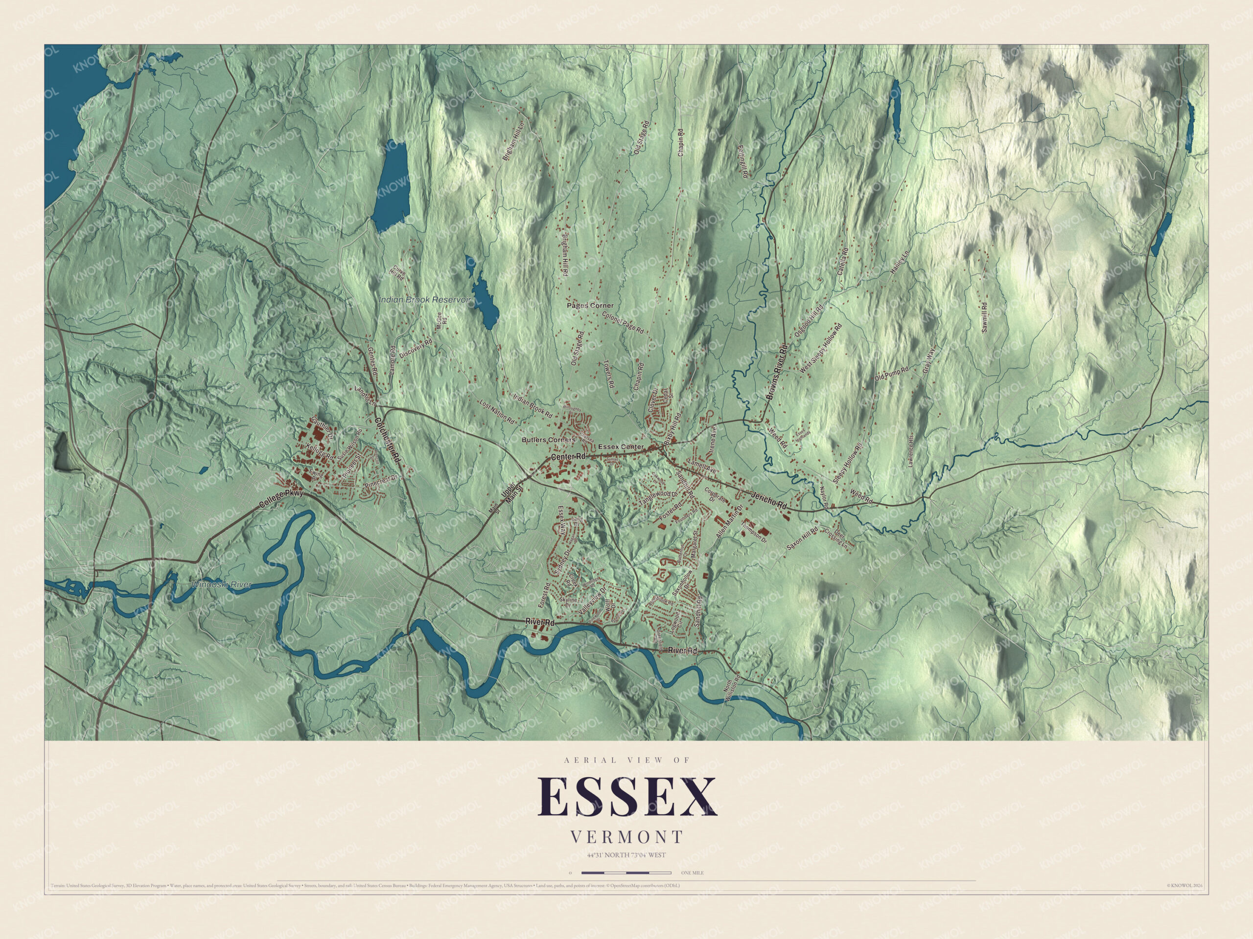
The town of Essex has moved its center more than once. Butlers Corners came first, then Essex Center, and until 2022 the village of Essex Junction, now a city of its own, sat inside the town. This map prints Butlers Corners, Essex Center and Pages Corner, the Indian Brook Reservoir and the Winooski River, and roads like Jericho Road, Browns River Road, Center Road, River Road, Colchester Road and College Parkway.
Essex is a town in Chittenden County, Vermont.
KNOWOL made this map in 2026 from public survey data and gave it the look of an old county atlas, with the hills shaded from United States Geological Survey elevation data and the roads and town line taken from the Census Bureau. Essex sits in the middle of Chittenden County, with the Winooski River along its southern edge and the city of Essex Junction tucked into its southwest side. Click here to purchase a print of this map for your wall.
Butlers Corners and Essex Center
New Hampshire granted Essex on June 7, 1763, naming it after the Earl of Essex, and the town organized on March 22, 1786. Dubartis Willard was its first representative in the legislature that same year. In 1822 Roswell Butler bought land along what’s now Upper Main Street and soon built a brick house and a store there; his brother built a house too, and the neighborhood has been Butlers Corners ever since. Butler’s main business was lumber, which he shipped through the Champlain Canal to towns on the Hudson River. His Federal-style house, built about 1822, is on the National Register of Historic Places. Butlers Corners was a center of town life until 1830, when Essex Center took over, with the town hall, the school and the churches.
A village and a town
On November 15, 1892, the Village of Essex Junction was formed inside the town to give its residents sidewalks, water and sewers; the rural parts of town didn’t want those services or the taxes that came with them. As the rest of town grew, it added services of its own, and by 1958 voters were petitioning to merge the two. Votes came and went for decades without passing in both places. On November 7, 2006, a merger finally passed in both, and the regional paper briefly reported that it had failed before running a correction. A petition forced a re-vote, and on January 23, 2007, the merger was overturned by 191 votes. Essex Junction later went its own way and became a city in 2022, and the two shared municipal services until July 1, 2023.
Click to explore a larger preview. The digital watermark does not appear on printed maps.
Names on this map
These names are printed on this map.
Places: Indian Brook Reservoir, Winooski River, Butlers Corners, Essex Center and Pages Corner.
Streets and roads: River Road, College Parkway, Center Road, Jericho Road, Browns River Road, Colchester Road, Sydney Drive, Essex Way, Old Stage Road, Chapin Road, Lost Nation Road, Brigham Hill Road.
More street names, A to Z
Alderbrook Road, Allen Martin Drive, Bixby Hill Road, Brigham Hill Lane, Butternut Court, Catella Road, Cedar Street, Chelsea Road, Clover Drive, Colonel Page Road, Corporate Drive, Creek Road, Curve Hill Road, Deer Crossing Lane, Discovery Road, Essex Highlands, Ewing Place, Forest Road, Foster Road, Founders Road, Gauthier Drive, Gentes Road, Gray Way, Greenfield Road, Hagan Drive, Hanley Lane, Indian Brook Road, Irene Avenue, Kellogg Road, Lamell Avenue, Lamore Road, Landfill Lane, Lang Drive, Lawrence Heights, Logwood Circle, Main Street, Margaret Street, McGee Road, Naylor Road, North Williston Road, Oakwood Lane, Old Pump Road, Osgood Hill Road, Pettingill Road, Pinecrest Drive, Pinewood Drive, Pioneer Street, Prescott Street, Raymond Drive, Sandhill Road, Sawmill Road, Saxon Hill Road, Saxonhollow Drive, Skyline Drive, Sleepy Hollow Road, Sunset Drive, Susie Wilson Road, Tanglewood Drive, Thompson Drive, Towers Road, Upper Main Street, Valleyview Drive, Weed Road, West Sleepy Hollow Road, Willoughby Drive, Windridge Road, Wolff Drive.
See it on a wall
The Essex map as a framed print. Swipe for more.


Essex has two large pieces of protected land. The Indian Brook Town Conservation Area covers 575 acres, and the Saxon Hill Town Forest covers 335. The Harriet Farnsworth Powell Museum, in a former two-room schoolhouse, keeps old costumes, school things and local memorabilia. Vermont Route 289, the Circ, crosses the town from east to west; it opened in October 1993 as part of a planned beltway around Burlington’s suburbs, and only the Essex section was finished before court challenges halted the rest. William B. Castle, born in Essex in 1814, opened Cleveland’s first lumberyard with his father and later served as mayor of Cleveland, Ohio.
On the map, find Jericho Road, Browns River Road, Center Road, River Road, Colchester Road and College Parkway. Butlers Corners, Essex Center and Pages Corner are printed too, and the Indian Brook Reservoir and the Winooski River are labeled on the map.
This map of Essex is made for everyone who calls Essex home, and it shows the town as it looks today, from Butlers Corners to the reservoir. Hang it in an office, library or den, or use it to teach children the geography and history of their town. KNOWOL created it in 2026, and it’s printed on museum quality archival paper. Zoom in on the preview above to explore the details, then click here to get your copy of the Essex, Vermont map.

Sources