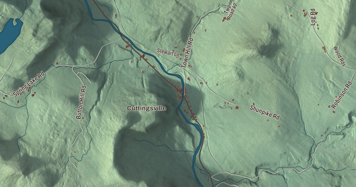
Shrewsbury climbs from Cuttingsville and the Mill River in its southwest corner up toward the Coolidge Range, with the Appalachian Trail and the Long Trail crossing the town from southwest to northeast. This map prints Cuttingsville, Russellville and North Shrewsbury, with Cold River Road, Northam Road, CCC Road, Tabor Road, Lottery Road and Gilman Road.
Shrewsbury is a town in Rutland County, Vermont.
KNOWOL made this map in 2026 from public survey data and gave it the look of an old county atlas, shading the hills from United States Geological Survey elevation data and drawing the roads and town line from the Census Bureau. The town covers 50.2 square miles, and 1,096 people lived here at the 2020 census. Click here to purchase a print of this map for your wall.
A mountain town east of Rutland
New Hampshire granted Shrewsbury on September 4, 1761, and named it for the Earl of Shrewsbury. The town organized on March 20, 1781, and sent Benedict Webber to the legislature that year. The Cold River rises in the Coolidge Range northeast of North Shrewsbury and flows southwest through that village before turning west toward Otter Creek. In the northwestern part of town, in a remote wooded ravine, the Brown Covered Bridge carries Upper Cold River Road over the river. Nichols M. Powers, a noted Vermont bridgewright then living in Clarendon, built it in 1880 for less than $1,100, and it’s the last bridge he’s known to have built. It took its name from George Brown, whose home stood about 100 yards away. It’s believed to be the only standing covered bridge in the United States with a slate roof, and it became a National Historic Landmark in 2014 as one of the finest and least-altered Town lattice truss covered bridges in the country. Flooding from Tropical Storm Irene closed it in 2011, and it reopened on July 5, 2016.
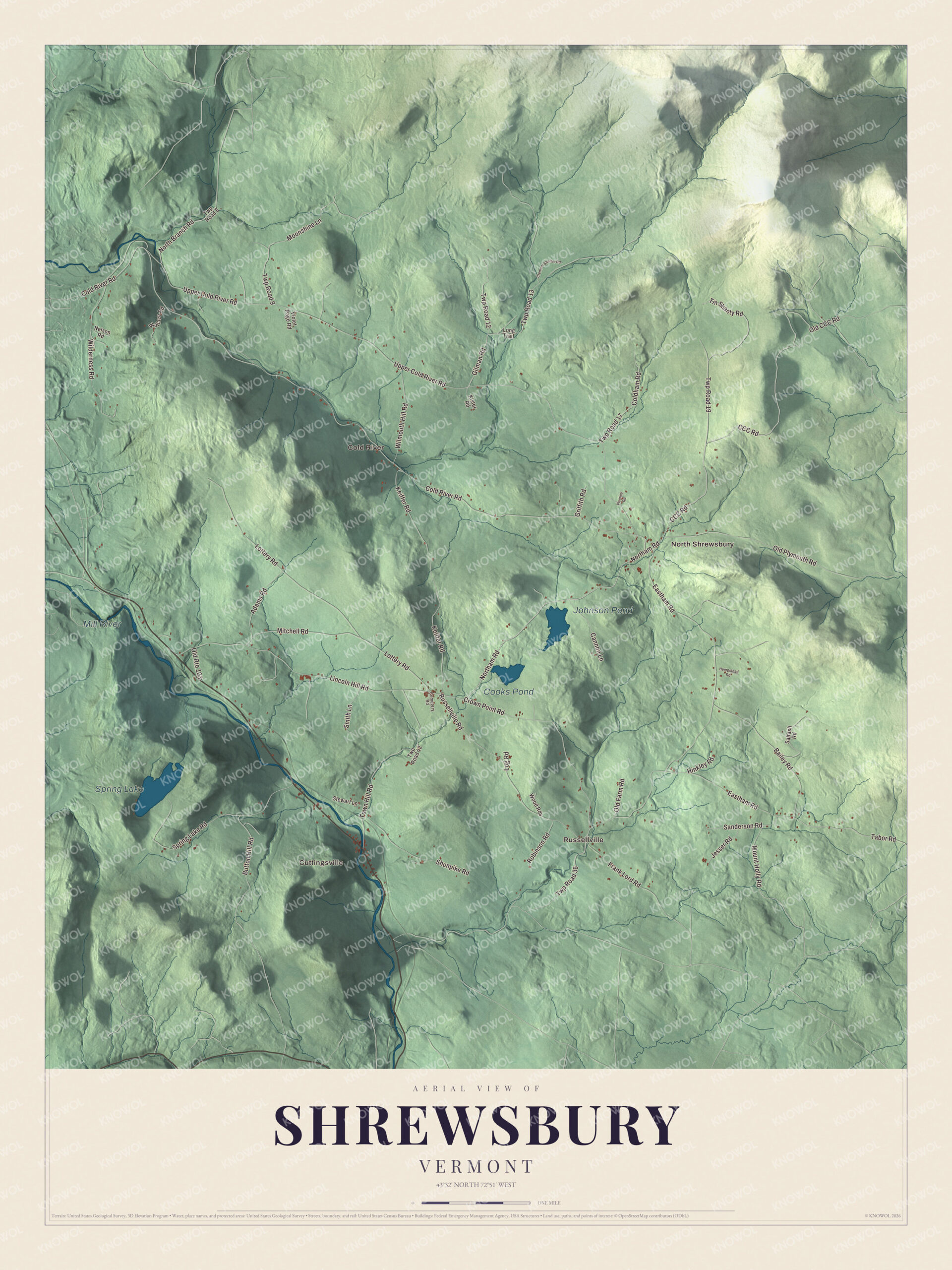
Click to explore a larger preview. The digital watermark does not appear on printed maps.
Names on this map
These names are printed on this map.
Places: Cuttingsville, Russellville, North Shrewsbury, Cold River, Spring Lake, Johnson Pond, Cooks Pond and Mill River.
Streets and roads: Cold River Road, Northam Road, CCC Road, Tabor Road, Lottery Road, Gilman Road, Upper Cold River Road, Eastham Road, Russellville Road, Lincoln Hill Road, Keiffer Road, Old Plymouth Road.
More street names, A to Z
Adams Road, Bailey Road, Button Hill Road, Cannon Lane, Cemetery Road, Clement Shelter Road, Coldham Road, Crown Point Road, Frank Lord Road, Griffith Road, Hempstead Road, Hinkley Road, Jesser Road, Kister Road, Log Road, Long Trail, Mitchell Road, Moonshine Lane, Mount Holly Road, Nelson Road, North Branch Road, Old CCC Road, Old Farm Road, Old Route 103, Plumley Road, Robinson Road, Saltash Road, Sanderson Road, Shunpike Road, Smith Lane, Spring Lake Road, Stewart Lane, Tin Shanty Road, Town Hill Road, Twp Road 8, Twp Road 9, Twp Road 12, Twp Road 13, Twp Road 17, Twp Road 19, Twp Road 36, Twp Road 42, Violet Page Road, Wallace Road, Wilderness Road, Wilmouth Hill Road, Wood Rds.
See it on a wall
The Shrewsbury map as a framed print. Swipe for more.


Cuttingsville and Shrewsbury Center
Cuttingsville sits along Route 103 and the Mill River, about nine and a half miles south-southeast of Rutland, and the town’s volunteer fire department is there. Just south of the village, Route 103 runs between the two halves of Laurel Hall, built from 1880 to 1882 for John Porter Bowman, a Clarendon native who made his fortune in tanning and leather, supplying the Union Army during the Civil War. The Queen Anne house and carriage barn stand on one side, and the Egyptian Revival Laurel Glen Mausoleum, raised above the road on a granite wall, stands on the other. The estate joined the National Register of Historic Places in 1998.
The meetinghouse in Shrewsbury Center houses the community church and hosts a talent show and contra dances, and the town keeps a small elementary school, Shrewsbury Mountain School, and a small volunteer library. Most people here work outside town, many in Rutland. Jim Jeffords made his home in Shrewsbury and chaired the town’s Republican committee before his election to the Vermont Senate in 1966. He went on to serve in the United States House and then the Senate from 1989 to 2007, and in 2001 he left the Republican Party to become an independent. In the winter of 1986 and 1987, Shrewsbury drew attention from the media around the world when a moose spent 76 days courting a local farmer’s cow, with no success, and the story became a book, A Moose for Jessica.
On the map, start with Cuttingsville, then follow Cold River Road, Northam Road, CCC Road, Tabor Road, Lottery Road and Gilman Road across town. Then look outward toward Russellville, North Shrewsbury and Cold River. Spring Lake, Johnson Pond, Cooks Pond and the Mill River are printed too. Shrewsbury dates to 1761.
This map of Shrewsbury is made for everyone who calls Shrewsbury home, and it shows the town as it looks today, from Cuttingsville and the Mill River to North Shrewsbury and Spring Lake. Hang it in an office, library or den, or use it to teach children the geography and history of their town. It’s printed on museum quality archival paper. Zoom in on the preview above to explore the details, then click here to get your copy of the Shrewsbury, Vermont map.

Sources