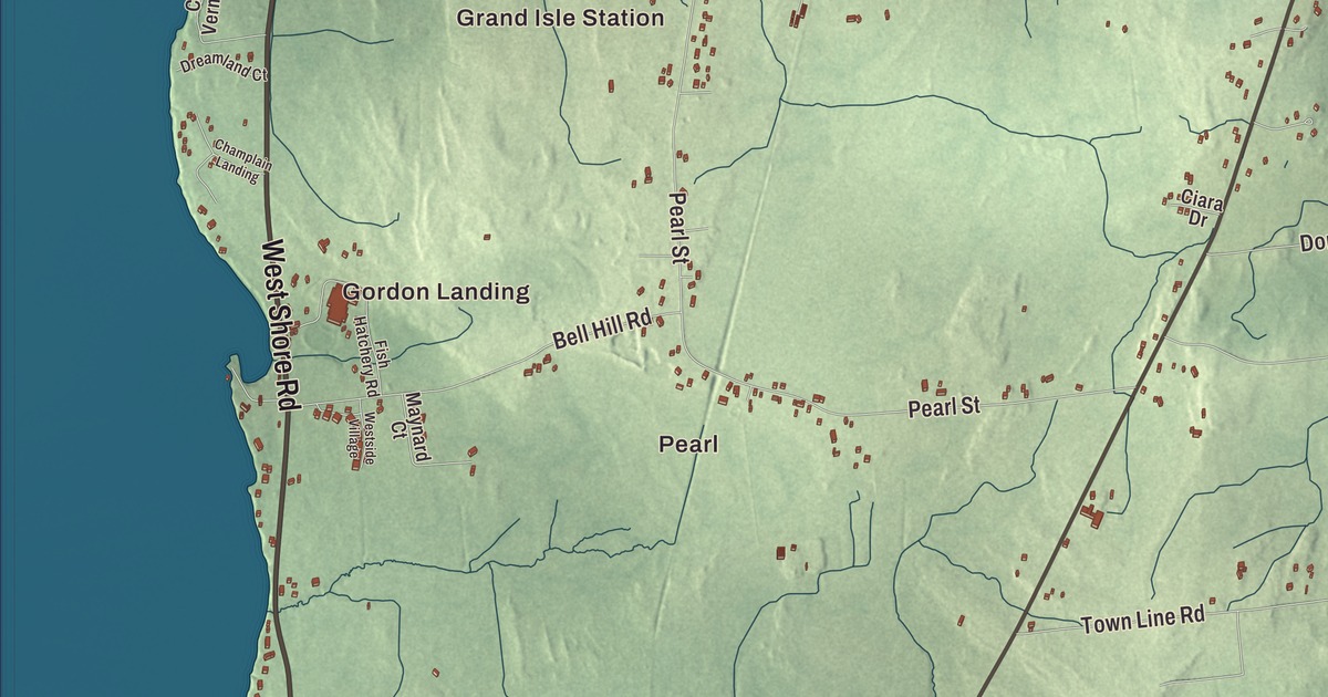
Grand Isle is an island town, the northern half of South Hero Island in Lake Champlain, where the ferry to Plattsburgh leaves from Gordon’s Landing. This map prints Gordon Landing, Pearl, Grand Isle Station and Adams Landing, with West Shore Road, Allen Road, Moccasin Avenue, Griswold Road, Simms Point Road and Reynolds Road, and Lake Champlain all around.
Grand Isle is a town in Grand Isle County, Vermont.
KNOWOL made this map in 2026 from public survey data and gave it the look of an old county atlas, with the land shaded from United States Geological Survey elevation data and the roads and town line taken from the Census Bureau. More than half of the town’s area is water. South Hero lies to the south and North Hero to the north, with Plattsburgh, New York, across the western channel of the lake and Milton and St. Albans across the eastern one. Click here to purchase a print of this map for your wall.
Middle Hero
Grand Isle began as part of South Hero. On November 7, 1798, the legislature set it off as a town of its own called Middle Hero, and the town organized on March 7, 1799. It was part of Chittenden County until Grand Isle County was formed in 1805, and on November 5, 1810, Middle Hero became Grand Isle, the name many people also give the island itself. Besides its half of the island, the town takes in Savage Island to the east and the small Young and Bixby islands, known together as the Sister Islands, in the northwest.
A surveyor’s home from those early years still stands. Jedediah Hyde Jr., who surveyed the Grand Isle area for Ira and Ethan Allen, built the Hyde Log Cabin in 1783 from peeled cedar logs. He raised ten children in it, and his family lived there for 150 years. In 1946 the cabin was moved about two miles to its present spot on U.S. Route 2, north of the town center, and today the Grand Isle Historical Society opens it as a museum. It’s believed to be one of the oldest log cabins in the United States.
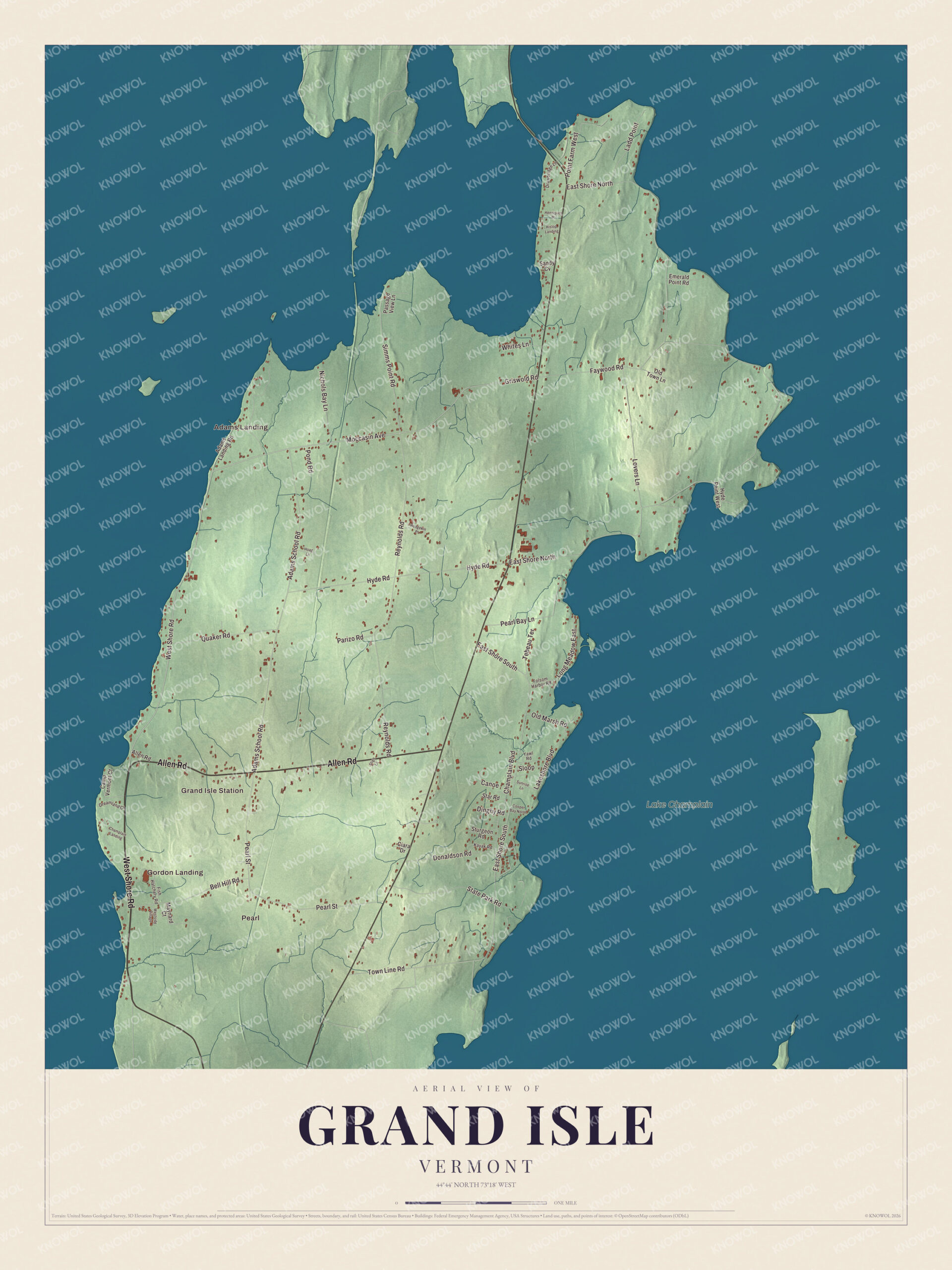
Click to explore a larger preview. The digital watermark does not appear on printed maps.
Names on this map
These names are printed on this map.
Places: Gordon Landing, Pearl, Grand Isle Station, Adams Landing and Lake Champlain.
Streets and roads: West Shore Road, Allen Road, Moccasin Avenue, Griswold Road, Simms Point Road, East Shore North, East Shore South, Reynolds Road, Adams School Road, Pearl Street, Hyde Road, Lovers Lane.
More street names, A to Z
Adams Landing Road, Bell Hill Road, Camp Vermont Court, Canoe, Champlain Boulevard, Champlain Landing, Ciara Drive, Cooper Bay North, Dinghy Road, Donaldson Road, Drawbridge Lane, Dreamland Court, Emerald Point Road, Faywood Road, Fish Hatchery Road, Folsom Harbor Road, Henriques Place, Hislop Landing, Hoag Lane, Hodgekin Place, Hyde Point West, Kayak Road, Ladd Point, Lakeshore Boulevard, Long Meadow East, Maynard Court, Nichols Bay Lane, Old Marsh Road, Old Town Lane, Parizo Road, Passage View Lane, Pearl Bay Lane, Point Farm West, Pond Road, Quaker Road, Sandy Cv, Sligo Lane, Sloop, Star Road, State Park Road, Sturgeon Road, Sunrise Lane, Tebeau Terrace, Town Line Road, Westside Village, Whites Lane, Yawl Road.
See it on a wall
The Grand Isle map as a framed print. Swipe for more.


Ferry and shore
On West Shore Road, just north of the ferry landing, stands the stone Gordon-Center House, apparently finished in 1824. Tradition says Hazen Bell began it and a man named Boardman completed it, and both ran the ferry. Its later owners kept running the ferry until 1941, and the Gordon and Center families held both the house and the ferry rights in the 1800s. The ferry still crosses today: the Lake Champlain Transportation Company runs the Grand Isle to Plattsburgh route around the clock all year, breaking ice in winter to reach Cumberland Head on the New York side.
In the village, the brick Grand Isle United Methodist Church, built in 1853 and 1854 for the Congregationalists, is the town’s oldest surviving church building, with a Greek Revival portico of four fluted columns. Grand Isle State Park covers 226 acres on the lake in the southeastern part of town, with campsites, a boat launch and a nature center. Herman R. Beardsley, whose family moved to Grand Isle in the early 1800s, later sat on the Vermont Supreme Court.
On the map, start at Gordon Landing and follow West Shore Road along the shore, then take Allen Road, Moccasin Avenue, Griswold Road, Simms Point Road and Reynolds Road across the island. Pearl, Grand Isle Station and Adams Landing are printed too, and Lake Champlain is labeled all around. Grand Isle dates to 1798.
This map of Grand Isle is made for everyone who calls Grand Isle home, and it shows the town as it looks today, from Gordon Landing to the state park. Hang it in an office, library or den, or use it to teach children the geography and history of their town. It’s printed on museum quality archival paper. Zoom in on the preview above to explore the details, then click here to get your copy of the Grand Isle, Vermont map.

Sources
- Grand Isle, Vermont, Wikipedia
- Town histories and representatives, G towns, Vermont Legislature
- Hyde Log Cabin, Wikipedia
- Gordon-Center House, Wikipedia
- Lake Champlain Transportation Company, Wikipedia
- Congregational Church, Grand Isle, Wikipedia
- Grand Isle State Park (Vermont), Wikipedia
- Herman R. Beardsley, Wikipedia