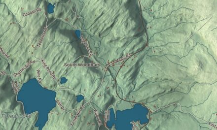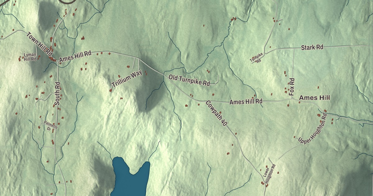
Every summer the hills of Marlboro fill with chamber music, played on the Potash Hill campus, which began as three farms. This map prints the Molly Stark Trail, Augur Hole Road, Lower Dover Road, North Pond Road, Higley Hill Road and Butterfield Road, with Ames Hill, Sunset Lake, South Pond and Hidden Lake.
Marlboro is a town in Windham County, Vermont.
KNOWOL made this map in 2026 from public survey data and gave it the look of an old county atlas, shading the hills from United States Geological Survey elevation data and drawing the roads and town line from the Census Bureau. Vermont Route 9, the Molly Stark Trail, crosses the town on its way over the mountains between Bennington and Brattleboro, and the town is drained by the western branch of the West River, Whetstone Brook and the Green River. Click here to purchase a print of this map for your wall.
New Marlborough
New Hampshire first chartered the town on April 29, 1751, to Timothy Dwight and 64 others from Northampton, Massachusetts, and nearby towns. The French and Indian War kept settlers away, and that charter was forfeited. Governor Benning Wentworth issued a new one on September 21, 1761, and again on April 17, 1764, as New Marlborough, after the Duke of Marlborough, and the town kept that name until 1800. Surveyors divided it in 1762 into 64 equal rights, with four lots in the center set aside. The first settlers came in 1763, and families from Massachusetts and Connecticut followed quickly through 1770. The town organized on May 8, 1775. By 1799 there were 313 children in its schools, and the population peaked in 1820 at 1,300. The ground is mountainous, but the soil is rich and deep, and in 1859 the town was still almost entirely farms.
The town’s first church was organized in 1776 and raised at the top of Town Hill in 1778. When a newer church replaced it in 1820, its timbers and boards went into the Town House of 1822, and between 1836 and 1844 both buildings were moved down the hill to the Town Common. The church burned in 1931 and was rebuilt that year as a slightly smaller copy, the Marlboro Meeting House. In 1966 a new, oversized snow plow struck the Town House, and the town moved it across South Road to where it stands now, still used for town meetings. Also on the Common is the Whetstone Inn, built around 1775 by Deacon Jonas Whitney, who came to Marlboro in 1773 and later represented it in the legislature. Over the years the inn has served as a courthouse, church, tavern, dance hall and post office.
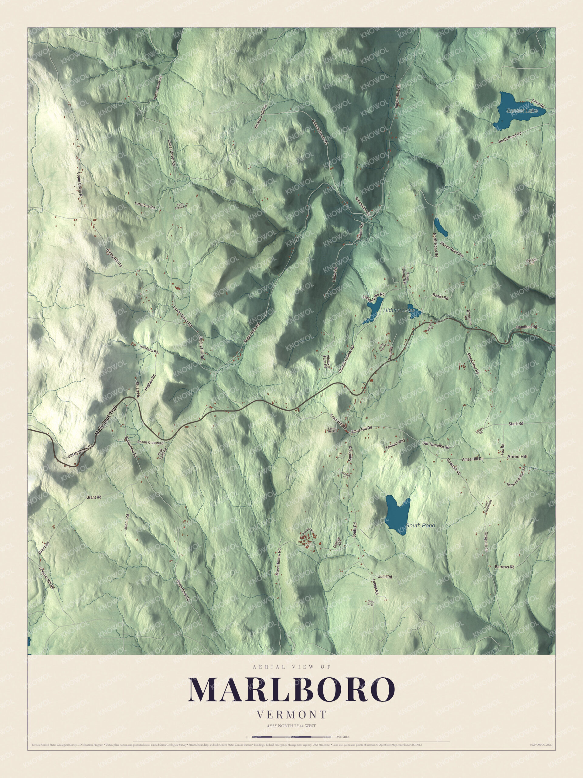
Click to explore a larger preview. The digital watermark does not appear on printed maps.
Names on this map
These names are printed on this map.
Places: Ames Hill, Sunset Lake, South Pond and Hidden Lake.
Streets and roads: Molly Stark Trail, Augur Hole Road, Lower Dover Road, North Pond Road, Higley Hill Road, Butterfield Road, South Road, Ames Hill Road, Church Hollow Road, Cowpath 40, Stratton Hill Road, Grant Road.
More street names, A to Z
Adams Brook Road, Adams Crossroad, Alexander Road, Banks Road, Barrows Road, Collins Road, Cottage Road, Fisher Cat Lane, Forty Second Street, Fox Road, Hall Farm Road, Hamilton Road, Hidden Lake Road, Hughes Road, Hunter Brook Road, Indian Pipe Road, Jenne Road, Judd Road, Lahar Road, Lake Road, Larrabee Road, Lower Houghton Road, Lucier Road, Lyman Hill Road, Macarthur Road, Mercier Road, Moss Hollow Road, Old Hogback Road, Old Turnpike Road, Palmetto Drive, Piney Brook Way, Pool Farm Road, Raven Road Pvt, Shearer Hill Road, Sokoki Hill, Stark Road, Staver Road, Stuart Lane, Theater Road, Town Hill Road, Trillium Way, Turnpike Road, Upper Dover Road, Upper Houghton Road, Whetstone Road, Whitaker Farm Road.
See it on a wall
The Marlboro map as a framed print. Swipe for more.


Potash Hill and Marlboro Music
In 1946 Walter Hendricks founded Marlboro College on the site of three farms at Potash Hill, for veterans returning from World War II, with the poet Robert Frost as its first trustee. Hendricks became close friends with the violinist Adolf Busch and the pianist Rudolf Serkin, who had come to Vermont in the 1940s as refugees from the Third Reich, and on their advice he brought in Marcel, Louis and Blanche Moyse, the Moyse Trio. In 1951 Busch and Serkin founded the Marlboro Music School and Festival, and Busch, Serkin and the Moyse Trio are its recognized founders. For seven weeks each summer young musicians rehearse and perform alongside master artists, with public concerts every weekend. Blanche Moyse chaired the college’s music department for 25 years, and Louis Moyse taught there for 27. The college closed in 2020 and passed its endowment to Emerson College in Boston, and the Potash Hill campus still hosts the festival.
Marlboro people
Two leaders of the early Latter Day Saint movement were born here: Newel K. Whitney, in 1795, who became the second Presiding Bishop of the church, and Newel Knight, in 1800, one of its first branch presidents. Edson B. Olds, born in Marlboro in 1802, went west to Ohio and served three terms in Congress. The folk singer Margaret MacArthur moved with her husband in 1951 into a 200-year-old Marlboro farmhouse with no electricity and went on to collect old ballads from traditional singers around Vermont. The children’s illustrator Tasha Tudor lived and died in Marlboro, and the biologist Richard Lewontin built a log cabin here with his family, served for years as a volunteer firefighter in town and was a trustee of the music festival.
On the Molly Stark Trail, at the Hogback Mountain overlook in West Marlboro, the Southern Vermont Natural History Museum opened in 1996 around a collection of native birds and mammals representing 250 species. Hogback Mountain, 2,409 feet, rises just north of the road. From 1946 to 1986 a ski area ran across the highway on Mount Olga, with free skiing every week for students from the Marlboro School, and about 590 acres there were given to the town as the Hogback Mountain Conservation Area.
On the map, follow the Molly Stark Trail, then take Augur Hole Road, Lower Dover Road, North Pond Road, Higley Hill Road and Butterfield Road. Ames Hill is printed, and so are Sunset Lake, South Pond and Hidden Lake. Hidden Lake, 1,500 feet above sea level, is the source of Whetstone Brook, which runs down through Brattleboro to the Connecticut River. Marlboro dates to 1751.
This map of Marlboro is made for everyone who calls Marlboro home, and it shows the town as it looks today, from Ames Hill to Hidden Lake. Hang it in an office, library or den, or use it to teach children the geography and history of their town. It’s printed on museum quality archival paper. Zoom in on the preview above to explore the details, then click here to get your copy of the Marlboro, Vermont map.

Sources
- Marlboro, Vermont, Wikipedia
- Town histories and representatives, M towns, Vermont Legislature
- Marlboro College, Wikipedia
- Marlboro Music School and Festival, Wikipedia
- Rudolf Serkin, Wikipedia
- Blanche Honegger Moyse, Wikipedia
- Louis Moyse, Wikipedia
- Newel K. Whitney, Wikipedia
- Newel Knight, Wikipedia
- Edson B. Olds, Wikipedia
- Margaret MacArthur, Wikipedia
- Tasha Tudor, Wikipedia
- Richard Lewontin, Wikipedia
- Southern Vermont Natural History Museum, Wikipedia
- Hogback Mountain (Vermont), Wikipedia
- Vermont Route 9, Wikipedia
- Whetstone Brook, Wikipedia