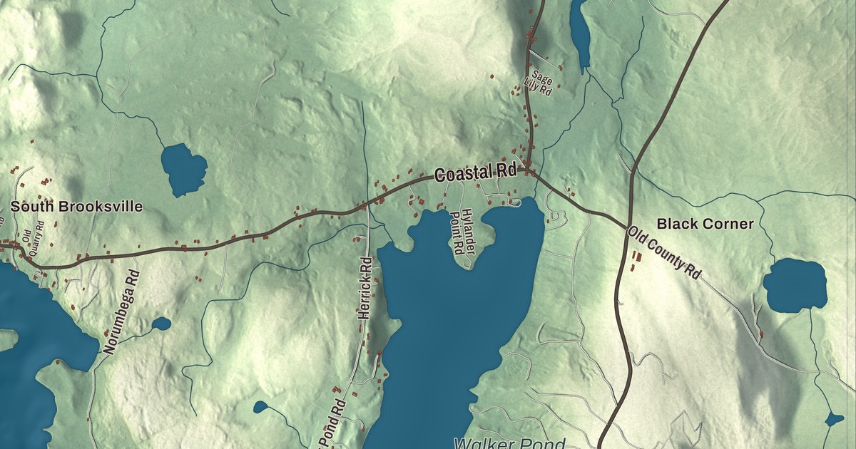
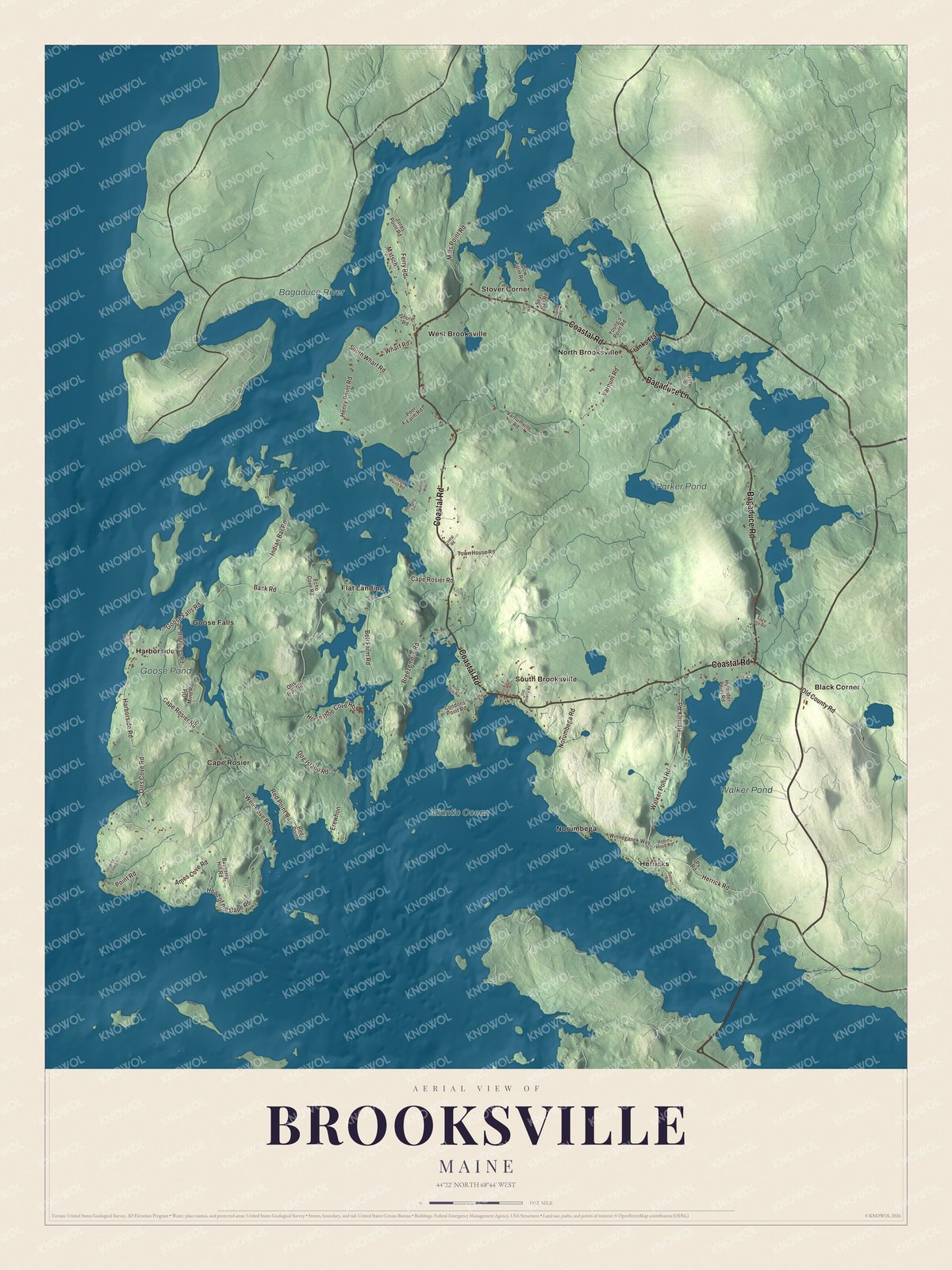
Brooksville is nearly an island, and this map traces its long shoreline, with Black Corner and Cape Rosier, Harborside, Goose Falls, Flat Landing, Herricks and North Brooksville all named on it. Coastal Road, Bagaduce Road, Bagaduce Lane, Goose Falls Road, Orrs Cove Road and Indian Bar Road are printed too, along with the Bagaduce River, Walker Pond, Goose Pond and Parker Pond. Click here to purchase a print of this map for your wall.
Brooksville is a town in Hancock County, and 935 people lived here at the 2020 census.
KNOWOL made this map in 2026 from public survey data and gave it the look of an old atlas. The land is shaded from United States Geological Survey elevation data, and the roads and town line come from the Census Bureau, which counts 51.12 square miles in Brooksville, 19.99 of them water. Penobscot Bay lies to the west, the tidal Bagaduce River to the north and east, and Eggemoggin Reach to the south, and the town’s page counts 53.75 miles of shoreline, with only two slim land bridges to the rest of the mainland.
Soldiers, granite and the coasting trade
People have likely lived here for more than 11,000 years, and before English settlers came, Wabanaki people lived here, most likely Penobscot. Brooksville’s first English settlers were John Wasson, Samuel Wasson and David Hawes, all soldiers in the Revolutionary War. Brooksville dates to 1817. It was incorporated on June 13 of that year from parts of Castine, Penobscot and Sedgwick, and named for John Brooks, the governor of Massachusetts, which still governed Maine.
The ground here is full of granite, and several quarries were opened, while the clay loam grew wheat and potatoes. The town page calls Buck’s Harbor one of the best coves in the region for small boats, and many townspeople went into the coasting trade and the fisheries. By 1880, when 1,419 people lived here, the town had a porgy oil factory, sawmills, gristmills, a wool carding mill and a cloth and yarn factory. Ships were repaired at the foot of Wasson’s Wharf Road, and as late as 1912 there were 18 schooners at the wharf under repair. The Wasson and Tapley families produced many ship captains, among them the six sons of Captain Robert Tapley, who all followed their father to sea.
Brooksville people
Lucy Hale Tapley, born in West Brooksville in 1857, was the daughter of Captain Thomas Tapley, one of six seafaring brothers. She went to Atlanta in 1890 to teach at what was then Spelman Seminary, rose to become its third president in 1910, cleared its debt and led it as it became Spelman College in 1924; Tapley Hall there is named for her. David Atwood Wasson, also born in West Brooksville, became a minister and Transcendentalist writer who lost a pulpit for his abolitionist views and later succeeded Theodore Parker in Boston. Clarence M. Condon, born in South Brooksville in 1875, received the Medal of Honor for his service in the Philippines.
Others found Brooksville later. The children’s author and illustrator Robert McCloskey set One Morning in Maine here; its story takes his daughters across to South Brooksville on Buck’s Harbor, where the garage and store in the book can still be seen, and it won a Caldecott Honor in 1953. Archibald Cox, the solicitor general under President Kennedy and later the Watergate special prosecutor, made his home in Brooksville and died there in 2004.
Click to explore a larger preview. The digital watermark does not appear on printed maps.
See it on a wall
The Brooksville map as a framed print. Swipe for more.


Cape Rosier and Goose Falls
Black Corner and Cape Rosier are printed on the map. Cape Rosier is the western part of the town, almost cut off from the rest at a narrow neck, and it’s named for James Rosier, who wrote the account of Captain Weymouth’s 1605 voyage along this coast. Harborside, printed as well, is its village. Helen and Scott Nearing moved to a homestead on Cape Rosier in 1952 and grew much of their own food there, and their 1954 book, Living the Good Life, inspired the back-to-the-land movement of the 1960s and 1970s. Their place is now the Good Life Center. The organic farmer Eliot Coleman grows vegetables year-round on the cape in lightly heated greenhouses, and the Holbrook Island Sanctuary, a 1,345-acre state park of woods, marsh and rocky shore that began with Anita Harris’s gift of land in 1971, has 11 miles of trails.
Goose Falls and Goose Pond are printed on the map too. Goose Falls is one of just a few reversing falls on the East Coast, all of them in Maine, where the water runs one way and then the other with the tide. At low tide Goose Pond empties into Penobscot Bay through a cleft in the rock, and at high tide the sea pours back in. Goose Falls Road is printed as well.
Walker Pond and the Bagaduce
Walker Pond and the Bagaduce River are printed on the map. The river begins where Black Brook and the outflow of Walker Pond meet, then runs about 14 miles as the line between Brooksville and its neighbors Sedgwick, Penobscot and Castine. On the north shore of Walker Pond, off State Route 176, stands Topside, a summer estate built in 1918 of huge hand-hewn spruce logs to a plan by the Tennessee architect William Crutchfield, looking more like a mountain house of the South than a Maine cottage. Coastal Road is printed on the map. It’s Route 176, and on its east side near West Brooksville stands the West Brooksville Congregational Church, a Greek Revival church finished in 1855 for a congregation formed in 1812. Flat Landing, Herricks and North Brooksville are printed on the map, along with Parker Pond, Bagaduce Road, Bagaduce Lane, Orrs Cove Road and Indian Bar Road.
This Brooksville map makes a handsome addition to an office, library or den, and it can teach children the geography and history of a Penobscot Bay town. It’s made for anyone who calls Brooksville home, from Cape Rosier to North Brooksville, as it looks today. Zoom in on the preview above to explore the details, then click here to get your copy of the Brooksville, Maine map.

Sources
- Brooksville, Maine, Wikipedia
- Lucy Hale Tapley, Wikipedia
- David Atwood Wasson, Wikipedia
- Clarence M. Condon, Wikipedia
- One Morning in Maine, Wikipedia
- Archibald Cox, Wikipedia
- Cape Rosier, Maine, Wikipedia
- Helen Nearing, Wikipedia
- Holbrook Island Sanctuary State Park, Wikipedia
- Bagaduce River, Wikipedia
- Topside (Brooksville, Maine), Wikipedia
- West Brooksville Congregational Church, Wikipedia