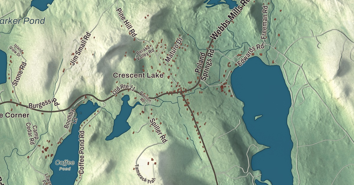
Roosevelt Trail, Meadow Road and Quaker Ridge Road are printed on this map of Casco, Maine, and so are South Casco, Crescent Lake, Cook Mills and Pike Corner. Poland Spring Road, Webbs Mills Road, Mayberry Hill Road, Songo Lock, Thomas Pond and Parker Pond carry their names too. Click here to purchase a print of this map for your wall.
Casco is a town in Cumberland County, with 3,646 people at the 2020 census.
KNOWOL made this map in 2026 from public survey data and gave it the look of an old atlas. United States Geological Survey elevation data shades the land, and the roads and town line come from the Census Bureau, which counts 38.01 square miles in Casco. Water covers 6.77 of them, and the town borders the east shore of Sebago Lake.
Behind Rattlesnake Mountain
Casco began as part of Raymondtown Plantation, which the Massachusetts General Court granted on January 30, 1767, to Captain William Raymond of Beverly, Massachusetts, and his company of soldiers for their service with Sir William Phipps in the 1690 Battle of Quebec. Raymondtown was incorporated as Raymond in 1803. In 1838 the western half of Raymond asked the legislature to be set off as a township because it lay apart, behind Rattlesnake Mountain. That petition failed, but another was accepted three years later, and Casco was incorporated on March 18, 1841.
Farmers found the ground uneven and the rocky soil only “tolerably productive”, but the outlets of the ponds gave Casco good sites for water mills. The town had four sawmills, four gristmills, a shook mill, a barrel stave mill, four shingle factories, a carriage factory and a tannery. In 1832 the Cumberland and Oxford Canal made Sebago Lake a direct trade route to Portland, and steamboats began carrying tourists and freight on the waters in the 1840s. Sebago Lake State Park, which lies partly in Casco, opened in 1938 as one of Maine’s five original state parks.
Quaker Ridge Road
Quaker Ridge Road is printed on the map. On its west side, south of Route 11, stands the Friends Meetinghouse, built in 1814, the oldest surviving Quaker meeting house in Maine. A shuttered partition divided the room so men and women sat apart, by Quaker custom, while the two sides could still talk across it. When Casco was separated from Raymond in 1841, the town held its first town meeting here. Regular services ended in 1921, and the building has been used for summer services since.
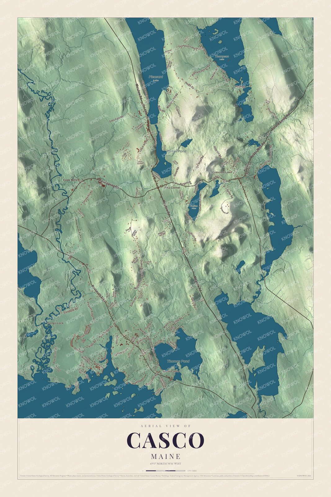
Click to explore a larger preview. The digital watermark does not appear on printed maps.
See it on a wall
The Casco map as a framed print. Swipe for more.


Roosevelt Trail and South Casco
Roosevelt Trail is printed on the map. It’s the local name for U.S. Route 302, which the town’s page calls the main street of the lakes region. Where Raymond Cape Road meets Route 302 is the Watkins House and Cabins property. Sumner Watkins started a carriage factory there in 1877 that ran until 1907, and in the 1920s Charley Watkins turned the place into a summer rental stop for the new automobile travelers, with an office and eight cabins. The Raymond-Casco Historical Society keeps its museum at Watkins Farm on Route 302.
South Casco is printed on the map. It sits along Route 302 in the southeast corner of town, between Sebago Lake and Thomas Pond. Thomas Pond is printed too. On Raymond Cape Road in South Casco is the Richard Manning House, a Federal house probably built around 1795 by Richard Manning of Salem, Massachusetts. He was the uncle of Nathaniel Hawthorne, whose widowed mother lived nearby, just over the line in Raymond, and young Nathaniel likely visited.
Meadow Road is printed on the map. It’s State Route 121, which continues into the village of Casco, and Webbs Mills Road is State Route 85, named for its end at Webbs Mills, a small village in Casco. The town’s page gives State Route 11, the longest state highway in Maine, the local name Poland Springs Road, and Cook Mills lies along Route 11 near the western border. Poland Spring Road, Mayberry Hill Road, Cook Mills, Pike Corner, Crescent Lake and Parker Pond are printed on the map.
Songo Lock is printed on the map. The lock itself is in Naples, on the Songo River at the north end of Sebago Lake State Park. Built in 1830, it’s the last surviving lock of the Cumberland and Oxford Canal, and pleasure boats still pass through it.
Casco has notable residents of its own. Luther Gulick, who founded the Camp Fire Girls with his wife and is in the Basketball Hall of Fame, had a camp in Casco, and the mime artist Tony Montanaro lived, taught and directed in Casco in his later years. Each year the town holds Casco Days, a community fair in Casco Days Park on the last Saturday in July.
This Casco map makes a handsome addition to an office, library or den, and it can help teach children the geography and history of the area. It’s made for everyone who calls Casco home, from Quaker Ridge Road to South Casco, as it looks today. Zoom in on the preview above to explore the details, then click here to get your copy of the Casco, Maine map.

Sources
- Casco, Maine, Wikipedia
- Friends Meetinghouse (Casco, Maine), Wikipedia
- Watkins House and Cabins, Wikipedia
- Richard Manning House, Wikipedia
- Songo Lock, Wikipedia
- Sebago Lake State Park, Wikipedia
- Maine State Route 121, Wikipedia
- Maine State Route 85, Wikipedia
- Luther Gulick (physician), Wikipedia
- Tony Montanaro, Wikipedia