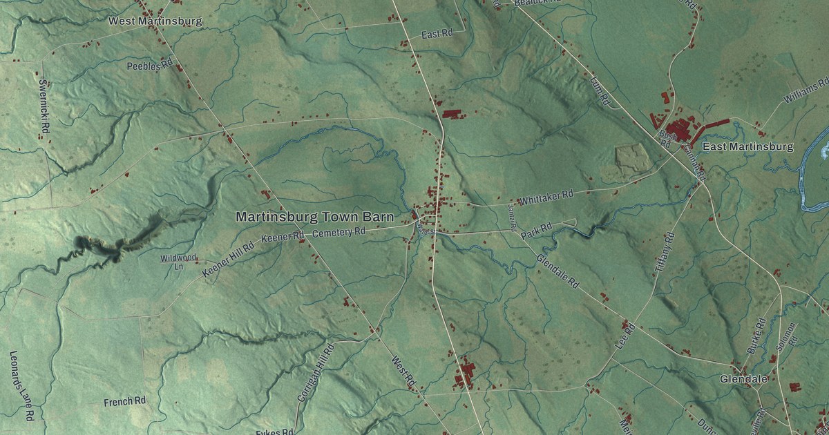
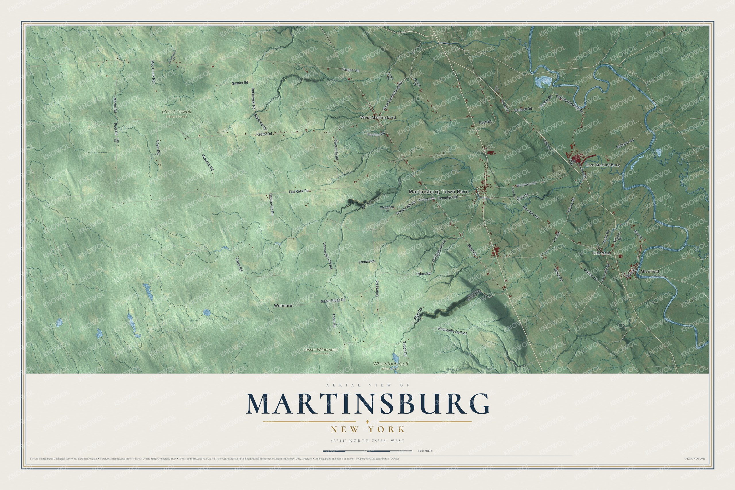
This beautifully detailed map of Martinsburg, New York was created in 2026 using aerial imagery combined with modern topographical, census, street and landmark data. It’s a one-of-a-kind view of Martinsburg that combines accurate data with a vintage aesthetic. The map shows every building in its true location, many of the roads carry their names, and the shaded topographic relief shows the shape of the land.
Explore an aerial view of Martinsburg, New York
On the map you’ll find Martinsburg Town Barn, Glenfield, East Martinsburg, Glendale, West Martinsburg, Wetmore, Grant Powell State Forest, Lesser Wilderness State Forest, and Whetstone Gulf State Park, along with Keener Hill Road, Cemetery Road, Martinsburg Road, Blue Street, and more. If you look closely you can even find your house accurately drawn in its correct location. Zoom in on the preview to look for yours.
Did You Know?
Martinsburg carries the name of its founder, General Walter Martin. The town hall went up in 1812 and hosted the first Lewis County court session that year. Martinsburg stayed the county seat until 1864, when the courts moved to Lowville.
Take a closer look at the Martinsburg map
Names on this map
These names are printed on this map.
Places: Martinsburg Town Barn, Glenfield, Grant Powell State Forest, Lesser Wilderness State Forest, Whetstone Gulf State Park, East Martinsburg, Glendale, West Martinsburg and Wetmore.
Streets and roads: Keener Hill Road, Cemetery Road, West Martinsburg Road, Blue Street, Tiffany Road, Corrigan Hill Road, Main Street, Flat Rock Road, Gardner Road, Rector Road, West Road, French Road.
More street names, A to Z
Alger Road, Bealuck Road, Bealuk Road, Borkowski Road, Burke Road, Bush Road, Cannan Road, Carey Road, Centerville Road, Door Road, Doyle Road, Duncan Road, East Martinsburg Road, East Road, Fykes Road, Glendale Road, Graves Road, Houseville Gulf Road, Houseville Road, Jantzi Road, Keener Road, Lee Road, Leonards Lane Road, Loucks Road, Lum Road, Maple Ridge Road, McCue Road, Meiss Road, Moren Road, Mud Creek Road, Park Road, Peebles Road, Poor Road, Ramos Road, Rowsam Road, Seasonal Road, Sharp Road, Snyder Road, Solomon Road, Steinmacker Road, Swernicki Road, Tabolt Road, Toole Road, Water Street, Whittaker Road, Wildwood Lane, Williams Road.
See it on a wall
The Martinsburg map as a framed print. Swipe for more.


This beautifully detailed map of Martinsburg makes an attractive addition to your office, library, or den, and it can even be used to teach children the geography and history of the area. It also makes a great gift for anyone who grew up in Martinsburg or moved away. When you’re done exploring, click here to get your copy of the Martinsburg map.