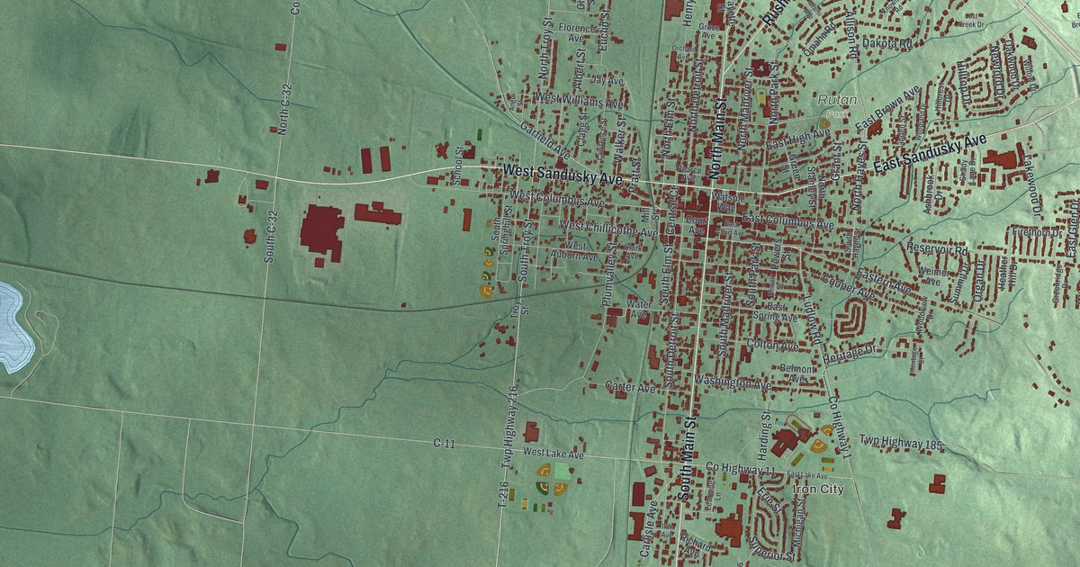
If you grew up in Bellefontaine, went to school here or still drive down Main Street past the courthouse, this map has plenty for you to find. It's a modern aerial view of Bellefontaine in Logan County, Ohio, made from modern data with a vintage artistic feel. The town sits in the middle of soft green hills, with more than 7,700 buildings marked in deep red. It runs from Rush Avenue in the north down the long arm of South Main Street, with open farm country all around.
Main Street, Sandusky Avenue and Iron City
Start in the middle of town, where North Main Street and South Main Street meet the Sandusky Avenues. West Sandusky Avenue heads west toward the open fields. East Sandusky Avenue runs off to the northeast. Just south of that corner, West Columbus Avenue and East Columbus Avenue cross Main. Court Avenue sits a little farther south, by the courthouse square. North Detroit Street runs just west of Main, and North Madriver Street runs just east. Rush Avenue heads northeast toward the top of the sheet, past Northview Drive.
Now follow South Main Street south. It runs down the long arm of town, and near the bottom Gunntown Road heads off to the east. On the way, look to the left for Iron City, where Co Highway 11 meets Superior, Erie and Michigan Streets. Back up north, Allison Road and Dakota Road pass Rutan Park. On the right side of the sheet, near Sloan Boulevard, the land rises to Campbell Hill. A state marker there says it's the highest point in Ohio, at 1,549.09 feet. Many roads are labeled, and each red shape is a building, so zoom in and look for yours.
Court Avenue, the first concrete street in America
Here's a story to tell guests. America's first concrete streets were the ones around the Logan County courthouse, according to a marker from the Ohio History Connection. In 1891, workers laid an 8-foot strip of concrete along Main Street, where people hitched their horses. Two years later, they paved Court Avenue in concrete. It was made with local marl from the Buckeye Cement Company, about 8 miles northeast. The street is now on the National Register as the First Concrete Street in the U.S. To find it, go to the spot where South Main Street meets Court Avenue.
The railroad canteen near West Columbus Avenue
Bellefontaine was also a railroad town from the 1890s to the 1950s. It had one of the biggest roundhouses on the Big Four line. Up to ninety freight trains and over forty passenger trains came through each day. During World War II, volunteers ran a free canteen in a small white building on the rail platform. Margaret Clingerman started it, and 170 women kept it going. They fed more than 700,000 soldiers, sailors and marines on their way to and from the war. It stood by the tracks between Mill Street and Elm Street, just off West Columbus Avenue.
From South Main Street to the hills east of Bellefontaine
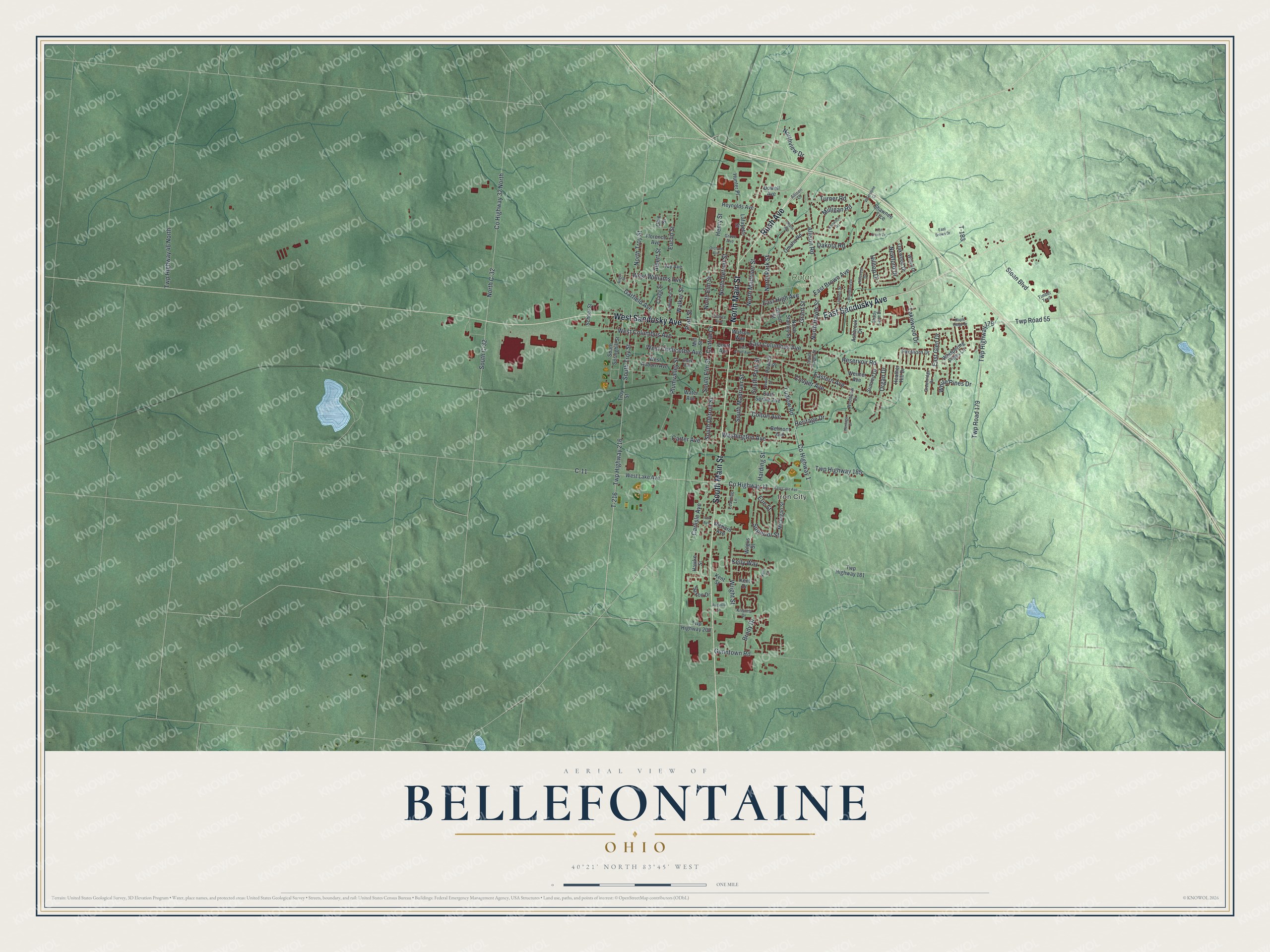
Created by KNOWOL in 2026, this map of Bellefontaine uses USGS elevation data for its shaded hills and Census Bureau records for its streets. From across a room, it's a red town on green hills. Up close, you can pick out single houses along South Main Street. The title panel reads "Aerial View of Bellefontaine, Ohio," with the coordinates 40°21' North, 83°45' West and a one-mile scale bar.
It fits an office, a den or a kitchen wall. It's a good gift for someone who grew up a few blocks from the courthouse square, or for family who moved away and still miss Main Street. Open the preview, zoom in and find the street you know. See sizes and frames for the Bellefontaine map.