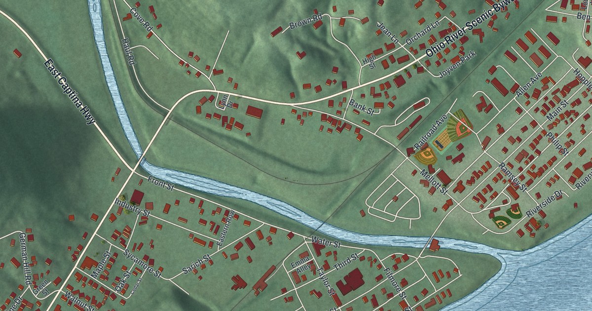
If you grew up in Powhatan Point, or your family worked the coal mines here, this map shows home from above. It's a modern aerial view of Powhatan Point in Belmont County, Ohio, made with modern data and given a vintage feel. The village sits on a flat strip of land between green hills and the wide Ohio River. A blue creek winds in from the west and meets the river right in the middle of town. Streets fill the flat ground on both sides of the creek, and the hills rise behind them.
Powhatan Point, where Captina Creek meets the Ohio River
On this map you'll find Main Street, Front Street, Water Street, Allen Avenue, Philip Street, Mellott Street, Railroad Avenue, Belt Street, Crescent Street, German Hill Road, East Captina Highway, the Ohio River Scenic Byway, Joyven Park, Parish Road Cemetery, and more. Each red shape is a building, so zoom in on the preview and look for yours.
The town's name points to its spot on the map. The state's Powhatan Point marker says the "point" is where Captina Creek meets the Ohio River. The land was first surveyed in 1849, and Franklin Knox laid out the village. A flour mill and a woolen factory went up in 1850. For its first 75 years, Powhatan Point was a shipping center for York Township and the Captina Valley. Local businesses sent grain, fruit, lumber, cheese, wool, tobacco and livestock to northern and southern ports. There were three boat landings: Boger's, Hornbrook's and Dorsey's. Each had an incline track that ran from the warehouses down to the river's edge. On the map, look where the winding blue creek meets the wide river. The marker stands in a gazebo there, on Mellott Street.
The Powhatan No. 1 mine
In 1922, the Cleveland and Western Coal Company opened the Powhatan No. 1 mine here. The coal lay 100 feet below the river. The spot let the company ship by both river and rail. It became the largest deep mine in Ohio. It was also the first mine in the state to be fully mechanized. The company became the North American Coal Corporation in 1925, and it ran seven shaft mines in this area. Powhatan Point grew into a mining town that still leaned on the river. On July 5, 1944, a mine fire took the lives of 66 men. Years later, four of the mines closed between 1980 and 1984. New clean air rules made the local high-sulfur coal hard to sell. A second marker tells the mine's story at the park on the corner of Allen Avenue and Philip Street.
Main Street and the river at Powhatan Point

Created by KNOWOL in 2026, this print shows Powhatan Point from above, with shaded green hills, a blue river and creek, and each building in red. The title panel reads "Aerial View of Powhatan Point, Ohio" with the coordinates 39°52' North 80°49' West.
It fits a living room, a den or a hallway by the front door. It's a good gift for a family with mining roots, or for anyone who grew up near Joyven Park and moved away. Open the preview and find your street. See sizes and frames for the Powhatan Point map.