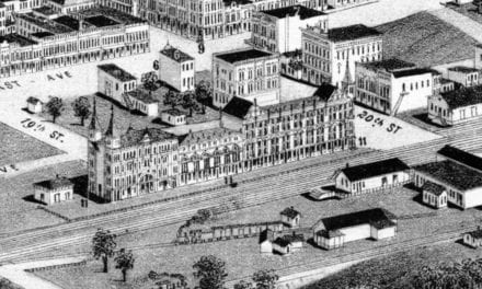
This historic map of Huntsville, Alabama was created in 1871 by Albert Ruger, a prominent 19th century map maker, and lithographed by Ehrgott & Krebs of Cincinnati. The map shows a bird’s eye view of Huntsville as it once was, looking northwest across Madison County toward the surrounding hills. Streets, homes, churches, fields, orchards, rail lines, and public buildings are carefully drawn across the landscape, with the center of town gathered around the courthouse square.
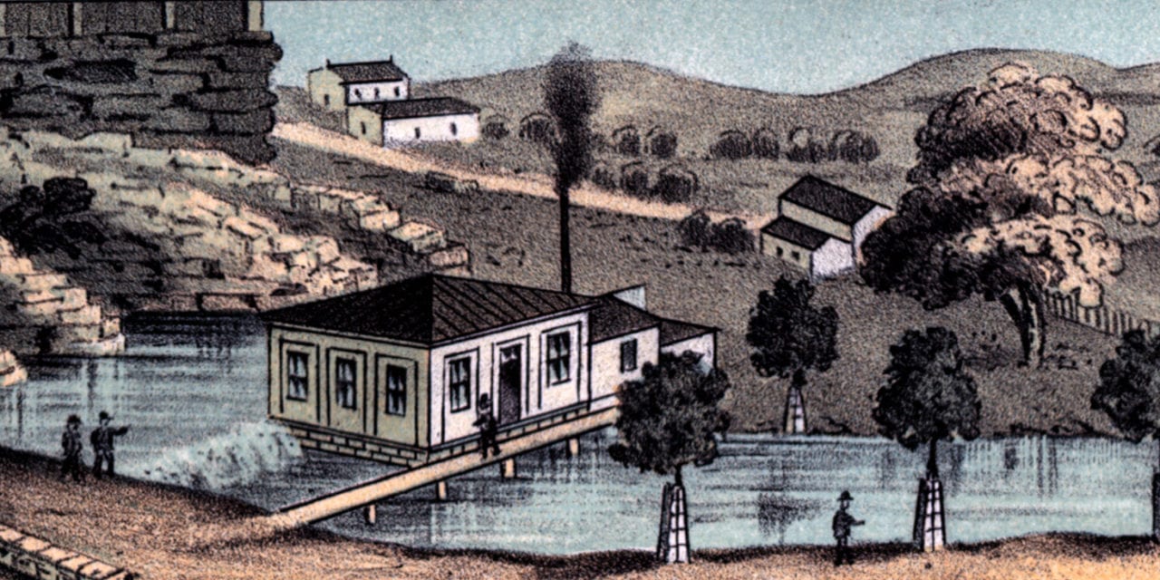
Historic Huntsville landmarks on the map include Huntsville Spring, Market House, Female College, Female Seminary, County Jail, Court House, Memphis and Charleston Railroad Depot, and the Spring and Water Reservoir Works. The map also identifies several churches, including Baptist, Episcopal, Methodist, Presbyterian, Cumberland Presbyterian, Roman Catholic, and African churches, marking the religious and community life of Huntsville in the years after the Civil War.
This historic map of Huntsville has been lovingly restored by KNOWOL. Reproductions of the restored map are available here. You can click on the image below to zoom in and explore the details.
Historic Old Map of Huntsville, Alabama from 1871
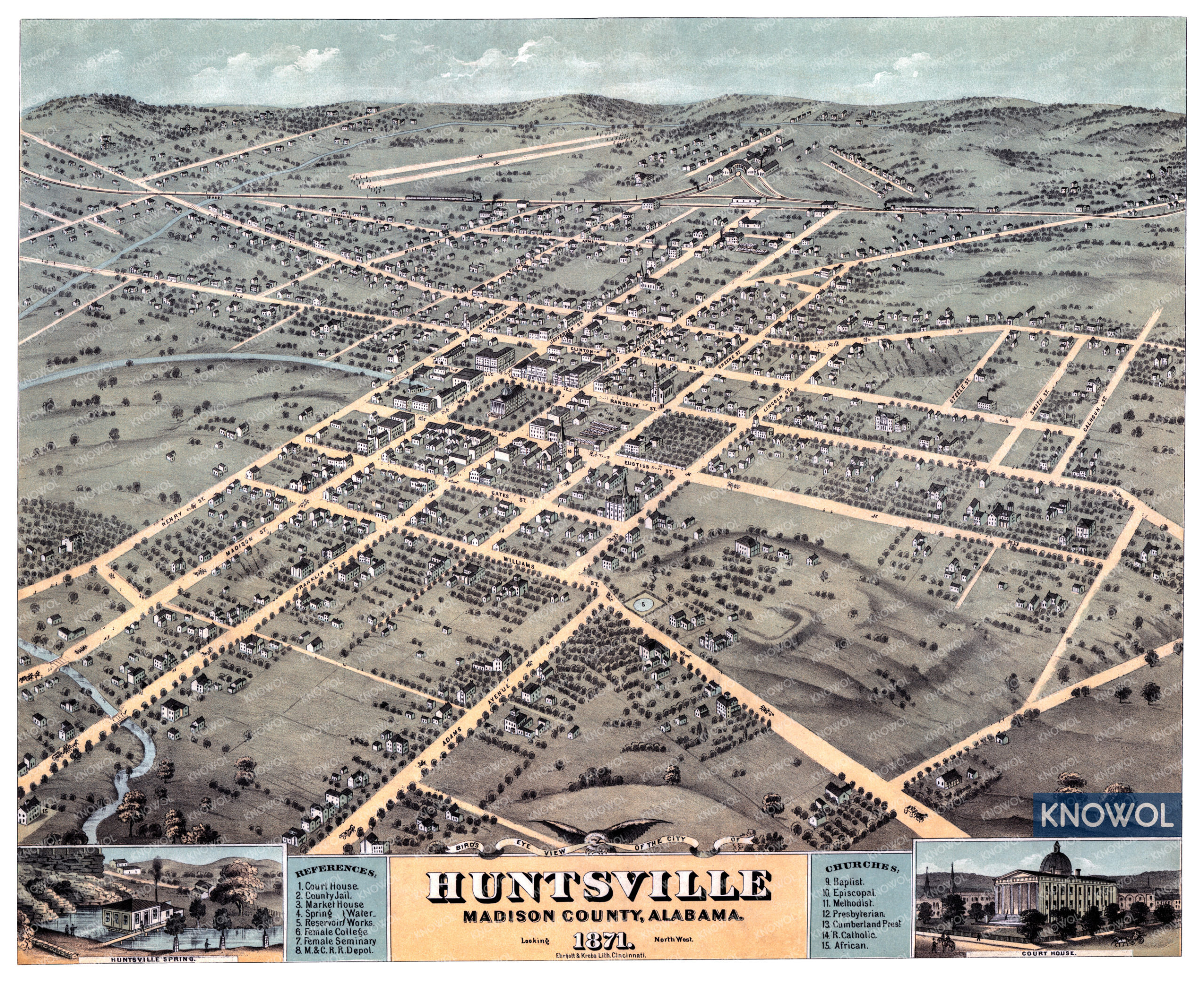
By 1871, Huntsville was an established county seat with deep roots in Alabama history. The city had grown around Big Spring, the courthouse square, local markets, schools, churches, and the railroad lines that connected northern Alabama to a wider commercial world. Madison County’s earlier prosperity had been tied closely to cotton, and the map still shows Huntsville as a town surrounded by cultivated fields, open land, and green hills beyond the street grid. At the same time, the dense center of town, the railroad depot, and the public buildings shown in the view suggest a city rebuilding and reorganizing itself in the years after the Civil War.
For anyone who grew up in Huntsville, raised a family there, studied its history, or still thinks of it as home, this old map offers a quiet way to study the city’s earlier years. Familiar street names such as Madison, Franklin, Randolph, Eustis, Gates, Williams, Lincoln, White, and Adams Avenue appear among homes, gardens, churches, and civic buildings.
This vintage map of Huntsville makes an attractive addition to your office, library, or den and can even be used to teach children the geography and history of the area. When you’re done exploring, click here to get your copy of the restored map.