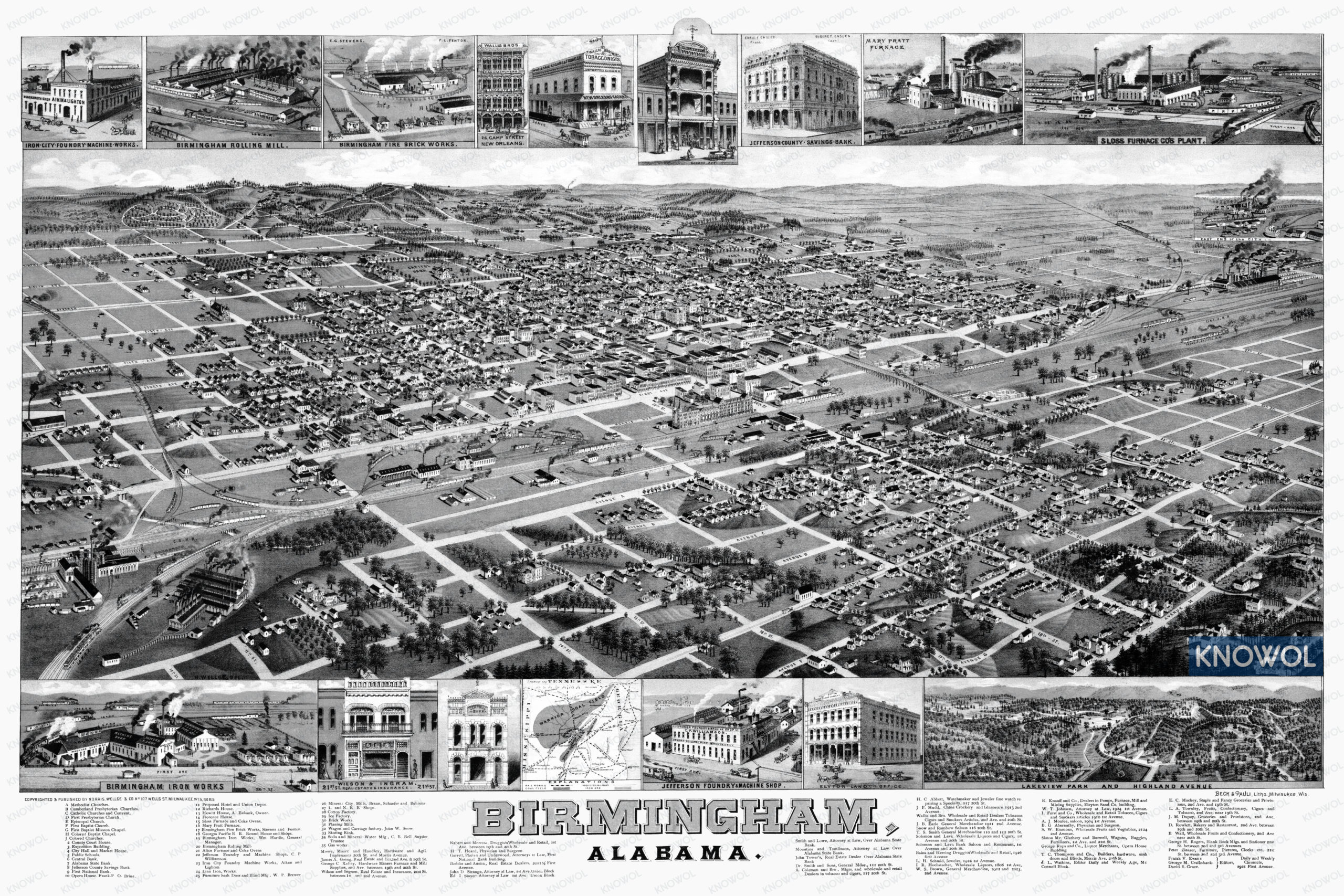
This historic map of Birmingham, Alabama was created in 1885 by George Norris and Henry Wellge, prominent 19th century map makers. The map shows a bird’s eye view of the area as it once was, including street names and old landmarks. The map has been restored by KNOWOL. Reproductions are available here.
The artist drew the map by first sketching the outline of the street grid using records at city hall. They would then spend anywhere from days to weeks walking throughout the town sketching in buildings, natural features, and other landmarks. The impressive detail on the map gives the viewer a chance to see what life in Birmingham was like in the late 19th century.
Landmarks on the map include numerous churches, Birmingham Fire Brick Works, Iron City Foundry, Mineral City Mills, Cotton Factory, Ice Factory, Skating Rink, Soda & Mineral Water Manufacturing Company, Jefferson Foundry & Machine Shops, Georgia Pacific Railroad, and more.
Historic Old Map of Birmingham, Alabama from 1885
This map of Birmingham will make an attractive addition to your office, library, or den and can even be used to teach children the geography and history of the area. When you’re done exploring, click here to get your copy of the restored map.