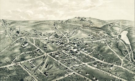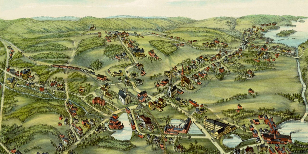
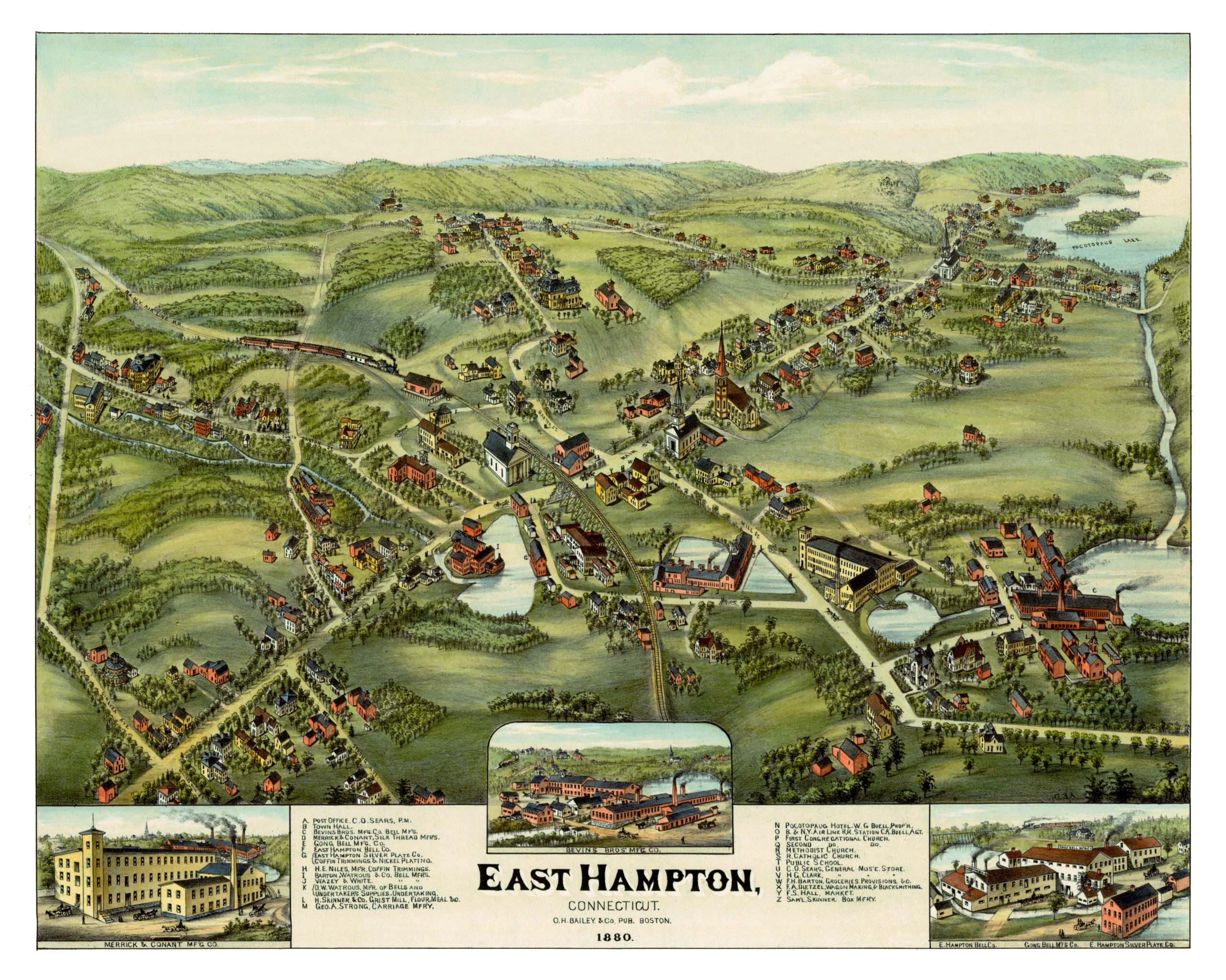
This map of East Hampton, Connecticut was first published in 1880 by O.H. Bailey of Boston, MA. Oakley Hoops Bailey was one of the most prolific panoramic map publishers of the 19th century, and spent a majority of his life publishing beautiful hand drawn maps of American towns.
The map shows a bird’s eye view of East Hampton, CT as it looked at the end of the 19th century. Notable landmarks on the map include East Hampton Town Hall, George A. Strong’s Carriage Manufactury, H.E. Niles’ Coffin Trimmings, Pocotopaug Hotel, and the East Hampton Bell Company.
Reproductions of the restored map are available through our store. A high resolution version can be viewed below.
Click here to see the map of East Hampton, CT in 1880.
This map of East Hampton has been lovingly restored by the team at KNOWOL. Reproductions of the restored map are available on museum quality, archival paper to ensure that this piece of East Hampton history can be passed on to the next generation. Click here to get a copy of the map.