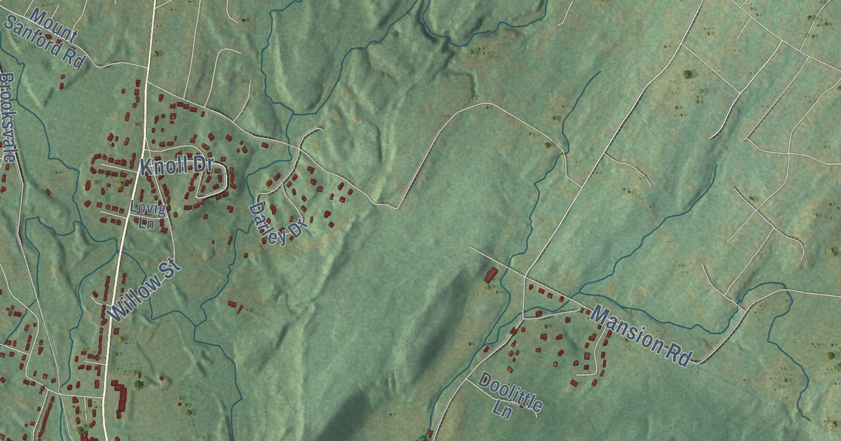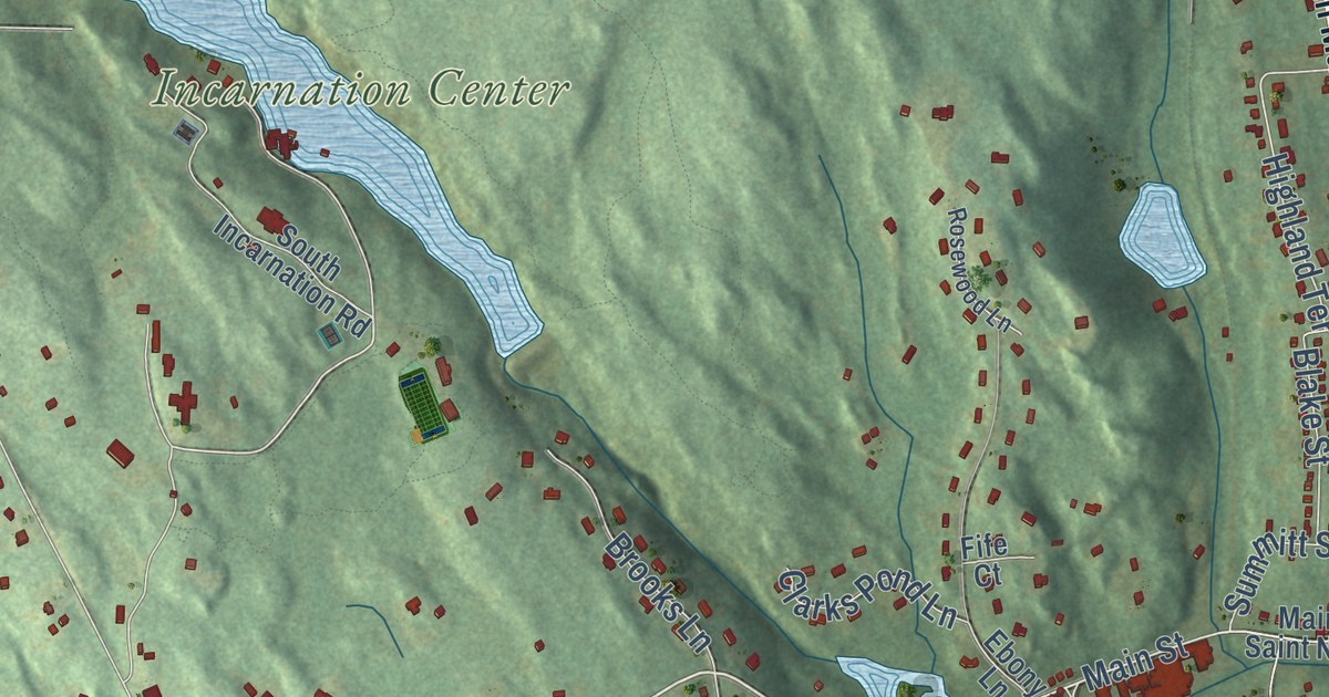
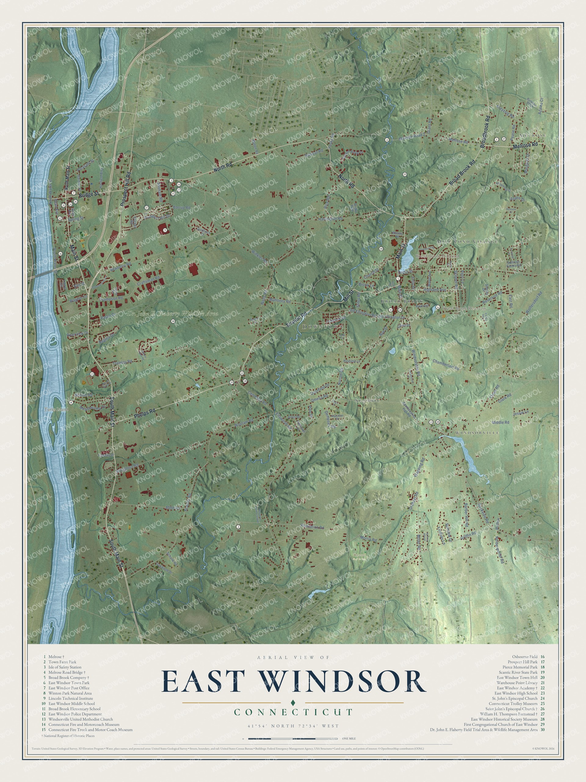
This beautifully detailed map of East Windsor, Connecticut was created in 2026 using aerial imagery combined with modern topographical, census, street and landmark data. It’s a one-of-a-kind view of East Windsor that combines accurate data with a vintage aesthetic. The map shows every building in its true location, many of the roads carry their names, and the shaded topographic relief shows the shape of the land.
See it on a wall
The East Windsor map as an 18 x 24 inch print in a black frame.

Explore an aerial view of East Windsor, Connecticut
On the map you’ll find Downtown, Melrose, Windsorville, Turks Island, Broad Brook Millpond, Broad Brook Reservoir, Topstone Golf Course, Scantic, Broad Brook, and Mill Pond Village, along with South Main Street, Main Street, and more. If you look closely you can even find your house accurately drawn in its correct location. Zoom in on the preview to look for yours. Click here to learn more about the history of East Windsor.
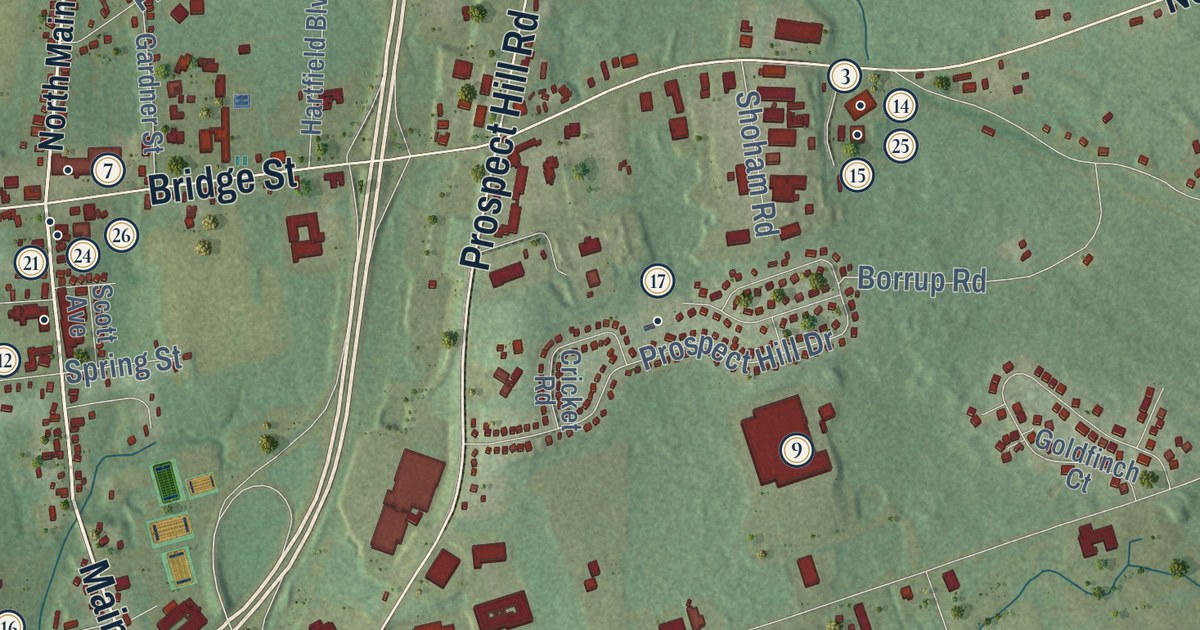
Take a closer look at the East Windsor map
Click to explore a larger preview. The digital watermark does not appear on printed maps.
Names on this map
These names are printed on this map.
Places: Downtown, Melrose, Windsorville, Turks Island, Broad Brook Millpond, Broad Brook Reservoir, Dr. John E. Flaherty Wildlife Area, Topstone Golf Course, Scantic, Broad Brook and Mill Pond Village.
Streets and roads: South Main Street, Main Street, Prospect Hill Road, Scantic Road, Mill Street, Melrose Road, North Road, Broad Brook Road, Broadbrook Road, Phelps Road, Bridge Street, Windsorville Road.
More street names, A to Z
Abbe Road, Acorn Street, Allen Drive, Apothecaries Hall Road, Aspen Drive, Azalea Court, Barber Hill Road, Borrup Road, Bridle Path, Brook Lane, Brookwood Court, Buckhorn Brook, Canyon Ridge Drive, Cemetery Road, Chamberlain Road, Church Street, Clark Road, Cobblestone Drive, Craftsman Road, Cricket Road, Dean Avenue, Deerfield Drive, Dempsey Road, Depot Street, East Road, Eastwood Drive, Elaine Drive, Ellsworth Road, Elm Street, Emily Road, Fairway Drive, Folkstone Road, Gardner Street, Goldfinch Court, Graham Road, Grant Road, Greenwoods Lane, Griffin Road, Harrington Road, Hartfield Boulevard, Hayfield Lane, Hemlock Drive, Highland Avenue, Holly Lane, Jessie Lane, Joseph Farm Road, King's Court, Kreyssig Road, Laurel Circle, Lindsay Lane, Mahoney Road, Maple Avenue, Margaret Drive, Masons Brook Lane, Mathew, Meadowview Drive, Melrose Road 2, Middle Road, Miller Road, Morris Road, Mullen Road, Napoleon Drive, Neiderwerfer Road, Newberry Road, North Main Street, North Water Street, Norton Road, Oakwood Drive, Old Ellington Drive, Old Ellington Road, Omelia Road, Park Hill, Pasco Drive, Pease Road, Perri Lane, Petticoat Lane, Pine Drive, Plantation Road, Plantation Road Extended, Pleasant Street, Prospect Hill Drive, Regina Drive, Reservoir Road, Revay Road, Rice Road, Riverview Drive, Rockville Road, Rolocut Road, Rye Street, Schank Road, Scott Avenue, Scott Road, Sharon Lane, Shoham Road, Simone Drive, Skinner Road, South Water Street, Spring Street, Steeple Chase Road, Stiles Road, Stoughton Road, Sullivan Farms Road, Sunview Drive, Thompson Road, Thrall Road, Townhouse Road, Tree Top Lane, Tromley Road, Wagner Lane, Wapping Road, Wells Road, Wesley Road, Winkler Road, Winton Road, Wolfersdorf Road, Woolam Road, Yosky Road.
This beautifully detailed map of East Windsor makes an attractive addition to your office, library, or den, and it can even be used to teach children the geography and history of the area. It also makes a great gift for anyone with East Windsor roots. When you’re done exploring, click here to get your copy of the East Windsor map.