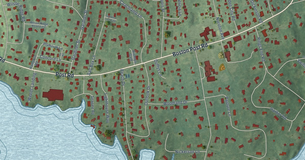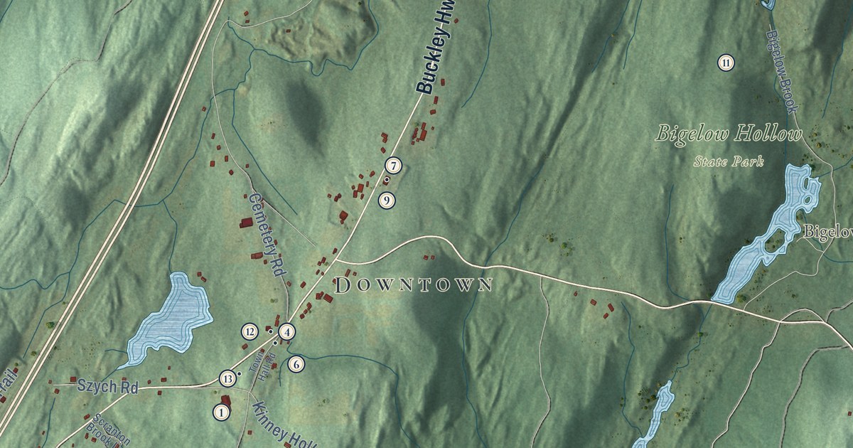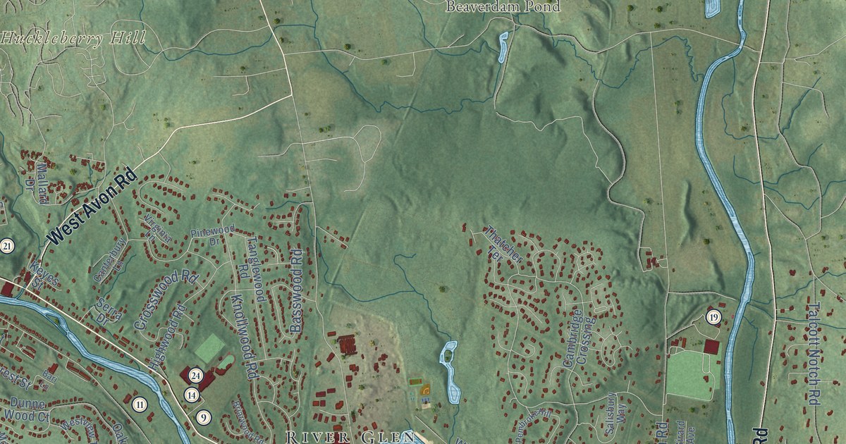
This beautifully detailed map of Farmington, Connecticut was created in 2026 using aerial imagery combined with modern topographical, census, street and landmark data. It’s a one-of-a-kind view of Farmington that combines accurate data with a vintage aesthetic. The map shows every building in its true location, many of the roads carry their names, and the shaded topographic relief shows the shape of the land.
See it on a wall
The Farmington map as an 18 x 24 inch print in a black frame.

Explore an aerial view of Farmington, Connecticut
On the map you’ll find Downtown, East Farmington Heights, Oakland Gardens, Burnt Hill, Campground Hill, Huckleberry Hill, Batterson Park Pond, Beaverdam Pond, Meadow Land, Quirk Park, Shade Swamp Sanctuary, Bensted Corner, and more. If you look closely you can even find your house accurately drawn in its correct location. Zoom in on the preview to look for yours. Click here to learn more about the history of Farmington.
Take a closer look at the Farmington map
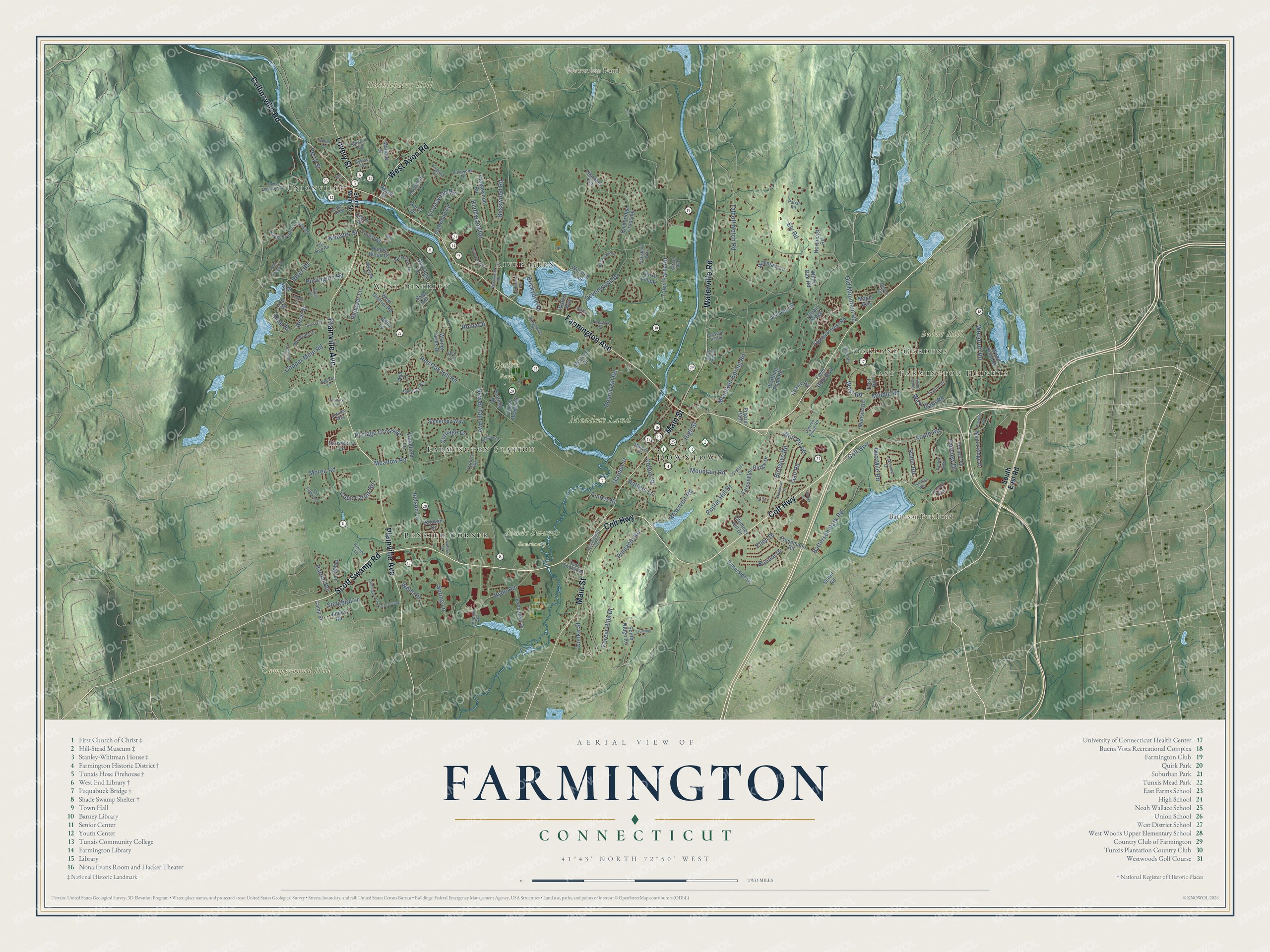
Click to explore a larger preview. The digital watermark does not appear on printed maps.
Names on this map
These names are printed on this map.
Places: Downtown, East Farmington Heights, Oakland Gardens, Burnt Hill, Campground Hill, Huckleberry Hill, Batterson Park Pond, Beaverdam Pond, Meadow Land, Quirk Park, Shade Swamp Sanctuary, Bensted Corner, Unionville, West District, River Glen and Farmington Station.
Streets and roads: Colt Highway, Scott Swamp Road, Farmington Avenue, Lovely Street, Plainville Avenue, Main Street, Collinsville Road, Waterville Road, West Avon Road, Batterson Park Road, Two Mile Road, Birch Street.
More street names, A to Z
Ash Court, Autumn Way, Bailey Court, Baldwin Drive, Bari Lane, Basswood Road, Beech Street, Bella Lane, Birdseye Road, Bonnie Drive, Bradford Walk, Briar Hill, Briarwood Road, Brickyard Road, Bridgehampton Crossing, Bridgewater Road, Burlington Road, Burnt Hill Road, Butternut Drive, Cambridge Crossing, Camp Street, Canterbury Lane, Carriage Drive, Carrier Place, Chimney Hill Drive, Colt Highway Cutoff, Colton Street, Cooke Street, Cope Farms Road, Copper Mine Road, Crosswood Road, Depot Place, Devonwood Drive, Doris Street, Dunne Wood Court, East Road, Ellen Drive, Elm Street, Ely Road, Executive Drive, Fairlawn Street, Fairview Drive, Farm Glen Boulevard, Farmington Chase Crescent, Farmington Ridge Drive, Fenwick Drive, Field Stone Run, Fienemann Road, Fir Drive, Forest Hills Drive, Forest Street, Fox Run Road, Gail Road, Garden Gate, Garden Street, Girard Avenue, Glen Hollow Drive, Goodrich Road, Hamilton Way, Hampton Court, Harold Road, Hatters Lane, High Street, Highwood Road, Hunters Ridge, Hyde Road, Inwood Lane, Johnson Avenue, Judson Lane, Junior Road, Kent Lane, Keyes Street, Knollwood Road, Lakeshore Drive, Lake Street, Lakeview Drive, Lido Road, Lincoln Street, Maiden Lane, Main Road, Mallard Drive, Maple Avenue, Maple Ridge Drive, Meadow Lane, Meadow Road, Melrose Drive, Middle Road, Mohawk Drive, Morea Road, Mountain Lane, Mountain Road, Mountain Spring Road, Muls Hill Drive, Munson Road, Nauset Lane, New Britain Avenue, Northeast Road, Oakridge Drive, Old Mountain Road, Orchard Road, Parish Road, Patrick Flood Road, Peggy Lane, Pembroke Hill, Penfield Place, Perry Street, Petemont Drive, Pheasant Hill Road, Pilgrim Path, Pine Drive, Pinewood Drive, Pinnacle Road, Poplar Hill Drive, Portage Crossing, Prattling Pond Road, Quail Ridge, Quarry Road, Redcoat Lane, Red Oak Hill Road, Reservoir Road, River Road, Robin Road, Roma Drive, Round Hill Road, Salisbury Way, Sanford Avenue, Serra Drive, Skyline Drive, Slater Road, Snowberry Lane, Somersby Way, Songbird Lane, South East Road, South Main Street, South Ridge Road, South Road, Spring Lane, Sunset Drive, Sunset Terrace, Sylvan Avenue, Taine Mountain Road, Talcott Forest Road, Talcott Notch Road, Tall Timbers Drive, Tanbark Trail, Tanglewood Road, Thatcher Terrace, Town Farm Road, Trotters Gln, Trumbull Lane, Tunxis Meade Drive, Tunxis Street, Tunxis Village, Vine Hill Road, Virginia Lane, Wakefield Lane, Walnut Farms Drive, Walton Way, Waterside Drive, Webster Street, Wells Drive, West District Road, West Gate Road, West Road, Westview Terrace, White Oak Road, Winding Trail, Wolf Pit Road, Wood Pond Road, Woodruff Road, Woodside Drive, Wyndwood Road.
This beautifully detailed map of Farmington makes an attractive addition to your office, library, or den, and it can even be used to teach children the geography and history of the area. It also makes a great gift for someone who left Farmington and still calls it home. When you’re done exploring, click here to get your copy of the Farmington map.