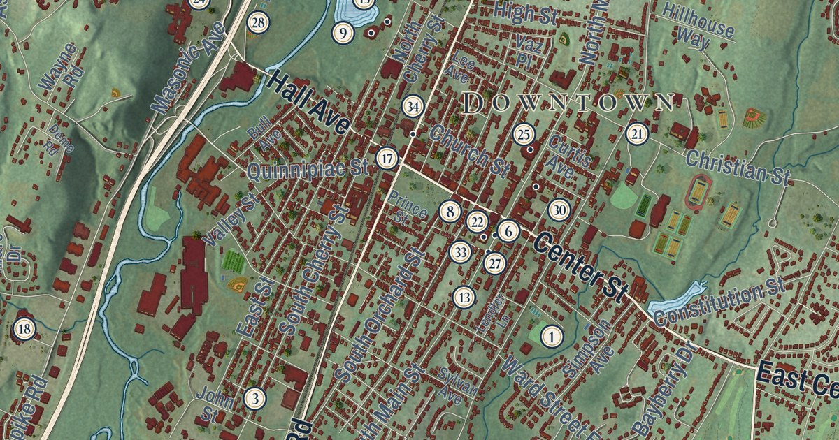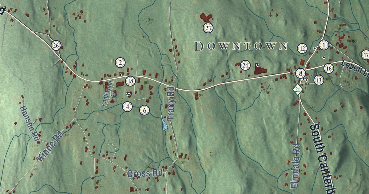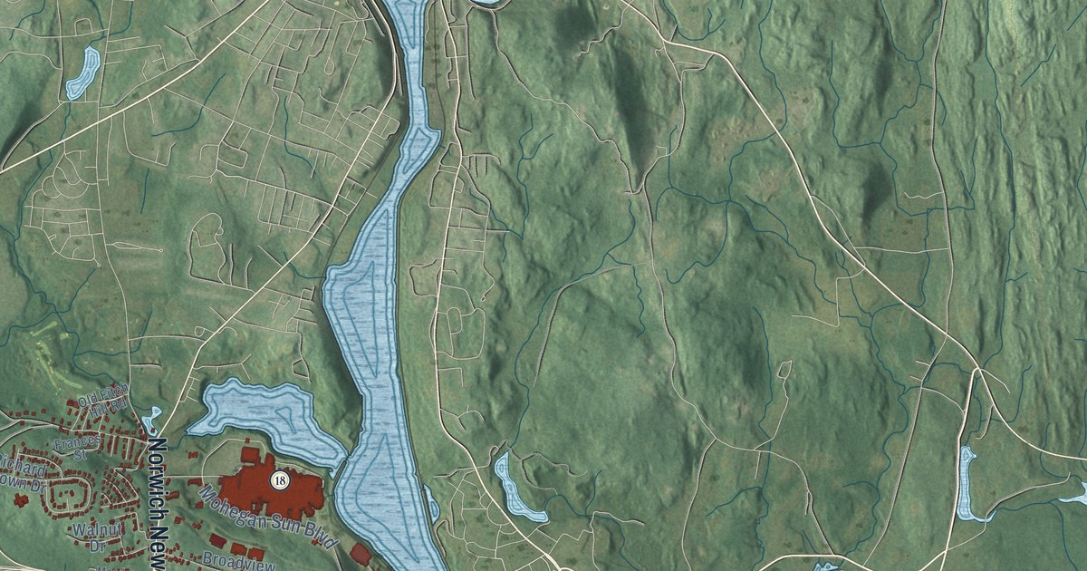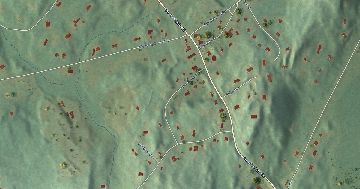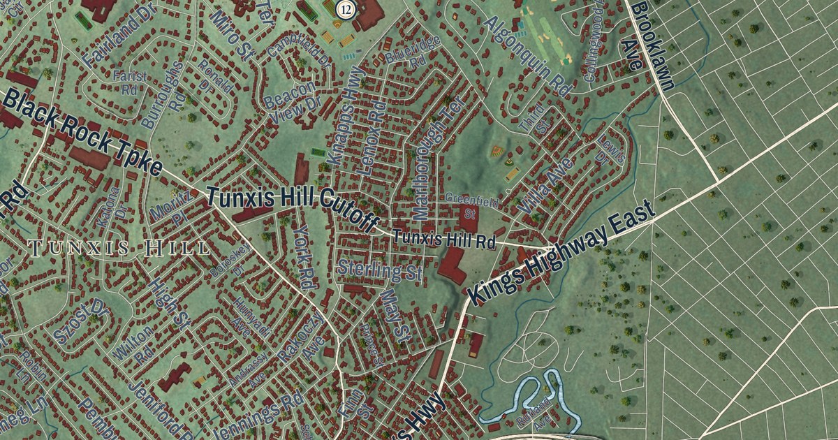
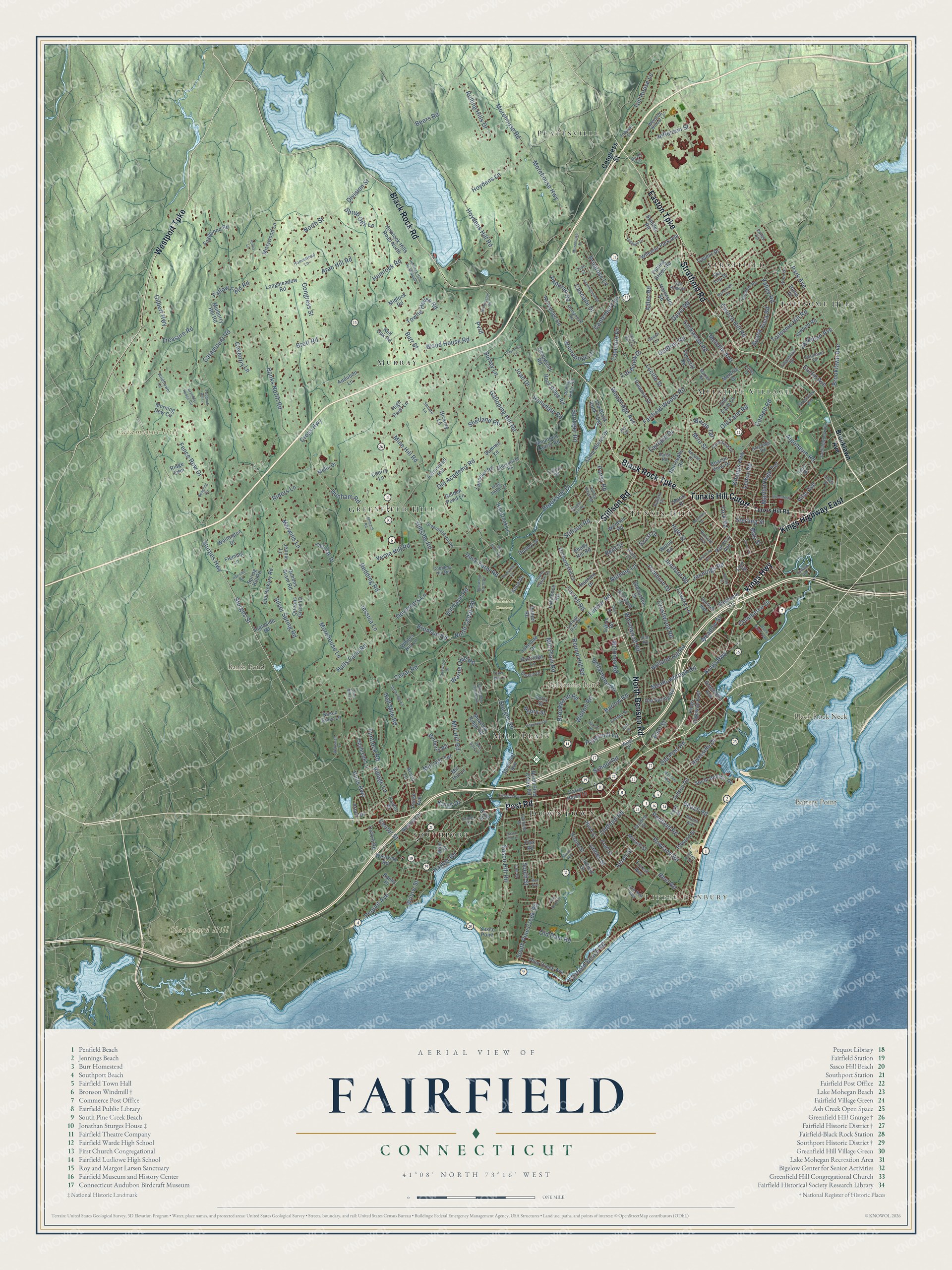
This beautifully detailed map of Fairfield, Connecticut was created in 2026 using aerial imagery combined with modern topographical, census, street and landmark data. It’s a one-of-a-kind view of Fairfield that combines accurate data with a vintage aesthetic. The map shows every building in its true location, many of the roads carry their names, and the shaded topographic relief shows the shape of the land.
See it on a wall
The Fairfield map as an 18 x 24 inch print in a black frame.

Explore an aerial view of Fairfield, Connecticut
On the map you’ll find Downtown, Little Danbury, Battery Point, Black Rock Neck, Catamount Hill, Clapboard Hill, Banks Pond, Bellarmine Pond, Oaklawn Cemetery, Plattsville, Murray, Melville Village, and more. If you look closely you can even find your house accurately drawn in its correct location. Zoom in on the preview to look for yours. Click here to learn more about the history of Fairfield.
Take a closer look at the Fairfield map
Click to explore a larger preview. The digital watermark does not appear on printed maps.
Names on this map
These names are printed on this map.
Places: Downtown, Little Danbury, Battery Point, Black Rock Neck, Catamount Hill, Clapboard Hill, Banks Pond, Bellarmine Pond, Oaklawn Cemetery, Plattsville, Murray, Melville Village, Tunxis Hill, Toilsome Hill, Southport, Greenfield Hill, Stratfield and Mill Plain.
Streets and roads: Post Road, Black Rock Turnpike, Kings Highway East, Kings Highway, Stillson Road, Stratfield Road, Tunxis Hill Cutoff, North Benson Road, Westport Turnpike, Easton Turnpike, Black Rock Road, Sturges Highway.
More street names, A to Z
Acorn Lane, Adley Road, Algonquin Road, Alma Drive, Andrassy Avenue, Aran Hill Road, Arbor Drive, Audubon Lane, Banks North Road, Banks Place, Barberry Road, Barlow Place, Barlow Road, Beach Road, Beacon View Drive, Beagling Circle, Beers Road, Bellarmine Road, Bennington Road, Bittersweet Road, Blueridge Road, Boroskey Drive, Brambly Hedge Circle, Brett Road, Brion Drive, Bronson Road, Brookbend Road, Brooklawn Avenue, Brookside Drive, Brookview Avenue, Buena Vista Road, Burroughs Road, Burr Street, Campfield Drive, Canterbury Lane, Carroll Road, Carter Henry Drive, Cascade Drive, Casmir Drive, Catamount Road, Cedar Road, Center Street, Cherry Lane, Church Hill Road, Cider Mill Lane, Coach Lane, Cobblers Hill Road, College Park Drive, Collingwood Avenue, Commerce Drive, Congress Street, Cornell Road, Coventry Lane, Crestwood Road, Cross Highway, Davis Road, Daybreak Lane, Deepwood Road, Dill Road, Division Street, Doreen Drive, Duck Farm Road, Dudley Drive, Dunham Road, Eastfield Drive, Edgewood Road, Edward Street, Eliot Street, Elm Street, Ermine Street, Euclid Avenue, Fairfield Beach Road, Fairfield Place, Fairfield Woods Road, Fairland Drive, Fairmount Terrace, Fair Oak Drive, Fallow Field Road, Farist Road, Farmstead Hill, Federal Street, Fence Row Drive, Ferncliff Road, Fern Street, Field Point Drive, Finn Street, Flax Road, Fleming Lane, Flintlock Road, Florence Lane, Flower House Drive, Foggwood Road, Forest Avenue, Frog Pond Lane, Fulling Mill Lane North, Galloping Hill Road, Gate Ridge Road, Gilbert Highway, Glenarden Drive, Godfrey Road, Golden Pond Lane, Gould Avenue, Governors Lane, Grasmere Avenue, Greenfield Hill Road, Greenfield Street, Grist Mill Lane, Half Mile Road, Hanford Drive, Harbor Road, Harvester Road, Hemlock Hills Road North, Hemlock Hills Road South, Hemlock Road, Henry Street, Hickory Lane, High Point Lane, High Street, Hilary Circle, Hill Brook Lane, Hill Farm Road, Hillside Road, Holland Hill Road, Hollydale Road, Homestead Lane, Hoydens Hill Road, Hoydens Lane, Hulls Farm Road, Hulls Highway, Hunter Road, Hunyadi Avenue, Hurd Street, Ingleside Road, Inwood Road, Ironside Road, Jackman Avenue, James Street, Jay Circle, Jefferson Street, Jeniford Road, Jennie Lane, Jennings Road, Jessica Lane, Joan Drive, Judson Road, Katona Drive, Kings Drive, Knapps Highway, Knollwood Drive, Lakeside Drive, Lakeview Drive, Lalley Boulevard, Lancelot Road, Lawrence Road, Leeber Road, Lee Drive, Lenox Road, Lewis Drive, Linley Drive, Linwood Avenue, Lockwood Road, Longmeadow Road, Lovers Lane, Lucille Street, Lynch Road, Main Street, Marian Road, Mariners Way, Marlborough Terrace, May Street, McInnes Road, Meadowbrook Road, Meadow Ridge Road, Meadow Street, Melin Drive, Melville Avenue, Melville Drive, Merwins Lane, Midlock Road, Milbank Road, Millard Street, Mill Hill Lane, Mill Hill Road, Mill Hill Terrace, Mill Plain Road, Mill River Road, Mine Hill Road, Miro Street, Mistywood Lane, Morehouse Drive, Morehouse Highway, Morehouse Lane, Morehouse Road, Moritz Place, Morning Dew Circle, Mountain Laurel Road, Mulberry Hill Road, Nonopoge Road, North Cedar Road, North Pine Creek Road, North Street, Nutmeg Lane, Old Academy Road, Old Black Rock Turnpike, Old Dam Road, Old Farm Lane, Old Farm Road, Oldfield Drive, Oldfield Road, Old Hickory Road, Old Post Road, Old Spring Road, One Rod Highway, Open Gate Lane, Orchard Hill Lane, Oxford Road, Paddock Hill Lane, Palamar Drive, Pansy Road, Papermill Lane, Papurah Road, Park Avenue, Partridge Lane, Paulding Street, Pease Avenue, Pemburn Drive, Penfield Road, Pequot Avenue, Perry Street, Pine Creek Avenue, Pratt Street, Primrose Lane, Prince Street, Putting Green Road, Pvrd, Queens Grant Drive, Queens Grant Road, Rakoczy Avenue, Random Road, Redding Road, Red Oak Road, Reef Road, Reid Street, Rena Place, Rennell Drive, Rhoda Avenue, Riders Lane, Ridge Cmn, Rita Avenue, Riverside Drive, River Street, Riverview Circle, Robin Lane, Rock Ridge Road, Rolling Hills Drive, Rolling Ridge Road, Romanock Road, Ronald Drive, Ross Road, Round Hill Road, Rowland Road, Ruane Street, Rutland Avenue, Samp Mortar Drive, Sasco Hill Road, Sasco Hill Terrace, Sasco Point, Sasco River Lane, Saxonwood Road, Schiller Road, School Road, School Street, Senate Lane, Shady Hill Road, Sherwood Drive, Sherwood Farm Road, Shetland Road, Short Hill Lane, Shrub Oak Lane, Silver Spring Road, Sky Top Drive, Somerset Avenue, South Benson Road, South Pine Creek Road, South Street, Springer Road, Spring Hill Road, Stella Lane, Stephens Lane, Sterling Street, Stoneleigh Road, Sturbridge Lane, Sturges Road, Sturges Street, Summit Lane, Sunset Avenue, Surrey Lane, Szost Drive, Tahmore Drive, Taintor Drive, Taylor Place, Third Street, Toilsome Hill Road, Toll House Lane, Towne House Road, Trail Street, Treasure Road, Trillium Road, Tunxis Hill Road, Unquowa Road, Valley Circle, Valley Road, Valley View Road, Veres Street, Verna Hill Road, Villa Avenue, Village Lane, Wagon Hill Road, Wakeman Lane, Walls Drive, Warde Terrace, Warner Hill Road, Weeping Willow Lane, Wellington Drive, Westway Road, Wheeler Park Avenue, Whites Hill Lane, Wildflower Lane, Willow Street, Wilton Road, Windsor Road, Winnepoge Drive, Winton Road, Wood House Road, Woodridge Avenue, Wormwood Road, York Road.
This beautifully detailed map of Fairfield makes an attractive addition to your office, library, or den, and it can even be used to teach children the geography and history of the area. It also makes a great gift for anyone who grew up in Fairfield or moved away. When you’re done exploring, click here to get your copy of the Fairfield map.