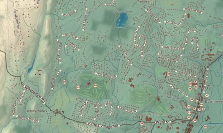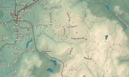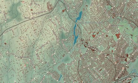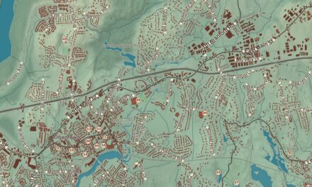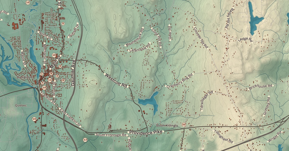
If you grew up in Killingly, or you’ve ever walked Main Street in Danielson past the old brick blocks, you’ll find your town on this map just as it stands in 2026. Look for your road. Main Street, Hartford Pike, North Street, Providence Pike, Thompson Pike, Westcott Road, Green Hollow Road, Snake Meadow Road, River Road, Valley Road, Taft Street and Maple Street are all printed by name, along with many more.
Killingly is in Windham County, in the northeast corner of Connecticut on the Rhode Island line.
KNOWOL made this map in 2026 from public survey data, and gave it the look of an old atlas. The shaded hills, from Danielson and the Quinebaug valley east to Pineville and the high country along Rhode Island, come from United States Geological Survey elevation data. The streets and the town line come from the Census Bureau, right down to small roads like South Frontage Road. Killingly Center, Danielson, Dayville, Ballouville, East Killingly, South Killingly and Pineville are printed by name. A guide of 34 numbered landmarks runs along the bottom, with the National Register sites marked, and we checked those against National Park Service records.
Aspinock Becomes Killingly
This was the land of the Quinebaug people, and the name Quinebaug means “long pond.” In 1653 John Winthrop the younger, son of the Massachusetts Bay Colony’s founding governor, received a grant of the Quinebaug Country, and English colonists first settled the part that’s now Killingly in 1700. They called it Aspinock. When the town was incorporated in May 1708, Governor Saltonstall was asked to suggest a name. His family’s old lands lay at Killanslie and Pontefract in Yorkshire, so he suggested “Kellingly,” and the spelling later changed. That’s the year on the title panel: Incorporated 1708.
Killingly began as a string of mill villages on its rivers, the Five Mile and the Quinebaug. In the 1830s it was Connecticut’s largest maker of cotton goods, spinning cotton shipped up from the Deep South, and in the early 1900s it was known as the curtain capital of the world. Many of the old mill villages are still lively places today. In 1979 the first Laotian family came to Danielson, sponsored by Daniel and Carolyn O’Leary, and over the next decade the O’Learys sponsored nearly 500 Laotian refugees.
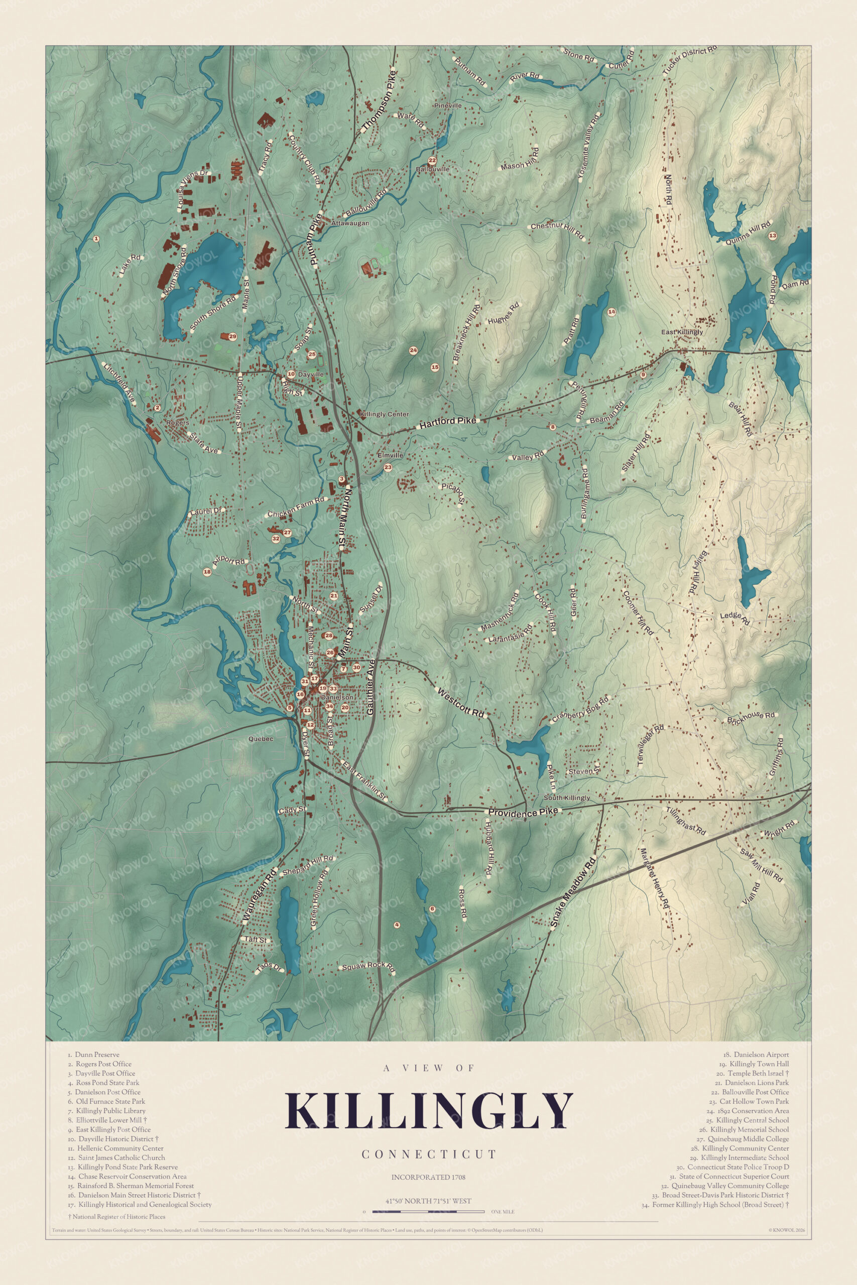
Click to explore a larger preview. The digital watermark does not appear on printed maps.
Names on this map
These names are printed on this map.
Places: Pineville, Bear Hill, Quebec, 1892 Conservation Area, Ballouville Post Office, Breakneck Hill, Broad Street--Davis Park Historic District, Cat Hollow Town Park, Chase Reservoir Conservation Area, Danielson Lions Park, Danielson Main Street Historic District, Danielson Post Office, Dayville Historic District, Dayville Post Office, Dunn Preserve, East Killingly, Elliottville Lower Mill, Hellenic Community Center, Killingly Center, Killingly Central School, Killingly Community Center, Killingly High School, Killingly Historical and Genealogical Society, Killingly Intermediate School, Killingly Memorial School, Killingly Pond State Park Reserve, Killingly Public Library, Killingly Town Hall, Old Furnace State Park, Quinebaug Middle College, Quinebaug Valley Community College, Rainsford B. Sherman Memorial Forest, Rogers Post Office, Ross Pond State Park, Slater Hill, South Killingly, State of Connecticut Superior Court and Temple Beth Israel.
Streets and roads: S Shore Rd, Tracy Rd, Maple St, Thompson Pike, Breakneck Hill Rd, Pratt Rd, Chicken Farm Rd, Soap St, Main St, Valley Rd, Hill Rd, Sunset Dr.
More street names, A to Z
Bailey Hill Rd, Broad St, Cady St, E Franklin St, Gauthier Ave, Geer Rd, Griffiths Rd, Henry Rd, Hubbard Hill Rd, Mashentuck Rd, Shepard Ave, Slater Hill Rd, Taft St, Wauregan Rd, Wright Rd.
Danielson
The thickest cluster of numbers is the borough of Danielson, just above the meeting of the Quinebaug and Five Mile Rivers. It was first named Danielsonville, for General James Danielson, who built the first house there, and its growth began in 1809, when the brothers James and Hezekiah Danielson built a cotton spinning mill. The Norwich and Worcester Railroad came through in the 1830s, and downtown Danielson grew up along Main Street on both sides of Railroad Square. The guide marks it as the Danielson Main Street Historic District (16), 20 acres and more than 40 buildings, mostly masonry business blocks built between about 1850 and 1920. It was listed on the National Register in 1992. Killingly Town Hall (19) is in the district, in an 1876 Gothic Revival music hall, and the State of Connecticut Superior Court (31), the Hellenic Community Center (11) and Saint James Catholic Church (12) are close by. The Killingly Historical and Genealogical Society (17) is right beside the town hall.
Just north is the Broad Street-Davis Park Historic District (33), where well-off families built large Victorian houses above the river terrace. It takes in Davis Park, a triangular green laid out in 1890, and the house of Hezekiah Danielson, built about 1825, the oldest building in the district. It was listed on the National Register in 1998. Inside it stands the Former Killingly High School (Broad Street) (34), built in 1908 and used until 1965. It was listed on the National Register in 1992 and now serves as the town’s community center. The guide also lists the Killingly Community Center (28) a little to the north.
East of the business district is Temple Beth Israel (20), one of the first Modernist synagogues in Connecticut. After the Second World War, Holocaust survivors settled in the area and joined the Jewish families already here to found a temple. Members of the congregation helped build it, beginning in 1951, and it was dedicated in 1961. It’s on the National Register and is now a cultural and historical center. Farther north are the Killingly Public Library (7), Killingly Memorial School (26), Connecticut State Police Troop D (30) and Danielson Lions Park (21). The guide also lists the Danielson Post Office (5).
Dayville and the North
Northwest of Danielson are Danielson Airport (18), Quinebaug Valley Community College (32), which opened in 1971 and built its Upper Maple Street campus in 1983, and Quinebaug Middle College (27). Farther north is Dayville, named for Captain John Day, who owned the water rights on the Five Mile River. When the railroad opened, Dayville became a freight hub for the mill villages along the river, and its Greek Revival church went up by 1849. The Dayville Historic District (10), with temple-front Greek Revival houses and later Italianate and Queen Anne homes of mill owners, was listed on the National Register in 1988. Killingly Central School (25) and Killingly Intermediate School (29) are close by, and the guide lists the Dayville Post Office (3). Farther north is the Ballouville Post Office (22), and to the east are the Rainsford B. Sherman Memorial Forest (15), Cat Hollow Town Park (23), the Chase Reservoir Conservation Area (14) and the Killingly Pond State Park Reserve (13) in the northeast.
East Killingly and the Furnace
In East Killingly, on Peep Toad Road where it crosses Whetstone Brook, is the Elliottville Lower Mill (8), also called the Peep Toad Mill. Built about 1850, it’s a rare surviving wood-frame textile mill, with its dam, pond, raceway and a stone arch bridge, and it was listed on the National Register in 1982. The guide also lists the East Killingly Post Office (9).
South of Route 6 are Old Furnace State Park (6) and Ross Pond State Park (4). Old Furnace is named for an iron furnace that ran here from before the Revolution until the mid-1800s. During the war its iron was made into horseshoes for the Continental Army, and later into parts for the area’s cotton mills. The town bought the land in 1909 and passed it to the state in 1918. The guide also lists the Rogers Post Office (2), the Dunn Preserve (1) and the 1892 Conservation Area (24).
This map of Killingly makes a handsome addition to a living room, office, library or den, and it can even help teach children the geography and history of the town. It’s a thoughtful gift for anyone who calls Killingly home, grew up here, or moved away. Created by KNOWOL in 2026, it’s printed on museum quality archival paper in three sizes. Zoom in on the preview above to explore the details, then click here to get your copy of the Killingly map.

Sources
- Killingly, ConnecticutHistory.org
- Killingly, Connecticut, Wikipedia
- Danielson, Connecticut, Wikipedia
- Danielson Main Street Historic District, Wikipedia
- Broad Street-Davis Park Historic District, Wikipedia
- Killingly High School, Wikipedia
- Temple Beth Israel, Wikipedia
- Quinebaug Valley Community College, Wikipedia
- Dayville Historic District, Wikipedia
- Elliottville Lower Mill, Wikipedia
- Old Furnace State Park, Wikipedia