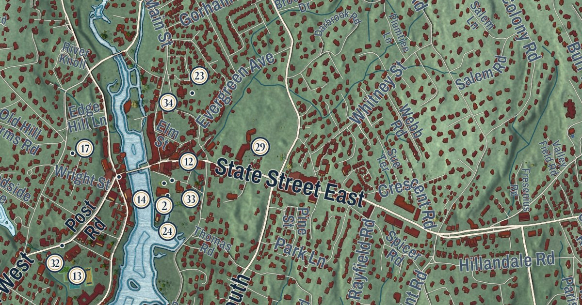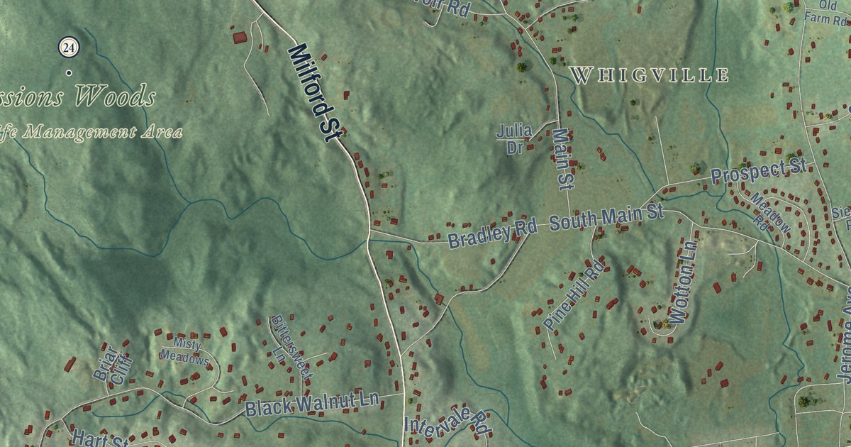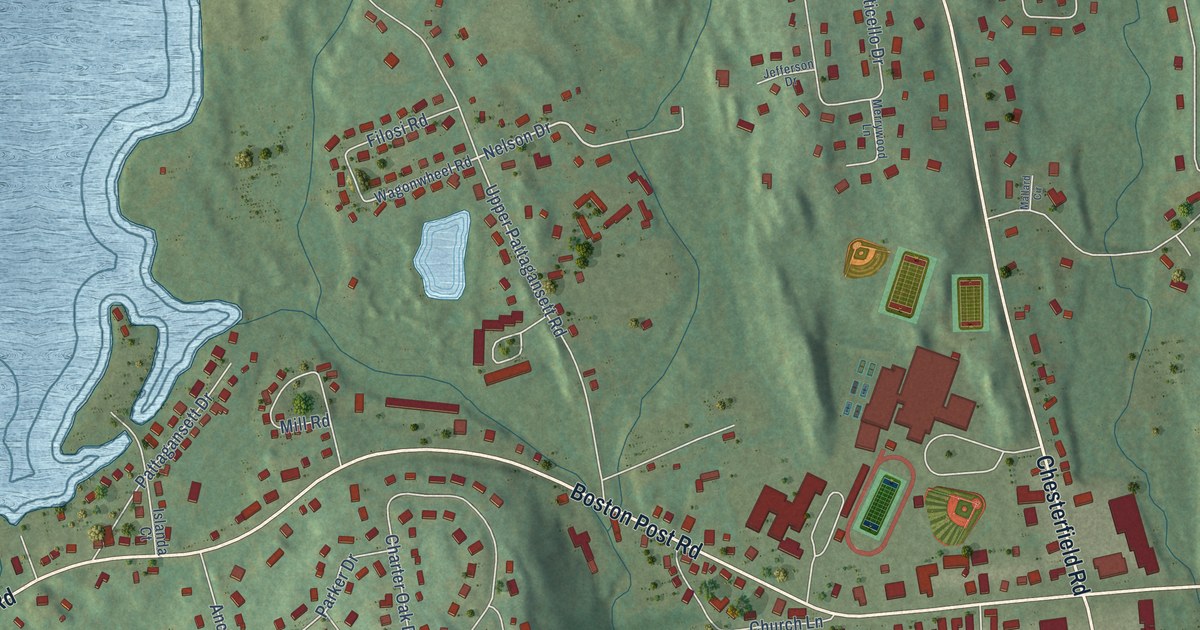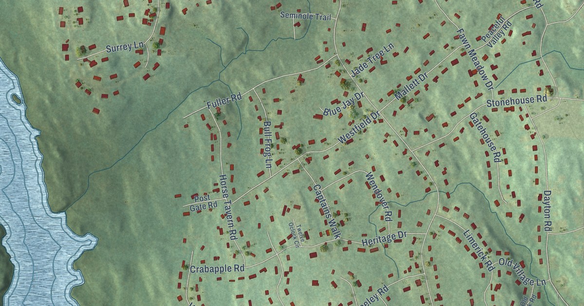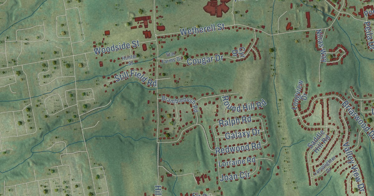
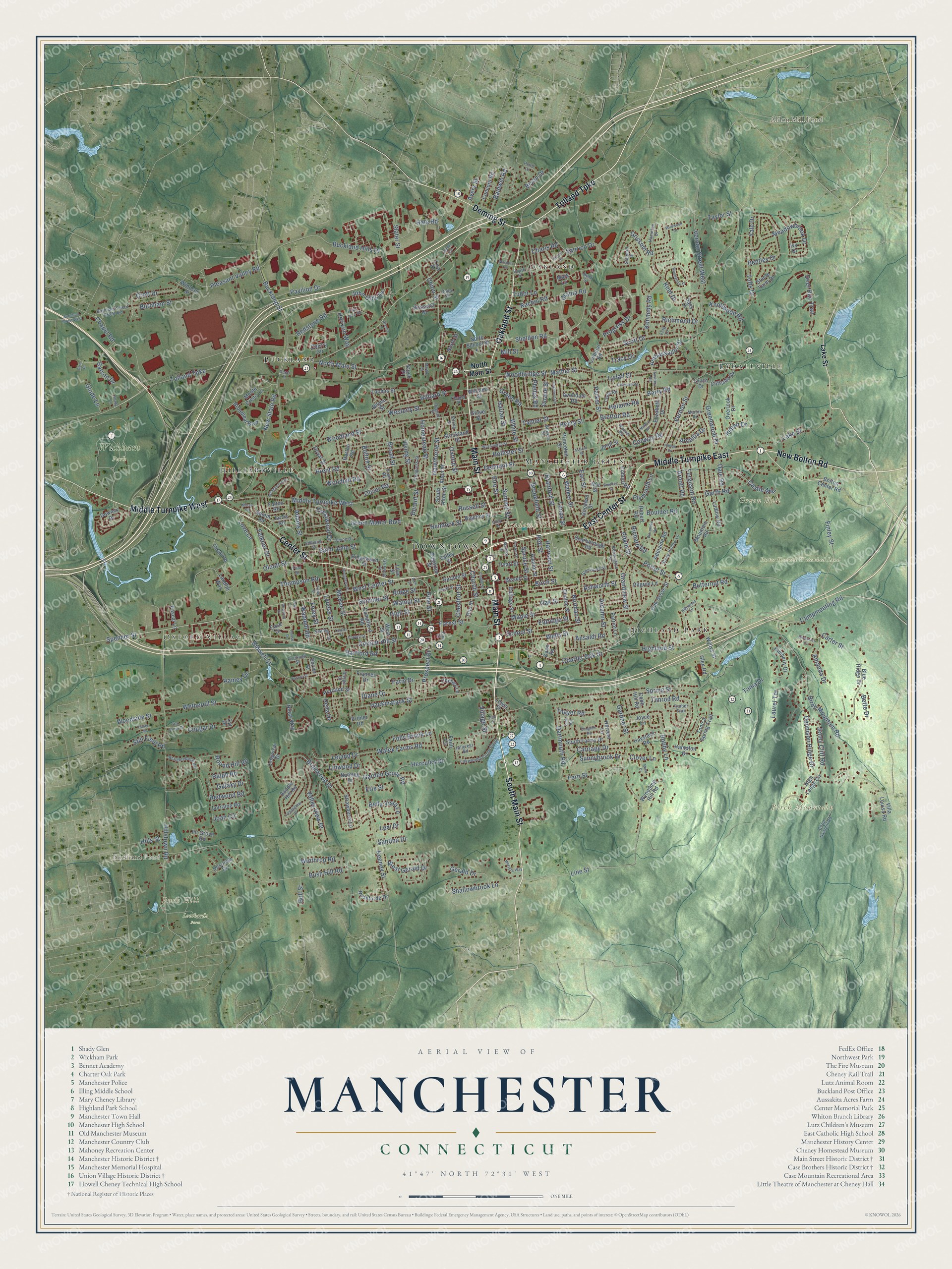
This beautifully detailed map of Manchester, Connecticut was created in 2026 using aerial imagery combined with modern topographical, census, street and landmark data. It’s a one-of-a-kind view of Manchester that combines accurate data with a vintage aesthetic. The map shows every building in its true location, many of the roads carry their names, and the shaded topographic relief shows the shape of the land.
See it on a wall
The Manchester map as an 18 x 24 inch print in a black frame.

Explore an aerial view of Manchester, Connecticut
On the map you’ll find Downtown, Lydallville, Oxford Village, Academy Hill, Birch Mountain, Bush Hill, Green Hill, Aldon Mill Pond, Buckland Pond, Lombardo Farm, Porter Howard Watershed Land, Wickham Park, and more. If you look closely you can even find your house accurately drawn in its correct location. Zoom in on the preview to look for yours. Click here to learn more about the history of Manchester.
Take a closer look at the Manchester map
Click to explore a larger preview. The digital watermark does not appear on printed maps.
Names on this map
These names are printed on this map.
Places: Downtown, Lydallville, Oxford Village, Academy Hill, Birch Mountain, Bush Hill, Green Hill, Aldon Mill Pond, Buckland Pond, Lombardo Farm, Porter Howard Watershed Land, Wickham Park, Buckland, Oakland, Highland Park, Hilliardville and Manchester Green.
Streets and roads: Main Street, South Main Street, Tolland Turnpike, Center Street, East Center Street, Deming Street, Middle Turnpike East, Middle Turnpike West, Oakland Street, New Bolton Road, Hartford Road, Spencer Street.
More street names, A to Z
Ada Lane, Adams Street, Adelaide Road, Alton Street, Amanda Drive, Ambassador Drive, Ansaldi Road, Arcellia Drive, Arch Street, Arnott Road, Ash Street, Ashworth Street, Asylum Street, Autumn Street, Avery Street, Avondale Road, Baldwin Road, Barry Road, Batson Drive, Bella Vista Lane, Bell Street, Bentley Drive, Bent Street, Bette Drive, Bidwell Street, Bigelow Street, Bilyeu Street, Birch Mountain Road, Birch Street, Bissell Street, Bluefield Drive, Blue Ridge Drive, Bobby Lane, Bolton Center Road, Bolton Street, Boulder Road, Bowers Street, Bramblebush Road, Branford Street, Brent Road, Bretton Road, Briarwood Drive, Bridge Street, Broadleaf Boulevard, Broad Street, Brookfield Street, Brookview Circle, Bryan Drive, Buckland Hills Drive, Buckland Street, Burnham Street, Burnham Street Extended, Burnham Street West, Bush Hill Road, Butternut Road, Campfield Road, Campmeeting Road, Carriage Drive, Carter Street, Case Drive, Castle Mill, Chapel Road, Chapel Street, Charis Road, Charter Oak Street, Cheney Lane, Cherry Circle, Chestnut Street, Church Street, Cliffside Drive, Clinton Street, Clover Lane, Clyde Road, Cobb Hill Road, Coburn Road, Coleman Road, Colonial Road, Concord Road, Congress Street, Conway Road, Cooper Hill Street, Coop Sawmill Road, Cornell Street, Cottage Street, Cougar Drive, Coughlin Road, Crestwood Drive, Croft Drive, Cyr Drive, Dale Road, Dartmouth Road, Deer Run Trail, Delmont Street, Dennison Ridge Drive, Depot Street, Desousa Drive, Devon Drive, Diane Drive, Doane Street, Dougherty Street, Downey Drive, Durant Street, Duval Street, Earl Street, Edgerton Street, Edmund Street, Eldridge Street, Elizabeth Drive, Elm Street, Elro Street, Elvree Street, Erie Street, Faith Circle, Falknor Drive, Falls View Road, Farm Drive, Ferguson Road, Fern Street, Finley Street, Fir Grove Road, Flag Drive, Flint Drive, Foley Street, Folly Brook Lane, Forest Street, Foster Street, Frances Drive, Fulton Road, Galaxy Drive, Garden Grove Road, Garden Street, Gardner Street, Garth Road, Gear Drive, Gerald Drive, Gianna Drive, Glen Road, Glenwood Street, Glode Lane, Goodwin Street, Grandview Street, Grant Road, Green Manor Boulevard, Green Road, Greenwood Drive, Grissom Road, Griswold Street, Grove Street, Hackmatack Street, Hale Road, Hamilton Drive, Hamlin Street, Hampton Drive, Harlan Street, Harrison Street, Harvest Lane, Hawthorne Street, Haystack Road, Helaine Road, Hemlock Street, Henry Street, Hercules Drive, Highland Street, High Ledge Circle, High Street, Highwood Drive, Hillcrest Road, Hilliard Street, Hills Street, Hillstown Road, Hilltop Drive, Hollister Street, Holl Street, Homestead Street, Horace Street, Horizon Way, Horton Road, House Drive, Hunter Street, Hyde Street, Indian Drive, Irving Street, Ivy Drive, Jarvis Road, Jenny Cliff Road, Joan Circle, John Olds Drive, Jordt Street, Joyce Lane, Kane Road, Keeney Street, Kennedy Road, Kensington Street, Kent Drive, Kimberly Drive, Knollwood Road, Lake Street, Lakewood Circle South, Lamplighter Drive, Landfill Way, Laurel Street, Laurel Terrace, Leland Drive, Lenox Street, Lewis Street, Lexi Drive, Lilac Street, Lilley Street, Linden Street, Line Street, Linwood Drive, Lisa Drive, Longview Drive, Loomis Street, Lorraine Road, Love Lane, Lucian Street, Ludlow Road, Lydall Street, Lynch Drive, Lyness Street, Madison Street, Maple Street, Marble Street, Marion Drive, Marjorie Lane, Mark Lane, Masters Way, Mather Street, McKee Street, Meadowbrook Drive, Milford Road, Mill Street, Monte Cristo Lane, Morse Road, Mountain Road, New State Road, Ninas Way, Nolan Circle, Norman Street, North Main Street, North School Street, North Street, Nutmeg Drive, Nye Street, Oak Grove Street, Oak Street, Oakwood Road, Olcott Street, Oliver Road, Otis Street, Overland Street, Overlook Drive, Oxford Street, Parker Street, Pascal Lane, Patriot Lane, Pavilion Drive, Pearl Street, Peila Drive, Phelps Road, Pilgrim Lane, Pine Street, Pitkin Street, Pleasant Valley Road, Plymouth Lane, Pond Lane, Porter Street, Portland Street, Primer Road, Princeton Street, Progress Drive, Prospect Street, Rachel Road, Ralph Road, Ramey Drive, Redstone Road, Redwood Road, Reed Drive, Regent Street, Richard Road, Richmond Drive, Ridge Street, Ridgewood Street, Robert Road, Rossetto Drive, Round Hill Road, Rushforde Drive, Russell Street, Saddle Hill Road, Saint John Street, Salem Road, Sanrico Drive, Santina Drive, Sass Drive, Saulters Road, Scarborough Road, School Street, Scott Drive, Seaman Circle, Server Street, Shady Lane, Shallowbrook Lane, Sheldon Road, Shepard Drive, Slater Street, South Alton Street, South Farms Drive, South Street, Spring Street, Spruce Street, Star Farms Drive, Steele Farm Drive, Steep Hollow Lane, Stephen Street, Still Field Road, Stock Place, Strawberry Lane, Strickland Street, Strong Street, Summer Street, Summit Street, Sunnybrook Drive, Tania Drive, Tanner Street, Taylor Street, Thayer Road, Thompson Road, Thrall Road, Timber Trail, Timrod Road, Tonica Spring Trail, Tracy Drive, Tuck Road, Tudor Lane, Tufts Drive, Union Place, Union Street, Utopia Road, Valley Street, Valley View Drive, Vernon Street, Vernon Street West, Village Street, Villa Louisa Road, Waddell Road, Walek Farms Road, Walker Street, Walnut Street, Waranoke Road, Washington Street, Weaver Road, Wedgewood Drive, Wells Street, West Center Street, Westerly Street, West Gerald Drive, West Street, Wetherell Street, White Street, Wildwood Drive, Williams Street, Windsor Street, Winthrop Road, Woodbridge Street, Woodhill Road, Woodland Street, Woodside Street, Woodstock Drive, Wyllys Street, Wyneding Hill Road, Yale Drive.
This beautifully detailed map of Manchester makes an attractive addition to your office, library, or den, and it can even be used to teach children the geography and history of the area. It also makes a great gift for anyone who grew up in Manchester or moved away. When you’re done exploring, click here to get your copy of the Manchester map.