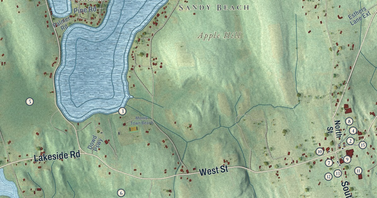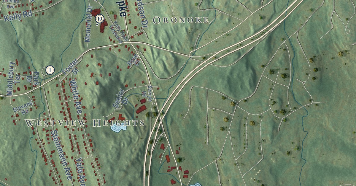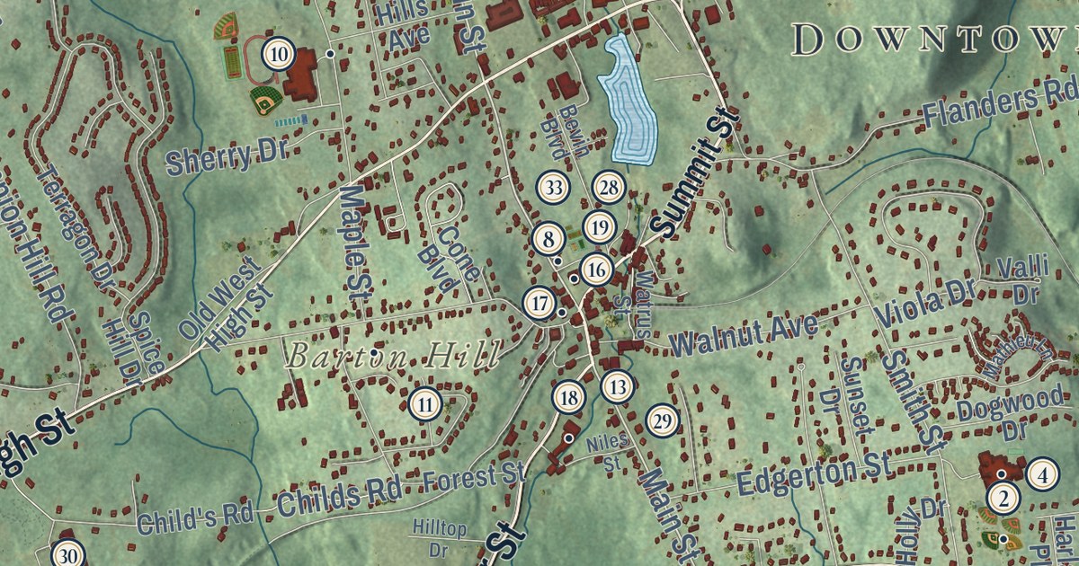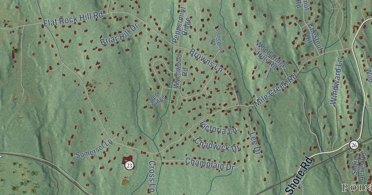
This beautifully detailed map of Old Lyme, Connecticut was created in 2026 using aerial imagery combined with modern topographical, census, street and landmark data. It’s a one-of-a-kind view of Old Lyme that combines accurate data with a vintage aesthetic. The map shows every building in its true location, many of the roads carry their names, and the shaded topographic relief shows the shape of the land.
See it on a wall
The Old Lyme map as an 18 x 24 inch print in a black frame.

Explore an aerial view of Old Lyme, Connecticut
On the map you’ll find Downtown, Point O’Woods, Amon Hill, Ayers Point, Bills Hill, Calves Island, Big Pond, Black Hall Pond, Ames Family Open Space, Champlain South Open Space, Lay-Allen Preserve, Nehantic State Forest, and more. If you look closely you can even find your house accurately drawn in its correct location. Zoom in on the preview to look for yours. Click here to learn more about the history of Old Lyme.
Take a closer look at the Old Lyme map
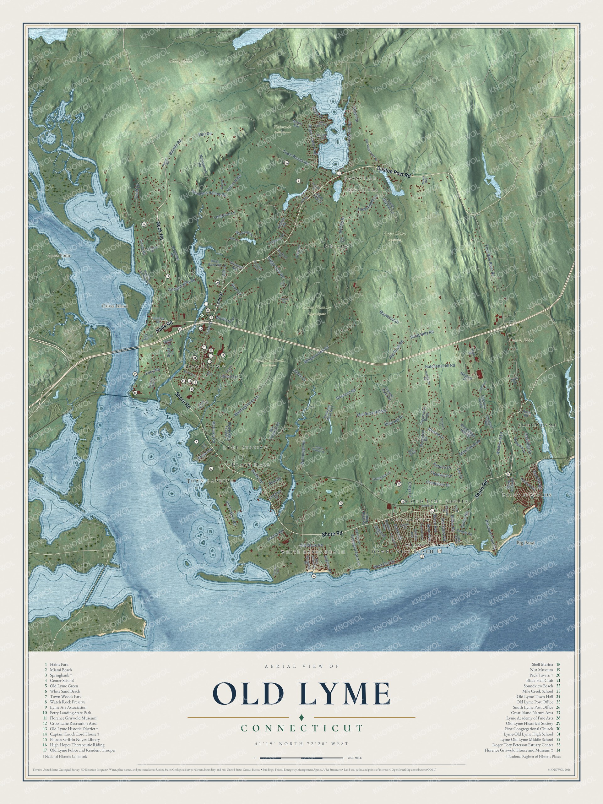
Click to explore a larger preview. The digital watermark does not appear on printed maps.
Names on this map
These names are printed on this map.
Places: Downtown, Point O'Woods, Amon Hill, Ayers Point, Bills Hill, Calves Island, Big Pond, Black Hall Pond, Ames Family Open Space, Champlain South Open Space, Lay-Allen Preserve, Nehantic State Forest, White Sands Beach, Sound View, Lyme Station, South Lyme, Jericho, Old Lyme Shores, Town Landing, Miami Shores, Hawks Nest Beach, Black Hall and Laysville.
Streets and roads: Boston Post Road, Shore Road, Neck Road, Halls Road, Lyme Street, Sea Spray Road, Four Mile River Road, McCurdy Road, Mile Creek Road, Whippoorwill Road, Sill Lane, Buttonball Road.
More street names, A to Z
Academy Lane, Apple Tree Drive, Bailey Road, Ball Lane, Ben Franklin Road, Bill Hill Road, Billow Road, Binney Road, Blackwell Road, Boggy Hole Road, Breen Avenue, Briar Hill Drive, Brighton Road, Browns Lane, Burr Road, Canty Lane, Cedar Hollow Drive, Chadwick Drive, Champlain Drive, Chestnut Hill, Chestnut Hill Road, Clifton Street, Coach Drive, Corsino Avenue, Coult Lane, Craig Road, Cross Lane, Cutler Road, Deer Ridge, Dennis Road, Dogwood Drive, Duck River Lane, Dunns Lane, Edge Lea Road, Ferry Road, Finnegan Farm Lane, Flat Rock Hill Road, Flat Rock Road, Gould Lane, Grassy Hill Road, Griswold Avenue, Griswold Point, Groton Street, Hatchett Point Road, Hatchetts Hill Road, Hawthorne Road, Haywagon Drive, High Street, Hillcrest Road, Hillside Road, Huntley Road, Jadon Drive, Jean Drive, Jericho Drive, Joel Road, Johnny Cake Hill Road, Knutson Road, Ladyslipper Lane, Landing Road, Lantern Lane, Laurel Drive, Ledgewood Drive, Lee Drive, Library Lane, Littlefield Drive, Lone Pine Trail, Longacre Lane, Lords Meadow Lane, Macknik Drive, Mansewood Road, Matson Ridge, Maywood Drive, Meetinghouse Lane, Mill Lane, Mill Pond Lane, Moore Avenue, New Britain Road, Nicaja Way, North Lane, Noyes Road, Oakridge Drive, Old Bridge Road, Old Shore Road, Old Stagecoach Road, Osprey Road, Otter Rock Road, Peppermint Ridge, Person Road, Pilgrim Landing Road, Pine Road, Pin Oak Trail, Portland Avenue, Prospect Street, River Bank Road, River Road, Riverview Drive, Robbin Avenue, Rogers Lake Trail, Rose Lane, Rowland Road, Rowland Road No 1, Saltaire Drive, Sandpiper Point Road, Sands Drive, Saunders Hollow Road, Seaview Road, Shore Acres Road, Shore Drive, Short Hills Road, Smith Neck Road, Somerset Lane, Springfield Road, Stoneleigh Knoll, Stonewood Road, Sunset Drive, Swan Avenue, Talcott Farms Road, Thomas Waite Road, Tisbury Road, Town Woods Road, Victoria Lane, West End Drive, Whippletree Lane, Wickford Lane, Wildwood Drive, Windward Lane, Wolcott Lane, Wood Ridge Hills Road, Wychwood Road.
This beautifully detailed map of Old Lyme makes an attractive addition to your office, library, or den, and it can even be used to teach children the geography and history of the area. It also makes a great gift for anyone with Old Lyme roots. When you’re done exploring, click here to get your copy of the Old Lyme map.