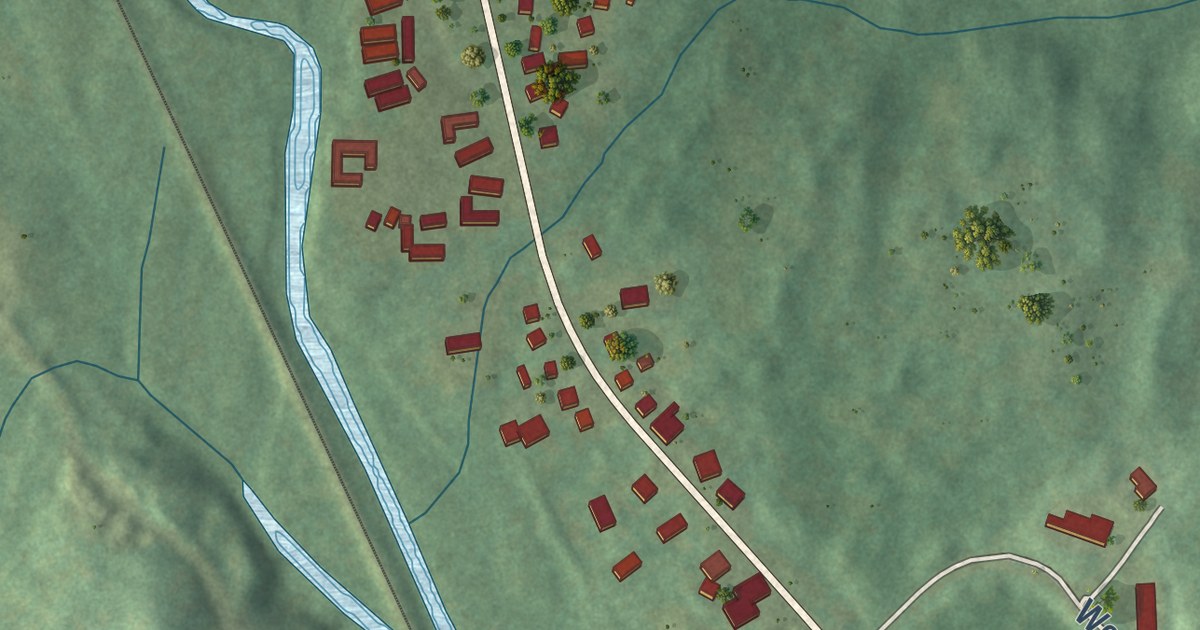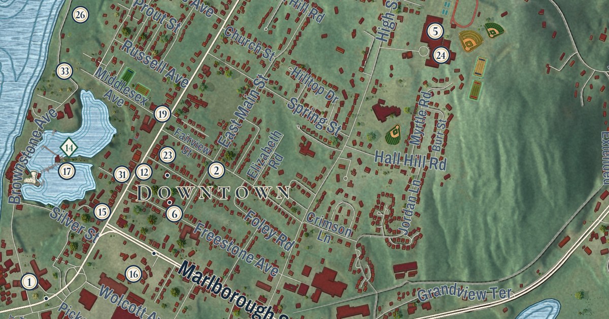
This beautifully detailed map of Portland, Connecticut was created in 2026 using aerial imagery combined with modern topographical, census, street and landmark data. It’s a one-of-a-kind view of Portland that combines accurate data with a vintage aesthetic. The map shows every building in its true location, many of the roads carry their names, and the shaded topographic relief shows the shape of the land.
See it on a wall
The Portland map as an 18 x 24 inch print in a black frame.

Explore an aerial view of Portland, Connecticut
On the map you’ll find Downtown, Belltown Hill, Bodkin Rock, Clark Hill, Cranberry Bog, Meshomasic State Forest, Wangunk Meadows Wildlife Management Area, Cobalt Landing, Fogelmarks Corners, Gildersleeve, and Riverdale, along with Main Street, and more. If you look closely you can even find your house accurately drawn in its correct location. Zoom in on the preview to look for yours. Click here to learn more about the history of Portland.
Take a closer look at the Portland map
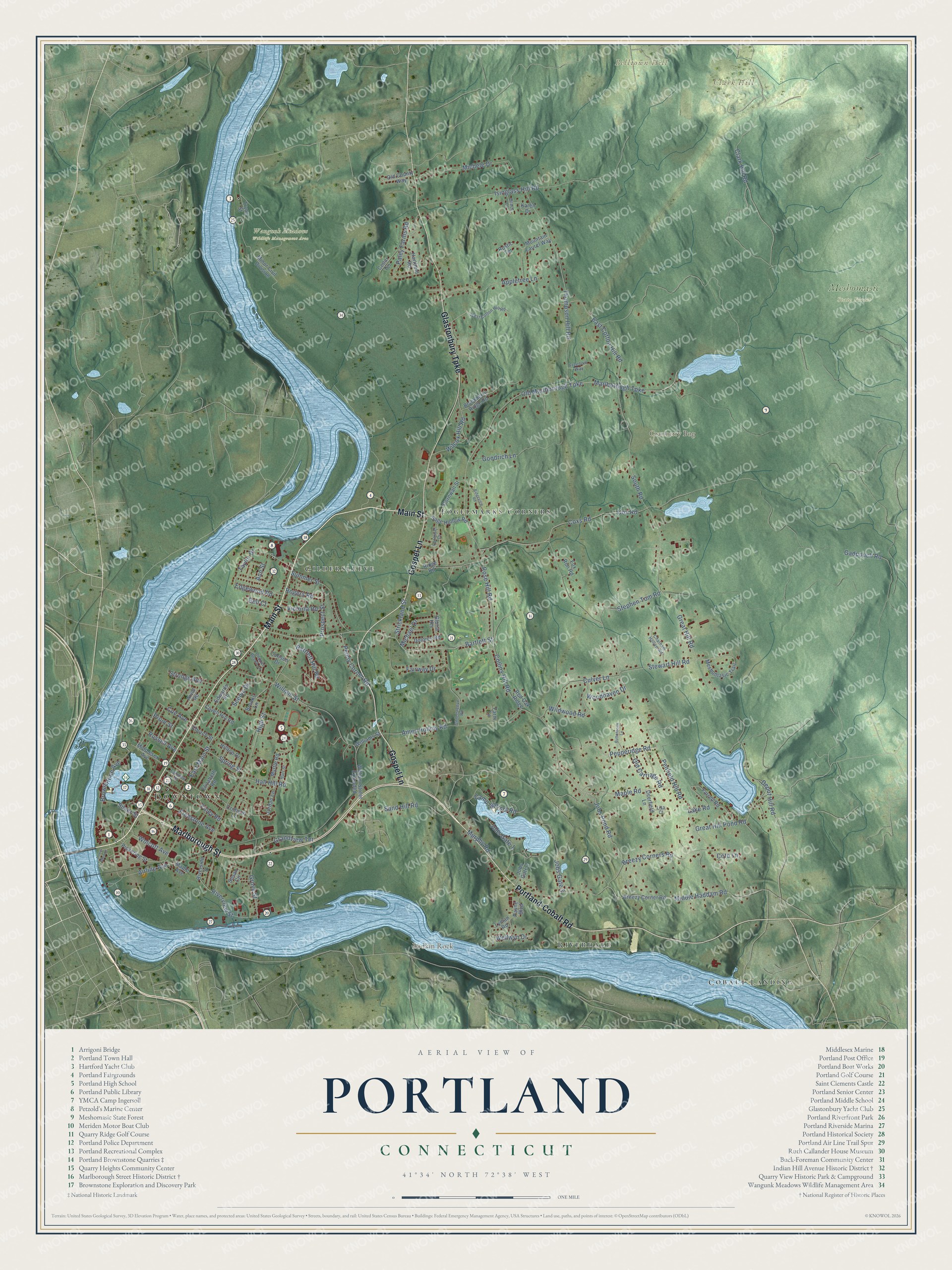
Click to explore a larger preview. The digital watermark does not appear on printed maps.
Names on this map
These names are printed on this map.
Places: Downtown, Belltown Hill, Bodkin Rock, Clark Hill, Cranberry Bog, Meshomasic State Forest, Wangunk Meadows Wildlife Management Area, Cobalt Landing, Fogelmarks Corners, Gildersleeve and Riverdale.
Streets and roads: Main Street, Marlborough Street, Gospel Lane, Portland-Cobalt Road, Glastonbury Turnpike, Bartlett Street, Rose Hill Road, Old Marlborough Turnpike, Collins Hill Road, Marlborough Turnpike, Great Hill Pond Road, Gadpouch Road.
More street names, A to Z
Airline Avenue, Ames Hollow Road, Ann Street, Appletree Lane, Arvid Road, Bartlett Hill Road, Bell Court, Blackberry Ridge Road, Breezy Corner Road, Breezy Corners Road, Brooks Lane, Brownstone Avenue, Burr Street, Buttonhook Lane, Camp Ingersol Road, Carlson Drive, Carousel Drive, Cedar Terrace, Chatham Hollow Road, Church Street, Clark Hill Road, Coe Avenue, Copper Beech Lane, Cornwall Street, Cote Lane, Covell Hill Road, Cox Road, Coxs Road, Crimson Lane, Culver Lane, Deerfield Lane, Depot Hill Road, Dolores Road, East Cotton Hill Road, East Main Street, Edgewood Road, Edwards Road, Elizabeth Road, Fairview Street, Fairway Drive, Farm Lane, Farrell Road, Foley Road, Fox Run Road, Freedom Way, Freestone Avenue, Gildersleeve Road, Gloria Heights, Goodrich Lane, Grace Lane, Grandview Terrace, Great Hill Road, Grove Street, Hall Hill Road, Hartfield Road, High Street, Hilltop Drive, Isinglass Hill Road, Jobs Gate 1, Jobs Gate 2, Jobs Gate 3, Jobs Pond Road, Jordan Lane, Karen Drive, Lake Road, Lisa Court, Lower Main Street, Lyman Road, Maple Avenue, Maple Road, Meshomasic Trail, Michael Drive, Michele Drive, Middle Haddam Road, Middlesex Avenue, Minor Civil Division, Mountain Laurel Way, Murphy Road, Myrtle Road, Old Carriage Road, Old County Way, Paley Farms Road, Payne Boulevard, Penfield Hill Road, Penny Corner Road, Pepperidge Road, Pickering Street, Prospect Street, Prout Street, Red Oak Ridge, Ridge Road, Ridgeview Road, Riverside Street, Riverview Street, Rogers Road, Russell Avenue, Rustic Terrace, Sage Hollow Road, Sand Hill Road, Scenic Drive, Silver Street, South Road, Spring Street, Stephen Tom Road, Stewart Hill Road, Strickland Street, Strongs Avenue, Summer Street, Susan Circle, Taylor Drive, Thompson Hill Road, Tryon Street, Victoria Road, Wellwyn Drive, West Cotton Hill Road, Wilcox Hill Road, Wildwood Road, Williams Street, William Street, William Street Extended, Wolcott Avenue, Woodhaven Drive.
This beautifully detailed map of Portland makes an attractive addition to your office, library, or den, and it can even be used to teach children the geography and history of the area. It also makes a great gift for anyone with Portland roots. When you’re done exploring, click here to get your copy of the Portland map.