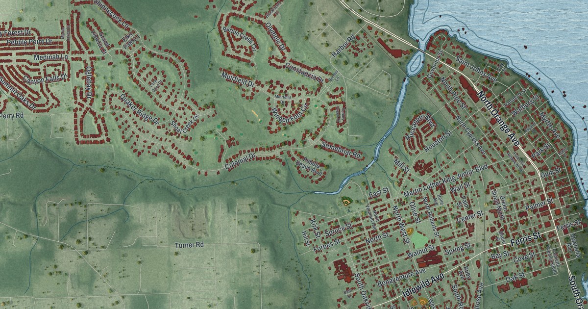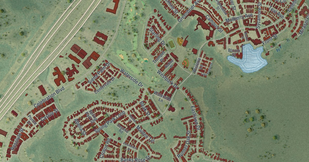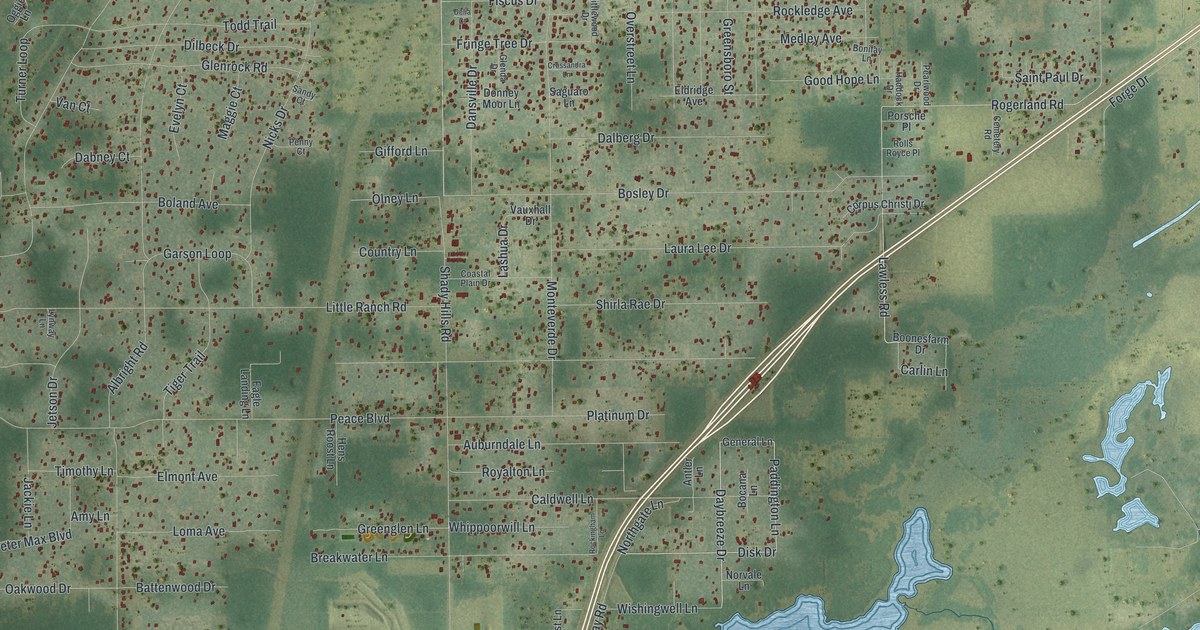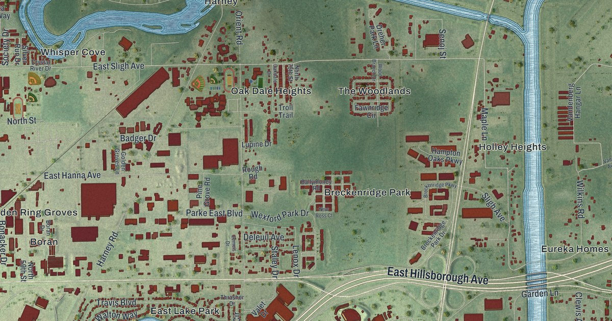
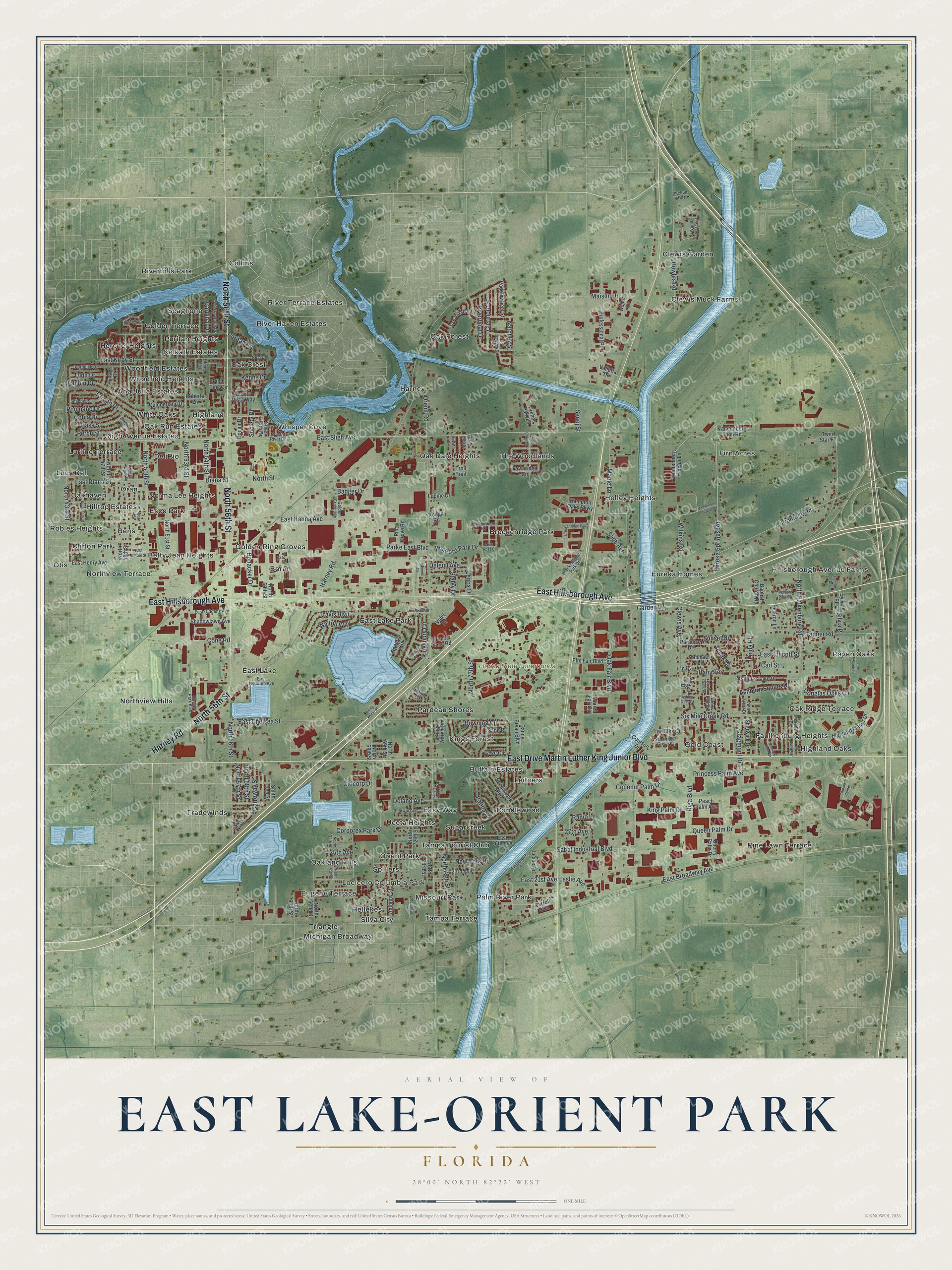
This beautifully detailed map of East Lake-Orient Park, Florida was created in 2026 using aerial imagery combined with modern topographical, census, street and landmark data. It's a modern aerial view of East Lake-Orient Park in Hillsborough County, Florida, that combines modern data with a vintage aesthetic. The roads feature printed names, and if you look closely you can find your exact house accurately shown in its correct location.
Explore an aerial view of East Lake-Orient Park, Florida
On this map you'll find Florida State Fairgrounds, Triangle, Hillsborough Avenue Farms, Oak Forest, Palm River Park, Faulkenburg Heights, Northview Hills, Scaglione, Breckenridge Park, Clifton Park, Pardeau Shores, Pine Lawn Terrace, and more. Each red shape is a building, so zoom in on the preview and look for yours.
East Lake-Orient Park is a community in Hillsborough County. The Census Bureau counted 28,050 people here in 2020. East Lake-Orient Park sits about 3 miles south of Temple Terrace, 4 miles west of Mango and 5 miles southwest of Thonotosassa. The map prints the town name in its title panel, with the coordinates below it.
Take a closer look at the East Lake-Orient Park map
Names on this map
These names are printed on this map.
Places: Florida State Fairgrounds, Triangle, Hillsborough Avenue Farms, Oak Forest, Palm River Park, Faulkenburg Heights, Northview Hills, Scaglione, Breckenridge Park, Clifton Park, Pardeau Shores, Pine Lawn Terrace, Boran, Firn Acres, Clewis Muck Farms, Eureka Homes, East Lake, Orient Park, Whisper Cove, Raven Oaks, Tradewinds, Woodfield Heights, Leitners, Oak Dale Heights, East Lake Park, Easy Way, Holley Heights, Hilltop Estates, The Woodlands, Oakland Hills, Harney, Tampa Terrace, Clewis Garden, Gold Coast, Sligh Avenue Estates, Collins, Oak Ridge Terrace, Oak Crest, Tampa Tourist Club, Kings Forest, Kelkath Estates, Betty Jean Heights, Hellekes, Candlewood, Golden Terrace, River Terrace Estates, Oakhaven, Uceta Heights, Highland, Lurline Terrace, Norma Lee Heights, Del Rio, Woodfield Estates, Lucy Dell, Eugene Terrace, White Oaks, Northview Terrace, Buffalo Estates, River Haven Estates, Silva City, Spillers, Highland Oaks, Locicero Columbia Park, Bens, Golden Ring Groves, Sugarcreek, Missouri Park, Oran, Esco Park, Robles Heights, Herchel Heights, Riverhills Park, Puritan Heights, Oak Run Estates, Ana Julia Estates, Otis and Michigan Broadway.
Streets and roads: East Hillsborough Avenue, East Drive Martin Luther King Junior Boulevard, North 56th Street, Harney Road, East Sligh Avenue, Eureka Springs Road, Maple Lane, Wilkins Road, Orient Road, North Falkenburg Road, East Broadway Avenue, Queen Palm Drive.
More street names, A to Z
23rd Avenue, 25th Avenue, 27th Avenue, Ann Arbor Drive, Anthony Street, Ashburn Lake Drive, Ashburn Square Drive, Ashley Oaks Court, Backup Road, Badger Drive, Baldwin Avenue, Ballymoney Road, Baptist Church Road, Bass Street, Beechwood Boulevard, Bismark Palm Drive, Bonacker Drive, Bonair Drive, Bonita Vista Way, Boran Drive, Bowles Road, Bream Street, Breckenridge Park Drive, Breckenridge Parkway, Cardinal Drive, Carl Street, Carroll Boulevard, Carroway Street, Cherry Palm Drive, Citibank Center, Citicorp Drive, Clermont Street, Clewis Avenue, Cobia Drive, Coconut Palm Drive, Comfort Drive, Cone Road, Corporex Park Drive, Courson Drive, Cragmont Drive, Crystal River Drive, Cumberland Drive, Danny Bryan Boulevard, Delano Avenue, Deleuil Avenue, Depot Lane, Diana Street, Dolphin Drive, Douglas Oaks Circle, Downing Circle, Draper Place Road, Dreher Park Lane, East 21st Avenue, East 26th Avenue, East Chelsea Street, East Clifton Street, East Diana Street, East Ellicott Street, East Giddens Avenue, East Hanna Avenue, East Henry Avenue, East Kirby Street, East Osborne Avenue, Eden Drive, Elm Fair Boulevard, Eric Slane Lane, Fairview Cove Lane, Fawn Circle, Fawnridge Circle, Fieldbrook Lane, Frontage Road, Garden Lane, Golden Groves Lane, Green Grass Place, Green Palm Lane, Hampton Oaks Parkway, Highland Manor Drive, Highland Park Drive, In Court, Kenny Drive, King Alfred Drive, King Palm Drive, Kingsbury Circle, Laurel Fair Circle, Lee Ellis Court, Lenox Drive, Leslie Avenue, Leslie Road, Linda Place, Living Water Place, Lupine Drive, Maislin Drive, Mc Lane Drive, McLane Drive, Michael Lane, Moses White Square, Motorsport Drive, Natchez Street, Neal Drive, New Ross Court, New York Drive, North 43rd Street, North 45th Street, North 47th Street, North 48th Street, North 50th Street, North 51st Street, North 53rd Street, North 54th Street, North 57th Street, North 58th Street, North 59th Street, North 60th Street, North 62nd Street, North 64th Street, North 65th Street, North 68th Street, North 69th Street, North 72nd Street, North 73rd Street, North 75th Street, North 77th Street, North 78th Street, North Street, Oakdale Drive, Oak Fair Boulevard, Ommer Park Boulevard, Oran Street, Paddlewheel Street, Palifox Circle, Paradise Drive, Parke East Boulevard, Patina Drive, Peach Palm Avenue, Perch Street, Pickron Lane, Pine Grove Road, Pine Hill Drive, Pitch Pine Circle, Polak Drive, Pompano Drive, Porpoise Drive, Princess Palm Avenue, Professional Place, Puritan Road, Radio Lane, Riga Boulevard, Riverboat Drive, River Vista Lane, Roberta Lane, Rough Road, Sabal Industrial Boulevard, Sabalridge Grove Place, Sane Place, Savannah Lane, Senoj Street, Shadowlawn Avenue, Sherwick Drive, Silver Run Drive, Silvia Place, Six Mile Creek Road, Sligh Avenue, Smith Tree Street, Snapper Street, Snook Drive, Society Drive, Spencer Circle, Staley Drive, Sunset Drive, Sylvia Place, Tanner Road, Tarpon Drive, Terra Ceia Drive, Thrasher Drive, Tierra Verde Drive, Tiffany Terrace, Tom Sawyer Drive, Travis Boulevard, Trinity Place, Troll Trail, Tuna Drive, Twin Star Place, Valet Drive, Valletta Drive, Vandenberg Airport Road, Vandenberg Hangar Lane, Vandenberg Loop Road, Walton Way, Wexford Park Drive, Wood Branch Drive, Wood Terrace Drive, Zemeis Drive.
See it on a wall
The East Lake-Orient Park map as a framed print. Swipe for more.


Created by KNOWOL in 2026. The buildings are small red shapes, the roads carry their printed names, and shaded relief shows the shape of the land. The title panel reads "AERIAL VIEW OF EAST LAKE-ORIENT PARK, FLORIDA" with 28°00' NORTH 82°22' WEST.
It suits a den, a classroom or a front hall, and it makes a gift for anyone with East Lake-Orient Park roots. Open the preview and find the block you know. See sizes and frames for the East Lake-Orient Park map.