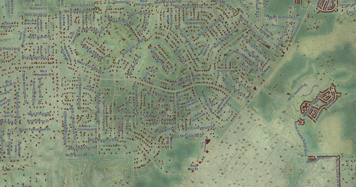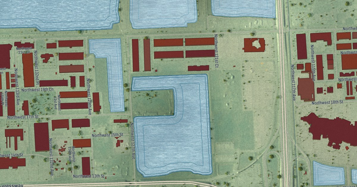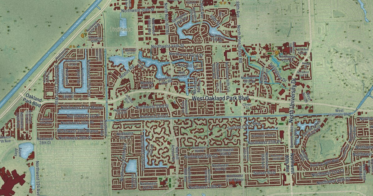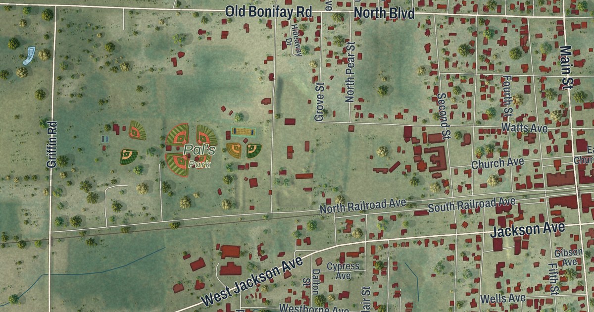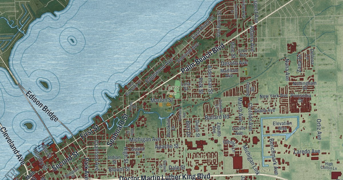
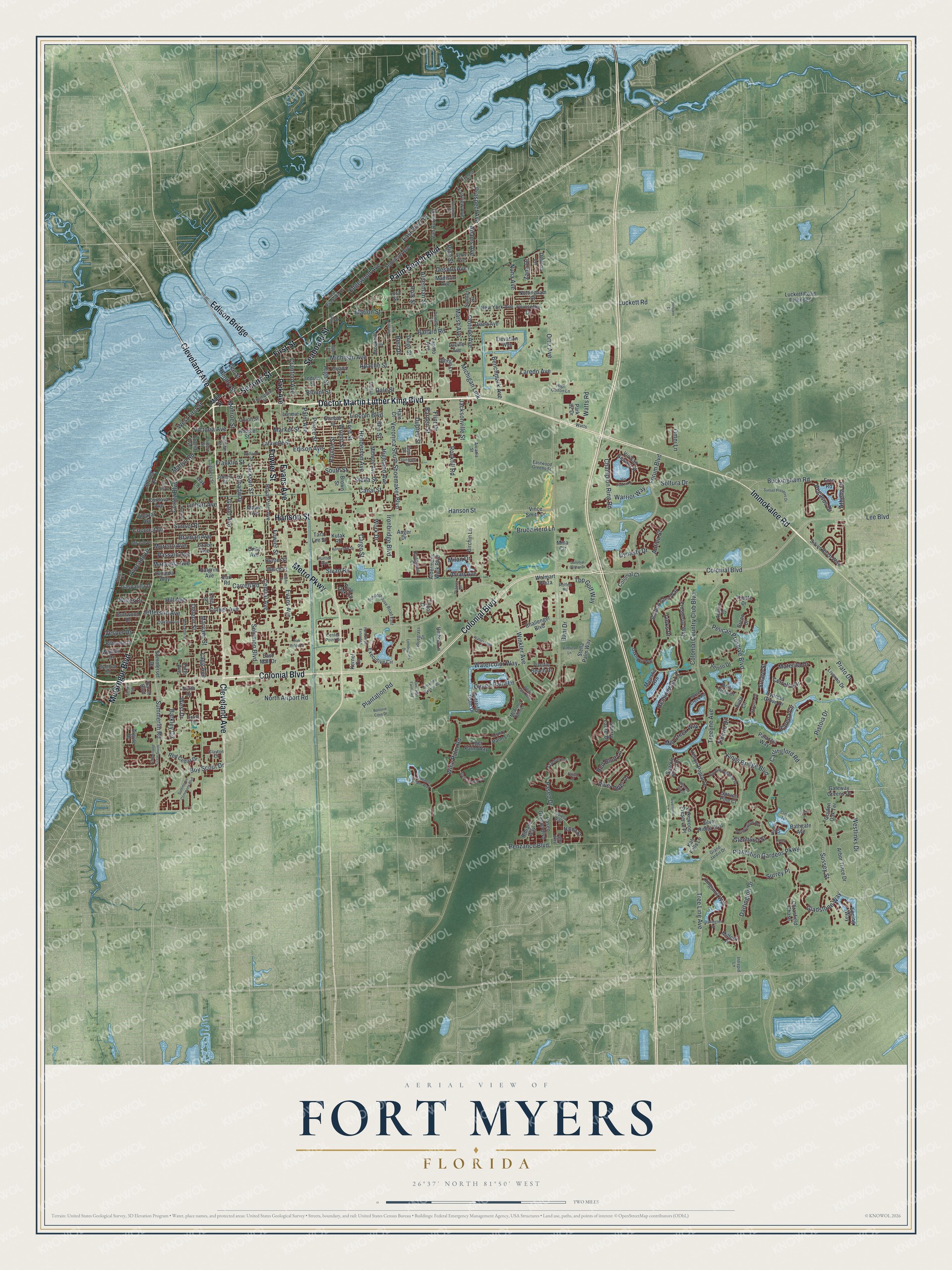
This beautifully detailed map of Fort Myers, Florida was created in 2026 using aerial imagery combined with modern topographical, census, street and landmark data. It’s a one-of-a-kind view of Fort Myers that combines accurate data with a vintage aesthetic. The map shows every building in its true location, many of the roads carry their names, and the shaded topographic relief shows the shape of the land.
Explore an aerial view of Fort Myers, Florida
On the map you’ll find Terry Park and Edison Bridge, along with Doctor Martin Luther King Boulevard, Colonial Boulevard, Immokalee Road, Second Street, Seaboard Street, Cleveland Avenue, Metro Parkway, Palm Beach Boulevard, McGregor Boulevard, Fowler Street, and more. If you look closely you can even find your house accurately drawn in its correct location. Zoom in on the preview to look for yours.
Did You Know?
Inventor Thomas Edison was cruising the Florida west coast in 1885 when he stopped at Fort Myers. He soon bought 13 acres beside the Caloosahatchee River. There he built Seminole Lodge, a winter home with a laboratory. The lodge was done in 1886, and for many winters after, Edison and his wife Mina stayed in town.
Take a closer look at the Fort Myers map
Names on this map
These names are printed on this map.
Places: Terry Park.
Streets and roads: Doctor Martin Luther King Boulevard, Colonial Boulevard, Immokalee Road, Second Street, Seaboard Street, Cleveland Avenue, Metro Parkway, Palm Beach Boulevard, McGregor Boulevard, Edison Bridge, Fowler Street, Evans Avenue.
More street names, A to Z
Adams Avenue, Alcazar Avenue, Alderman Street, Aldermans Walk Boulevard, Allen Street, Antica Street, Apache Street, Arbor Trace Drive, Arcadia Street, Argyle Drive, Athena Court, Auger Drive, Avian Avenue, Aviano Drive, Avila Circle, Avocado Drive, Azzurra Drive, Ballard Road, Barden Street, Barkley Circle, Bathgate Avenue, Bella Vista Drive, Benchmark Avenue, Ben Street, Bert Drive, Bibiana Way, Billie Street, Biltmore Drive, Birchin Lane, Blount Street, Bluegrass Drive, Bonavie Cove Drive, Bourke Place, Boy Scout Drive, Bradford Road, Braman Avenue, Breno Drive, Bridgewell Court, Broadway, Brookhill Drive, Brown Street, Bruce Herd Lane, Buckingham Road, Burtwood Drive, Butterfly Palm Drive, Canal Street, Capri Drive, Carena Circle, Cargo Street, Carlingford Road, Carolina Willow Drive, Carrell Road, Center Point Drive, Central Avenue, Cetrella Drive, Challenger Boulevard, Champion Ring Road, Cherry Laurel Drive, Chrasfield Chase, Clayton Court, Clifford Street, Clifton Terrace, Clotilde Avenue, Coconut Drive, Collier Avenue, Colonial Center Drive, Colonial Country Club Boulevard, Colonial Court, Congress Street, Cordova Avenue, Cortez Boulevard, Cranford Avenue, Curry Palm Lane, Cypress Grove Drive, Cypress Lane, Dale Street, Dani Drive, Darcy Place, Darlington Drive, Dartington Drive, Deer Run Farms Road, Deleon Street, Dellena Lane, Del Rio Drive, Demery Circle, Dennington Road, Desoto Avenue, Diana Avenue, Diego Street, Dixon Drive, Dunbar Street, Dupree Street, Dynasty Drive, Earl Road, East Mall Drive, East River Drive, East Riverside Drive, Eastwood Greens Street, Edgewood Avenue, Edison Avenue, Elevation Way, Epping Way, Eros Road, Esteban Drive, Euclid Avenue, Executive Circle, Fairview Avenue, Falisto Place, First Street, Flint Drive, Ford Street, Ford Street Extended, Forum Boulevard, Franklin Street, French Street, Gasparilla Drive, Gateway Greens Drive, Gladstone Way, Glenhurst Street, Glenn Drive, Golden Oak Terrace, Grace Avenue, Grand Avenue, Grand Jardin Drive, Guava Street, Hale Court, Halgrim Avenue, Hanson Street, Heitman Street, Hemingway Lane, Henderson Avenue, Hendry Street, High Cotton Lane, Highland Avenue, High Street, Hill Avenue, Holly Road, Holstein Drive, Hoople Street, Horse Creek Road, Hunter Avenue, Hunter Street, Indian Street, Intrepid Lane, Ironbridge Boulevard, Jackson Street, Jacksonville Street, Javiera Way, Jeffcott Street, Jefferson Avenue, Kati Falls Lane, Kelly Street, Kennesaw Street, Kernel Circle, Kings Bridge Boulevard, Kingsmill Way, Kutak Road, Lafayette Street, Lagg Avenue, Lakewood Preserve Place, Laredo Avenue, Larmie Street, Lee Boulevard, Lee Street, Lemongrass Drive, Lincoln Boulevard, Linhart Avenue, Links Drive, Livorno Drive, Lora Street, Lucille Avenue, Luckett Road, Luckett Road Extended, Madison Avenue, Main Street, Majestic Avenue, Maple Avenue, Maravilla Avenue, Marion Street, Market Street, Marlyn Road, Marsh Avenue, Marvaez Street, Materita Drive, McArthur Palm Lane, Michigan Avenue, Michigan Link, Midway Avenue, Milan Drive, Milford Place, Mill Creek Way, Mimosa Silk Drive, Mina Circle, Miracle Lane, Monroe Street, Moreno Avenue, Nalda Street, New York Avenue, North Airport Road, North Drive, Nottingham Drive, Nuna Avenue, Oakhurst Way, Oak Lane, Oakley Avenue, Oak Ridge Court, Olmeda Way, Omni Lane, Ortiz Avenue, Othello Lane, Pacific Beach Drive, Palazzo Way, Palba Way, Palm Avenue, Palmetto Avenue, Park 82 Drive, Park Avenue, Paseo Drive, Paseo Grande Boulevard, Passaic Avenue, Pauldo Street, Pegasus Drive, Pelican Preserve Boulevard, Penzance Boulevard, Piazza Drive, Pimlico Lane, Pine Oak Circle, Pine Street, Pistoia Drive, Plantation Gardens Parkway, Plantation Road, Poinsettia Drive, Polk Street, Prato Drive, Prince Street, Princeton Street, Prospect Avenue, Prosperity Way, Queen Palm Lane, Rarco Boulevard, Red Bluff Lane, Red Cedar Drive, River Otter Drive, Riverstone Lane, Rockfill Road, Rolfes Road, Rosemont Drive, Royal Palm Avenue, Schoolhouse Road East, Scott Avenue, Seminole Avenue, Seminole Palm Way, Shadow Glen Way, Shriver Drive, Sierra Palm Court, Silver Birch Way, Silver Ridge Boulevard, Sivan Road, Solaro Street, Solomon Boulevard, Soltura Drive, Sommerset Drive, South Drive, South Street, Sparkle Berry Drive, Spruce Pine Court, Stella Palm Way, Stella Street, Stuart Court, Summerlin Commons Boulevard, Summerlin Road, Sumter Drive, Sunset Place, Sunset Preserve Drive, Suntrust Drive, Surrey Place, Sussex Street, Tara Lee Street, Thompson Street, Tiberio Drive, Tiger Palm Way, Tilbor Circle, Timberland Circle South, Top Golf Way, Tree Line Avenue, Treeline Avenue, Trieste Drive, Tufts Avenue, Umbria Lane, Union Street, Unity Avenue, Unnamed Access Road, Van Buren Street, Venito Drive, Veronica South Shoemaker Boulevard, Vesper Drive, Via Piazza Lp, Via Royale, Via San Giovani Street, Victoria Avenue, Vince Smith Drive, Walden Drive, Wales Drive, Walmart Plaza, Warrior Way, Watercolor Way, Waterscape Lane, Watts, Watts Road, Welch Street, West Drive, West First Street, Westlinks Drive, White Palm Way, Willard Street, Wine Palm Road, Winkler Avenue, Work Drive, Wright Street, Yellow Poplar Drive, Zana Drive, Zapato Avenue.
See it on a wall
The Fort Myers map as a framed print. Swipe for more.


This beautifully detailed map of Fort Myers makes an attractive addition to your office, library, or den, and it can even be used to teach children the geography and history of the area. It also makes a great gift for someone who left Fort Myers and still calls it home. When you’re done exploring, click here to get your copy of the Fort Myers map.