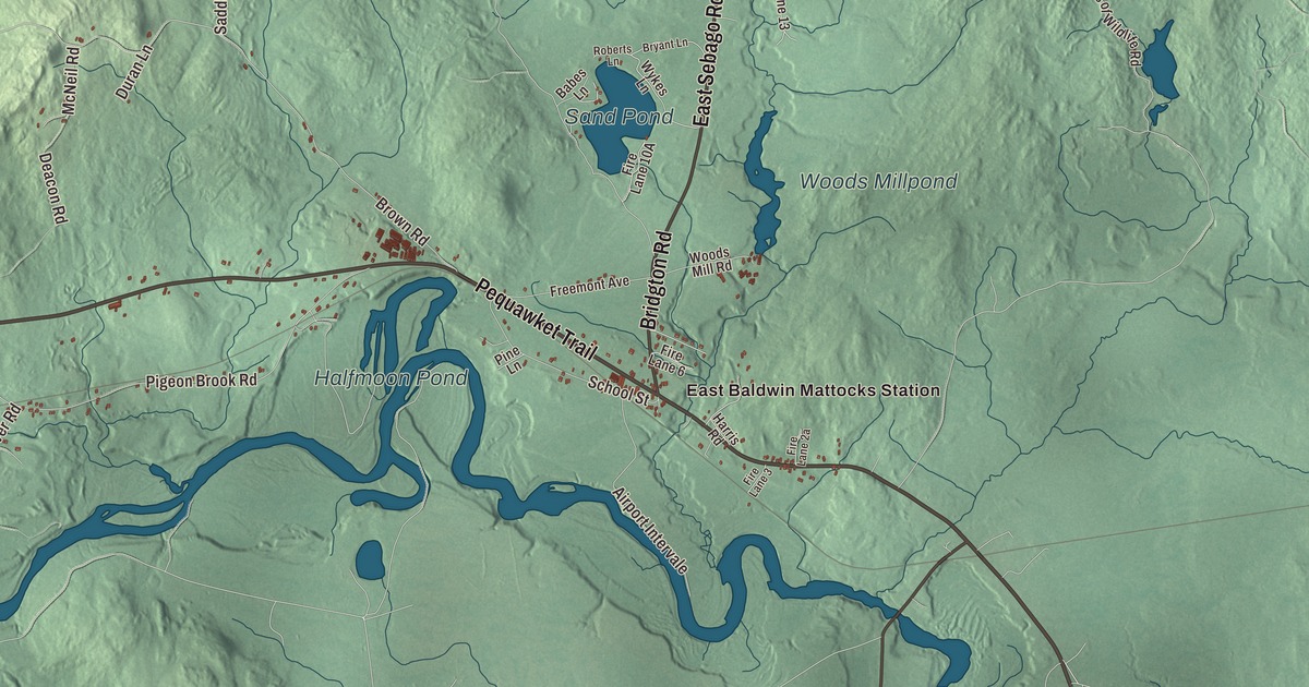
Baldwin is the Saco River town on the western edge of Cumberland County, named for the man behind the Baldwin apple. This map prints its villages, East Baldwin Mattocks Station, North Baldwin and West Baldwin, the Pequawket Trail with Depot Road, Bridgton Road, Sebago Road, East Sebago Road and Savage Road, and three ponds, Sand Pond, Halfmoon Pond and Ingalls Pond. Click here to purchase a print of this map for your wall.
Baldwin is in Cumberland County, and it had 1,520 people at the 2020 census.
KNOWOL made this map in 2026 from public survey data and gave it the look of an old atlas. The shaded terrain comes from United States Geological Survey elevation data, and the roads and the town line come from the Census Bureau, which counts 36.35 square miles here, 35.32 of them land. Breakneck Brook and the Saco River drain the town, and state routes 5, 107, 113 and 117 cross it. Sebago lies to the north, Standish to the east, Hiram to the west, and Cornish and Limington to the south.
A grant for Captain Flint’s company
The town began with a grant to old soldiers. Around 1735 the survivors of a company from Concord, Massachusetts, commanded by Captain John Flint, were granted a township called Township No. 3, but when the state lines were adjusted in 1741 it turned out to be in New Hampshire, where Walpole is now. In 1774 the Massachusetts General Court gave them this land instead, as Flintstown Plantation. On June 23, 1802, Flintstown was incorporated as Baldwin, and in 1826 Sebago was set off as a town of its own.
The new name honored Colonel Loammi Baldwin of Woburn, Massachusetts. He led the Woburn militia at Lexington and Concord as a major, crossed the Delaware with Washington and fought at Trenton, and later surveyed and built the Middlesex Canal, and he’s known as one of the earliest American civil engineers. He’s perhaps best remembered for an apple. It was found on John Ball’s farm in Wilmington, Massachusetts, around 1750, and Baldwin saw its promise and spread it across the Northeast, and it carries his name.
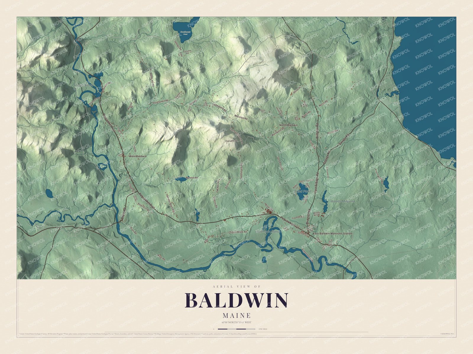
Click to explore a larger preview. The digital watermark does not appear on printed maps.
See it on a wall
The Baldwin map as a framed print. Swipe for more.


The Pequawket Trail
The Pequawket Trail is printed on the map. It carries routes 5, 113 and 117, and it was long the main road between the southern Maine coast and Fryeburg, where the Native community of Pequawket stood. On its west side in West Baldwin is the Burnell Tavern, which its page dates to 1737 and believes to be the oldest building standing in Baldwin. Gideon Burnell, a farmer who also ran grist and saw mills and a store, kept it for travelers between Portland and central New Hampshire, and his descendants owned it into the 20th century. It’s a private home today. Near the middle of town on Saddleback Road is Valley Lodge, begun in 1792 by Ephraim Brown, who came with his brother David in 1788 to land granted to their father for his service in the Revolution.
The town’s surface is broken, but the soil was good for grain and hay, and Baldwin became known for its orchards. East Baldwin had a factory for drying apples, and there was a corn factory too. The brooks turned mills that made boards, barrel staves and shooks, and the Portland and Ogdensburg Railroad ran up the Saco valley the whole length of the town. West Baldwin and North Baldwin are printed on the map, along with Depot Road.
Josiah Pierce, born in Baldwin in 1792, became president of the Maine Senate and wrote a history of Gorham, and Isaac W. Dyer, born here in 1855, was United States attorney for Maine and represented Baldwin in the Maine House. Andrew Clements, author of the children’s novel Frindle, lived in Baldwin and died at his home here in 2019.
This Baldwin map makes a handsome addition to an office, library or den, and it can teach children the geography and history of an orchard town on the Saco. It’s made for anyone who calls Baldwin home, from West Baldwin to Sand Pond, as it looks today. Zoom in on the preview above to explore the details, then click here to get your copy of the Baldwin, Maine map.

Sources