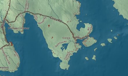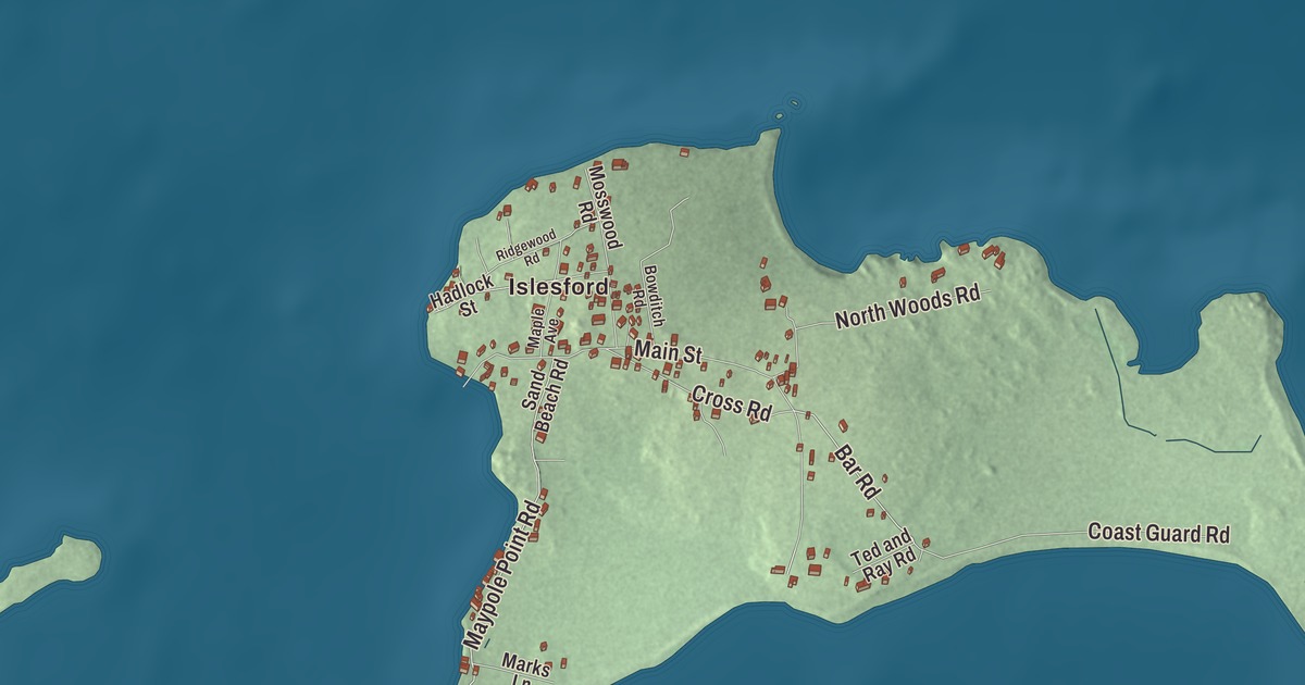
Islesford is the first name to find on this map of Cranberry Isles, Maine, and from there the island roads take over: Bar Road, Great Cranberry Road, Main Street, Harding Point Road, Maypole Point Road and Mink Brook Road. Click here to purchase a print of this map for your wall.
Cranberry Isles is a town in Hancock County, with 160 people at the 2020 census.
KNOWOL made this map in 2026 from public survey data and gave it the look of an old coastal atlas. The town line and the roads come from the Census Bureau, which counts 45.57 square miles inside that line and only 3.17 of them as land; the other 42.40 are sea. United States Geological Survey elevation data shades the islands themselves.
Five islands, two villages
Cranberry Isles was set off from Mount Desert and incorporated as a town on March 16, 1830. It’s made up of five islands: Great Cranberry Island, Little Cranberry Island, Sutton Island, Bear Island and Baker Island. Only the first two have post offices and people living there all year. Great Cranberry, the largest, carries the postal name Cranberry Isles, and Little Cranberry, an island of about 200 acres, carries the name Islesford.
Great Cranberry is roughly two miles long and a mile wide. More than 300 people stay there in summer and about 40 the year round, most of them fishermen, and many islanders tie up their own boats at Spurling Cove. Ferries cross from Northeast Harbor and Southwest Harbor on Mount Desert Island. The Ladies’ Aid Fair has been held on the island every August since 1900. In the southwest corner lies The Heath, a peatland its page singles out as an exceptional place to study how different kinds of peat lie side by side and one above another.
Islesford and its museum
Islesford sits on Little Cranberry Island, southeast of Mount Desert Island, and had about sixty-five year-round residents as of 2013. Its museum began with William Otis Sawtelle, a Haverford College physics professor who spent his summers there. He bought the Blue Duck Ships’ Store, a chandlery Edwin Hadlock built at the water’s edge about 1850, and after 1919 he kept it as the headquarters and museum of the Islesford Historical Society. A brick museum in the Georgian Colonial Revival style went up in 1927, and its page calls it one of the first of its kind. The National Park Service acquired both buildings in 1948, and they’re part of Acadia National Park today. The Blue Duck is leased to Islesford Boatworks, which teaches traditional wooden boatbuilding to all ages.
The village’s two-room public school was named in 2011 for Ashley Bryan, the writer and illustrator who retired to Islesford in the late 1980s after teaching art at Dartmouth College. Most of his books drew on the African-American experience; he received the Children’s Literature Legacy Award in 2009, and his picture book Freedom Over Me earned a Newbery Honor. The Ashley Bryan School is the first Maine public school named for a visual artist or for an African-American, and his sea glass windows hang in the Islesford Congregational Church. The folklorist Mary Winslow Smyth summered in Islesford while collecting the ballads in Minstrelsy of Maine. Stephen Hillenburg, the creator of SpongeBob SquarePants, worked summers as a fry cook at the Islesford Dock Restaurant, and the Islesford page says those summers gave him the idea for SpongeBob’s job.
The lights on the outer islands
Baker Island Light, on Baker Island within Acadia National Park, was set up in 1828 to mark the southern entrance to Frenchman Bay, and it was the first light station along this part of the coast near Mount Desert Island. The present brick tower and keeper’s house both date from 1855, and the tower stands at the island’s high point, about 70 feet above the sea. Bear Island Light, on the west end of 11-acre Bear Island just off Northeast Harbor, was built in 1889 and staffed until 1981. Sutton Island has only summer residents and no roads, and the poet Rachel Field kept a summer home there.
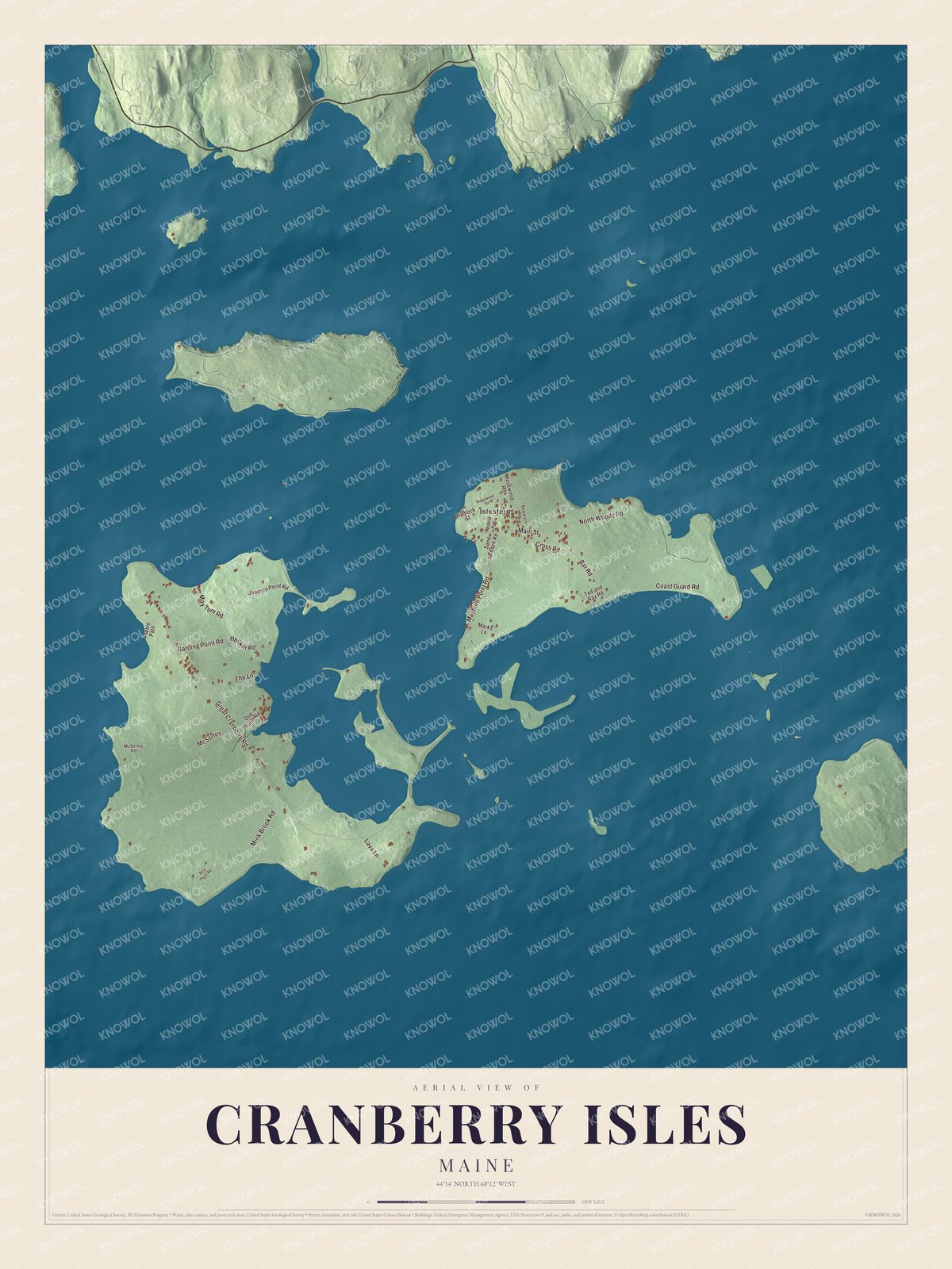
Click to explore a larger preview. The digital watermark does not appear on printed maps.
See it on a wall
The Cranberry Isles map as a framed print. Swipe for more.


Reading the island roads
Islesford is printed on the map, and so are Bar Road, Great Cranberry Road and Main Street. Harding Point Road, Maypole Point Road and Mink Brook Road carry their names too, and the smaller lanes off them are drawn in as well.
This Cranberry Isles map makes a fine addition to an office, library or den, and it can help teach children the geography and history of the area. It’s made for everyone who calls Cranberry Isles home, from Islesford to the far end of Mink Brook Road, as it looks today. Zoom in on the preview above to explore the details, then click here to get your copy of the Cranberry Isles, Maine map.

Sources
- Cranberry Isles, Maine, Wikipedia
- List of municipalities in Maine, Wikipedia
- Maine Private and Special Laws 1830, chapter 113, An Act to divide the town of Mount Desert and incorporate the town of Cranberry Isles
- Maine Private and Special Laws 1830, chapter 113, An Act to divide the town of Mount Desert and incorporate the town of Cranberry Isles
- Great Cranberry Island, Wikipedia
- Little Cranberry Island, Wikipedia
- Islesford, Maine, Wikipedia
- Islesford Historical Museum and Blue Duck Ships Store, Wikipedia
- Ashley Bryan, Wikipedia
- Baker Island Light, Wikipedia
- Bear Island (Maine), Wikipedia
- Sutton Island, Wikipedia