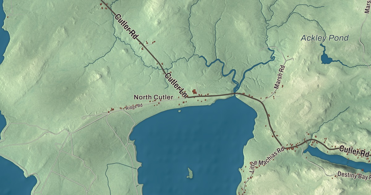
Cutler Road is the first name to find on this map of Cutler, Maine, and North Cutler and Little Machias are printed along with it. Cutler Lane, Ackley Road, Marsh Road, Daniels Street and Destiny Bay Road fill in the rest, with Norse Pond, Ackley Pond and the Atlantic Ocean on the water. Click here to purchase a print of this map for your wall.
Cutler is a town in Washington County, with 524 people at the 2020 census.
KNOWOL made this map in 2026 from public survey data and gave it the look of an old coastal atlas. The Census Bureau draws a big town line here: 117.93 square miles, and 70.98 of them are water. Its files give the roads, and United States Geological Survey elevation data shades the 46.95 square miles of land.
On the Little River
Cutler was incorporated in 1826, and it’s named for Joseph Cutler, an early settler who came from Newburyport, Massachusetts. The town sits on the northern bank of the Little River, a tidal inlet on the Down East coast. The actress Blanche Craig was born in Cutler in 1866 and appeared in films such as The City of Illusion, The Magic Cup and Darkened Rooms.
At the mouth of the inlet, on Little River Island, stands Little River Light. A light station was authorized there in 1846 and went into service the next year, and the present tower, built in 1876 by the Army Corps of Engineers, is one of the only iron lighthouses in Maine. The light was automated in 1975 and moved to a steel skeleton tower nearby. In 2001 the American Lighthouse Foundation took over the old tower and restored it, and on October 2, 2001, a beacon was lit in the original lantern after 26 years of darkness, with more than 1,000 people at the ceremony. Coming so soon after September 11, the relighting was called a “Beacon of Freedom to the World.” The keeper’s house now takes overnight guests.
The Navy station and the islands
The United States Navy’s very low frequency radio station at Cutler went into service on January 4, 1961. It sends one-way messages to submarines of the Atlantic Fleet, on the surface or submerged, under the call sign NAA, and its page lists it among the most powerful radio transmitters in the world. Its antenna is two identical arrays, each built around a central mast 997.5 feet tall and ringed by twelve shorter masts, and from above each array has the shape of a snowflake. State Route 191 passes the station on its way through Cutler.
Off the coast, the Cross Island National Wildlife Refuge covers 1,700 acres of islands that belong to the town of Cutler, including Cross Island, Scotch Island and Old Man Island, where people tried to save the eider ducks in 1908. Farther out, about 8.6 nautical miles southeast of Cutler, is Machias Seal Island, claimed by both the United States and Canada. Canada has kept a lighthouse there since 1832, and the island is a sanctuary for Atlantic puffins, razorbills, terns and other seabirds. The State Route 191 page notes a ferry to Machias Seal Island from Cutler.
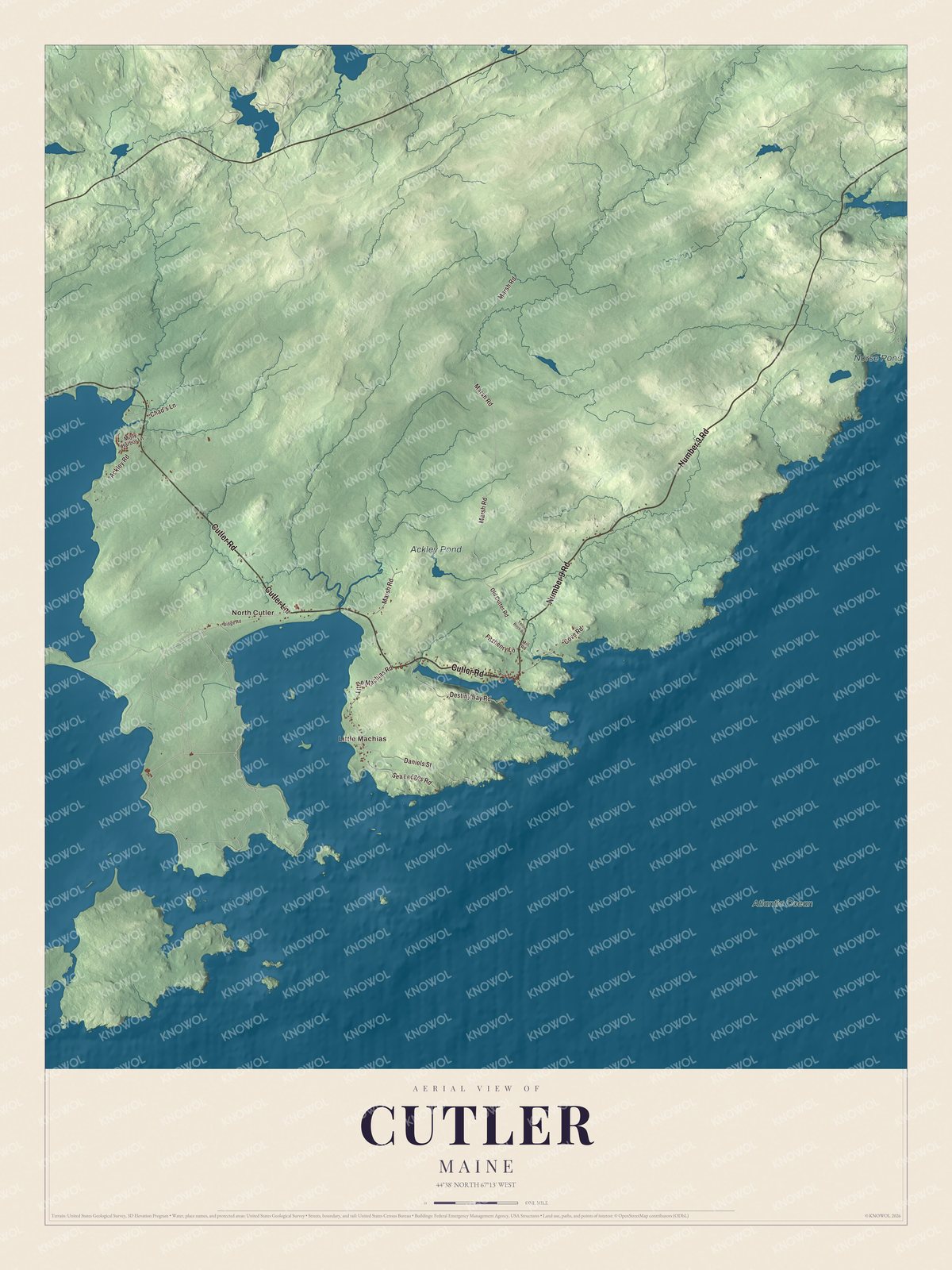
Click to explore a larger preview. The digital watermark does not appear on printed maps.
See it on a wall
The Cutler map as a framed print. Swipe for more.


Along the shore
North Cutler is printed on the map, and so is Little Machias. Cutler Road, Cutler Lane, Ackley Road, Marsh Road, Daniels Street and Destiny Bay Road are printed too. Norse Pond and Ackley Pond are labeled on the map, and so is the Atlantic Ocean.
This Cutler map makes a fine addition to an office, library or den, and it can help teach children the geography and history of the area. It’s made for everyone who calls Cutler home, from North Cutler to the shore of the Atlantic Ocean, as it looks today. Zoom in on the preview above to explore the details, then click here to get your copy of the Cutler, Maine map.

Sources
- Cutler, Maine, Wikipedia
- List of municipalities in Maine, Wikipedia
- Varney, A Gazetteer of the State of Maine (1886)
- Varney, A Gazetteer of the State of Maine (1886)
- Blanche Craig, Wikipedia
- Little River Light, Wikipedia
- VLF Transmitter Cutler, Wikipedia
- Maine State Route 191, Wikipedia
- Cross Island National Wildlife Refuge, Wikipedia
- Machias Seal Island, Wikipedia