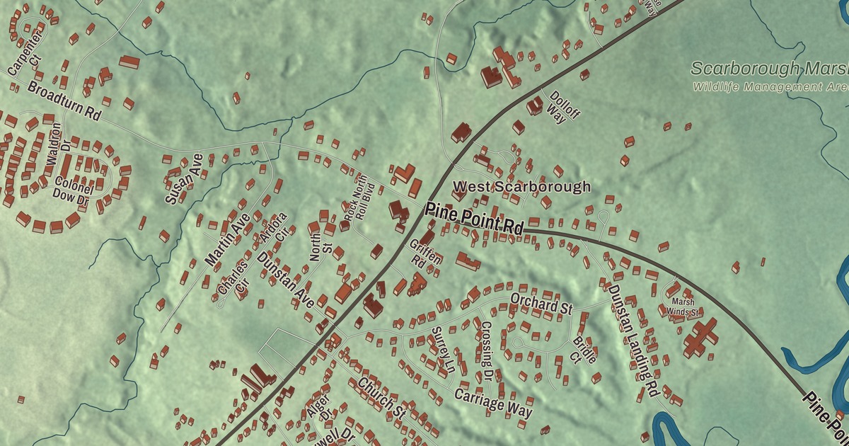
Pine Point Road, Broadturn Road and Dunstan Avenue are the names to find first on this map of Dunstan, Maine, with West Scarborough printed too. Payne Road, Old Blue Point Road, Beech Ridge Road and Cascade Brook fill in the rest. Click here to purchase a print of this map for your wall.
Dunstan is a named community in the town of Scarborough, Cumberland County, with 2,083 people at the 2020 census.
KNOWOL made this map in 2026 from public survey data and gave it the look of an old atlas. The community is mapped with its own boundary, the census-designated place the Census Bureau first drew around Dunstan before the 2020 census, and the finished artwork gives Dunstan its own place title. United States Geological Survey elevation data shades the ground, which sits at a listed elevation of 66 feet.
Dunstan Corner
Dunstan was one of the settlements that came together as Scarborough. Settlements grew up at Black Point, Blue Point, Dunstan and Stratton Island in the 1600s, and on July 14, 1658, the Massachusetts General Court joined them into one town named for Scarborough in Yorkshire, England. Blue Point is the old name for Pine Point, and Old Blue Point Road shares it.
The community sits in the southwest part of Scarborough along U.S. Route 1, centered where Route 1 meets Broadturn Road and Pine Point Road, in the area known as Dunstan Corner. In the railroad era it was also known as West Scarborough, after the Eastern Railroad’s station of that name, though today that name usually means the rural farm and forest country farther northwest. Route 9 comes up Route 1 from Portland and turns southeast at Dunstan as Pine Point Road, toward Old Orchard Beach. The Maine Turnpike forms the community’s northwestern edge, the York County line and the city of Saco lie to the southwest, and the Dunstan River, an arm of the tidal Scarborough River, marks the northeast edge.
On Route 1
Two buildings on U.S. Route 1 are on the National Register of Historic Places. At Dunstan Corner, the Portland Railroad Company Substation of 1911 powered the Saco Division of the region’s trolley line, and its page calls it the best preserved building left from Maine’s days of light rail. It’s now the Scarborough Historical Museum. The West Scarborough United Methodist Church, also on Route 1 and listed as the Dunstan Methodist Episcopal Church, serves a congregation founded in 1802. Its building went up in 1839 and was remade in 1907 by Monmouth architect and artist Harry Hayman Cochrane, who added the tower, the steeper roof and Gothic stained glass. It’s one of only nine Cochrane commissions known to survive, and the only one outside Monmouth.
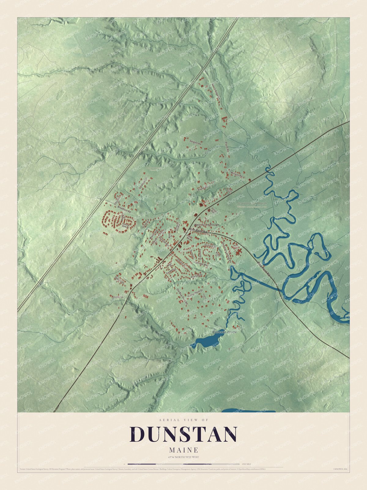
Click to explore a larger preview. The digital watermark does not appear on printed maps.
See it on a wall
The Dunstan map as a framed print. Swipe for more.


The marsh
The Dunstan River runs 6 miles, its lower part through salt marsh, and Route 1 crosses a section of Scarborough Marsh at what used to be called the Dunstan Corner part of town. At 3,200 acres it’s the largest salt marsh in Maine, a state wildlife management area that the Abenaki called Owascoag, “a place of much grass.” Cascade Brook is one of the marsh’s main waterways. Maine Audubon runs a nature center on Pine Point Road and lends canoes for paddling the Dunstan and Scarborough rivers.
Around Dunstan
Pine Point Road, Broadturn Road and Dunstan Avenue are printed on the map, and so are Payne Road, Old Blue Point Road and Beech Ridge Road. West Scarborough is printed too, and Cascade Brook is labeled on the map. The side streets around them are drawn in as well.
This Dunstan map makes a fine addition to an office, library or den, and it can help teach children the geography and history of the area. It’s made for everyone who calls Dunstan home, from Pine Point Road to Beech Ridge Road, as it looks today. Zoom in on the preview above to explore the details, then click here to get your copy of the Dunstan, Maine map.

Sources