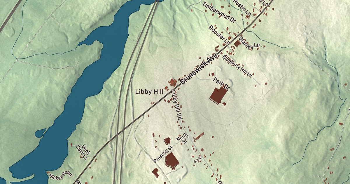
Water Street runs through the middle of this Gardiner map, close to where Cobbosseecontee Stream meets the Kennebec River. Brunswick Avenue, Maine Avenue, River Avenue and Cobbossee Avenue branch off from there, and Libby Hill, South Gardiner and River Road fill out the rest of the city. Click here to purchase a print of this map for your wall.
Gardiner is a city in Kennebec County, on the west bank of the Kennebec just south of Augusta.
KNOWOL made this map in 2026 from public survey data and gave it the look of an old atlas. United States Geological Survey elevation data shades the terrain, and Census Bureau files supply the streets and the city line. Gardiner had 5,961 people at the 2020 census, on 16.57 square miles of land and water.
A doctor’s town at the head of navigation
Dr. Silvester Gardiner was a Boston physician who made his fortune importing drugs, and he became one of the main owners of the Kennebec Purchase. In 1754 he picked this spot at the head of navigation on the Kennebec, where Cobbosseecontee Stream comes down over falls that drop 130 feet, as the place for a mill town called Gardinerstown Plantation. He brought in a gristmill builder, a millwright, a carpenter and a wheelwright, along with a man he enslaved, Isaac “Hazard” Stockbridge, and houses, mills, a church and a blockhouse went up. Gardinerstown was set off from Pittston in 1760.
Dr. Gardiner sided with the Crown and fled when the British left Boston in 1776, and his Maine lands were confiscated. An error in the confiscation let his heirs win the property back, and his grandson Robert Hallowell Gardiner came to manage it in the early 1800s. He settled titles with the squatters he found, rebuilt the dams and mills, built stores, a church, an inn and a wharf, and later served as the first mayor. Gardiner was incorporated on February 17, 1803.
Ice, paper and the river
Gardiner shipped ice. Each winter, men cut big blocks from the Kennebec, packed them in sawdust in warehouses and loaded them onto ships bound across the country and the world. The city was noted for its clean Kennebec ice, cut at the farthest point upriver that deep-draft ships could reach. Paper mills grew from the 1860s, and the commercial ice trade ran from the 1880s into the 1920s. One of the first workable steam automobiles in America was built here in 1858.
By 1850 Gardiner was one of the leading ports on the river, with eight dams on the stream running mills of many kinds. Industry and river traffic both faded in the twentieth century, and many mills had closed by the 1960s. That left the late 1800s downtown on Water Street close to intact. The Gardiner Historic District, listed on the National Register of Historic Places in 1980, starts at Brunswick Avenue and runs along both sides of Water Street to the public library. Its 47 historic buildings are mostly brick, two or three stories tall, in Greek Revival and Italianate styles, and the library was designed in 1881 by Henry Richards.
Tilbury Town
The poet Edwin Arlington Robinson moved to Gardiner with his family in 1870, when he was about a year old, and grew up in the house at 67 Lincoln Avenue. He graduated from Gardiner High School, spent two years at Harvard and came back home in 1893 to write. Tilbury Town, the setting of “Richard Cory”, “Mr. Flood’s Party” and many other poems, was modeled on Gardiner. Robinson won the Pulitzer Prize for Poetry in 1922, 1925 and 1928. His boyhood home was named a National Historic Landmark in 1971, and he’s buried at Oak Grove Cemetery in Gardiner.
The writer Laura E. Richards, daughter of Julia Ward Howe, moved to Gardiner in 1876 when her husband took a management job at his family’s paper mill. She wrote more than 90 books, including Captain January, and in 1917 she shared a Pulitzer Prize with her sisters for their biography of their mother. In 1935 she raised money from across the country for the Robinson monument on Gardiner Common, and an elementary school in the city carries her name. The anthropologist John R. Swanton was born in Gardiner too.
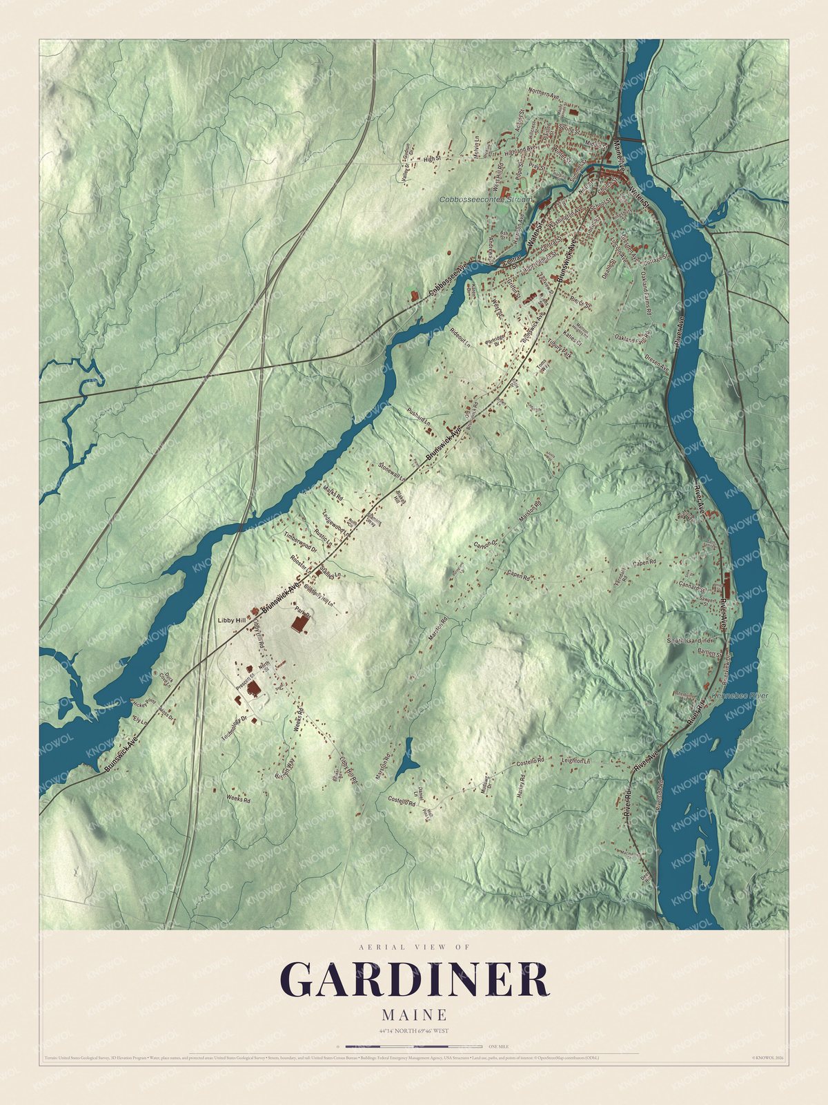
Click to explore a larger preview. The digital watermark does not appear on printed maps.
See it on a wall
The Gardiner map as a framed print. Swipe for more.


Churches, stations and a stone house
Christ Episcopal Church stands at 1 Dresden Avenue, on the town common. Its congregation was organized in 1772 by Silvester Gardiner and is the oldest in the Episcopal Diocese of Maine. The stone church, built in 1820, is the oldest known example of Gothic Revival church architecture in New England, and it carries Dr. Gardiner’s cenotaph.
Down by the river, the Maine Central Railroad built a stone and brick station in 1911, designed by the Portland architect George Burnham. It served trains until the 1950s and has housed a variety of businesses since. In the south end of the city, Oaklands overlooks the Kennebec west of River Road. Richard Upjohn designed the granite Gothic Revival house for the Gardiner family, and building started in 1835, using stone quarried in nearby Hallowell, and the estate is still worked as a farm.
Finding your street
Start where the stream meets the river and follow Water Street through the old downtown. Brunswick Avenue, Maine Avenue and Cobbossee Avenue are printed close by, and River Avenue and River Road run along the Kennebec shore. Libby Hill and South Gardiner are printed too. Look for them in the preview, along with the smaller streets drawn around them.
For people who call Gardiner home, this map keeps the river, the stream and the downtown together as it looks today. It makes a fine addition to an office, library or den, and it can help teach children the geography and history of a river city. Zoom in on the preview above to explore the details, then click here to get your copy of the Gardiner, Maine map.

Sources
- Gardiner, Maine, Wikipedia
- Silvester Gardiner, Wikipedia
- Robert Hallowell Gardiner, Wikipedia
- Gardiner Historic District, Wikipedia
- Edwin Arlington Robinson, Wikipedia
- Edwin Arlington Robinson House, Wikipedia
- Laura E. Richards, Wikipedia
- John R. Swanton, Wikipedia
- Christ Episcopal Church (Gardiner, Maine), Wikipedia
- Gardiner Railroad Station, Wikipedia
- Oaklands (Gardiner, Maine), Wikipedia