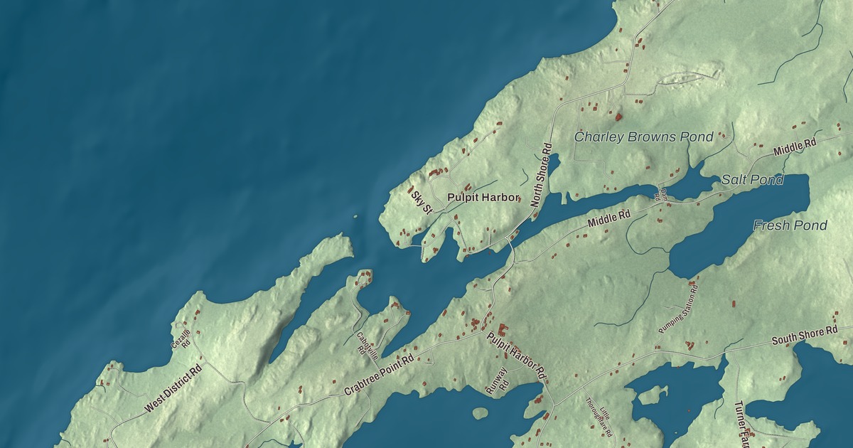
North Shore Road, South Shore Road and Crabtree Point Road cross this map of North Haven, the Penobscot Bay island town Martin Pring counted among the Fox Islands. Click here to purchase a print of this map for your wall.
North Haven is a town in Knox County.
KNOWOL made this map in 2026 from public survey records, United States Geological Survey elevation data and Census Bureau files. Its atlas layout brings together North Haven’s roads, buildings, ponds, coves and terrain, the town boundary and the pattern of buildings.
The Fox Islands
English explorer Martin Pring came through in 1603, at age 23, and named these the Fox Islands for the silver-gray foxes he saw. The name lives on in the Fox Islands Thoroughfare, the strait between North Haven and Vinalhaven that boats use to cross Penobscot Bay. People were here thousands of years earlier. In the 1970s archaeologists from the Maine State Museum surveyed the islands, and the Turner Farm Site in North Haven showed occupation going back to about 5200 BCE. It was one of the first sites to give clear evidence of year-round living by Native people on the Maine coast before contact, and eight North Haven sites are on the National Register of Historic Places.
North Haven was once the North Island of Vinalhaven. It was set off and incorporated on March 1, 1847, as the town of Fox Isle, and the name was changed to North Haven on July 13 that year. In 1850 a state act gave most islanders the right to have the roads they saw fit, and the majority chose to have no roads at all, or roads closed by gates or bars where landowners wanted them.
Hay, lamb and boats
North Haven was known as the farming island for its flat, fertile ground, and hay was a staple crop for many years. Steamships carried its produce and lamb to Boston and other New England cities. Fishing and farming became the chief work. Many islanders caught lobsters, scallops and oysters, and boatbuilding grew into an important trade that’s still carried on in two active boatyards.
In 1885 William Weld challenged the island’s yachtsmen to a race in the tender from his yacht and lost. He had a better dinghy built in Salem, Massachusetts, and won the next year. Henry Calderwood made two copies, and in 1888 James Osman Brown built four more, the beginning of the J. O. Brown & Sons boatyard. North Haven Dinghies are still raced out of the island’s sailing club, the North Haven Casino, which makes them the oldest continuously raced class in the United States.
The summer colony
Summer rusticators found the island in the 1880s, first from Boston and a decade later from New York and Philadelphia. They built cottages on both sides of the Thoroughfare and later a second colony at Pulpit Harbor. The Impressionist Frank Weston Benson rented Wooster Farm on North Haven as a summer home, and some of his best known pictures, among them Eleanor and Summer, show his daughters outdoors there.
The Wharf House, on granite piers at the waterfront just east of the main dock, began in 1880 as a fish canning facility, according to local historians. It was a sail loft when John Reynolds Jr. bought it in 1897, and in 1912 he had it remade as a summer home, one of the state’s most unusual examples of a building adapted into a summer home. At the eastern entrance to the Thoroughfare stands Goose Rocks Light, a cast iron sparkplug lighthouse built in 1890. It was automated in 1963 and is still an active aid to navigation.
North Haven Community School teaches kindergarten through grade 12, which is unusual among Maine island communities, and it’s one of Maine’s smallest public schools. The island is roughly 7.9 miles long and 2.9 miles wide at its widest points, and water makes up 70.87 of the town’s 82.49 square miles.
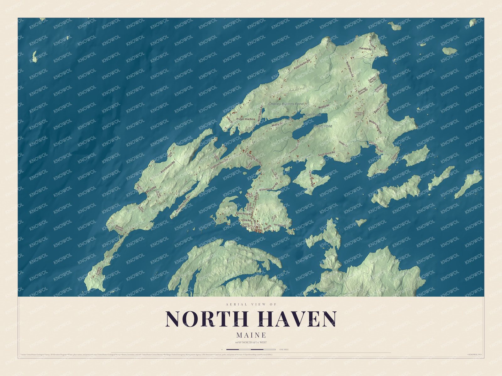
Click to explore a larger preview. The digital watermark does not appear on printed maps.
See it on a wall
The North Haven map as a framed print. Swipe for more.


Explore the North Haven map
Start at Pulpit Harbor, then follow North Shore Road, South Shore Road, Main Street, Crabtree Point Road, Beach Road and West District Road across the island. Those names are printed on the artwork, and Fresh Pond, Salt Pond and Charley Browns Pond are labeled too. Compare the open fields of the farming island with the coves and points along its shore.
For people who call North Haven home, this map shows the town as it looks today. Put it in your office, library, or den, or use it to teach children the geography and history of the area. Zoom in on the preview above to explore the details, then click here to get your copy of the North Haven, Maine map.

Sources