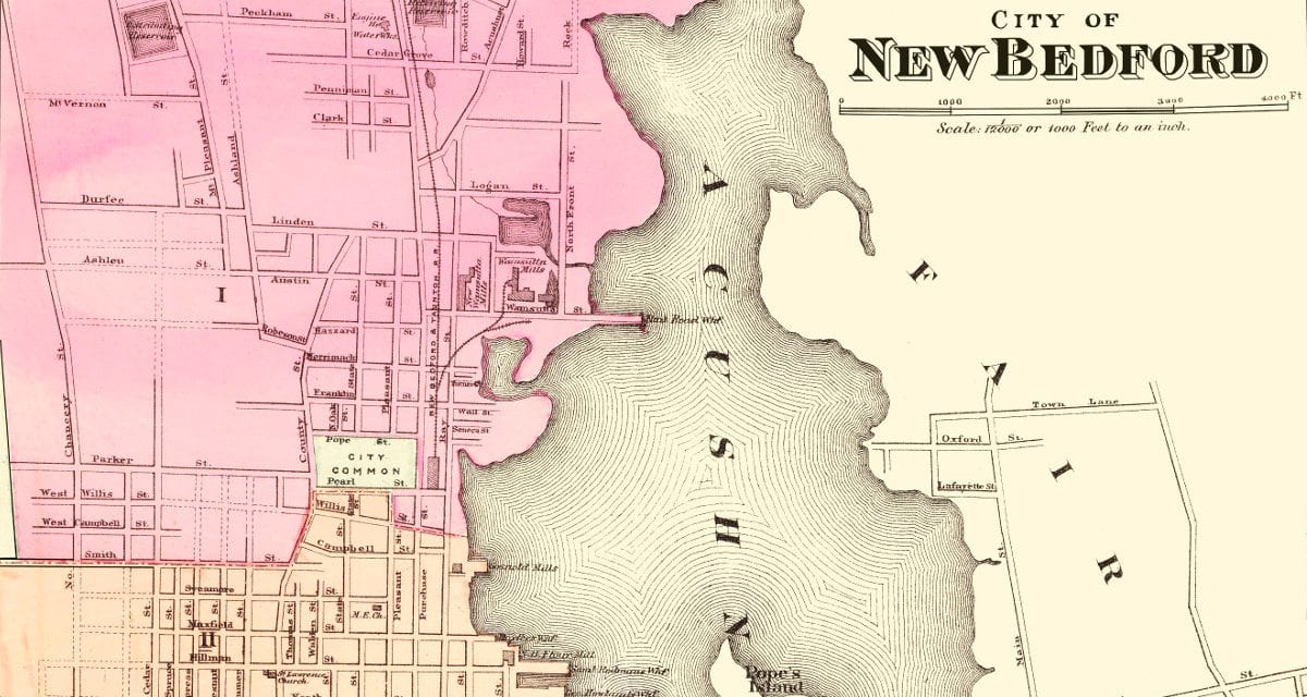
In 1871, this map of New Bedford, Massachusetts was printed in the “Official Topographical Atlas of Massachusetts”, that included 16 accurate, color maps of Massachusetts towns, including New Bedford.
This map of New Bedford, Massachusetts has been restored by KNOWOL and shows the city layout, neighborhoods and public spaces including the Acushnet River, Crow Island, the City Common and more. Reproductions are available here.
Click here to see the full map.
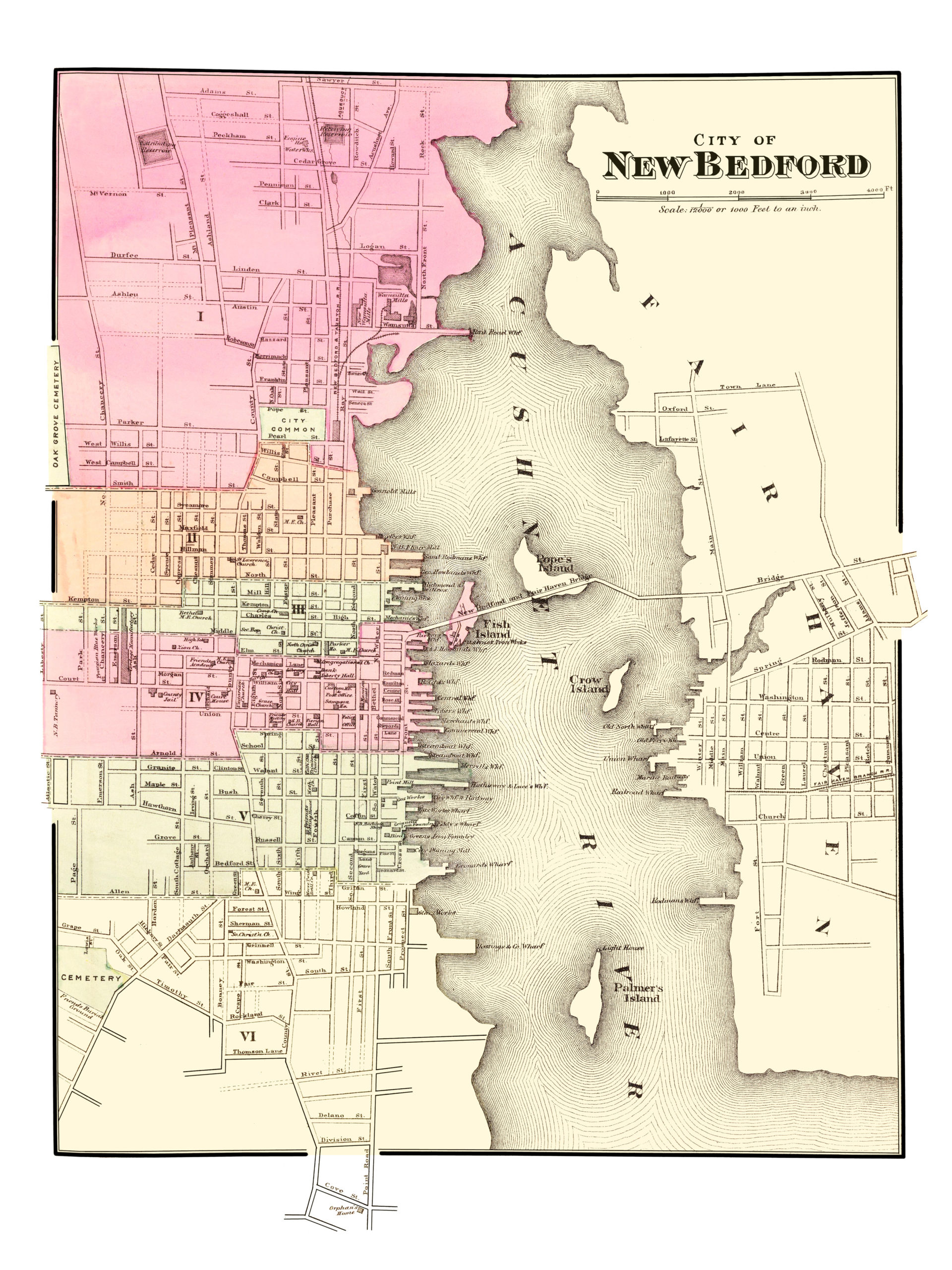
This map of New Bedford, Massachusetts provides hours of entertainment and helps you learn about the town’s history in the process. This historic wall map will make an attractive addition to your office, library, or den, and can even be used to teach kids the history of New Bedford.