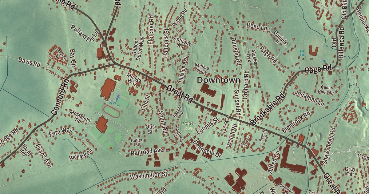
If you grew up in Bedford, the town center on Great Road is where the old houses, the common and the church all meet, and the Concord River runs along the edge of town. This map prints Great Road, North Road, Concord Road, Carlisle Road, Burlington Road and Page Road, with the Concord River, Fawn Lake, the Great Meadows National Wildlife Refuge, Balls Hill, Crosbys Hill and Davis Hill. Click here to purchase a print of this map for your wall.
Bedford is in Middlesex County, about 21 miles northwest of Boston.
KNOWOL made this map in 2026 from public survey data and gave it the look of an old atlas. The relief comes from United States Geological Survey elevation data, and the roads and the town line come from the Census Bureau. Bedford is a nearly round town of 13.9 square miles, with Billerica, Burlington, Lexington, Lincoln, Concord and Carlisle around it, and 14,383 people at the 2020 census.
Two Brothers
In 1637 the General Court granted land along the Concord River to Governor John Winthrop and Deputy Governor Thomas Dudley. When the two men looked over it in early 1638, they agreed to split it at two great boulders on the river’s eastern bank, Winthrop taking the land past one and Dudley the land past the other. They named the rocks the Two Brothers, and the town page ties the name to the marriage of Dudley’s son, the Reverend Samuel Dudley, and Winthrop’s daughter Mary. Around 1889 Dudley Leavitt Pickman, a descendant of both governors who had bought the land without knowing its history, had the rocks carved with “Dudley,” “Winthrop” and 1638. They still sit by the river inside the Great Meadows National Wildlife Refuge, reached by canoe on the Concord River or by trails through the Altmann Conservation Area, and the Two Brothers Rocks-Dudley Road Historic District joined the National Register of Historic Places in 2010.
The Town of Bedford’s recorded history, in the Secretary of the Commonwealth’s list, dates European settlement to 1640, and the town page agrees on “around 1640.” Bedford was incorporated as a town in 1729, made from about three fifths of Billerica and two fifths of Concord. The town remains part of Middlesex County today. Its first meeting house went up in 1730 on land given by the settler Israel Putnam, and Great Road was laid out sometime between 1713 and 1731.
April 19, 1775
Early on the morning of April 19, 1775, an alarm warned Bedford that British soldiers were marching from Boston to Concord. Their captain, Jonathan Willson, told the minutemen, “It is a cold breakfast boys, but we’ll give them a hot dinner.” Job Lane, a minuteman, was wounded at Concord that day, and two of Bedford’s schools, Davis and Lane, are named for officers who took part in the battle. The Bedford Flag, on display at the Bedford Free Public Library, is a small crimson silk banner painted with an armored arm, a sword and the motto “Vince Aut Morire,” “Conquer or Die.” Its own page calls it the oldest known surviving complete flag in the United States. Page family tradition holds that Nathaniel Page carried it to the North Bridge at Concord, though no account written at the time mentions it.
The center on Great Road
The Bedford Center Historic District runs along Great Road between Bacon Road and Concord Road. Its oldest building is the Fitch Tavern, built in 1710, and its centerpiece is the Federal-style First Parish Church of 1816, facing the common. The town hall across the common was built in 1857 as a school. At 4 Great Road, the brick-ended Elijah Stearns Mansion of about 1800 had a store beside it, the Boston Cash Store, which became the town’s first post office in 1825, when Stearns was named postmaster, and the Bedford Public Library in 1867. On North Road, at number 295, the saltbox Job Lane House, built around 1713 by Job Lane on land his grandfather had bought in 1664, is now a town-owned house museum. Along Vine Brook, on Wilson and Old Burlington Road, lie the ruins of the John Wilson mills, dating from about 1685, which ground grain, sawed lumber and later pressed cider.
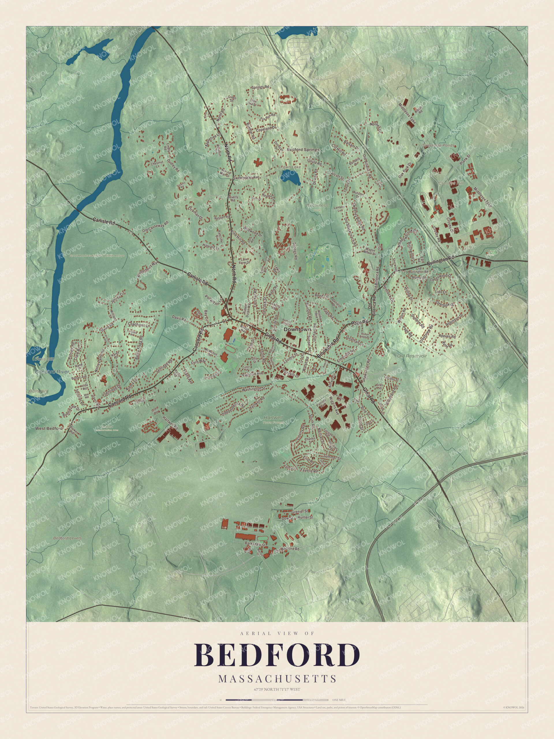
Click to explore a larger preview. The digital watermark does not appear on printed maps.
Names on this map
These names are printed on this map.
Places: Downtown, West Bedford, Bedford Springs, Balls Hill, Bedford Levels, Crosbys Hill, Davis Hill, Fawn Lake, Spectacle Ponds, Concord River, Bedford Conservation Area, Great Meadows National Wildlife Refuge, Hartwell Town Forest, Old Reservoir, Wilderness Park, Mitre Fields, Page Field and Patriots Park.
Streets and roads: Concord Road, North Road, Burlington Road, Page Road, Carlisle Road, Great Road, Brooksbie Road, Old Billerica Road, Sunset Road, Walsh Road, Railroad Avenue, Old Bedford Road.
More street names, A to Z
Alaska Avenue, Albion Road, Alcott Street, Alfred Circle, Anthony Road, Appletree Lane, Arnold Street, Ashby Place, Autumn Drive, Avalon Drive, Avon Road, Bacon Road, Balsam Drive, Bandera Drive, Barksdale Street, Battle Flagg Road, Bay Circle, Bedford Village, Beverly Road, Birchwood Drive, Bonair Avenue, Bonnievale Drive, Bridge Street, Buehler Road, Caesar Jones Way, Caribou Street, Cedar Ridge Drive, Charles Street, Chestnut Lane, Clark Road, Coachmen Lane, Copeland Drive, Cot Hill Road, Crestview Road, Crosby Drive, Crosby Road, Curve Street, Cutler Street, Dana Road, Daniels Drive, Davis Road, Deangelo Drive, Dewey Road, Donovan Drive, Doris Road, Dow Street, Dudley Road, Dunelm Road, Dunster Road, Dutton Lane, Earl Road, Eliot Road, Elmbrook Road, Elm Street, El Will Farm Road, Emery Road, Evans Avenue, Evergreen Avenue, Fayette Road, Fern Way, Fletcher Road, Flintlock Drive, Fox Run Road, Genetti Circle, Glen Ora Drive, Glenridge Drive, Gould Road, Gray Terrace, Green Street, Grenier Street, Hancock Street, Hardy Road, Hartford Street, Hartwell Road, Harvard Drive, Hayden Lane, Hemlock Lane, Hilda Road, Hillcrest Road, Hillside Avenue, Hilltop Drive, Hume Road, Hunter Street, Independence Road, Irene Road, Jeffrey Circle, Jonathan Lane, Karen Drive, Lane Avenue, Lane Farm Drive, Lantern Lane, Ledgewood Drive, Lewis Road, Liberty Road, Lido Lane, Loomis Street, Lynnfield Street, Macintosh Road, Mae Road, Marrett Street, McMahon Road, Meadowbrook Road, Middlesex Turnpike, Minute Man Drive, Mudge Way, Neillian Street, Neillian Way, Noreen Drive, Norma Road, Notre Dame Road, Oak Park Drive, Old Burlington Road, Old Causeway Road, Old Stagecoach Road, Orchard Road, Otis Street, Overlook Drive, Parker Road, Perham Street, Pickman Drive, Pine Hill Road, Pine Street, Plank Street, Pollard Inn Lane, Preston Court, Putnam Road, Radcliffe Circle, Rand Place, Reed Lane, Reeves Road, Richard Road, Roberts Drive, Robinson Drive, Ruben Duren Way, Russett Road, Selfridge Road, Shawsheen Road, Sheridan Road, Sherwood Drive, Shire Lane, Short Street, Sorens Way, South Road, Springs Road, Stearns Road, Summer Street, Sweeney Ridge Road, Sweetwater Avenue, Temple Terrace, Wagon Wheel Drive, Washington Street, Wayte Road, Wiggins Avenue, Wildwood Drive, William Street, Willow Lane, Wilson Road, Winterberry Way, Woodland Road.
See it on a wall
The Bedford map as a framed print. Swipe for more.


Around the map
The Concord River forms part of the town line, and the Shawsheen River flows through town; Vine Brook joins the Shawsheen here, and in the 1840s a large paper mill on the brook supplied many of Bedford’s jobs. The Great Meadows National Wildlife Refuge stretches 12 miles along the Concord and Sudbury rivers, from Billerica up to Wayland, and about 85 percent of its 3,600 acres is freshwater wetland, a feeding ground for ducks and migrating shorebirds. Hanscom Air Force Base lies mostly in Bedford, beside the civilian Hanscom Field, and the Minuteman Bikeway starts in Bedford and runs 10 miles to Alewife station in Cambridge on the old Lexington Branch railroad. Lydia O’Leary, born in Bedford in 1900, invented a makeup to cover birthmarks and won a patent for it in 1932, after taking off her own makeup in front of the patent examiners to show what it hid.
Start in West Bedford, then follow Great Road, North Road, Concord Road, Carlisle Road, Burlington Road and Page Road out toward Bedford Springs. Fawn Lake, Balls Hill, Crosbys Hill and Davis Hill are printed on the map along with the river and the refuge.
Bedford’s map makes a good addition to an office, library or den, and it can help teach children the geography and history of the town that answered the alarm of April 19. It’s made for people who call Bedford home, from West Bedford to Bedford Springs, and it shows the town as it looks today. Zoom in on the preview above to explore the details, then click here to get your copy of the Bedford, Massachusetts map.

Sources
- Bedford, Massachusetts, Wikipedia
- Two Brothers Rocks-Dudley Road Historic District, Wikipedia
- Bedford Center Historic District, Wikipedia
- Job Lane House, Wikipedia
- Bedford Flag, Wikipedia
- Great Meadows National Wildlife Refuge, Wikipedia
- Hanscom Air Force Base, Wikipedia
- Minuteman Bikeway, Wikipedia
- Lydia O’Leary, Wikipedia
- City and Town Incorporation and Settlement Dates, Secretary of the Commonwealth of Massachusetts (archived copy)