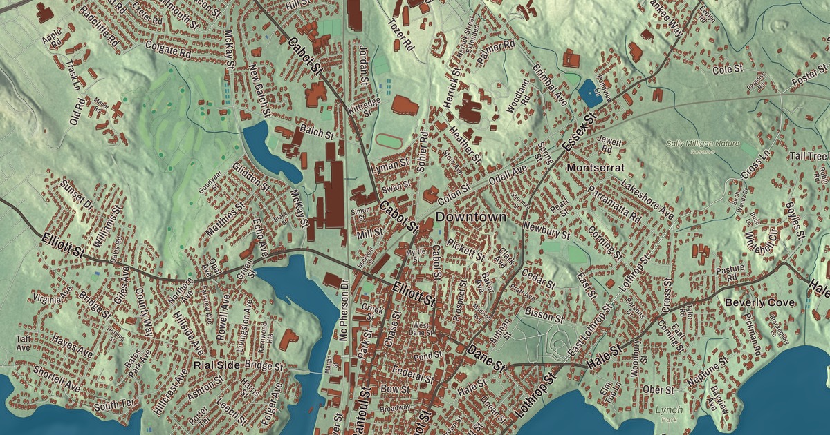
Ask anyone from Beverly where they’re from and you may get a village for an answer: the Cove, Centerville, Montserrat, Prides Crossing, Beverly Farms or Rial Side. This map prints them all, along with Cabot Street, Rantoul Street, Hale Street, Lothrop Street and Essex Street, and Wenham Lake, Beaver Pond and Norwood Pond up north. Click here to purchase a print of this map for your wall.
Beverly is in Essex County, on the North Shore about 17 miles northeast of Boston.
KNOWOL made this map in 2026 from public survey data and gave it the look of an old atlas. United States Geological Survey elevation data shapes the relief, and the Census Bureau supplies the streets and the city line. Beverly covers 22.6 square miles, and about a third of it is water: coves, Beverly Harbor at the mouth of the Danvers River, the Bass River, and the Great and Little Misery Islands offshore. Salem lies across the harbor to the south, with Danvers, Wenham and Manchester-by-the-Sea on the other sides, and 42,670 people lived here at the 2020 census.
Set off from Salem
English colonists under Roger Conant settled here in 1626, as part of Salem. The City of Beverly’s historical record says the area was part of Salem before it became a separate town in 1668, once the Reverend John Hale and the First Parish Church were officially recognized. The town page says the name came from Beverley, the county town of the East Riding of Yorkshire. Farming and fishing were the leading local industries through the seventeenth and eighteenth centuries. Cotton manufacturing followed after the American Revolution, and home shoemaking and then commercial shoe factories grew through the nineteenth century. Beverly was incorporated as a city in 1894.
The oldest survivor of those first years stands at 448 Cabot Street. John Balch received the land in 1635, and the house on it was long dated to 1636; tree-ring testing in 2006 put its earliest part at about 1679, with the southern part added in 1721. The Balch House is called one of the oldest wood-frame houses in the United States, and Historic Beverly opens it as a museum in season.
The Hannah and the cotton mill
On September 5, 1775, the armed schooner Hannah sailed out of Beverly Harbor under Captain Nicholson Broughton, commissioned by George Washington to go after ships supplying the British army in Boston. On that strength Beverly calls itself the “Birthplace of America’s Navy,” and the Hannah rides on the patch of the city’s police. Marblehead makes a similar claim, in part because Broughton was from there.
Twelve years later, in 1787, the Beverly Cotton Manufactory opened, and its page calls it the first cotton mill built in America and the largest of its era. Its proprietors, the Cabots among them, are credited with the first methods in America for spinning cotton commercially. George Washington visited Beverly on his New England tour in 1789 and wrote in his diary that “the whole seemed perfect,” and Beverly has been called the birthplace of the American Industrial Revolution. The horse-powered mill couldn’t keep up with the water-driven mills that followed, and its old brick building burned in 1828. A memorial stone marks the spot at Baker’s Corner, where Cabot Street meets Dodge Street in North Beverly. The town page also counts one of the country’s first Sunday schools, built here in 1810.
Shoes came next. In 1902 the United Shoe Machinery Corporation built a quarter mile of factory buildings in Beverly, an early landmark of reinforced concrete designed by Ernest L. Ransome. The plant closed in 1987, and since 1996 the old complex has become a campus of high-tech companies, medical offices, salons and restaurants. Parker Brothers, the makers of Monopoly, also had their headquarters here.
Ice, presidents and a poet
Wenham Lake, which Beverly shares with Wenham, was famous far beyond the North Shore. The first cargo of its ice reached England in 1844, and the ice was so prized in Britain for its purity that it’s said Queen Victoria used it; Norwegian exporters even renamed a lake of their own Wenham Lake for a while to borrow the name. Today it’s a reservoir for the Salem and Beverly water supply, fed in part by streams from Beaver Pond and Norwood Pond.
William Howard Taft spent his summers in Beverly as president. In 1909 and 1910 he rented a house on the spot now taken by the Italian Garden in Lynch Park, the city’s main park, and in 1911 and 1912 a house called Parramatta about a mile away. The town page says Beverly Hills, California, took its name in 1907 from Beverly Farms, where Taft vacationed. Lucy Larcom, a poet who went to work in the Lowell mills at age eleven, wrote about her early childhood in Beverly Farms in A New England Girlhood in 1889.
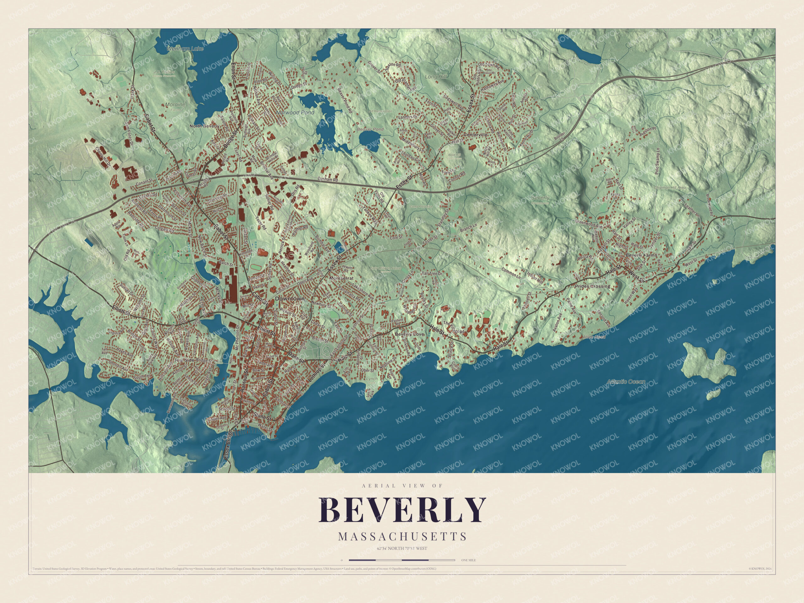
Click to explore a larger preview. The digital watermark does not appear on printed maps.
Names on this map
These names are printed on this map.
Places: Downtown, North Beverly, Allen Head, Beaver Pond, Wenham Lake, Norwood Pond, Alt Reservation, Atlantic Ocean, Bald Hill Open Space, Beverly Commons, Camp Paradise, Chipman Hill Area, J.C. Phillips Nature Preserve, Long Hill, Lynch Park, Moraine Farm, Sally Milligan Nature Reserve, Beverly Cove, Beverly Farms, Centerville, Montserrat, Prides Crossing and Rial Side.
Streets and roads: Cabot Street, Elliott Street, Dodge Street, Lothrop Street, Dane Street, Stone Street, Hale Street, West Street, Rantoul Street, Essex Bridge, Enon Street, Essex Street.
More street names, A to Z
Abbott Street, Access Road, Alcott Way, Amherst Road, Apple Road, Arbella Drive, Aricia Lane, Ashton Street, Avalon Avenue, Baker Avenue, Balch Street, Bartlett Street, Bass River Road, Bates Park Avenue, Bayview Avenue, Beach Street, Beacon Street, Beaver Pond Road, Beckford Street, Birch Lane, Birch Woods Drive, Bisson Street, Blake Street, Boulder Lane, Bow Street, Boyles Street, Brackenbury Lane, Branch Lane, Brandt Circle, Bridge Street, Brimbal Avenue, Brimbal Hills Drive, Broadway, Brookwood Road, Brown Street, Budleigh Avenue, Butman Street, Cedar Street, Central Street, Chase Street, Cherry Hill Drive, Cherry Road, Chipman Road, Clark Avenue, Cogswell Avenue, Cole Street, Colgate Road, College Lane, Colon Street, Common Lane, Conant Street, Congress Street, Connor Road, Cornell Road, Corning Street, County Way, Cox Court, Creek Street, Crescent Avenue, Cross Lane, Cross Street, Curtis Point, Dartmouth Street, Davis Road, Deer Haven Road, Dix Way, Dondi Road, Driscoll Lane, Dunham Road, Dyer Road, Eagle Lane, East Corning Street, East Lothrop Street, East Street, Echo Avenue, Ellsworth Avenue, Elm Top Lane, Evelyn Road, Everett Street, Exeter Road, Fairview Avenue, Farms Lane, Fayette Street, Federal Street, Fern Street, Folger Avenue, Foster Street, Front Street, Giles Avenue, Glidden Street, Goodyear Street, Green Street, Greenwood Avenue, Grover Street, Harris Street, Hart Street, Haskell Street, Hathaway Avenue, Haven Way, Hayes Avenue, Heather Street, Hellard Road, Herrick Street, Herrick Street Extended, High Street, Hillcrest Avenue, Hillside Avenue, Hill Street, Holding Street, Holly Lane, Horse Hill Lane, Hull Street, Indian Hill, Jewett Road, Jordan Street, Juniper Street, Kennel Hill Drive, Kernwood Avenue, Kernwood Heights, King Terrace, Kittredge Street, Lakeshore Avenue, Landers Drive, Laurel Street, Leather Lane, Leech Street, Linden Avenue, Lineham Lane, Livingston Avenue, Longham Road, Lovett Street, Lyman Street, Madison Avenue, Manor Road, Margin Street, Mark Road, Matthies Street, McKay Street, Mc Pherson Drive, Michael Road, Middlebury Lane, Millbrook Road, Miller Road, Mill Street, Myrtle Street, Nelson Avenue, Neptune Street, New Balch Street, Newbury Street, Noble Hill Road, Northern Avenue, Northridge Road, Oakhurst Road, Oak Street, Ober Street, Ocean Street, Odell Avenue, Old Essex Road, Old Planters Road, Old Road, Old Rubbly Road, Old Town Road, Opal Avenue, Otis Road, Paine Avenue, Palmer Road, Paradise Road, Park Street, Parramatta Road, Parsons Drive, Pasture Road, Patti Road, Pearl Street, Pershing Avenue, Pickett Street, Pickman Road, Pine Knoll Drive, Pleasant Street, Pole Swamp Lane, Pond Street, Pondview Lane, Porter Terrace, Pratt Avenue, Prescott Street, Preston Place, Prince Street, Priscilla Road, Prospect Street, Putnam Street, Radcliffe Road, Red Rock Lane, Rezza Road, River Street, Robb Road, Robin Road, Rowell Avenue, Salem Road, Sam Fonzo Drive, Scenna Road, School Street, Second Avenue, Sherman Street, Shortell Avenue, Simon Street, Sohier Road, Sonning Road, South Terrace, Spring Street, Standley Street, Stewart Lane, Story Avenue, Sunnyvale Street, Sunset Drive, Swan Street, Taft Avenue, Tall Tree Drive, Temi Road, Thaxton Road, The Village Road, Thissell Street, Thoreau Circle, Tozer Road, Trask Lane, Trask Street, Tyler Road, Valley Street, Vine Street, Virginia Avenue, Walker Road, Water Street, Webber Avenue, Webster Avenue, Wentworth Drive, West Dane Street, Whitehell Circle, Williams Street, Wirling Drive, Woodbury Street, Woodland Road, Wood Lane, Yankee Way.
See it on a wall
The Beverly map as a framed print. Swipe for more.


Around the map
Start downtown. The Cabot is one of only about 250 movie palaces of its kind left from an estimated 20,000 theaters built in the 1920s; Le Grand David’s magic show played there from 1977 to 2012, and it reopened as a nonprofit performing arts center after 2014. Nearby are the Larcom Theatre of 1912, built by the same Ware brothers, and the Odd Fellows’ Hall at the corner of Cabot and Broadway. Montserrat College of Art and Endicott College are both in Beverly, and the town page calls the Beverly Little League at Harry Ball Field the first and oldest little league in Massachusetts.
Follow Cabot Street, Rantoul Street, Hale Street, Lothrop Street or Essex Street across the city, then look outward toward Beverly Cove, Beverly Farms, Centerville, Montserrat, Prides Crossing and Rial Side. The commuter rail still stops at Montserrat and Beverly Farms on its way to Rockport. Wenham Lake, Beaver Pond and Norwood Pond are all printed on the map along with those neighborhoods. So is the Atlantic Ocean, off the city’s shore.
Beverly’s map makes a handsome addition to an office, library or den, and it can help teach children the geography and history of the city where the Hannah set sail. It’s made for people who call Beverly home, from Rial Side to Prides Crossing, and it shows the city as it looks today. Zoom in on the preview above to explore the details, then click here to get your copy of the Beverly, Massachusetts map.

Sources
- Beverly, Massachusetts, Wikipedia
- John Balch House, Wikipedia
- USS Hannah (1775), Wikipedia
- Beverly Cotton Manufactory, Wikipedia
- Wenham Lake, Wikipedia
- Lucy Larcom, Wikipedia
- Annual Comprehensive Financial Report (city history), City of Beverly
- City and Town Incorporation and Settlement Dates, Secretary of the Commonwealth of Massachusetts (archived copy)