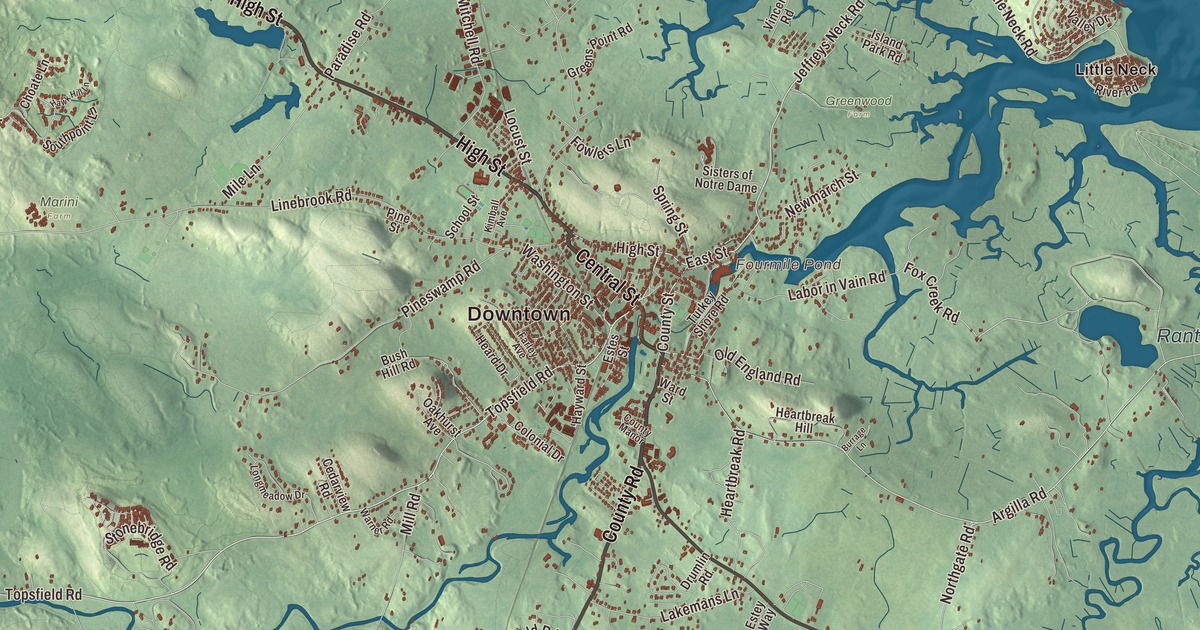
Ipswich runs from Willowdale State Forest in the west to the dunes of Crane Beach on Ipswich Bay. This map prints County Road, Central Street, Essex Road, High Street, the Newburyport Turnpike and Turnpike Road, with Little Neck, Averills Island, Bagwell Island, Stage Island Pool, Clark Pond and Bare Hill. Click here to purchase a print of this map for your wall.
Ipswich is in Essex County.
KNOWOL made this map in 2026 from public survey data and gave it the look of an old atlas. The relief comes from United States Geological Survey elevation data, and the streets and the town line come from the Census Bureau. Ipswich sits in central Essex County, 28 miles northeast of Boston, bordered by Rowley, Boxford, Topsfield, Hamilton and Essex, with Gloucester across Essex Bay. The Ipswich River and Plum Island Sound meet and empty past Castle Hill and Sandy Point into Ipswich Bay, and the town takes in the southern part of Plum Island. It had 13,785 people at the 2020 census.
Agawam becomes Ipswich
People lived here long before the English came. The Bull Brook archaeological site in Ipswich holds some of the oldest signs of human life in New England, dated to between 9,000 and 11,000 years ago. The English called the Native settlement on Ipswich Bay Agawam, after a name they heard from the sachem Masconomet. The Town of Ipswich’s recorded history, in the Secretary of the Commonwealth’s list, dates European settlement to 1633. That year John Winthrop the Younger, son of the colony’s first governor, sailed into Ipswich harbor in a shallop with 12 men. Ipswich was incorporated as a town in 1634, on August 5, named for Ipswich in Suffolk, England, “in acknowledgment of the great honor and kindness done to our people which took shipping there.” The town remains part of Essex County today.
Ipswich calls itself the “Birthplace of American Independence.” In 1687 the Reverend John Wise led residents in protesting a tax imposed by the royal governor, Sir Edmund Andros, arguing that taxation without representation wasn’t acceptable for Englishmen. Citizens were jailed, Wise among them, but Andros was recalled in 1689. Calvin Coolidge later named Wise as one of the inspirations for the Declaration of Independence. Nathaniel Ward, an assistant pastor here from 1634 to 1636, wrote the first code of laws for Massachusetts. The poet Anne Bradstreet, whose page calls her the first writer in England’s North American colonies to be published, lived in Ipswich before her family moved to Andover in the 1640s, and the Ipswich Public Library keeps a memorial to her.
Ipswich is also part of the story of freedom. Jenny Slew, born around 1719 to a free white mother, lived as a free woman in Ipswich until 1762, when she was seized from her home and held in slavery. In 1766 she won her case before a jury in Salem and was declared free, and her page calls her the first person to win freedom through a trial by jury. John Adams was most likely in the courtroom.
Lace, stockings and old houses
Women in Ipswich made bobbin lace, and by the 1760s they were trading it for goods; the lace’s page calls it the only known American hand-made bobbin lace to be produced commercially. The great clipper ships of the 1800s went to deeper ports, and Ipswich stayed a fishing and farming town where people lived in older homes they couldn’t afford to replace, which left it with a large stock of early architecture. The John Whipple House, begun in 1677, has been a museum since 1899 and became a National Historic Landmark in 1960. The stone Choate Bridge of 1764 carries South Main Street over the Ipswich River and is one of the oldest surviving bridges in North America. In 1868 Amos A. Lawrence started the Ipswich Hosiery Mills beside the river, and by the turn of the 20th century it was the nation’s largest stocking mill. Appleton Farms, granted to Samuel Appleton by the town in 1638, is one of the oldest continuously operating farms in Massachusetts.
In 1910 Richard T. Crane Jr. of Chicago bought Castle Hill, a drumlin on Ipswich Bay, and in 1928 a 59-room mansion called the Great House was finished on top. The estate went to The Trustees of Reservations after Mrs. Crane’s death in 1949, and it’s now a National Historic Landmark open to the public. Crane Beach, given by the family in 1945, has four miles of sand, dunes and pitch pine forest, and every June since 1911 Ipswich schoolchildren have gathered there for Crane Beach Day, a tradition the Cranes began for their son’s sixth birthday. The town is known for its clams, too, celebrated each year at the Ipswich Chowderfest. Click here to learn more about the history of Ipswich.
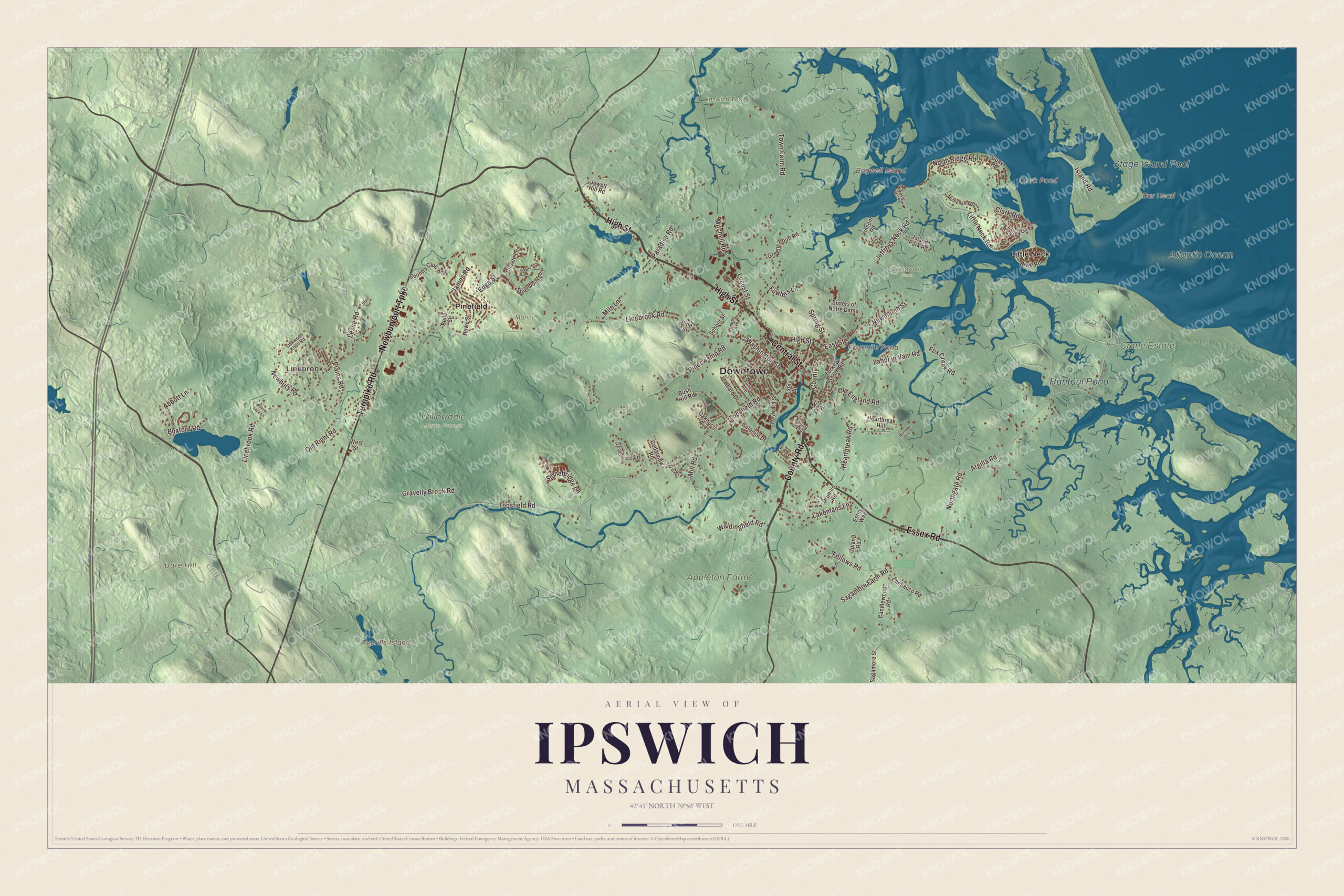
Click to explore a larger preview. The digital watermark does not appear on printed maps.
Names on this map
These names are printed on this map.
Places: Downtown, Linebrook, Averills Island, Bagwell Island, Bar Head, Bare Hill, Clark Pond, Fourmile Pond, Stage Island Pool, Rantoul Pond, Appleton Farms, Atlantic Ocean, Crane Estate, Greenwood Farm, Ipswich Town Farm, Marini Farm, Willowdale State Forest, Little Neck and Pinefield.
Streets and roads: County Road, Central Street, Essex Road, High Street, Newburyport Turnpike, Turnpike Road, Topsfield Road, East Street, County Street, Jeffreys Neck Road, Argilla Road, Little Neck Road.
More street names, A to Z
Abbott Lane, Belle Street, Blair Road, Boxford Road, Burrage Lane, Bush Hill Road, Candlewood Road, Cedarview Road, Chebacco Road, Choate Lane, Clark Road, Colonial Drive, Country Club Way, County Manor, Drumlin Road, Eagle Hill Road, Edge Street, Estes Street, Estey Way, Farley Avenue, Fellows Road, Fowlers Lane, Fox Creek Road, Gravelly Brook Road, Greens Point Road, Hawk Hill Lane, Hayward Street, Heard Drive, Heartbreak Hill, Heartbreak Road, Howe Street, Island Park Road, Island Road, James Road, Jewett Hill Road, Kimball Avenue, Labor in Vain Road, Lakemans Lane, Leslie Road, Linebrook Road, Locust Street, Longmeadow Drive, Mile Lane, Mill Road, Mitchell Road, Mulholland Drive, Newbury Road, Newmarch Street, Northgate Road, North Ridge Road, Oakhurst Avenue, Oakwood Knoll Road, Old England Road, Old Right Road, Paradise Road, Pillow Lace Lane, Pine Street, Pineswamp Road, Plains Road, Quay Road, River Road, Sagamore Farm Road, Sagamore Street, School Street, Sisters of Notre Dame, Southpoint Lane, Spring Street, Stonebridge Road, Town Farm Road, Turkey Shore Road, Upland Road, Valley Drive, Vincent Road, Waldingfield Road, Ward Street, Warner Road, Washington Street, West Street.
See it on a wall
The Ipswich map as a framed print. Swipe for more.


Around the map
Start with Linebrook, then follow County Road, Central Street, Essex Road, High Street, the Newburyport Turnpike and Turnpike Road across town. Look outward toward Little Neck and Pinefield. Clark Pond, Fourmile Pond, Stage Island Pool, Rantoul Pond, Bare Hill, Averills Island and Bagwell Island are all printed on the map, and every one of those names is right there on the artwork. Much of the western end of town is Willowdale State Forest, and the marshy northeast drains through the Rowley, Roger Island and Eagle Hill rivers into Plum Island Sound. The Ipswich map makes a fine addition to an office, library or den, and it can help teach children the geography and history of a town incorporated in 1634. It’s made for people who call Ipswich home, from Linebrook to Little Neck, and it shows the town as it looks today. Zoom in on the preview above to explore the details, then click here to get your copy of the Ipswich, Massachusetts map.

Sources
- Ipswich, Massachusetts, Wikipedia
- John Wise (clergyman), Wikipedia
- Anne Bradstreet, Wikipedia
- Jenny Slew, Wikipedia
- Ipswich lace, Wikipedia
- John Whipple House, Wikipedia
- Choate Bridge, Wikipedia
- Appleton Farms, Wikipedia
- Castle Hill (Ipswich, Massachusetts), Wikipedia
- Crane Beach, Wikipedia
- City and Town Incorporation and Settlement Dates, Secretary of the Commonwealth of Massachusetts (archived copy)