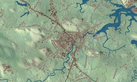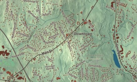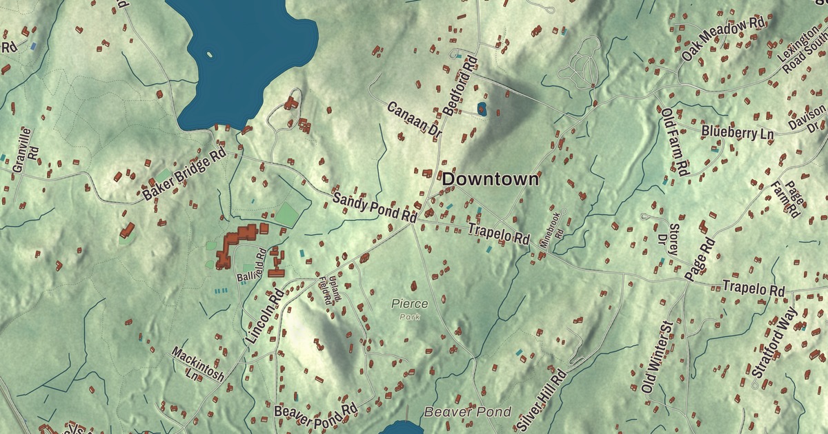
Lincoln keeps a lot of conservation land, from the fields and forests along the Battle Road Trail to the protected watershed around Flints Pond, with the town center and South Lincoln in between. This map prints North Great Road, South Great Road, Concord Road, Bypass Road, Marrett Street and the Cambridge Turnpike, with Flints Pond, Beaver Pond, Farrar Pond and Cranberry Hill. Click here to purchase a print of this map for your wall.
Lincoln is in Middlesex County.
KNOWOL made this map in 2026 from public survey data and gave it the look of a vintage atlas. United States Geological Survey elevation data shapes the hills and hollows, and the Census Bureau supplied the roads and the town line. Lincoln covers 15.0 square miles in Boston’s western suburbs, and it had 7,014 people at the 2020 census, counting the residents of Hanscom Air Force Base who live inside the town line. Commuter trains on the Fitchburg Line stop in Lincoln on the way to Boston’s North Station.
Niptown
Lincoln began as part of Concord. The Town of Lincoln’s recorded history, in the Secretary of the Commonwealth’s list, dates European settlement to 1650, and the town page gives 1654. Families on the edges of Concord, Weston and Lexington found the trip to their own meetinghouses too long, and they petitioned the General Court to become a town of their own. Lincoln was incorporated as a town in 1754, mostly from a large piece of southeast Concord, and because it was nipped from three towns it was sometimes called “Niptown.” Chambers Russell, a representative who helped bring the town about, was asked to name it, and he chose Lincoln after his family’s home in Lincolnshire, England. It’s one of the few American towns named for that county, and not for General Benjamin Lincoln or President Abraham Lincoln. The town remains part of Middlesex County today.
Russell’s house became the Codman House, also called The Grange, on a 16-acre estate at 36 Codman Road. He built it as a Georgian house around 1735, John Codman enlarged it in the 1790s into the three-story Federal house that stands today, and its grounds have been farmed almost without a break since 1735. The Reverend Charles Stearns served Lincoln’s Congregational church from late 1781 until his death 45 years later.
The road to Concord
Lincoln was in the thick of April 19, 1775. On the night before, a British patrol caught Paul Revere in Lincoln, and Samuel Prescott, who had been riding with him, jumped his horse over a wall and got away. Prescott came out at the Hartwell Tavern, just off the Battle Road, and woke Ephraim Hartwell, who sent Violet, a woman he enslaved, down the road to warn his son’s family. Mary Hartwell carried the word on to Captain William Smith of the Lincoln minutemen. The Lincoln men were the first to arrive to reinforce the colonists guarding the stores at Concord, and Colonel Abijah Pierce led his troops armed with only a cane, trading it for a British musket after the fight. A large part of the day’s fighting took place in Lincoln. Today the tavern, built in 1733 and restored to its 1775 look, is part of Minute Man National Historical Park, and a monument along the Battle Road Trail marks the spot where Revere was captured.
Modern Lincoln
In 1938 the Bauhaus architect Walter Gropius, who had fled Nazi Germany, built a modern house for his family at 68 Baker Bridge Road with his partner Marcel Breuer. The Gropius House is a National Historic Landmark and a museum today, part of the Woods End Road Historic District. On the southern shore of Flints Pond, the deCordova Sculpture Park and Museum opened in 1950 on the old estate of Julian de Cordova; its page calls it the largest park of its kind in New England, with more than 60 works across 30 acres. Ray Tomlinson, who in 1971 invented the first email program on the ARPANET, the first that could send mail between users on different computers, and used the @ sign to address it, lived in Lincoln, and the band They Might Be Giants named its 1988 album Lincoln for the hometown of its two founders.
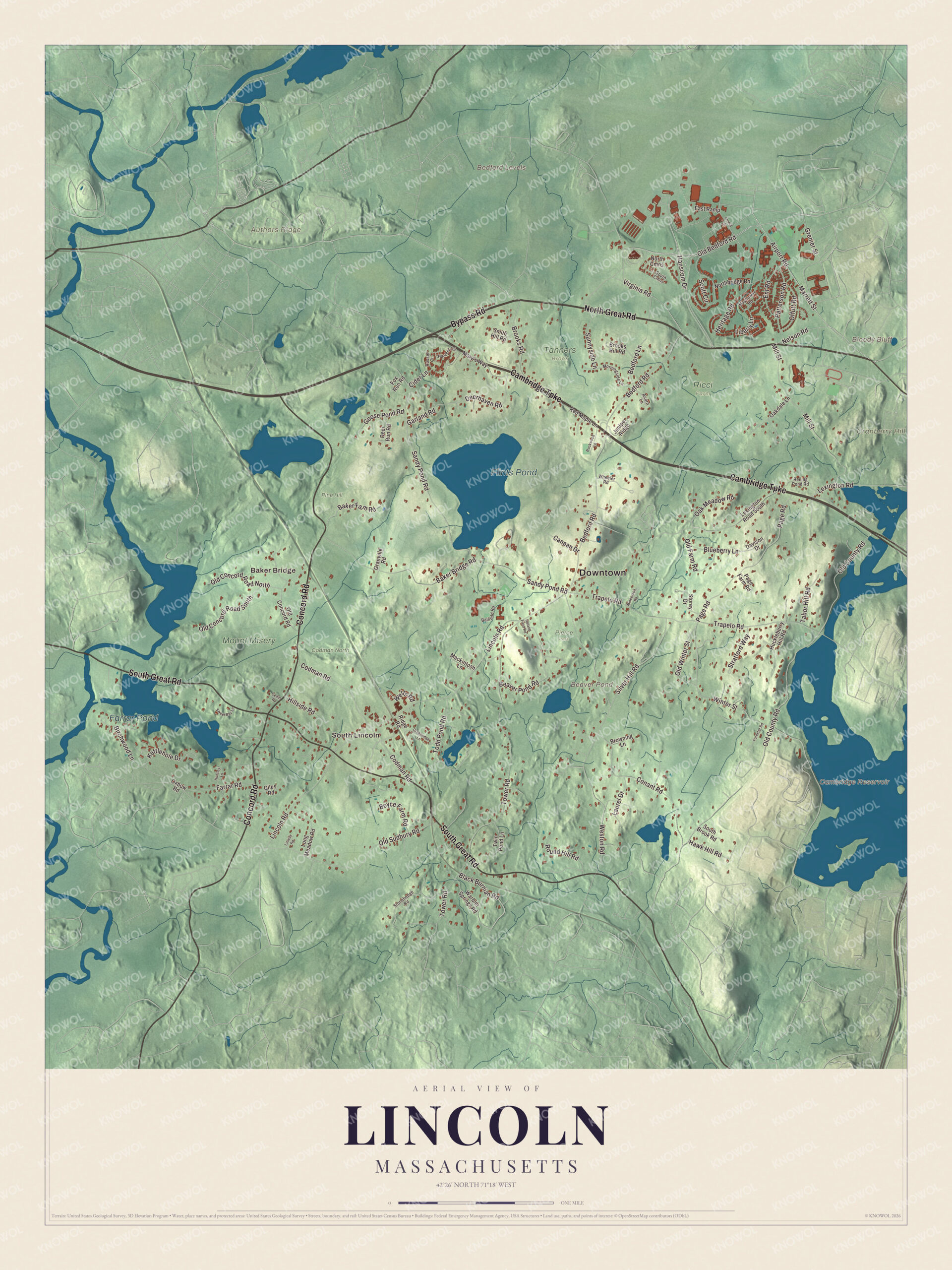
Click to explore a larger preview. The digital watermark does not appear on printed maps.
Names on this map
These names are printed on this map.
Places: Downtown, Baker Bridge, South Lincoln, Authors Ridge, Bedford Levels, Bloody Bluff, Cranberry Hill, Beaver Pond, Cambridge Reservoir, Flints Pond, Farrar Pond, Codman North, Mount Misery, Pierce Park, Pine Hill, Ricci Farm and Tanners Brook.
Streets and roads: North Great Road, Bypass Road, Cambridge Turnpike, South Great Road, Concord Road, Marrett Street, Old Bedford Road, Liberty Lane, Virginia Road, Bedford Road, Nelson Road, Old County Road.
More street names, A to Z
Acorn Lane, Airport Road, Arnold Street, Baker Bridge Road, Baker Farm Road, Ballfield Road, Beaver Pond Road, Bedford Lane, Birchwood Lane, Black Burnian Road, Blueberry Lane, Boyce Farm Road, Brooks Hill Road, Brooks Road, Browning Lane, Canaan Drive, Cedar Road, Cider Lane, Codman Road, Conant Road, Davison Drive, Deerhaven Road, Deer Run Road, East Ramp, Ent Road, Farrar Road, Forester Road, Fox Run Road, Garland Road, Giles Road, Goose Pond Road, Granville Road, Greenridge Lane, Grenier Street, Hanscom Drive, Harvest Circle, Hawk Hill Road, Heritage Road, Hillside Road, Huckleberry Hill Road, Huntley Lane, Juniper Ridge, Kettlehole Drive, Laurel Drive, Lexington Road, Lexington Road South, Lincoln Road, Linway Road, Long Meadow Road, Mackintosh Lane, Mary's Way, Mayflower Road, Mill Street, Minebrook Road, Morningside Lane, Northbridge Road, North Cmns, Oakdale Lane, Oak Meadow Road, Offutt Road, Old Concord Road, Old Concord Road North, Old Concord Road South, Old Farm Road, Old Sudbury Road, Old Winter Street, Oxbow Road, Page Farm Road, Page Road, Patterson Road, Red Maple Lane, Reiling Pond Road, Ridge Road, Rockwood Lane, Round Hill Road, Russet Court, Sandy Pond Road, Scott Circle, Silver Hill Road, Smith Hill Road, South Brook Road, South Cmns, Stonehedge Road, Storey Drive, Stratford Way, Sunnyside Lane, Sweet Bay Lane, Tabor Hill Road, Todd Pond Road, Tower Road, Trapelo Road, Twin Pond Lane, Upland Field Road, Warbler Springs Road, Wells Road, Weston Road, Wheeler Road, Winter Street.
See it on a wall
The Lincoln map as a framed print. Swipe for more.


Around the map
Start with Baker Bridge. Follow North Great Road, Bypass Road, the Cambridge Turnpike, South Great Road, Concord Road and Marrett Street across town. Then look outward toward South Lincoln. Beaver Pond, Cambridge Reservoir, Flints Pond, Farrar Pond, Authors Ridge, Cranberry Hill and Bloody Bluff are all printed on the map as well. Flints Pond, about a mile north-northwest of the town center, is Lincoln’s main water supply, and Thoreau’s classmate Charles Stearns Wheeler built a hut on its shore in 1836. Beaver Pond covers about 20 acres of conservation land, and Thomas Flint’s 750-acre grant of the 1600s reached all the way from Flints Pond to Beaver Pond. Authors Ridge is the hill in Sleepy Hollow Cemetery, in neighboring Concord, where several of the country’s great writers are buried.
The Lincoln map makes a fine addition to an office, library or den, and it can help teach children the geography and history of a Battle Road town. It’s made for people who call Lincoln home, from Baker Bridge to South Lincoln, and it shows the town as it looks today. Zoom in on the preview above to explore the details, then click here to get your copy of the Lincoln, Massachusetts map.

Sources
- Lincoln, Massachusetts, Wikipedia
- Codman House, Wikipedia
- Hartwell Tavern, Wikipedia
- Minute Man National Historical Park, Wikipedia
- Gropius House, Wikipedia
- DeCordova Sculpture Park and Museum, Wikipedia
- Ray Tomlinson, Wikipedia
- Flints Pond, Wikipedia
- Beaver Pond (Massachusetts), Wikipedia
- Sleepy Hollow Cemetery (Concord, Massachusetts), Wikipedia
- City and Town Incorporation and Settlement Dates, Secretary of the Commonwealth of Massachusetts (archived copy)