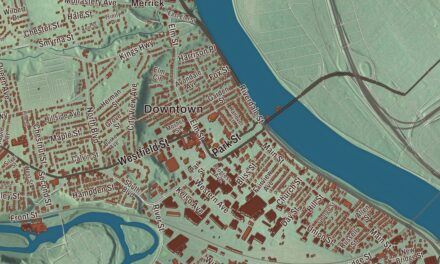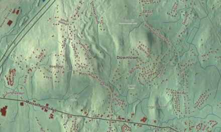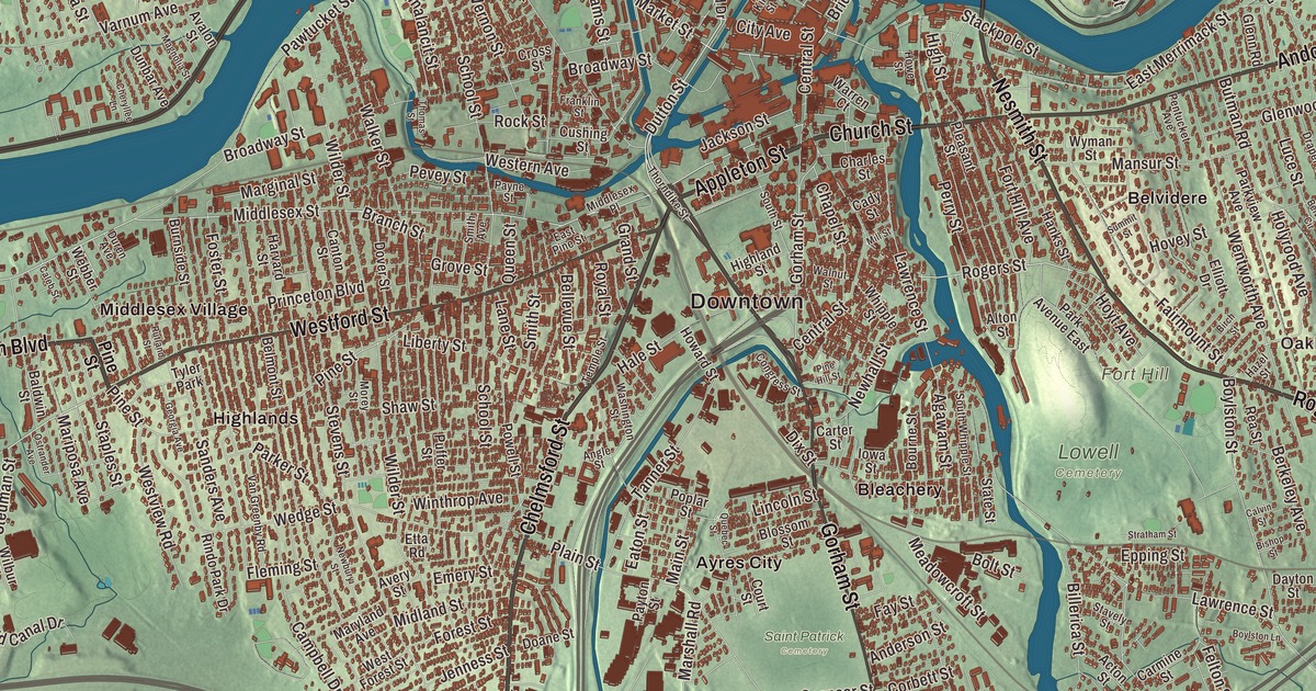
Lowell people grew up between the mills and the rivers, with the canals winding through the mill district, the Merrimack bending past Centralville and Pawtucketville, and the Concord coming in from the south past Belvidere. This map prints Chelmsford Street, Andover Street, Appleton Street, Rogers Street, Princeton Boulevard and the VFW Highway, with the Merrimack River, Fort Hill, Christian Hill and the Lowell Reservoir. Click here to purchase a print of this map for your wall.
Lowell is in Middlesex County.
KNOWOL made this map in 2026 from public survey data and gave it the look of a vintage city atlas. The drumlins and river valleys come from United States Geological Survey elevation data, and the Census Bureau supplied the streets and the city line. Lowell covers 14.5 square miles about 25 miles northwest of Boston, where the Concord River meets the Merrimack, and it had an estimated 115,554 people in 2020. The Pawtucket Falls, a mile-long run of rapids dropping 32 feet, end where the two rivers meet. Glacial deposits turned the Merrimack northeast here and left the drumlins that dot the city, most notably Fort Hill in Belvidere, with Christian Hill rising at the east end of Centralville on the Dracut line.
At the falls
The Pawtucket Falls were a seasonal fishing place for Native people long before the mills, and the Pawtucket people took their name from the spot, which means “at the falls.” In the mid-1600s the praying town of Wamesit stood where the Concord meets the Merrimack. The City of Lowell’s recorded history, in the Secretary of the Commonwealth’s list, dates European settlement to 1653. By the 1800s the area was East Chelmsford, a farming community, until a group of Boston investors chose it in the 1820s for a planned textile city powered by the falls. They named it for their late leader, Francis Cabot Lowell, who had studied British textile machines and helped bring the Industrial Revolution to the United States. Lowell was incorporated as a town in 1826, and it was incorporated as a city in 1836. The falls’ page calls it America’s first planned factory town.
The Spindle City
The old Pawtucket Canal became the feeder for 5.6 miles of power canals, and for some 30 years the falls alone drove Lowell’s textile mills. Irish immigrants dug many of the canals and built the factories, and the mills hired young women from New England farm families, the Lowell mill girls. By 1840 the mills had recruited more than 8,000 workers, nearly three quarters of them women. They earned only half what men did, yet many gained economic independence for the first time, and they formed book clubs and wrote for the Lowell Offering, a monthly of their own poetry and fiction published from 1840 to 1845. By the 1850s Lowell had the largest industrial complex in the United States, and in 1860 it held more cotton spindles than all eleven states that would form the Confederacy put together.
Later waves of French Canadians, Germans and others came to work in the mills, and by 1900 nearly half of Lowell’s people were born abroad. When the textile plants closed after World War II, Lowell found a new start as the headquarters of Wang Laboratories in the 1970s, and in those years thousands of refugees from Cambodia made new homes here. The city page credits Lowell with Cambodia Town and the second-largest Cambodian American population in the country.
Saving the mills
In the 1970s Lowell’s people pushed to save the old mill district, and United States Senator Paul Tsongas, a Lowell native, led the effort in Congress. Lowell National Historical Park was established in 1978, with weave rooms, a waterpower exhibit and walks along the restored canals, including the Boott Cotton Mills Museum. The Lowell Folk Festival fills six outdoor stages on the last full weekend of July, and its page counts it the second-largest free folk festival in the United States. On the river, the Great Gate that James B. Francis built in 1850 to seal the canals off from the Merrimack was nicknamed “Francis’ Folly,” but it saved the city from floods in 1852 and again in 1936.
Lowell has given the country some notable artists. James McNeill Whistler was born in 1834 in the house at 243 Worthen Street, built for the canal company’s manager and now the Whistler House Museum of Art. Jack Kerouac was born in Lowell in 1922 to French Canadian parents and grew up speaking French at home, and his birthplace stands at 9 Lupine Road in Centralville. Bette Davis was born at 22 Chester Street in the Highlands. Kerouac Park downtown and the Lowell Celebrates Kerouac Festival every October keep his memory close. Click here to learn more about the history of Lowell.
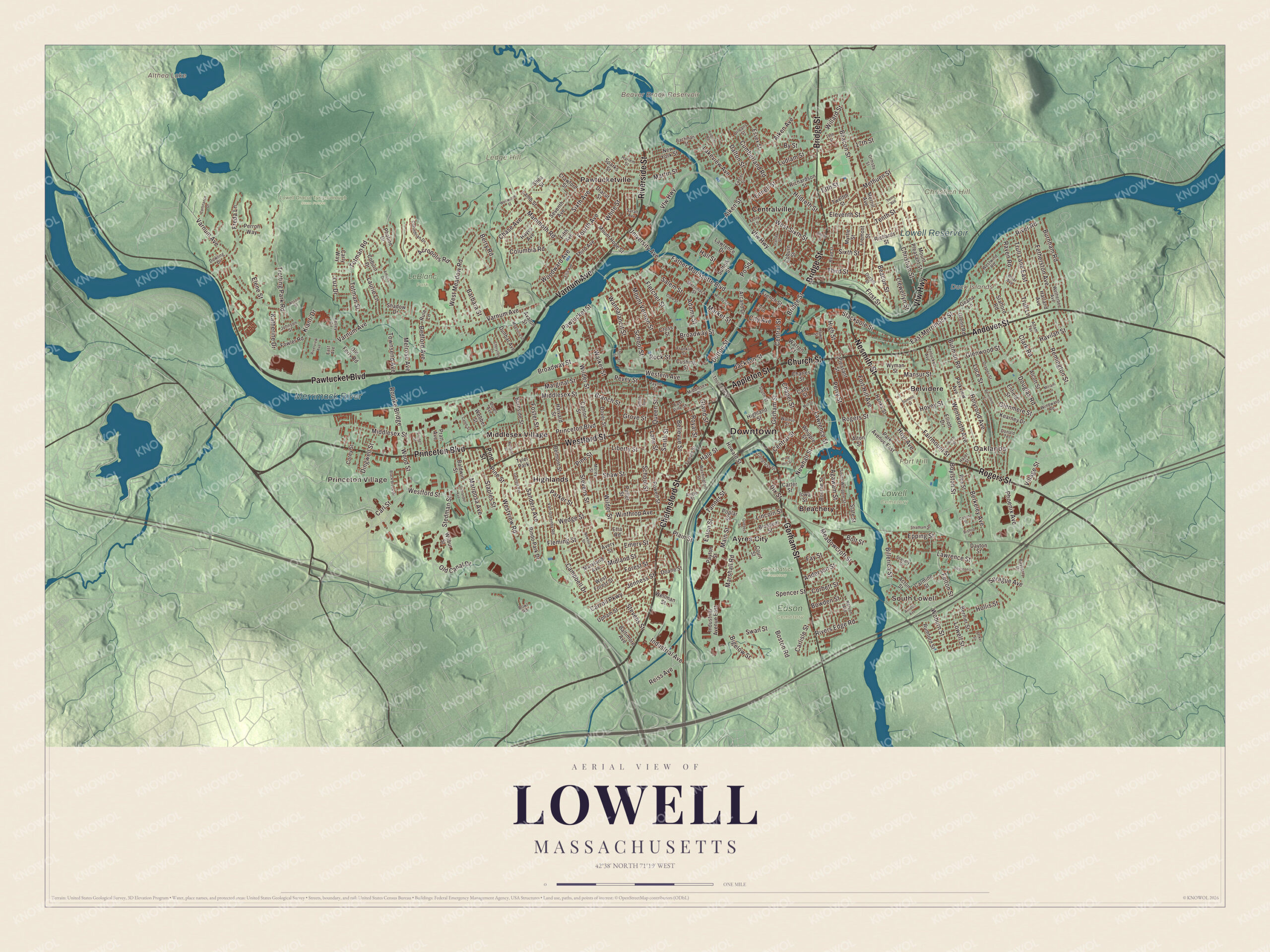
Click to explore a larger preview. The digital watermark does not appear on printed maps.
Names on this map
These names are printed on this map.
Places: Downtown, South Lowell, Princeton Village, Oaklands, Christian Hill, Duck Islands, Fort Hill, Ledge Hill, Althea Lake, Beaver Brook Reservoir, Lowell Reservoir, Merrimack River, Edson Cemetery, LeBlanc Park, Lowell Cemetery, Lowell Dracut Tyngsborough State Forest, Saint Patrick Cemetery, Ayres City, Belvidere, Bleachery, Centralville, Highlands, Middlesex Village, Pawtucketville and Tyler Park.
Streets and roads: Chelmsford Street, Andover Street, Vfw Highway, Rogers Street, Princeton Boulevard, Appleton Street, Church Street, Varnum Avenue, Riverside Street, Nesmith Street, Pawtucket Boulevard, Westford Street.
More street names, A to Z
13th Street, 17th Street, 19th Street, Acropolis Road, Acton Street, Adams Street, Adam Terrace, Agawam Street, Aiken Avenue, Aiken Street, Alcott Street, Alton Street, Anderson Street, Angle Street, Anson Street, Arcand Drive, Arnold Avenue, Athens Drive, Avalon Street, Avery Street, Bachman Street, Baldwin Street, Baltimore Avenue, Barbara Street, Bayberry Drive, Beacon Street, Bedford Avenue, Bellevue Street, Belmont Street, Belvidere Circle, Berkeley Avenue, Bernier Street, Berry Road, Bigelow Street, Billerica Street, Birch Street, Bishop Street, Black Brook Drive, Blossom Street, Bolt Street, Boston Road, Bourne Street, Bowden Street, Bowl Road, Boylston Lane, Boylston Street, Branch Street, Briar Avenue, Bridge Street, Broadway Street, Burnham Road, Burnside Street, Butman Road, By Street, Cady Street, Caleb Street, Calvin Street, Campbell Drive, Canton Street, Carlisle Street, Carl Street, Carly Way, Carmine Street, Carroll Parkway, Carter Street, Central Street, Chapel Street, Charles Street, Chase Avenue, Cheryllee Lane, Christian Street, City Avenue, Clark Road, Clark Street, Coburn Drive, Coburn Street, Columbia Road, Congress Street, Constance Drive, Corbett Street, Corey Street, Corinthian Drive, Cornell Street, Court Street, Crawford Street, Cross Street, Cumberland Road, Cushing Street, Dalton Street, Dayton Street, Dingwell Street, Dix Street, Doane Street, Donald Terrace, Douglas Road, Dover Street, Dowling Drive, Dracut Street, Draper Street, Dunbar Avenue, Durant Street, Duren Avenue, Dutton Street, East Avenue, East Merrimack Street, East Pine Street, Eaton Street, Elene Street, Eleventh Street, Elliott Drive, Ellis Avenue, Emery Street, Enfield Street, Ennell Street, Epping Street, Essex Street, Etta Road, Exeter Street, Fairmount Street, Father Morissette Boulevard, Fay Street, Felker Street, Felton Street, Ferry Lane, Fetherston Avenue, Fifth Avenue, First Street, Fleming Street, Fletcher Street, Forest Street, Fort Hill Avenue, Foster Street, Fourth Avenue, Fowler Road, Franklin Street, Freda Lane, Fremont Street, French Street, Geana Lane, Georgia Avenue, Glenmere Street, Glenn Road, Glenwood Street, Gorham Street, Grand Street, Grove Street, Hale Street, Hall Street, Hanks Street, Harland Avenue, Harlem Street, Harvard Street, Havilah Street, Hayes Avenue, Hazel Street, Highland Street, High Street, Hildreth Street, Hollis Street, Holyrood Avenue, Hovey Street, Howard Street, Howe Street, Hoyt Avenue, Industrial Avenue, Industrial Avenue East, Iowa Street, Jackson Street, Jenness Street, Johnson Street, Katherine Drive, Kearney Drive, Kelley Circle, Kianti Drive, Kirk Street, Lakeview Avenue, Lamb Street, Lane Street, Laurie Lane, Lawrence Drive, Lawrence Street, Liberty Street, Lincoln Street, Llewellyn Street, Lowell Street, Luce Street, Ludlam Street, Lupine Road, Luz Drive, Magnolia Street, Main Street, Mammoth Road, Mansur Street, Marginal Street, Mariposa Avenue, Market Street, Marshall Road, Martin Street, Maryland Avenue, Meadowcroft Street, Melrose Avenue, Merrill Avenue, Merrimack Street, Methuen Street, Middlesex Place, Middlesex Street, Midland Street, Mill Street, Miriam Lane, Moody Street, Morey Street, Mount Hope Street, Mount Pleasant Street, Mount Vernon Street, Myrtle Street, Nelson Avenue, Newbury Street, Newhall Street, New York Street, Old Canal Drive, Old Ferry Road, Orleans Street, Ormsby Street, Ostrander Avenue, Park Avenue East, Parker Street, Parkview Avenue, Pawtucket Street, Payne Street, Payton Street, Pentucket Avenue, Perron Way, Perry Street, Pevey Street, Phoenix Avenue, Photine Drive, Pine Hill Street, Pine Street, Plain Street, Pleasant Street, Poplar Street, Po Square, Powell Street, Pratt Avenue, Puffer Street, Quebec Street, Queen Street, Raven Road, Read Street, Rea Street, Reiss Avenue, Remington Street, Richardson Street, Richards Street, Rindo Park Drive, River Road, Rivers Edge Road, Riverview Avenue, Rock Street, Rourke Bridge, Royal Street, Rule Lane, Rumford Street, Rutland Street, Salem Street, Sanders Avenue, Sarah Avenue, School Street, Seventh Avenue, Shadow Drive, Shaw Street, Shea Street, Shedd Street, Sixth Avenue, Sixth Street, Smith Avenue, Smith Street, South Street, South Whipple Street, Sparks Street, Spencer Street, Sprague Avenue, Stackpole Street, Stafford Road, Stanley Street, Staples Street, State Street, Stavely Street, Stedman Street, Stevens Street, Stratham Street, Suffolk Street, Summit Street, Swan Street, Tanner Street, Temple Street, Tenth Street, Terry Avenue, Third Avenue, Third Street, Thomas Street, Thorndike Street, Totman Road, Totman Street, Townsend Avenue, Trotting Park Road, Trull Lane, Trull Lane East, Twelfth Street, University Avenue, Upham Street, Van Greenby Road, Village Street, Walker Street, Walnut Street, Wannalancit Street, Warren Court, Washington Street, Webber Street, Wedge Street, Wellman Street, Wellworth Street, Wentworth Avenue, Western Avenue, West Forest Street, West Meadow Road, West Sixth Street, Westview Road, Westwind Road, Wetherbee Avenue, Whipple Street, White Street, Wilbur Street, Wilder Street, Willard Street, Windward Road, Winthrop Avenue, Woburn Street, Wood Street, Woodward Avenue, Wyman Street.
See it on a wall
The Lowell map as a framed print. Swipe for more.


Around the map
Start with South Lowell, the part of town south of the railroad and east of the Concord River. Follow Chelmsford Street, Andover Street, the VFW Highway, Rogers Street, Princeton Boulevard and Appleton Street across the city. Then look outward toward Princeton Village, Oaklands, Ayres City, Belvidere and Bleachery. Althea Lake, Beaver Brook Reservoir, Lowell Reservoir, the Merrimack River, Christian Hill, Fort Hill and Ledge Hill are all printed on the map. Fort Hill Park grew from the old Rogers farm, which Zadock Rogers bought in 1805, and the surrounding Rogers Fort Hill Park Historic District takes in what its page calls the largest single residential development of 19th-century Lowell.
The Lowell map makes a fine addition to an office, library or den, and it can help teach children the geography and history of the mill city on the Merrimack. It’s made for people who call Lowell home, from Belvidere to the Highlands, and it shows the city as it looks today. Zoom in on the preview above to explore the details, then click here to get your copy of the Lowell, Massachusetts map.

Sources
- Lowell, Massachusetts, Wikipedia
- Pawtucket Falls (Massachusetts), Wikipedia
- Francis Cabot Lowell, Wikipedia
- Lowell mill girls, Wikipedia
- Lowell Offering, Wikipedia
- Lowell National Historical Park, Wikipedia
- Lowell Folk Festival, Wikipedia
- Merrimack River, Wikipedia
- Whistler House Museum of Art, Wikipedia
- Jack Kerouac, Wikipedia
- Rogers Fort Hill Park Historic District, Wikipedia
- City and Town Incorporation and Settlement Dates, Secretary of the Commonwealth of Massachusetts (archived copy)