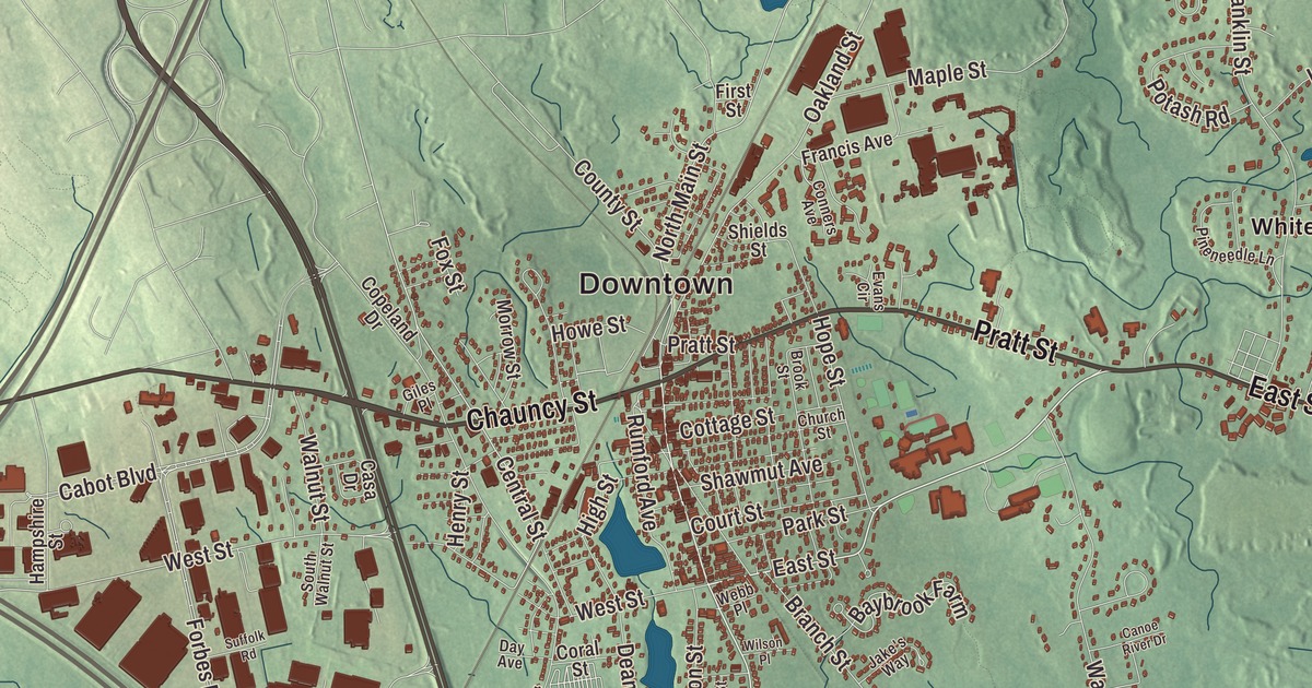
If you grew up in Mansfield, you know North Main Street and South Main Street, Pratt Street, Chauncy Street, East Street and Eastman Street, and the concerts at Great Woods. This map prints all six roads, with Beaumont Pond, Black Pond, Norton Reservoir, Greenwood Lake, Foolish Hill, High Rock and Moose Hill. Click here to purchase a print of this map for your wall.
Mansfield is in Bristol County.
KNOWOL made this map in 2026 from public survey data and gave it the look of an old atlas. The relief comes from United States Geological Survey elevation data, and the streets and the town line come from the Census Bureau. Mansfield covers 20.7 square miles, bordered by Foxborough and Sharon to the north, Easton to the east, Norton to the south, and North Attleborough and Attleboro to the west. The Canoe, Rumford and Wading rivers cross the town, all part of the Taunton River watershed. Boston is 23 miles to the northeast and Providence 22 miles to the southwest, and the town had 23,860 people at the 2020 census.
Named for a friend in the House of Lords
Captain Miles Standish scouted this land in 1640. The Town of Mansfield’s recorded history, in the Secretary of the Commonwealth’s list, dates European settlement to 1659, while the town page gives 1658. Mansfield was incorporated as a town in 1775 and named for William Murray, 1st Earl of Mansfield, a member of the House of Lords who was friendly to the colonies. The town remains part of Bristol County today, and its northern line is also part of the county’s northern border.
The Fisher-Richardson House on Willow Street, one of the oldest buildings in town, went up between 1743 and 1751. Ebenezer Wellman built it with the plank-frame method common here at the time, and Lemuel Fisher nearly doubled it around 1800. When the last local Richardson died in 1929, townspeople wanted it saved, and the house was given to the town, which restored it in 1930. The Mansfield Historical Society runs it today as a house museum. The railroad came early: the Boston and Providence Railroad opened through Mansfield in 1835, and the station in downtown Mansfield still serves the Providence/Stoughton Line.
Mansfield people and Mansfield firsts
Benjamin E. Bates was born in Mansfield in 1808. He became a textile and railroad industrialist, built the Bates Manufacturing Company’s first mill in Lewiston, Maine, in 1850, and his support of a Lewiston seminary led to the founding of Bates College, which carries his name. The stove and furnace maker Gordon Chilson worked in Mansfield too. Closer to home, Dick Bowen opened the first Honey Dew Donuts at 221 North Main Street on June 6, 1973, and the regional chain started there.
Great Woods is the name of the town’s largest conservation area, and it was also the first name of the outdoor amphitheater that opened in Mansfield on June 13, 1986, with Yo-Yo Ma and the Pittsburgh Symphony Orchestra. The planners chose Mansfield to make a regional stage within 40 miles of Providence, Boston, Worcester and Cape Cod. It has carried several names since, the Tweeter Center and the Comcast Center among them, and it’s the Xfinity Center today, with room for 19,900 people after its expansion.
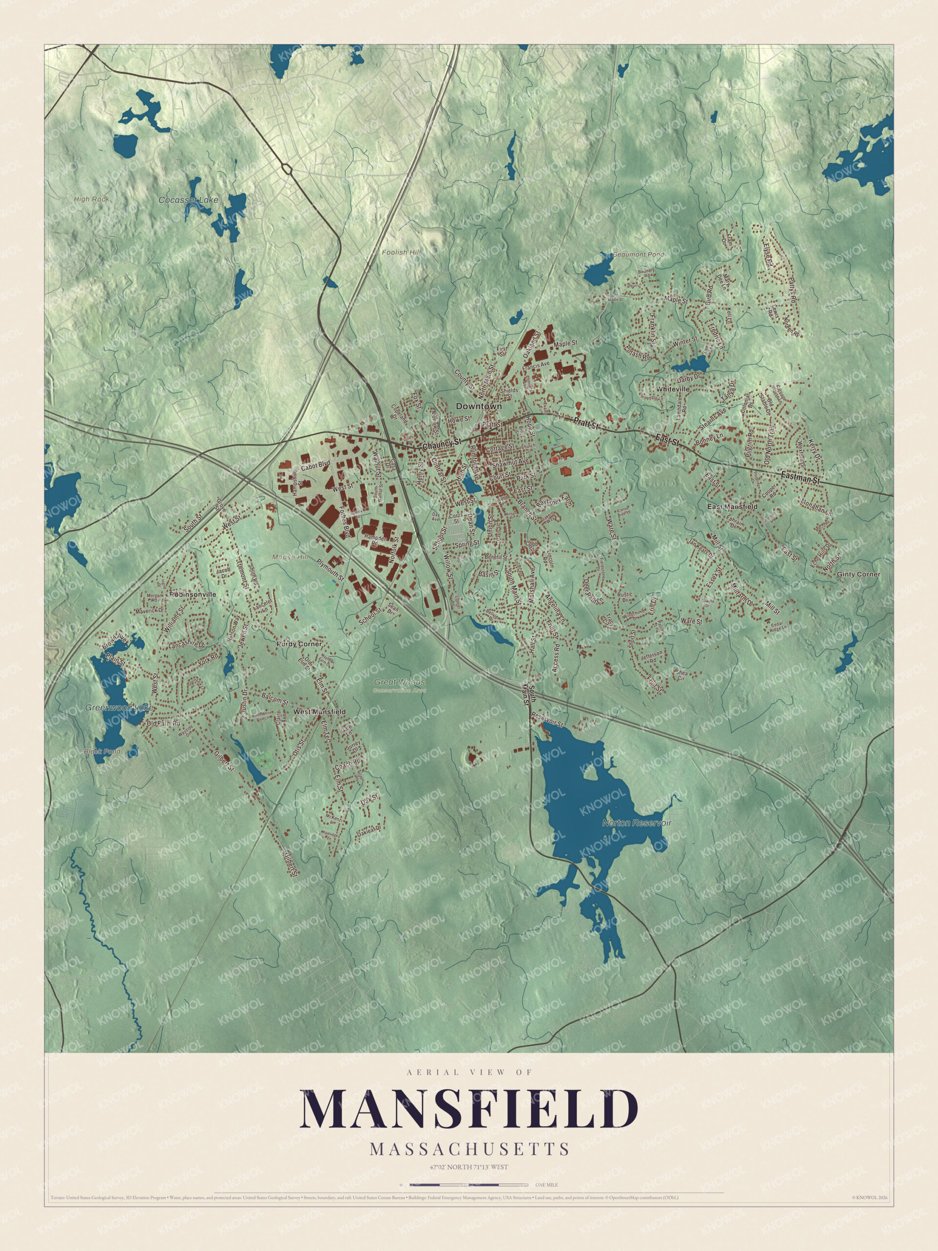
Click to explore a larger preview. The digital watermark does not appear on printed maps.
Names on this map
These names are printed on this map.
Places: Downtown, Ginty Corner, Foolish Hill, High Rock, Moose Hill, Beaumont Pond, Black Pond, Norton Reservoir, Greenwood Lake, Cocasset Lake, Great Woods Conservation Area, East Mansfield, Purdy Corner, Robinsonville, West Mansfield and Whiteville.
Streets and roads: Pratt Street, Chauncy Street, East Street, Eastman Street, South Main Street, North Main Street, Central Street, Forbes Boulevard, Oakland Street, West Street, Jewell Street, Justin Drive.
More street names, A to Z
Access Road, Angelina Lane, Balcom Street, Basin Street, Baybrook Farm, Bellview Drive, Benefit Street, Bird Road, Bonney Lane, Boundry Road, Branch Street, Brook Street, Brown Avenue, Cabot Boulevard, Canoe River Drive, Carriage House Lane, Casa Drive, Cedar Ridge Lane, Church Street, Claire Avenue, Coach Road, Cobbler Road, Cobb Street, Colonial Drive, Conners Avenue, Cooper Road, Copeland Drive, Coral Street, Cottage Street, County Street, Court Street, Darby Drive, Davis Street, Day Avenue, Dean Street, Deer Path Lane, Down Lane, Echo Hills Drive, Elm Street, Elm Terrace, Elyse Road, Ephraim Drive, Erin Drive, Essex Street, Evans Circle, Fieldstone Drive, First Street, Fox Street, Fram Drive, Francis Avenue, Franklin Street, Fredric Lane, Fruit Street, Gale Lane, Gilbert Street, Giles Place, Goward Drive, Grove Street, Hall Street, Hampden Road, Hampshire Street, Henry Street, High Street, Hope Street, Howe Street, Ian Keats Drive, Ingrid Drive, Jacob Drive, Jake's Way, Jefferson Road, Julia Lane, Keli Lane, Kerry Drive, Lancashire Drive, Lancelot Lane, Lawndale Road, Lewis Road, Lincoln Road, Maple Street, Marshall Avenue, Mary Dee Lane, Maverick Drive, Mayhew Farm Drive, McKenzi Lane, Millfarm Drive, Mill Street, Monahan Lane, Morgan Road, Morrow Street, Necco Road, Nelson Way, Noreen Road, Norfolk Street, North Street, North White Pine Lane, Oakleaf Drive, Oak Street, Old Elm Street, Old Farm Road, Old Maple Street, Old North Trail, Old Stable Drive, Otis Street, Park Street, Partridge Lane, Pattys Road, Paula Lane, Pilgrim Road, Pineneedle Lane, Plain Street, Plymouth Street, Potash Road, Reservoir Street, Robyn Lane, Rumford Avenue, Rustic Drive, School Street, Sean Drive, Shannon Lane, Shawmut Avenue, Shea Circle, Shields Street, Short Street, Smiley Avenue, Smith Road, Southpark Lane, South Street, South Walnut Street, Spring Street, Stearns Avenue, Sturbridge Drive, Suffolk Road, Surrey Drive, Tanya Drive, Tracy Circle, Tremont Street, Union Street, Village Road, Walnut Street, Ware Street, Wayside Drive, Webb Place, Wexford Drive, Williams Street, Willow Street, Wilson Place, Windchime Drive, Winter Street, York Road.
See it on a wall
The Mansfield map as a framed print. Swipe for more.


Around the map
Start with Ginty Corner, then follow Pratt Street, Chauncy Street, East Street, Eastman Street, South Main Street and North Main Street across town. Look outward toward East Mansfield, Purdy Corner, Robinsonville, West Mansfield and Whiteville; the town page lists all of them, with Ginty Corner and Mansfield Center, among Mansfield’s neighborhoods. Beaumont Pond, Black Pond, Norton Reservoir, Greenwood Lake, Great Woods, Foolish Hill, High Rock and Moose Hill are all printed on the map, and every one of those names is right there on the artwork. Norton Reservoir lies in both Norton and Mansfield, and the Rumford River empties into it. Besides Great Woods, the town keeps the Maple Park, York, Marie Strese and Sweet Pond conservation areas.
The Mansfield map makes a fine addition to an office, library or den, and it can help teach children the geography and history of a Bristol County town on the Taunton River watershed. It’s made for people who call Mansfield home, from Whiteville to West Mansfield, and it shows the town as it looks today. Zoom in on the preview above to explore the details, then click here to get your copy of the Mansfield, Massachusetts map.

Sources
- Mansfield, Massachusetts, Wikipedia
- Fisher-Richardson House, Wikipedia
- Benjamin E. Bates, Wikipedia
- Honey Dew Donuts, Wikipedia
- Xfinity Center (Mansfield, Massachusetts), Wikipedia
- Norton Reservoir, Wikipedia
- Mansfield station (MBTA), Wikipedia
- City and Town Incorporation and Settlement Dates, Secretary of the Commonwealth of Massachusetts (archived copy)