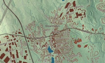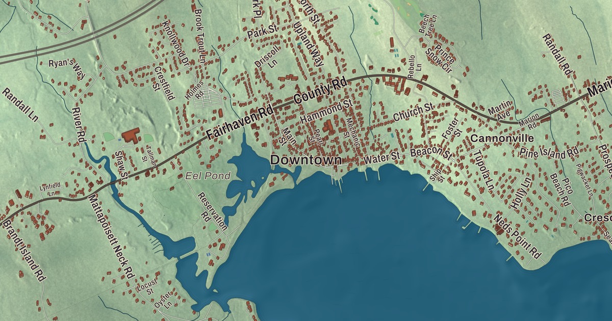
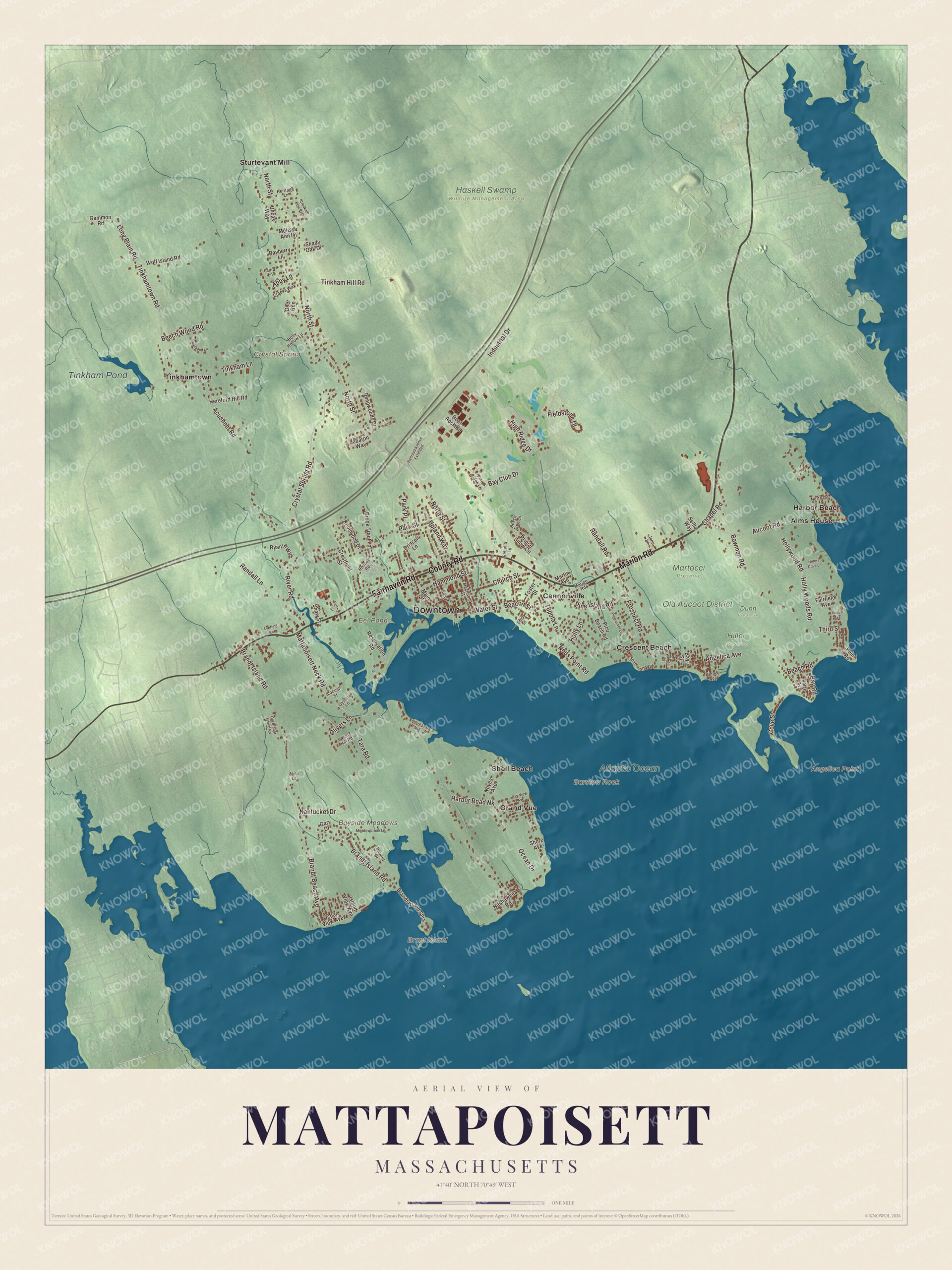
Mattapoisett was a shipbuilding and whaling town on Buzzards Bay, and its village still sits around the harbor. This map prints Marion Road, County Road, Fairhaven Road, Water Street, Angelica Avenue and Beacon Street, with Eel Pond, Tinkham Pond, Brant Island and the Atlantic Ocean along the shore. Click here to purchase a print of this map for your wall.
Mattapoisett is in Plymouth County.
KNOWOL made this map in 2026 from public survey data and gave it the look of an old atlas. The relief comes from United States Geological Survey elevation data, and the streets and the town line come from the Census Bureau. Mattapoisett covers 24.2 square miles, 17.4 of them land and 6.8 of them water, and it’s the southwesternmost town in Plymouth County. Fairhaven lies to the southwest, Acushnet to the northwest, Rochester to the north and Marion to the east, with Buzzards Bay to the south and New Bedford 9 miles to the west. The town had 6,508 people at the 2020 census.
A place of resting
The name Mattapoisett is Wampanoag for “a place of resting,” and there’s evidence of Wampanoag villages and burial grounds all over town. Governor William Brenton bought the land in 1664 from the Wampanoag leader Metacomet, and his son Ebenezer later sold it. The Town of Mattapoisett’s recorded history, in the Secretary of the Commonwealth’s list, dates European settlement to 1750, when it was still part of Rochester. Mattapoisett was incorporated as a town in 1857, and the town remains part of Plymouth County today. Logging and farming came first, but the town became best known for its part in the history of whaling.
The ships of Mattapoisett
Some 400 ships were built in Mattapoisett’s shipyards from 1740 into the 1870s, and in the first half of the nineteenth century the town supplied many of the whaling ships sailing from the East Coast. One of them was the Acushnet, the ship that Moby-Dick author Herman Melville sailed on and later deserted. The last whaler built here was the Wanderer, in 1878. After whaling and shipbuilding faded, Mattapoisett became a summer place for prominent New Yorkers and Bostonians, among them Oliver Wendell Holmes Jr. The poet and novelist Elizabeth Drew Stoddard, author of The Morgesons, was born here in 1823, and so was the artist Francis Davis Millet. In her 1976 novel Woman on the Edge of Time, Marge Piercy imagined Mattapoisett as a utopian community in the year 2137.
The Mattapoisett River runs 11.6 miles from Snipatuit Pond in Rochester down to Mattapoisett Harbor. Historically it has yielded the bay’s most abundant herring runs, and older residents still call it “the Herring Run.” Since 1934 it has carried the Rochester to Mattapoisett Memorial Day Boat Race. Ned Point Light, named for a local farmer, Ned Dexter, went up in the late 1830s from stone gathered mostly on nearby beaches; inside, 32 granite steps are set into the wall without mortar.
Click to explore a larger preview. The digital watermark does not appear on printed maps.
Names on this map
These names are printed on this map.
Places: Downtown, Angelica Point, Barstow Rock, Bayside Meadows, Brant Island, Crystal Spring, Eel Pond, Tinkham Pond, Atlantic Ocean, Dunn Preserve, Haskell Swamp Wildlife Management Area, Hiller Preserve, Martocci Preserve, Old Aucoot District, Alms House, Cannonville, Crescent Beach, Grand Vue, Harbor Beach, Shell Beach, Sturtevant Mill and Tinkhamtown.
Streets and roads: Marion Road, County Road, Fairhaven Road, Water Street, Angelica Avenue, Beacon Street, Park Street, Brandt Island Road, Prospect Road, Third Street, Acushnet Road, Upland Way.
More street names, A to Z
Abby Lane, Aucoot Road, Bayberry Lane, Bay Club Drive, Bay Road, Bay Street, Bay View Avenue, Beach Road, Beech Tree Lane, Beech Wood Road, Boat Rock Road, Bowman Road, Brandt Beach Avenue, Brandt Island Shrs, Brook Trout Lane, Chapel Road, Church Street, Cove Street, Crestfield Street, Crooked Bow Path, Crooks Way, Crystal Spring Road, Deepwoods Drive, Deer Run, Driscoll Lane, Dupont Drive, Fairfield Avenue, Fieldstone Drive, Foster Street, Gammon Road, Gary Drive, Hammond Street, Harbor Road Nk, Hereford Hill Road, Heritage Lane, High Ridge Drive, Hillers Cove Lane, Hilton Avenue, Holly Hollow Lane, Holly Lane, Hollywood Road, Holly Woods Road, Holmes Road, Industrial Drive, Island View Avenue, Jane Lane, Knollwood Drive, Laura Lane, Lebaron Way, Locust Street, Long Plain Road, Lynfield Lane, Main Street, Martin Avenue, Mattapoisett Neck Road, Meadowbrook Lane, Mechanic Street, Melissa Ann Lane, Nantucket Drive, Nashawena Road, Neds Point Road, North Road, North Street, Noyes Avenue, Ocean Drive, Ocean View Avenue, Old Brandt Island Road, Olivers Lane, Oyster Lane, Park Place, Pearl Street, Pico Beach Road, Pigwacket Lane, Pine Island Road, Pine Ridge Lane, Point Road, Prince Snow Circle, Railroad Avenue Extended, Randall Lane, Randall Road, Rebello Lane, Reservation Road, Ridge Avenue, Riverbend Lane, River Road, Ryan's Way, Seamarsh Way, Selha Way, Shady Oak Drive, Shaw Street, Ship Street, Shore Avenue, Shoreview Avenue, Tallman Street, Tara Road, Tinkham Hill Road, Tinkham Lane, Tinkhamtown Road, Tupola Lane, Uncas Way, Union Avenue, Wendell Street, West Hill Road, Wolf Island Road, Zena Drive.
See it on a wall
The Mattapoisett map as a framed print. Swipe for more.


Around the map
Start with Alms House, then follow Marion Road, County Road, Fairhaven Road, Water Street, Angelica Avenue and Beacon Street across town. The center around the harbor is known as The Village, and Tinkhamtown is the rural area north of Route 195. Then look outward toward Cannonville, Crescent Beach, Grand Vue, Harbor Beach and Shell Beach. Eel Pond, Tinkham Pond, the Atlantic Ocean, Brant Island and Crystal Spring are all printed on the map, and every one of those names is right there on the artwork. Four beaches and two parks line the waterfront. Near the Fairhaven line, the Nasketucket Bay State Reservation keeps 210 acres of rocky shore, open field and wooded trails on land that was once going to be house lots.
The Mattapoisett map makes a fine addition to an office, library or den, and it can help teach children the geography and history of a Buzzards Bay whaling town. It’s made for people who call Mattapoisett home, from Cannonville to Shell Beach, and it shows the town as it looks today. Zoom in on the preview above to explore the details, then click here to get your copy of the Mattapoisett, Massachusetts map.

Sources
- Mattapoisett, Massachusetts, Wikipedia
- Mattapoisett River, Wikipedia
- Ned Point Light, Wikipedia
- Nasketucket Bay State Reservation, Wikipedia
- Elizabeth Drew Stoddard, Wikipedia
- Francis Davis Millet, Wikipedia
- City and Town Incorporation and Settlement Dates, Secretary of the Commonwealth of Massachusetts (archived copy)