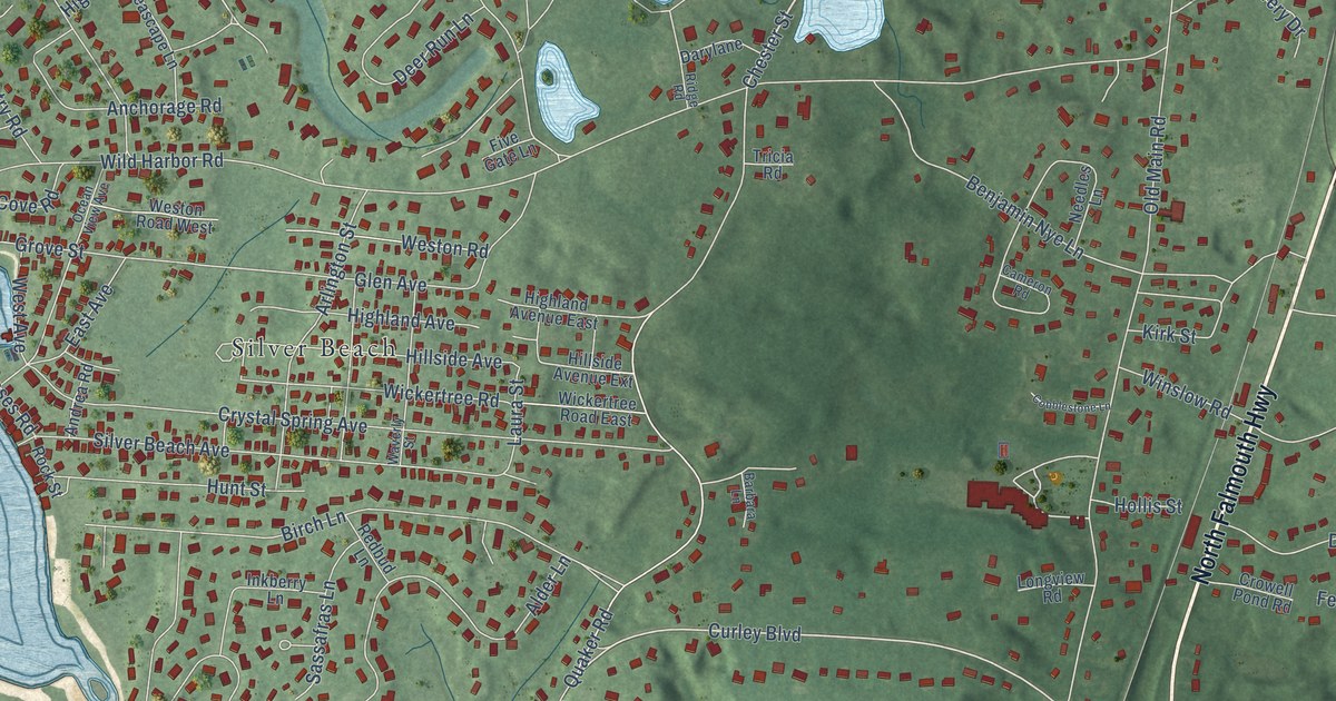
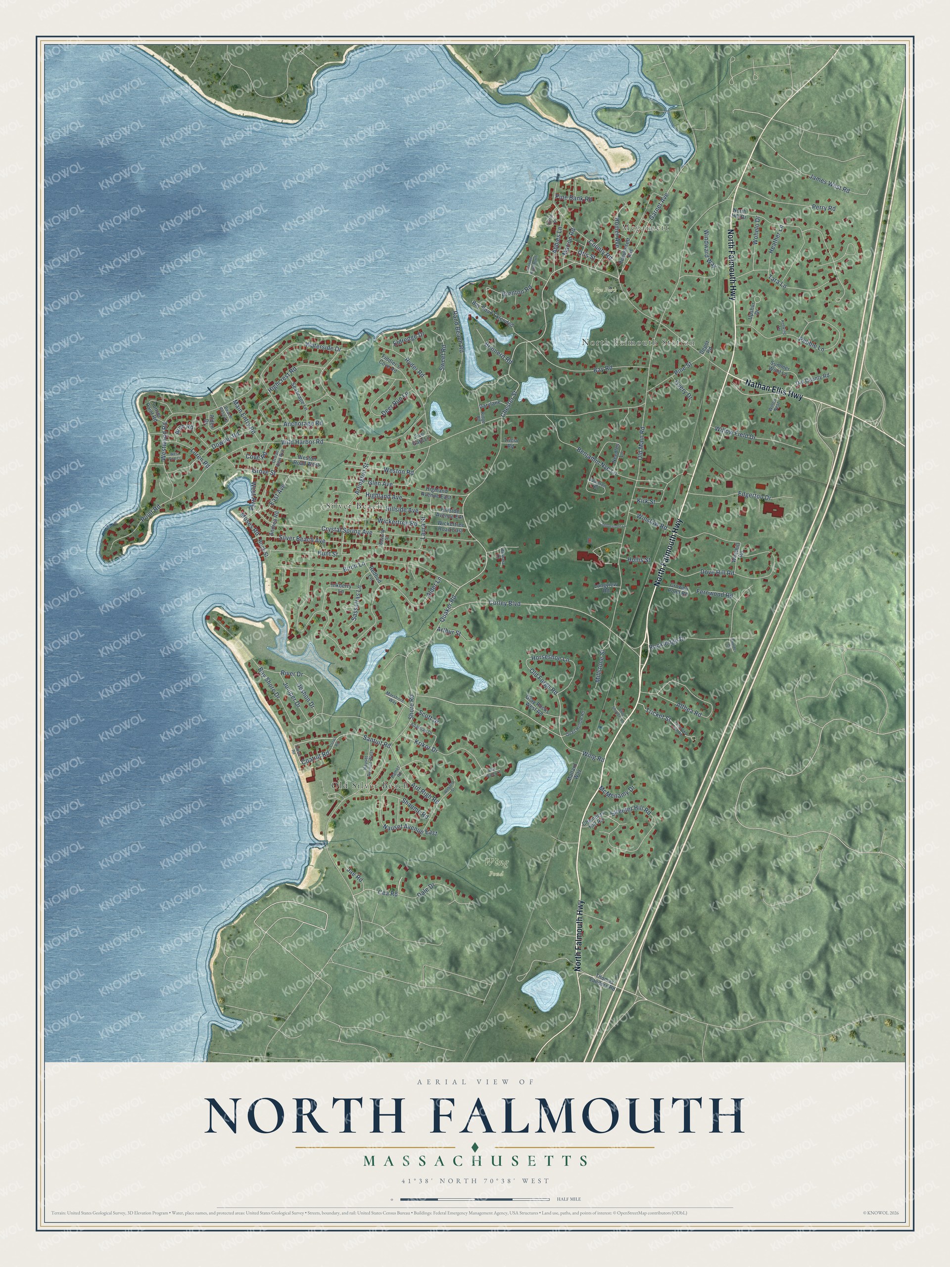
This beautifully detailed map of North Falmouth, Massachusetts was created in 2026 using aerial imagery combined with modern topographical, census, street and landmark data. It's a modern aerial view of North Falmouth in Barnstable County, Massachusetts, that combines modern data with a vintage aesthetic. The roads feature printed names, and if you look closely you can find your exact house accurately shown in its correct location.
Explore an aerial view of North Falmouth, Massachusetts
On this map you'll find North Falmouth Station, Megansett, Wing Pond, Nye Park, Silver Beach, Old Silver Beach, North Falmouth Highway, Nathan Ellis Highway, Chester Street, Santuit Road, Garnet Avenue, Cea Road, and more. Each red shape is a building, so zoom in on the preview and look for yours.
North Falmouth is a community in Barnstable County. The Census Bureau counted 3,293 people here in 2020. The map prints the town name in its title panel, with the coordinates below it.
Take a closer look at the North Falmouth map
Names on this map
These names are printed on this map.
Places: North Falmouth Station, Megansett, Wing Pond, Nye Park, Silver Beach and Old Silver Beach.
Streets and roads: North Falmouth Highway, Nathan Ellis Highway, Chester Street, Santuit Road, Garnet Avenue, Cea Road, Curley Boulevard, Waterside Drive, Old Forge Road, Quaker Road, Wild Harbor Road, Old Main Road.
More street names, A to Z
Abbies Lane, Adamian Drive, Alden Drive, Alder Lane, Althea Road, Anchorage Road, Andrea Road, Arch Road, Ard Righ Road, Arlington Street, Arthur Street, Barbara Lane, Bay Road, Bay Road Extended, Bay Shore Drive, Beach Rose Lane, Benjamin Nye Lane, Birch Lane, Blue Shutters Lane, Blue Water Lane, Boulder Circle, Brainerd Road, Brenton Road, Brenton Road North, Cameron Road, Chambers Hill Road, Circle Drive, Coatuit Road, Cobblestone Lane, Cotuit Road, County Road, Cove Road, Crowell Pond Road, Crystal Spring Avenue, Dale Drive, Darylane, Deer Run Lane, Depot Road, Deshon Drive, Dove Hill Road, Downer Road, East Avenue, Edgerton Drive, Eldredge Drive, Fernwood Road, Fiddler's Cove Road, Five Gate Lane, Glen Avenue, Gray Rocks West Road, Grove Street, Heather Lane, Highcrest Road, Highland Avenue, Highland Avenue East, Hillside Avenue, Hillside Avenue Extension, Hollis Street, Homer Avenue, Horseshoe Lane, Hunt Street, Inkberry Lane, Jae Road, James West Road, Juniper Drive, Kirk Street, Krikor Drive, Laura Street, Longview Road, Loren Road, Main Entry Road, Mallard Way, Marion Road, Marshore Way, McMenamy Drive, Millstone Street, Moses Road, Nauset Avenue East, Nauset Avenue West, Needles Lane, North Hill Drive, Ocean View Avenue, Old County Road, Otis Street, Overy Drive, Pamet Road, Pebble Lane, Pequossett Avenue, Perry Road, Pine Bank Road, Pine Street, Point Road, Quail Hollow Road, Rand Beach Road, Redbud Lane, Redwing Terrace, Ridge Road, River Drive, Rockledge Drive, Rock Street, Ryder Road, Sassafras Lane, Scott Drive, Seascape Lane, Shaume Road, Shore Road, Silver Beach Avenue, Streeter Hill Road, Summer Wind Lane, Sunset Point Road, Sweet Road, Tara Lane, Teneycke Hill Road, Thomas Landers Road, Tonset Road, Tricia Road, Tricket Street, Upshur Drive, Waverly Street, Webster Street, West Avenue, West End Court, Westhill Road, Weston Road, Weston Road West, Westwood Road, Wickertree Road, Wickertree Road East, Willow Field Drive, Willow Nest, Windward Way, Wing Road, Winslow Road, Wohelo Drive.
See it on a wall
The North Falmouth map as a framed print. Swipe for more.


Created by KNOWOL in 2026. The buildings are small red shapes, the roads carry their printed names, and shaded relief shows the shape of the land. The title panel reads "AERIAL VIEW OF NORTH FALMOUTH, MASSACHUSETTS" with 41°38' NORTH 70°38' WEST.
Hang it in the hallway, the office or the cabin, or give it to someone who left North Falmouth and still calls it home. Open the preview and look for a street you know. See sizes and frames for the North Falmouth map.