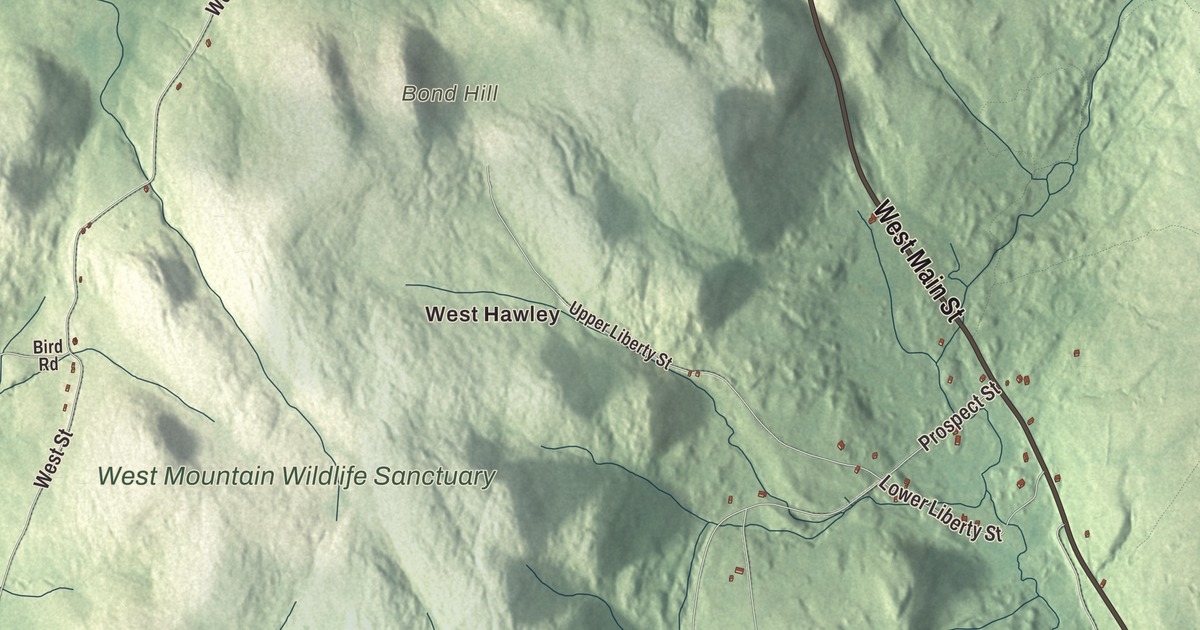
The peaks of West Mountain, at 2,125 feet, are the highest ground in Hampshire County, and they rise in Plainfield. This map prints West Main Street, East Main Street, Hallockville Road, North Central Street, Union Street and Grant Street, with Plainfield Pond, Hallockville Pond, Crooked Pond and the West Mountain Wildlife Sanctuary. Click here to purchase a print of this map for your wall.
Plainfield is in Hampshire County.
KNOWOL made this map in 2026 from public survey data and gave it the look of an old atlas. The high ground comes from United States Geological Survey elevation data, and the roads and the town line come from the Census Bureau. Plainfield is one of the Hilltowns of Western Massachusetts, on the northwestern edge of Hampshire County where it meets Franklin and Berkshire counties, about 25 miles east of Pittsfield. The town sits 1,620 feet above sea level, and its waters are headwaters of both the Westfield and Deerfield rivers. It covers 21.3 square miles and had 633 people at the 2020 census.
The youngest town in the county
Most of the first settlers came from Bridgewater. The Town of Plainfield’s recorded history dates European settlement to 1770. In 1785 Plainfield became a district within the town of Cummington, and on June 15, 1807, it became a town of its own. Plainfield was incorporated as a town in 1807. The town remains part of Hampshire County today. It’s the youngest town in Hampshire County. In the 1800s Plainfield was a thriving farm town that raised sheep and produced leather for tanning, but once steamships greatly cut the cost of importing mutton and leather from Australia and New Zealand in the 1870s, its farms earned less, and the population fell for decades. Sixty-one Plainfield men joined the Union Army late in the Civil War. After more than a century of decline, the town has been growing again since 1950.
Writers from Plainfield
Charles Dudley Warner was born in Plainfield in 1829. He became co-editor of The Hartford Courant and a friend of Mark Twain, and together they wrote The Gilded Age: A Tale of Today, the 1873 novel that gave that era of American history its name. The line “Everybody complains about the weather, but nobody does anything about it” is his, though it’s often credited to Twain. Martha J. Lamb, born here as Martha Nash in 1826, moved to New York City and wrote the History of the City of New York: Its Origin, Rise, and Progress. Erastus Newton Bates, born in Plainfield in 1828, sat in Minnesota’s first constitutional convention and later served as Illinois Treasurer. The novelist Ralph Ellison, whose Invisible Man won the National Book Award in 1953, kept a summer home in Plainfield.
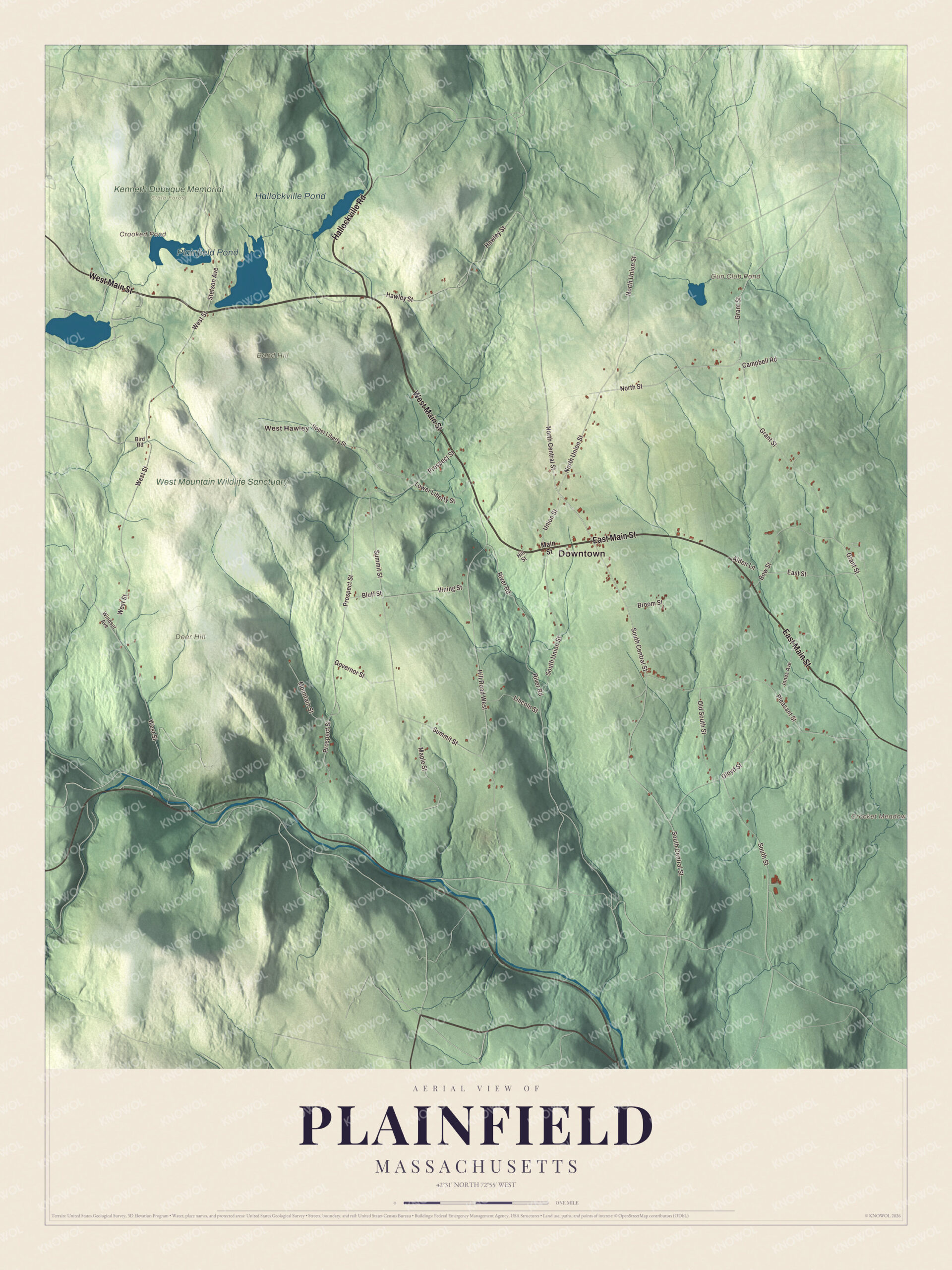
Click to explore a larger preview. The digital watermark does not appear on printed maps.
Names on this map
These names are printed on this map.
Places: Downtown, West Hawley, Bond Hill, Crocket Meadow, Deer Hill, Crooked Pond, Gun Club Pond, Plainfield Pond, Hallockville Pond, West Mountain Wildlife Sanctuary and Kenneth Dubuque Memorial State Forest.
Streets and roads: West Main Street, East Main Street, Hallockville Road, North Central Street, Union Street, Grant Street, South Central Street, North Street, East Street, Pleasant Street, West Street, Prospect Street.
More street names, A to Z
Alden Lane, Bird Road, Bluff Street, Bow Street, Broom Street, Campbell Road, Gloyd Street, Governor Street, Hawley Street, Hill Road West, Hill Street, Jones Avenue, Lincoln Street, Lower Liberty Street, Main Street, Maple Street, Mountain Street, North Union Street, Old South Street, River Road, South Street, South Union Street, Stetson Avenue, Summit Street, Upper Liberty Street, Vining Street, Windsor Avenue.
See it on a wall
The Plainfield map as a framed print. Swipe for more.


Around the map
Start with West Hawley. Follow West Main Street, East Main Street, Hallockville Road, North Central Street, Union Street and Grant Street across town. Crooked Pond, Gun Club Pond, Plainfield Pond, Hallockville Pond, the West Mountain Wildlife Sanctuary, Bond Hill, Deer Hill and Crocket Meadow are all printed on the map. Hallockville Pond sits in the Kenneth Dubuque Memorial State Forest, which spreads over Hawley, Plainfield and Savoy; a one-mile trail circles the pond, and the remains of a mill complex stand at the pond. The forest also holds a beehive-shaped fieldstone charcoal kiln and the cellar holes of the old South Hawley village. In town, the Shaw-Hudson House is a museum and historic home.
The Plainfield map makes a fine addition to an office, library or den, and it can help teach children the geography and history of the highest corner of Hampshire County. It’s made for people who call Plainfield home, from West Mountain to Hallockville Pond, and it shows the town as it looks today. Zoom in on the preview above to explore the details, then click here to get your copy of the Plainfield, Massachusetts map.

Sources
- Plainfield, Massachusetts, Wikipedia
- Charles Dudley Warner, Wikipedia
- Martha J. Lamb, Wikipedia
- Erastus Newton Bates, Wikipedia
- Ralph Ellison, Wikipedia
- Kenneth Dubuque Memorial State Forest, Wikipedia
- City and Town Incorporation and Settlement Dates, Secretary of the Commonwealth of Massachusetts (archived copy)