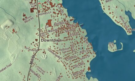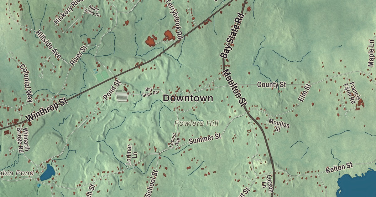
Rehoboth’s founder named it from a Hebrew word in Genesis meaning “broad places,” for the room the settlers found here, and it’s still a mostly rural town, with 53 historic cemeteries. This map of the town prints Bay State Road, Anawan Street, Tremont Street, Moulton Street, Plain Street and Park Street, with Annawan Rock, the Warren Upper Reservoir and Great Meadow Hill. Click here to purchase a print of this map for your wall.
Rehoboth is in Bristol County.
KNOWOL made this map in 2026 from public survey data and gave it the look of an old atlas. United States Geological Survey elevation data shows the hills, and the Census Bureau supplied the roads and the town line. Rehoboth covers 46.8 square miles about 11 miles east of Providence, and most of its brooks and swamps drain into the Palmer River, which flows south to Narragansett Bay. Seekonk runs along its whole western side, with Attleboro and Norton to the north, Taunton and Dighton to the east and Swansea to the south. It had 12,502 people at the 2020 census.
Old Rehoboth
The Town of Rehoboth’s recorded history, in the Secretary of the Commonwealth’s list, dates European settlement to 1636. The town page says it was established in 1643 by Samuel Newman, Walter Palmer and William Sabin, and Rehoboth was incorporated as a town in 1645, one of the earliest in Massachusetts. Newman, a clergyman who came by way of Weymouth, had just published a Bible concordance in London, the third of its kind in English; it was still being reprinted as the Cambridge Concordance in 1889. Old Rehoboth covered far more ground. It took in all of today’s Seekonk and East Providence, Rhode Island, and parts of Attleboro, North Attleborough, Swansea, Somerset, Barrington, Bristol, Warren, Pawtucket, Cumberland and Woonsocket. For the town’s 350th anniversary in 1992, Rehoboth staged a promotional “take back” of those places, and they ceremonially returned their land for the year.
The town page calls Rehoboth the birthplace of public education in North America: when the town was incorporated, the community and Newman’s church, in what’s now East Providence, chose to raise money to pay a teacher for all the settlement’s children, not only the children of the well-off. The Hornbine School, a one-room schoolhouse on Hornbine Road in the southern part of town, taught children until 1937 and is now a local history museum run by the Hornbine School Association. The 13th Continental Regiment, Rehoboth Minute Company, first chartered in 1774, was brought back in 1992 as a group of reenactors.
Bay State Road
The mill owner Darius Goff was born in Rehoboth into a family that dyed yarn at the Union Manufacturing Company here. In 1884 he gave money and land for a library and school, and Goff Memorial Hall opened in 1886; after lightning burned it in 1911, a brick hall went up in 1915 at 124 Bay State Road. The hall holds the Blanding Free Public Library, run by the Rehoboth Antiquarian Society, along with concerts and contra dances, and the society hosts a clambake behind it each summer, a tradition that began in 1884. The society also runs the Carpenter Museum on Locust Street.
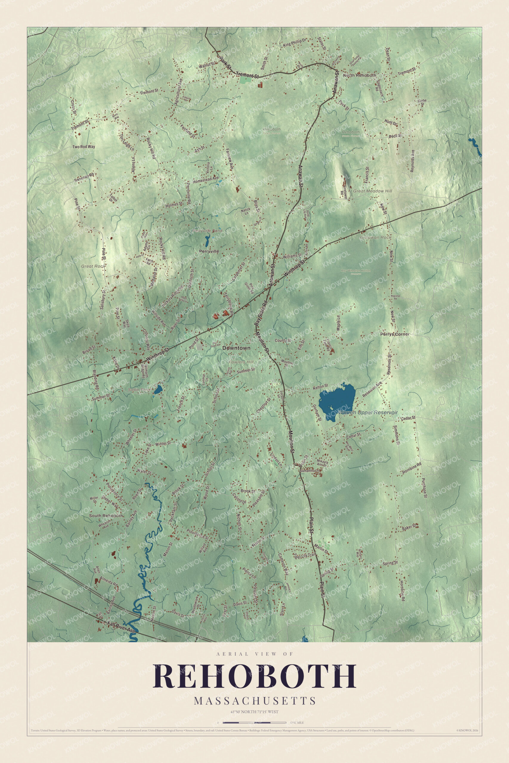
Click to explore a larger preview. The digital watermark does not appear on printed maps.
Names on this map
These names are printed on this map.
Places: Downtown, North Rehoboth, South Rehoboth, Annawan Rock, Fowlers Hill, Great Meadow Hill, Great Rock, Perryville Pond, Sabin Pond, Warren Upper Reservoir, Rehoboth Town Forest, Rehoboth State Forest, Roy Wheaton Horton Preserve, Perrys Corner and Perryville.
Streets and roads: Anawan Street, Moulton Street, Tremont Street, Bay State Road, Plain Street, Park Street, Winthrop Street, Fall River Avenue, Brook Street, Peckham Street, Summer Street, Fairview Avenue.
More street names, A to Z
Adams Circle, Agricultural Avenue, Allen Avenue, Allens Lane, Almeida Road, Apple Valley Drive, Ashlynn Way, Ash Street, Baker Street, Barney Avenue, Birchwood Drive, Blanding Road, Bliss Street, Broad Street, Calisto Drive, Cameron Way, Carpenter Street, Cedar Street, Cherry Lane, Chestnut Street, Clouds Way, Colonial Way, Columbine Road, County Street, Cross Street, Danforth Street, Davis Street, Dean Street, Elm Street, Esbjurn Drive, Fairfield Street, Fall Street, Farm Road, Firetower Road, First Street, Francis Farm Road, Francis Street, French Street, Glebe Street, Gorham Street, Great Cedar Swamp Road, Hickory Ridge Road, Hillside Avenue, Holly Lane, Holmes Street, Homestead Avenue, Hornbine Road, Hunt Drive, Johnnie's Way, Katie Drive, Kelton Street, Key West Boulevard, King Phillip Drive, Kingsley Way, Lake Street, Linden Lane, Locust Avenue, Lorimar Lane, Lorson Lane, Maple Lane, Martin Street, Mason Street, Meadowlark Drive, Medalist Drive, Mikayla Ann Drive, Miller Street, Natick Lane, New Street, Nichols Street, Nicole Way, Old Bliss Street, Peck Street, Perryville Road, Pierce Lane, Pine Grove Road, Pine Street, Pleasant Street, Pond Lily Avenue, Pond Street, Providence Street, Purchase Street, Ralsie Road, Reed Street, Regional Road, Reservoir Avenue, Reservoir Street, Reynolds Avenue, Rimic Way, River Street, Rocky Hill Road, Salisbury Street, Samantha Lane, School Street, Simmons Street, Skyla Way, Slater Street, Smith Street, Spring Street, Stagecoach Road, Starr Lane, Steber Way, Sweeney Road, Talbot Drive, Terrybrook Road, Tiger Lily Trail, Tori Leigh Lane, Two Rod Way, Victoria Lane, Walnut Street, Water Street, Wheaton Avenue, Wheeler Street, Willard Avenue, Williams Street, Wilmarth Bridge Road, Winter Street, Wood Street.
See it on a wall
The Rehoboth map as a framed print. Swipe for more.


Around the map
Start with North Rehoboth. Follow Anawan Street, Moulton Street, Tremont Street, Bay State Road, Plain Street and Park Street across town. Then look outward toward South Rehoboth, Perrys Corner and Perryville. Perryville Pond, Sabin Pond, the Warren Upper Reservoir, Annawan Rock, Fowlers Hill and Great Meadow Hill are all printed on the map. Annawan Rock, a dome of puddingstone reached by a short path off Route 44, is where Captain Benjamin Church captured the Wampanoag sachem Anawan on August 28, 1676; the capture was the final event of King Philip’s War, and Anawan was later executed by colonial officials despite Church’s promise to spare him. It’s one of the few places from the war still intact. The Warren Upper Reservoir, off Reservoir Street, is one of the town’s conservation areas, along with Rehoboth State Forest off Peck Street and Redway Plain, the field off Route 44 and Bay State Road where the town holds its harvest block party each September.
The Rehoboth map makes a fine addition to an office, library or den, and it can help teach children the geography and history of one of the oldest towns in Massachusetts. It’s made for people who call Rehoboth home, from North Rehoboth to South Rehoboth, and it shows the town as it looks today. Zoom in on the preview above to explore the details, then click here to get your copy of the Rehoboth, Massachusetts map.

Sources