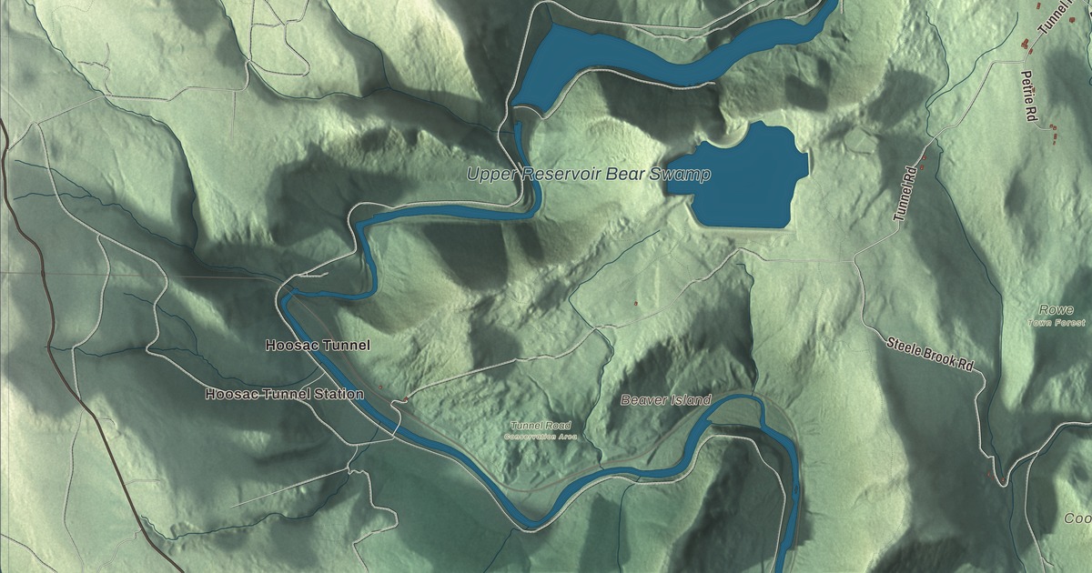
New England’s first nuclear power plant was built in Rowe, on the Deerfield River near the Vermont line, and the underground Bear Swamp power station still straddles the river on the Florida line. This map of the town prints Zoar Road, Tunnel Road, Pond Road, Steele Brook Road, Middletown Hill Road and Davenport Road, with the Sherman Reservoir, the Upper Reservoir Bear Swamp, Beaver Island and Adams Mountain. Click here to purchase a print of this map for your wall.
Rowe is in Franklin County.
KNOWOL made this map in 2026 from public survey data and gave it the look of an old atlas. United States Geological Survey elevation data raises the ridges, and the roads and the town line come from the Census Bureau. Rowe covers 24.0 square miles on the northern edge of Franklin County, bordering Whitingham, Vermont, to the north, Heath to the east, Charlemont to the south, and Florida and Monroe to the west. Two ridges run on either side of Pelham Brook, and Adams Mountain, on the eastern one, is the highest point in town. Rowe is one of a handful of Massachusetts towns with no state highway, and it had 424 people at the 2020 census.
Myrifield
Native people came here to fish and forage. White settlers first came through in 1744, and a fort stood here to guard against raids. The Town of Rowe’s recorded history, in the Secretary of the Commonwealth’s list, dates European settlement to 1762, the year the Rev. Cornelius Jones bought the land and named it Myrifield, from the Greek word for “thousand.” Rowe was incorporated as a town in 1785, when the General Court renamed it for John Rowe, a Boston merchant.
The town grew up around mills on the river, with sulfur, talc and soapstone mining besides. In the eastern part of town, H. J. Davis opened a mine around 1882 on an outcrop of iron pyrite, and Davis grew into a mining village with a blacksmith shop, a butcher shop, electric lights and at least 150 homes. It was once the largest iron pyrite mine in Massachusetts, until the mine caved in and closed in 1911. By 1937 all that was left was a blacksmith shop and about 150 cellar holes, and the ghost town lies near Pelham Lake. When the railroad came along the river in the late 1880s, Rowe became something of a small resort town, but by the early 1900s most industry had dried up.
Yankee Rowe
In the 1950s the Yankee Atomic Electric Company, backed by ten New England utilities, set out to build the region’s first nuclear power plant, and it went up in Rowe, on the Deerfield River by the Sherman Reservoir. Yankee Rowe was the first nuclear plant in New England and the third commercial one in the country, and it began commercial operation in 1961. It ran for about three decades, and its decommissioning was finished in 2007. Bear Swamp, a pumped-storage hydroelectric station built from 1968 to 1974 to store some of Yankee Rowe’s extra power, straddles the river between Rowe and Florida. Its upper reservoir, 88 acres, sits 770 feet above the lower one, and the station can make about 600 megawatts for up to six hours; an underground visitor center tells its story.
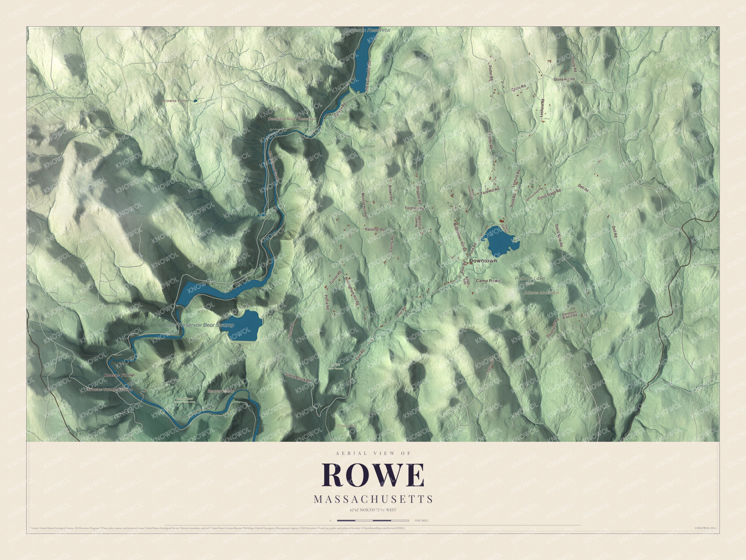
Click to explore a larger preview. The digital watermark does not appear on printed maps.
Names on this map
These names are printed on this map.
Places: Downtown, Hoosac Tunnel Station, Camp Rowe, Adams Mountain, Beaver Island, Coon Hill, Browns Pond, Deerfield River Reservoir, Sherman Reservoir, Upper Reservoir Bear Swamp, Pelham Lake Park, Rowe State Forest, Rowe Town Forest, Tunnel Road Conservation Area and Hoosac Tunnel.
Streets and roads: Zoar Road, Tunnel Road, Steele Brook Road, Pond Road, Middletown Hill Road, Davenport Road, Leshure Road, Cyrus Stage Road, Shippee Road, Old Railroad Grade, Tatro Road, Ford Hill Road.
More street names, A to Z
Brittingham Hill Road, Brown Road, County Road, Cross Road, Davenport Branch Road, Davis Mine Road, Dell Road, Hazelton Road, Kings Highway, Monroe Hill Road, Newell Cross Road, North Cemetary Road, Old Cyrus Stage Road, Petrie Road, Potter Road, Stone Hill Road, Stone Road, Town Park Road, Yankee Road.
See it on a wall
The Rowe map as a framed print. Swipe for more.


Around the map
Start with Hoosac Tunnel Station. Follow Zoar Road, Tunnel Road, Steele Brook Road, Pond Road, Middletown Hill Road and Davenport Road across town. A short stretch of railroad crosses the southwest corner of Rowe on its way west to the Hoosac Tunnel, whose east portal lies along the Deerfield River in neighboring Florida. Finished in 1875, the 4.75-mile tunnel was the world’s second-longest at the time. The Rowe Historical Society runs the Kemp-McCarthy Museum at 282 Zoar Road, and the Rowe Center, a Unitarian Universalist camp and retreat that the Rev. Anita Pickett started for young people in 1924, still holds summer camps and adult workshops. Then look outward toward Hoosac Tunnel.
Browns Pond, the Sherman Reservoir, the Upper Reservoir Bear Swamp, Adams Mountain, Coon Hill, Beaver Island and the Deerfield River Reservoir are all printed on the map. The Deerfield River is dammed near the Vermont border to form the Sherman Reservoir, and Beaver Island is a thickly wooded, uninhabited island in the river within Rowe. Pelham Lake feeds Pelham Brook, a tributary of the Deerfield, and much of the land southeast of the lake belongs to Pelham Lake Park.
The Rowe map makes a fine addition to an office, library or den, and it can help teach children the geography and history of a hill town on the Deerfield River. It’s made for people who call Rowe home, from Zoar Road to the Vermont line, and it shows the town as it looks today. Zoom in on the preview above to explore the details, then click here to get your copy of the Rowe, Massachusetts map.

Sources
- Rowe, Massachusetts, Wikipedia
- Davis, Massachusetts, Wikipedia
- Yankee Rowe Nuclear Power Station, Wikipedia
- Bear Swamp Hydroelectric Power Station, Wikipedia
- Hoosac Tunnel, Wikipedia
- Deerfield River, Wikipedia
- Beaver Island (Massachusetts), Wikipedia
- City and Town Incorporation and Settlement Dates, Secretary of the Commonwealth of Massachusetts (archived copy)