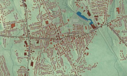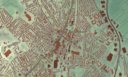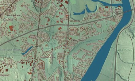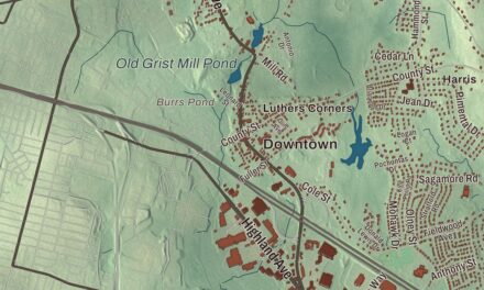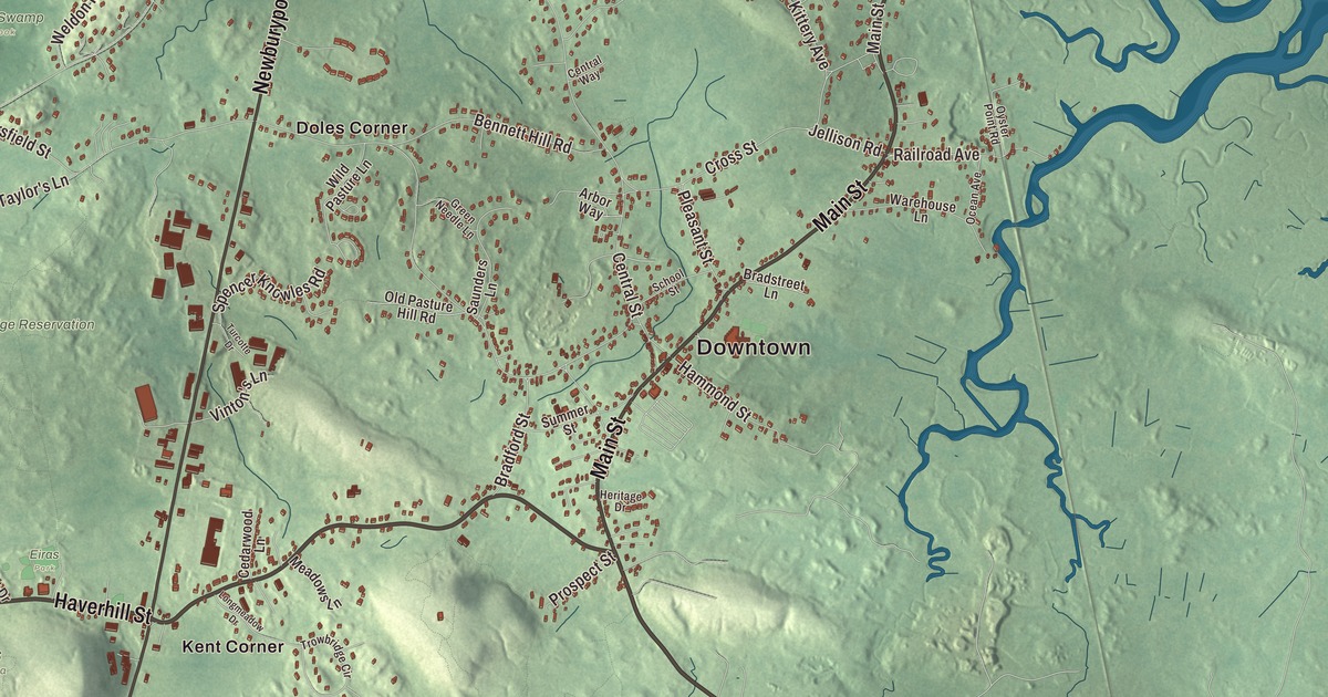
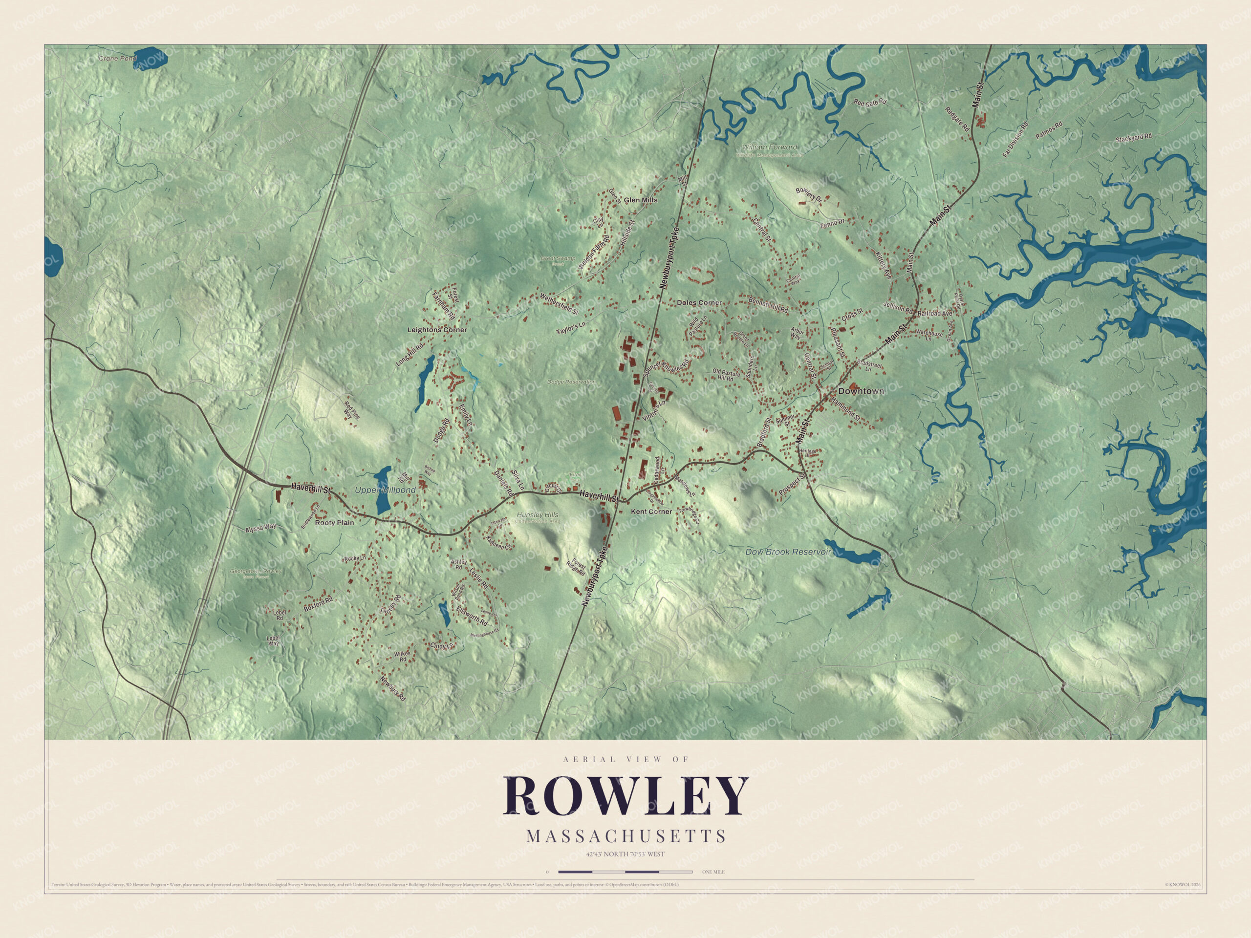
The Agawam Diner has stood at the corner of the Newburyport Turnpike and Haverhill Street since 1970, and on Main Street the Platts-Bradstreet House has stood since about 1677. This map of the town prints Main Street, Haverhill Street, the Newburyport Turnpike, Boxford Road, Ellsworth Road and Pleasant Street, with Crane Pond, the Dow Brook Reservoir and the Dodge Reservation. Click here to purchase a print of this map for your wall.
Rowley is in Essex County.
KNOWOL made this map in 2026 from public survey data and gave it the look of an old atlas. United States Geological Survey elevation data shapes the land, and the Census Bureau supplied the roads and the town line. Rowley lies on the Atlantic north of Cape Ann, 28 miles northeast of Boston, and covers 20.3 square miles, 2.2 of them water; a small piece of Plum Island and Plum Island Sound separate its mainland from the ocean. Much of the eastern mainland is salt marsh, part of the Great Marsh that runs along the North Shore from Cape Ann to southern New Hampshire. Newbury borders it to the north, Georgetown to the northwest, Boxford to the west and Ipswich to the south, and it had 6,161 people at the 2020 census.
Rogers Plantation
The Agawam people lived here under the sachem Masconomet. The Town of Rowley’s recorded history, in the Secretary of the Commonwealth’s list, dates European settlement to 1638. That December the Rev. Ezekiel Rogers, who had lost his post as rector of Rowley in Yorkshire after refusing to read The Book of Sports, landed in New England on the ship John of London with about twenty families of his congregation. The same ship brought the first printing press to the colonies, along with the printer Stephen Daye; the press later went to Harvard. The families spent the winter in Salem and settled here early in 1639, at first calling the place Rogers Plantation. Rowley was incorporated as a town in 1639, on September 4, and named for Rowley in the East Riding of Yorkshire, where Rogers had been pastor. It then took in parts of today’s Byfield, Groveland, Georgetown and Haverhill. Not until 1700 did the town pay Masconomet’s heirs nine pounds for a deed to the land.
A fulling mill went up in 1643 and a grist mill in 1645, and Rowley became known for its hemp, flax and cotton cloth. For the fulling mill, a stone arch bridge and dam were built on the Mill River in 1642, the first such in the colonies; the town page calls the bridge the first stone arch bridge in North America, made of hand-cut granite with no mortar, and it was rebuilt in the mid-1800s. A sawmill set up in 1669 is, the town page says, still in business. Moses E. Daniels built a wagon factory in 1868, and at the start of the 20th century the town had a booming shoe industry and successful boatbuilders. Jeremiah Chaplin, born in 1776 in a part of Rowley that’s now Georgetown, became the first president of Colby College in Maine, then called Waterville College, and the geologist Parker Cleaveland, born here in 1780, taught at Bowdoin College for the rest of his life and earned the title Father of American Mineralogy.
Click to explore a larger preview. The digital watermark does not appear on printed maps.
Names on this map
These names are printed on this map.
Places: Downtown, Crane Pond, Dow Brook Reservoir, Upper Millpond, Dodge Reservation, Eiras Park, Georgetown-Rowley State Forest, Great Swamp Brook, Hunsley Hills Conservation Area, William Forward Wildlife Management Area, Doles Corner, Glen Mills, Kent Corner, Leightons Corner and Rooty Plain.
Streets and roads: Haverhill Street, Main Street, Newburyport Turnpike, Boxford Road, Ellsworth Road, Pleasant Street, Wethersfield Street, Central Street, Stackyard Road, Dodge Road, Newbury Road, Far Division Road.
More street names, A to Z
Alyssa Way, Arbor Way, Ashley Road, Bennett Hill Road, Bishop Way, Bowlery Drive, Bradford Street, Bradstreet Lane, Bridlewood Lane, Cedarwood Lane, Central Way, Cindy Lane, Circuit Drive, Clay Lane, Cross Street, Daniels Road, Emily Lane, Farnham Road, Fenno Drive, Forest Ridge Road, Forest Street, Glen Street, Green Needle Lane, Hammond Street, Heritage Drive, Hillside Street, Intervale Circle, Jellison Road, Kathleen Circle, Kittery Avenue, Lebel Road, Lebel Way, Leslie Road, Leslie Terrace, Long Hill Road, Longmeadow Drive, Meadows Lane, Meetinghouse Road, Mill Road, Mill Street, Ocean Avenue, Old Pasture Hill Road, Oyster Point Road, Patmos Road, Prospect Street, Railroad Avenue, Red Gate Road, Redgate Road, Red Pine Way, Rocky Lane, Saunders Lane, School Street, Silva Lane, Spencer Knowles Road, Summer Street, Taylor's Lane, Tenney Road, Trowbridge Circle, Turcotte Drive, Vinton's Lane, Warehouse Lane, Weldon Farm Road, Wild Pasture Lane, Wilkes Road, Wilson Pond Road.
Around the map
Start with Doles Corner. Follow Haverhill Street, Main Street, the Newburyport Turnpike, Boxford Road, Ellsworth Road and Pleasant Street across town. Main Street is Route 1A through the town center, and the Platts-Bradstreet House, at 233 Main Street opposite Pleasant Street, has belonged to the Rowley Historical Society since the 1920s; Samuel Platts probably built its oldest part. The Newburyport Turnpike is U.S. Route 1, passing near the middle of town. At 109 Haverhill Street, the Chaplin-Clarke House, begun by Joseph Chaplin about 1670, is the oldest house in Rowley.
Then look outward toward Glen Mills, Kent Corner, Leightons Corner and Rooty Plain. The Agawam Diner stands at Kent’s Corner, on the southwest corner of the Newburyport Turnpike and Haverhill Street; it was built in 1954 by the Fodero Dining Car Company, moved here from Ipswich in 1970, and takes its name from the Agawam people. Crane Pond, the Dow Brook Reservoir and the Dodge Reservation are all printed on the map. Interstate 95 crosses the western end of town, and the 1,112-acre Georgetown-Rowley State Forest straddles it, with a section of the Bay Circuit Trail.
The Rowley map makes a fine addition to an office, library or den, and it can help teach children the geography and history of a town settled by Ezekiel Rogers’s congregation. It’s made for people who call Rowley home, from Doles Corner to the Great Marsh, and it shows the town as it looks today. Zoom in on the preview above to explore the details, then click here to get your copy of the Rowley, Massachusetts map.

We made a map for every town and city in Massachusetts. Explore the complete Massachusetts map collection and find your town.
Sources
- Rowley, Massachusetts, Wikipedia
- Ezekiel Rogers, Wikipedia
- Jeremiah Chaplin, Wikipedia
- Parker Cleaveland, Wikipedia
- Platts-Bradstreet House, Wikipedia
- Chaplin-Clarke House, Wikipedia
- Agawam Diner, Wikipedia
- Georgetown-Rowley State Forest, Wikipedia
- City and Town Incorporation and Settlement Dates, Secretary of the Commonwealth of Massachusetts (archived copy)