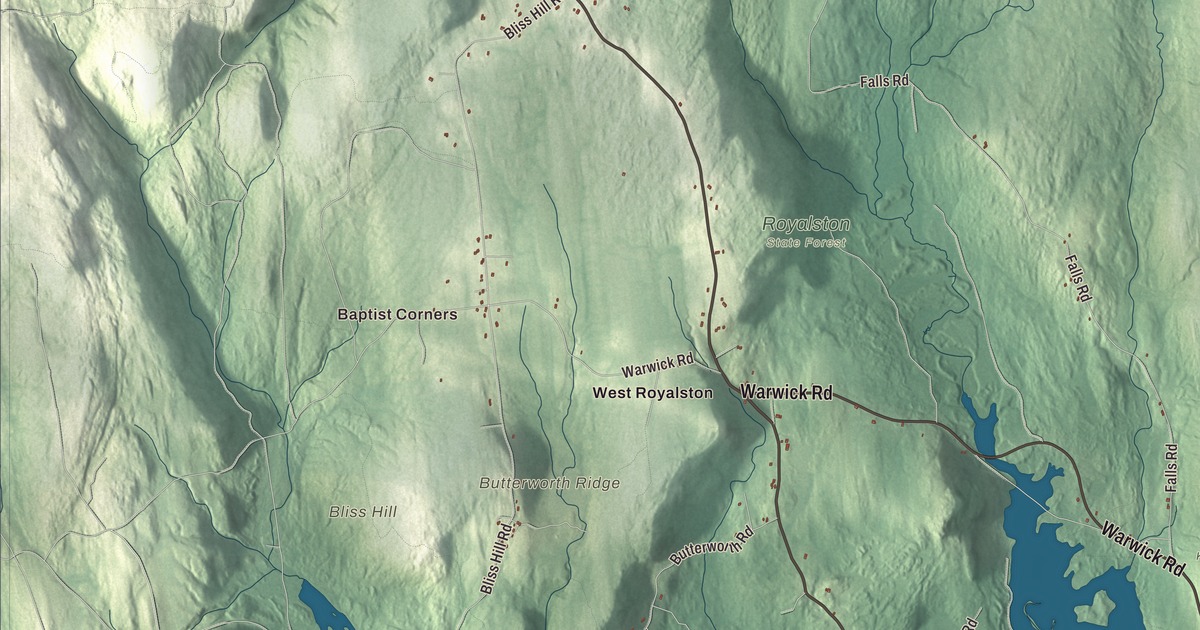
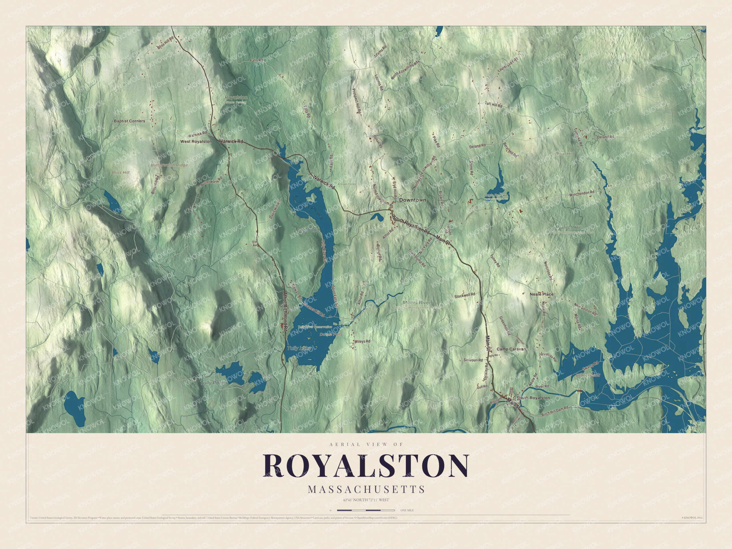
Royalston has three waterfalls, Royalston Falls, Doane’s Falls and Spirit Falls, and a town common laid out in 1752 at the heart of one of the best surviving examples of an 18th-century town center in Massachusetts. This map of the town prints Main Street, South Royalston Road, Athol Road, Athol-Richmond Road, Warwick Road and Northeast Fitzwilliam Road, with Tully Lake, Long Pond, Doane Falls and Butterworth Ridge. Click here to purchase a print of this map for your wall.
Royalston is in Worcester County.
KNOWOL made this map in 2026 from public survey data and gave it the look of an old atlas. United States Geological Survey elevation data raises the hills, and the roads and the town line come from the Census Bureau. Royalston fills the northwestern corner of Worcester County, against the New Hampshire line, and covers 42.5 square miles of hilly land, most of it forest and wetland. Athol lies to the south, Phillipston and Templeton to the southeast, Winchendon to the east, Richmond and Fitzwilliam in New Hampshire to the north, and Warwick and Orange to the west. White Hill, at 1,361 feet near the Warwick line, is the highest point, and the town had 1,250 people at the 2020 census.
The common
A group of Boston businessmen bought the land in 1752 and laid out the common and the cemetery at the same time. The Town of Royalston’s recorded history, in the Secretary of the Commonwealth’s list, dates European settlement to 1762. Royalston was incorporated as a town in 1765. It’s named for Isaac Royall, a Medford businessman who held people in slavery, and who the town page says founded the town in a land deal that year. Building picked up around 1800, when several houses, shops and a meeting house went up, and for a while the center was a market town for the farms around it, until that role faded by 1850. Owners of the mills in South Royalston later built several fine houses in the center.
The Royalston Common Historic District follows Main Street, Route 68, through the center, with most of its houses built before 1850 and the 1867 town hall and the 1911 library among its later buildings; Phinehas Newton gave the money for the library building. The town hall, post office, Congregational church and library all stand in the center. Two men born in Royalston rose high in public life: Alexander H. Bullock, governor of Massachusetts from 1866 to 1869 and a leader of the New England Emigrant Aid Society, which worked to settle Kansas with opponents of slavery, and Lysander Cutler, a Union general who commanded the Iron Brigade in the Civil War.
Click to explore a larger preview. The digital watermark does not appear on printed maps.
Names on this map
These names are printed on this map.
Places: Downtown, Baptist Corners, Beryl Hill, Bliss Hill, Butterworth Ridge, Beaver Pond, Doane Falls, Tully Lake, Tully Pond, Long Pond, Birch Hill Wildlife Management Area, Eagle Reserve Conservation Area, Kreiger Forest, Millers River Wildlife Management Area, Royalston State Forest, Tully River Reservation, Camp Caravan, Neale Place, South Royalston and West Royalston.
Streets and roads: Main Street, South Royalston Road, Athol-Richmond Road, Warwick Road, Athol Road, Northeast Fitzwilliam Road, Winchendon Road, Doanes Hill Road, New Boston Road, North Fitzwilliam Road, Falls Road, Bliss Hill Road.
More street names, A to Z
Adams Road, Beryl Hill Road, Birch Hill Dam Road, Blossom Street, Bolton Road, Brown Road, Butterworth Road, Davis Hill Road, Deland Road, Dickley Road, Elm Avenue, Frye Hill Road, Greenhall Road, Greenholl Road, Gulf Road, Jarvenpaa Road, Jolly Road, Laurel Lake Road, Loomis Road, Mill Yard Road, Morse Road, Neale Road, Norcross Road, Phillipston Road, Pike Road, Pleasant Street, Prospect Hill Road, River Road, Sinivouri Road, Spirit Falls Road, Stewart Road, Stockwell Road, Stone Road, Swamp Road, Taft Hill Road, Toney Road, Town Dump Road, Tully River Road, Turnpike Road, Upham Road, Wileys Road, Woods Road.
See it on a wall
The Royalston map as a framed print. Swipe for more.


Around the map
Start with Baptist Corners. Follow Main Street, South Royalston Road, Athol-Richmond Road, Warwick Road, Athol Road and Northeast Fitzwilliam Road across town. Then look outward toward Neale Place, South Royalston and West Royalston. South Royalston, in the southeastern corner along the Millers River, is the largest village, and the Village School, an independent school, opened a new building on South Royalston Road in 2018, on the former Camp Caravan property. Route 68 runs from South Royalston through the center to West Royalston.
Beaver Pond, Tully Lake, Tully Pond, Long Pond, Kreiger Forest, Beryl Hill, Bliss Hill, Butterworth Ridge and Doane Falls are all printed on the map. The Tully River runs down through Long Pond and Tully Lake on its way to the Millers River. Tully Lake, 1,262 acres, is a flood-control reservoir the Army Corps of Engineers built in 1949, with a tent campground run by the Trustees of Reservations and the 22-mile Tully Trail along its northern shore. Doane’s Falls is a string of five waterfalls on Lawrence Brook, named for Amos Doane, who ran a door, sash and blind mill there in the 1800s. Royalston Falls, off Route 32 near the New Hampshire border, drops 50 feet through a granite gorge.
The Royalston map makes a fine addition to an office, library or den, and it can help teach children the geography and history of a hill town in the North Quabbin. It’s made for people who call Royalston home, from South Royalston to Royalston Falls, and it shows the town as it looks today. Zoom in on the preview above to explore the details, then click here to get your copy of the Royalston, Massachusetts map.

Sources
- Royalston, Massachusetts, Wikipedia
- Royalston Common Historic District, Wikipedia
- Alexander Bullock, Wikipedia
- Lysander Cutler, Wikipedia
- Tully Lake, Wikipedia
- Doane’s Falls, Wikipedia
- Royalston Falls, Wikipedia
- City and Town Incorporation and Settlement Dates, Secretary of the Commonwealth of Massachusetts (archived copy)