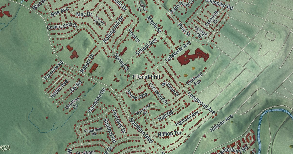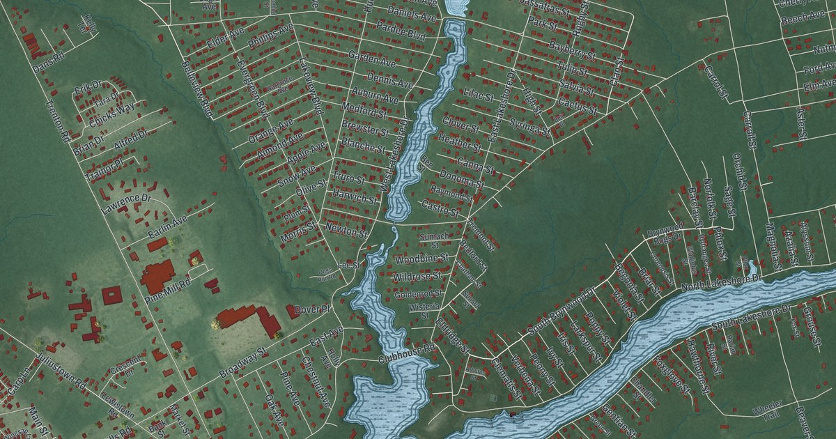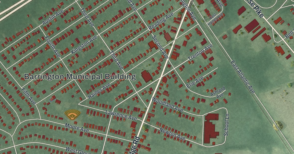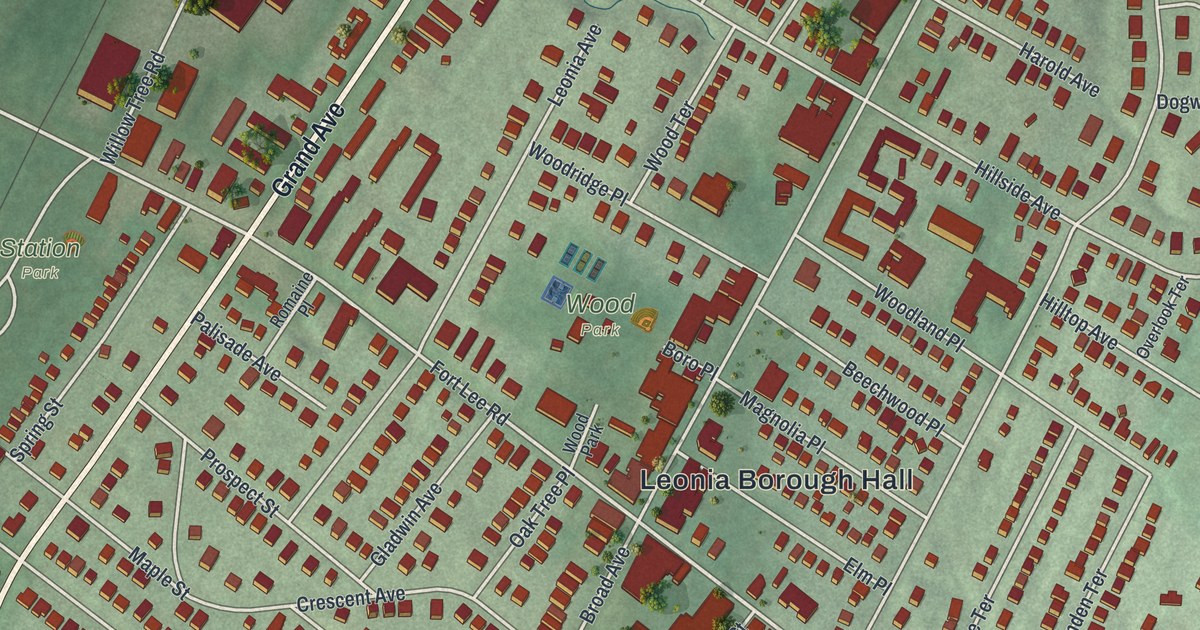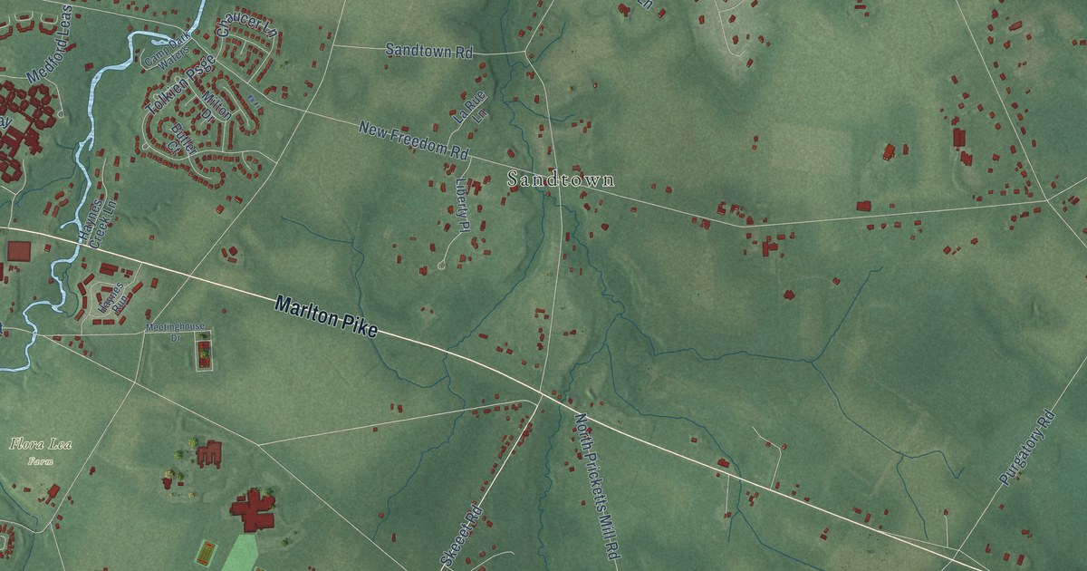
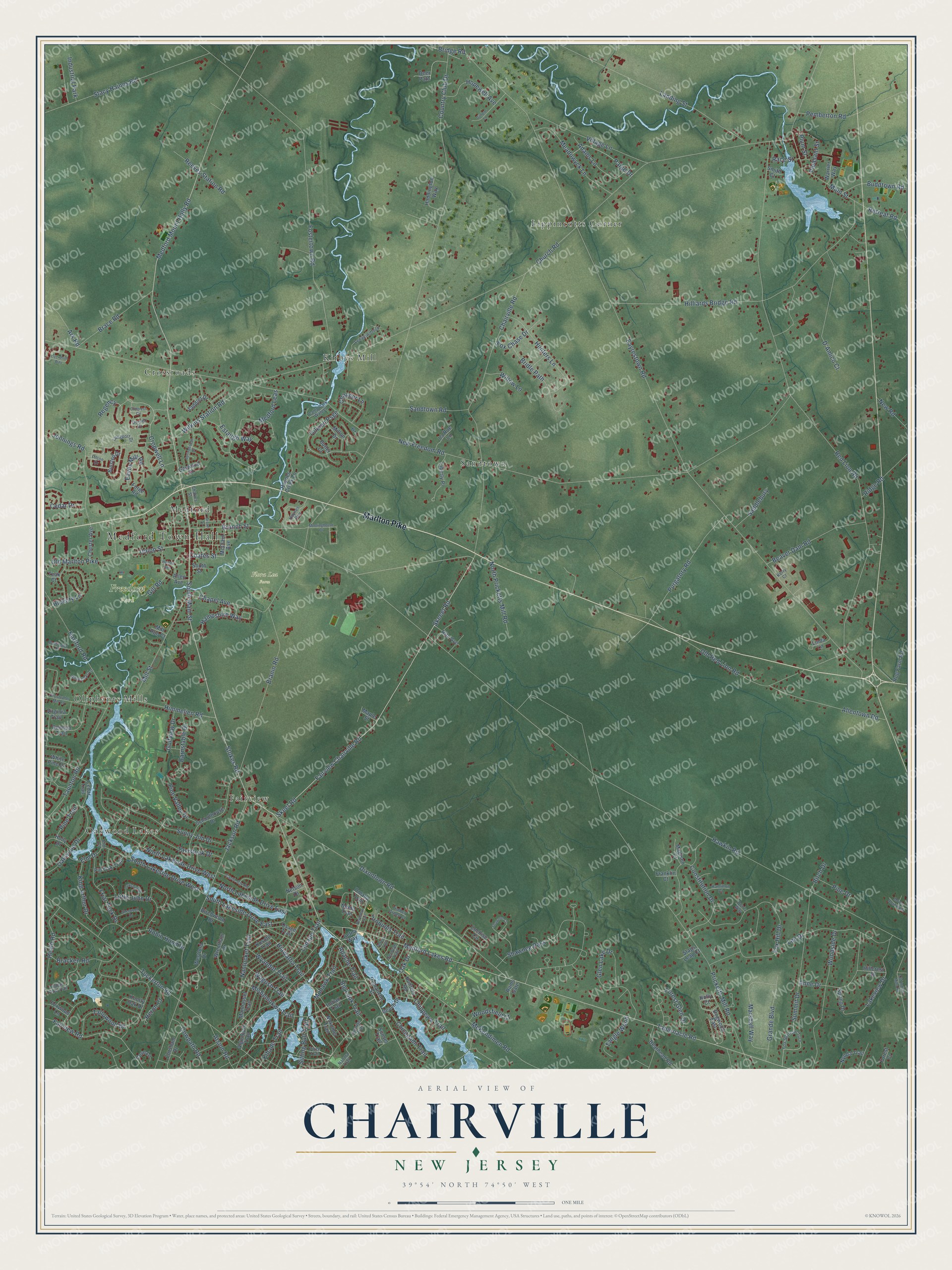
This beautifully detailed map of Chairville, New Jersey was created in 2026 using aerial imagery combined with modern topographical, census, street and landmark data. It’s a one-of-a-kind view of Chairville that combines accurate data with a vintage aesthetic. The map shows every building in its true location, many of the roads carry their names, and the shaded topographic relief shows the shape of the land.
Explore an aerial view of Chairville, New Jersey
On the map you’ll find Medford Town Hall, Flora Lea Farm, Freedom Park, Lippincotts Corner, Kirbys Mill, Oakwood Lakes, Crossroads, Fairview, Sandtown, Oliphants Mills, and Medford, along with Marlton Pike, and more. If you look closely you can even find your house accurately drawn in its correct location. Zoom in on the preview to look for yours.
Take a closer look at the Chairville map
Names on this map
These names are printed on this map.
Places: Medford Town Hall, Flora Lea Farm, Freedom Park, Lippincotts Corner, Kirbys Mill, Oakwood Lakes, Crossroads, Fairview, Sandtown, Oliphants Mills, Medford and Industrial Park.
Streets and roads: Marlton Pike, Stokes Road, Medford Mount Holly Road, South Main Street, Fairview Chairville Road, Skeet Road, Coates Street, Union Street, Tabernacle Road, Medford Leas, Mohawk Trail, Cropwell Lane.
More street names, A to Z
Adams Lane, Aetna Way, Algonquin Trail, Allen Avenue, Allentown Road, Anne Drive, Apache Trail, Ark Road, Atsion Road, Barnstable Drive, Beach Drive, Bearhead Road, Beaver Dam Road, Bennington Drive, Big Look Trail, Binsted Drive, Birch Drive, Birchwood Drive, Brace Road, Bracken Road, Branch Street, Branin Road, Bridge Road, Bridle Path, Broad Street, Buddtown Road, Butler Court, Camp Dark Waters, Carol Joy Road, Cedar Drive, Cedar Trail, Chairville Road, Chapel Avenue, Charles Street, Chaucer Lane, Chester Avenue, Chicagami Trail, Chippewa Trail, Christopher Mill Road, Church Road, Cochise Circle, Comanche Street, Congress Circle, Constitution Drive, Corsham Drive, Country Club Drive, Cove Lane, Cowpath Road, D'Amico Court, Decotah Trail, Deer Path, Dixontown Road, Dogwood East, Don's Way, Dorset Drive, Eaves Mill Road, Eayrestown Road, Elm Court, Elm Drive, Estaugh Way, Fairview Road, Forest Court, Forest Glen Drive, Forge Road, Fostertown Road, Fox Chase Drive, Fox Hill Drive, Fox Sparrow Turn, Foxwood Lane, Franklin Court, Friar Tuck Drive, Garwood Court, Georgia Trail, Gill Road, Githens Lane, Glen Lake Drive, Golfview Drive, Grande Boulevard, Haddington Way, Haines Avenue, Hamilton Court, Hampshire Way, Hartford Road, Hawkin Road, Haynes Creek Lane, Haynes Run, Heath Road, Heron Court, Hiawatha Trail, Hickory Lane, Hillcrest Drive, Hilliards Bridge Road, Himmelien Road, Hog Farm Road, Holly Court, Holly Drive, Hopewell Avenue, Hunters Lane, Hunters Road, Indian Pipe Trail, Indian Trail, Iroquois Trail, Jackson Road, Jennings Road, Kerry Court, Kihade Trail, King Arthur Drive, Knotty Oak Drive, Kosoto Trail, Lakeview Drive, Landing Street, Langport Drive, La Rue Lane, Lee Drive, Lenape Trail, Lenapiwittuck, Liberty Place, Linda Lane, Little John Drive, Liverpool Way, Madison Court, Main Street, Manhasset Trail, Maple Street, Marshall Way, McClain Avenue, McKendimen Road, Meadowyck Lane, Medford Lakes Road, Meetinghouse Drive, Mill Run Court, Mill Street, Milton Drive, Mishemokwa Trail, Moore Road West, Nahma Trail, Nantucket Trail, Neeta Trail, Nelson Drive, New Freedom Road, New Road, Nokomis Trail, North Lakeside Drive East, North Lakeside Drive West, North Pricketts Mill Road, Nyoda Trail, Oak Drive, Oakwood Drive, Old Indian Mills Road, Old Marlton Pike, Old Red Lion Road, Omaha Trail, Osage Trail, Paige Drive, Pemberton Road, Pilton Drive, Pine Drive, Pine Trail, Pine Valley Drive, Pin Oak Trail, Piute Trail, Pleasant Street, Plum Street, Powhatan Trail, Pricketts Mill Road, Purgatory Road, Race Street, Rams Gate, Rancocas Lane, Red Lion Road, Reeves Station Road, Regency, Retreat Road, Ridge Road, Rita Avenue, Robin Hood Drive, Saddlebury, Saddler Drive, Sandtown Road, Schoolhouse Drive, Seneca Trail, Shawnee Court, Shawnee Pass, Sherwood Drive, Sitting Bull Trail, Skeeet Road, Smith Court, South Lakeside Drive East, South Lakeside Drive West, South Street, Spring Drive, Springhouse Drive, Stacy Haines Road, Stags Leap Court, Summit Drive, Sunny Jim Drive, Sunrise Trail, Sunset Trail, Tallowood Drive, Tangle Wood, Taunton Road, Tavistock Drive, Teak Court, Timber Green Court, Tolkien Psge, Tuckerton Road, Village Lane, Virginia Trail, Wagush Trail, Warrier Way, Westford Drive, White Pine Drive, Wilkins Station Road, Willow Lane, Woodsfield Court, Woodside Drive, Wrentham Drive, Wyandot Trail, Yorkshire Drive.
See it on a wall
The Chairville map as a framed print. Swipe for more.


This beautifully detailed map of Chairville makes an attractive addition to your office, library, or den, and it can even be used to teach children the geography and history of the area. It also makes a great gift for anyone with Chairville roots. When you’re done exploring, click here to get your copy of the Chairville map.