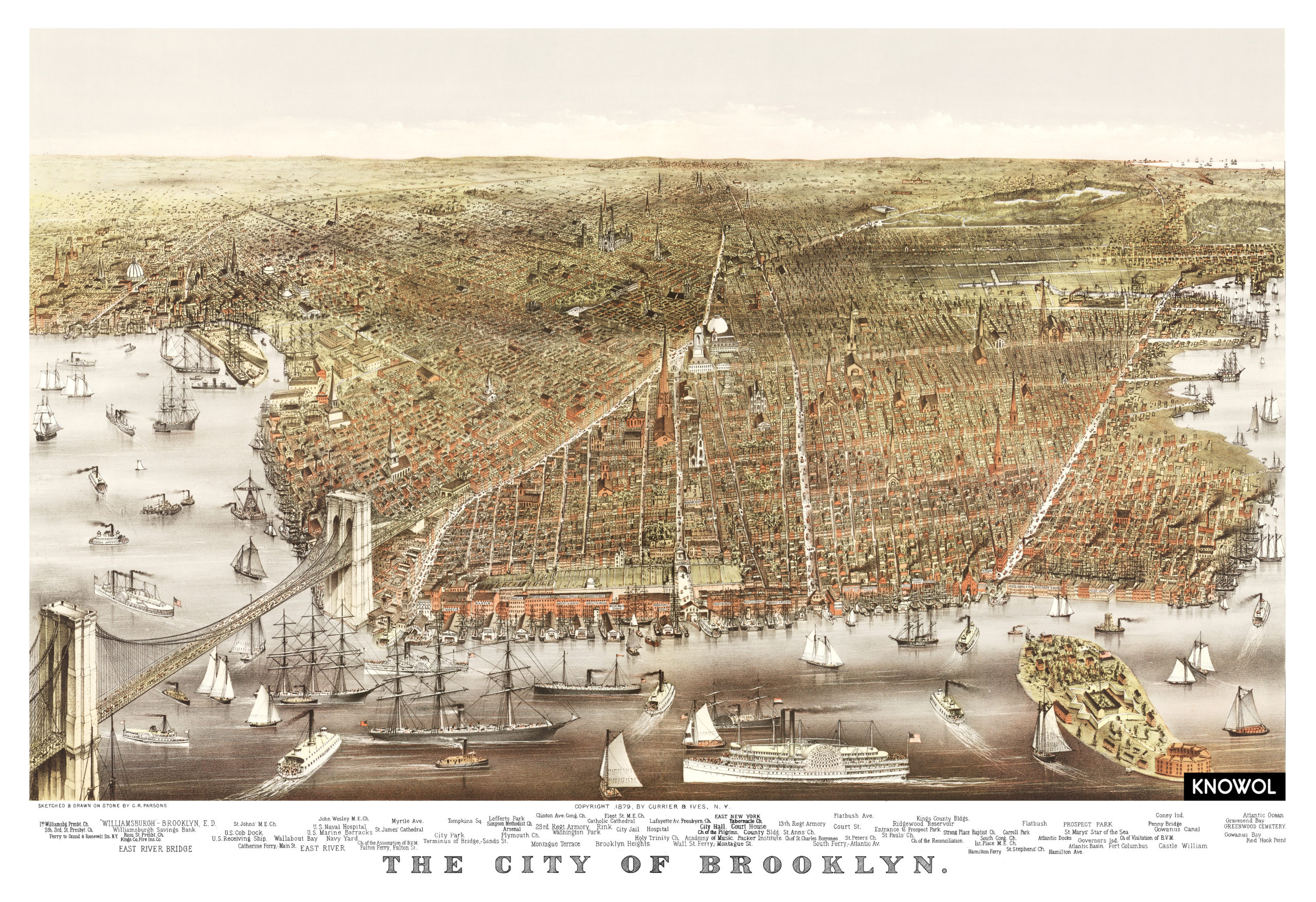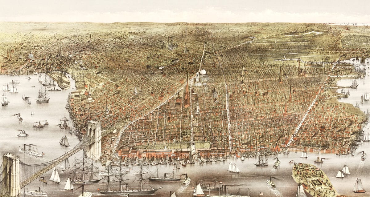
This map from 1879 shows Brooklyn, New York and the surrounding area. The map was created by Charles Richard Parsons, printed by Currier & Ives, and restored by KNOWOL. High resolution reproductions are available here.
The map includes Brooklyn landmarks such as City Park, Tompkins Square, Brooklyn Heights, Flatbush Ave, Gowanus Canal, Red Hook Point and more.
Click here to see a high resolution scan of the map.