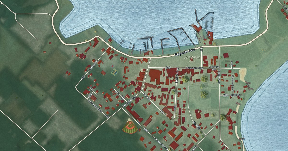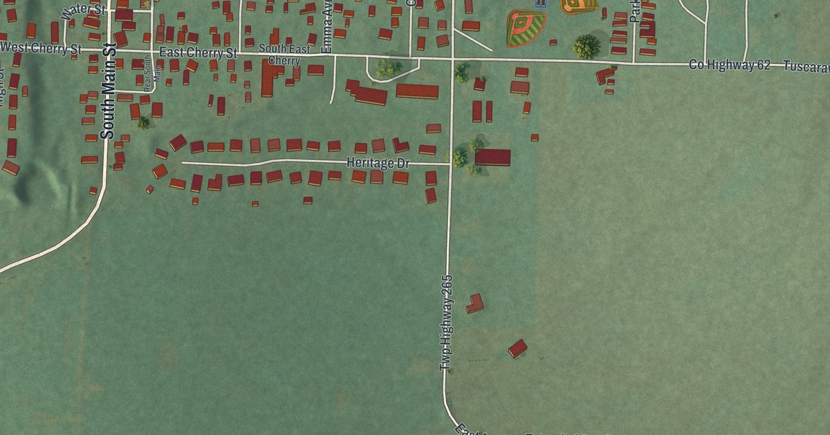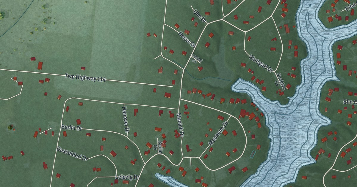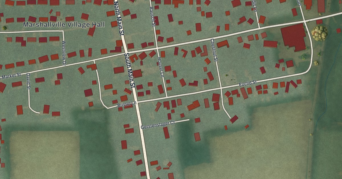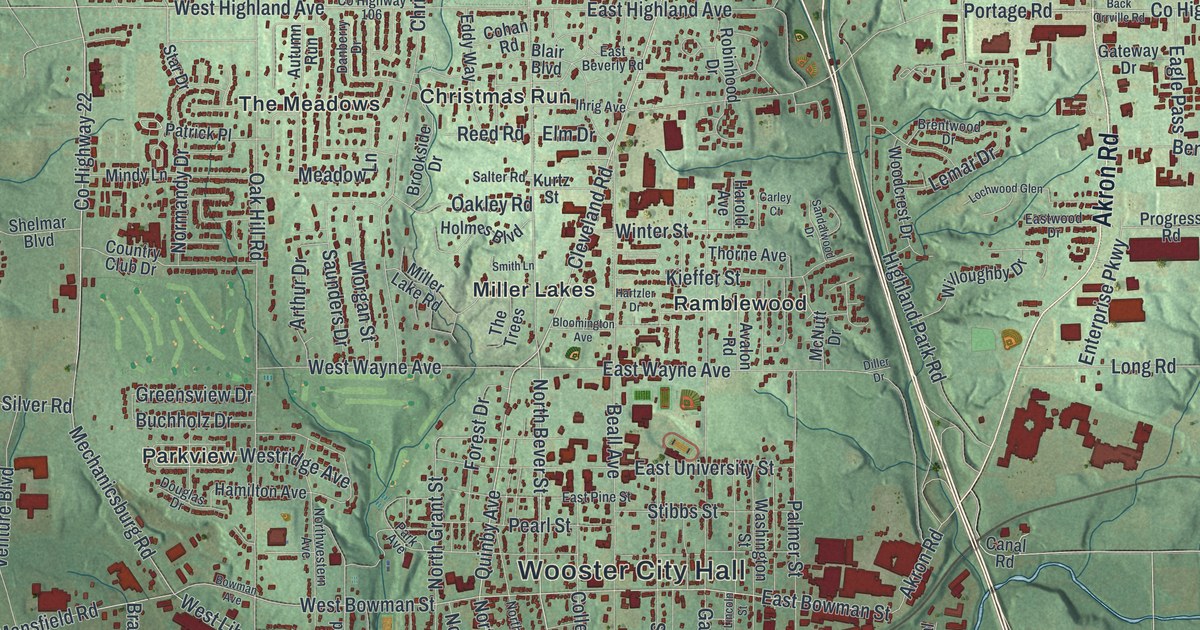
This beautifully detailed map of Wooster, Ohio was created in 2026 using aerial imagery combined with modern topographical, census, street and landmark data. It’s a one-of-a-kind view of Wooster that combines accurate data with a vintage aesthetic. The map shows every building in its true location, many of the roads carry their names, and the shaded topographic relief shows the shape of the land.
Explore an aerial view of Wooster, Ohio
On the map you’ll find Wooster City Hall, Madisonburg, Melrose Village, Deer Creek, Oak Hill Park, Wooster Cemetery, Boys Village, Christmas Run, Forest Creek, Madison Hill, Meadow Brook, Miller Lakes, and more. If you look closely you can even find your house accurately drawn in its correct location. Zoom in on the preview to look for yours.
Did you know this piece of Wooster, Ohio history?
John Bever, William Henry and Joseph Larwill founded Wooster in 1808. They named the town for David Wooster, a general who fought in the American Revolutionary War.
Take a closer look at the Wooster map
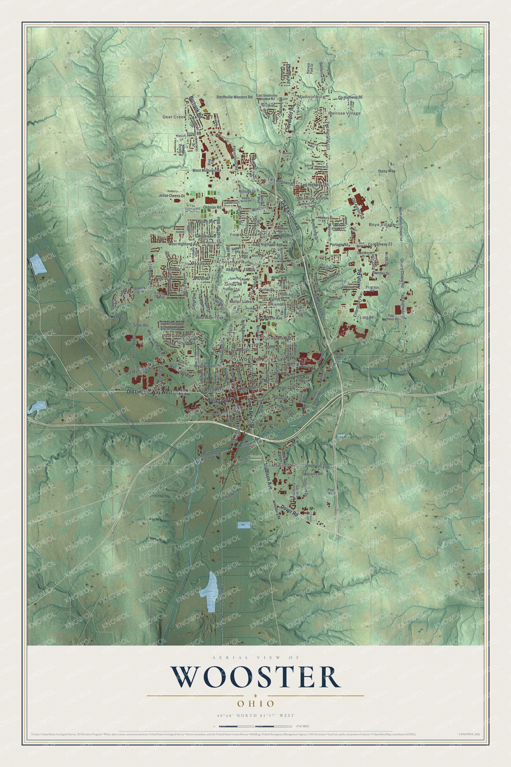
Street and place names on the Wooster, Ohio map
These names are printed on the map of Wooster, Ohio.
Places: Wooster City Hall, Madisonburg, Melrose Village, Deer Creek, Oak Hill Park, Wooster Cemetery, Boys Village, Christmas Run, Forest Creek, Madison Hill, Meadow Brook, Miller Lakes, Parkview, Ramblewood and The Meadows.
Streets and roads: West Liberty Street, South Bever Street, Madison Avenue, Dover Road, Cleveland Road, Old Lincoln Way West, Dix Expressway, Akron Road, Burbank Road, Pittsburg Avenue, North Market Street, Spruce Street.
More street names, A to Z
Amber Drive, Armstrong Drive, Arthur Drive, Autumn Run, Avalon Road, Back Orrville Road, Bannock Trail, Barrington Way, Beall Avenue, Benden Drive, Billiar Alley, Blair Boulevard, Bloomington Avenue, Bowman Avenue, Branstetter Street, Brentwood Drive, Brookside Drive, Buchholz Drive, Buena Vista Drive, Canal Road, Cannon Drive, Carley Court, Catalina Avenue, Cher Court, Christmas Run Boulevard, Cohan Road, College Avenue, Country Club Drive, Country Lane, County Highway 22, County Highway 23, County Highway 86, County Highway 106, County Highway 176, County Highway 359, County Highway 419, Daisy Way, Danberry Drive, Diller Drive, Dornoch Drive, Douglas Drive, Eagle Pass, East Beverly Road, East Bowman Street, Eastern Avenue, East Henry Street, East Highland Avenue, East Milltown Road, East North Street, East Pine Street, East Smithville Western Road, East South Street, East University Street, East Wayne Avenue, Eastwood Drive, Eddy Way, Elm Drive, Emalene Road, Emerick Street, Enterprise Parkway, Fairfield Drive, Forest Creek Drive, Forest Drive, Freedlander Road, Friendsville Road, Garrison Circle East, Garrison Circle West, Gasche Street, Gateway Drive, Geyers Chapel Road, Gossard Drive, Graustark Path, Greensview Drive, Greenwood Boulevard, Grosjean Road, Hamilton Avenue, Harold Avenue, Hartzler Drive, Harvest Park Drive, Hickory Lane, Highland Park Road, High Street, Hillside Drive, Holmes Boulevard, Hunters Chase Lane, Ihrig Avenue, Industrial Boulevard, Inverness Drive, Jesse Owens Drive, Kadas Lane, Kemrow Street, Kieffer Street, Kurtz Street, Lebby Drive, Lee Drive, Lemar Drive, Lincoln Street, Lochwood Glen, Logan Lane, Long Road, Maple Street, Mc Afee Road, McNutt Drive, Meadow Lane, Mechanicsburg Road, Mel Lane, Melrose Drive, Miller Lake Road, Millersburg Road, Mindy Lane, Montclair Avenue, Morgan Street, Neal Drive, Noble Drive, Nold Avenue, Normandy Drive, North Bauer Road, North Bever Street, North Buckeye Street, North Geyers Chapel Road, North Grant Street, Northview Drive, North Walnut Street, Northwestern Avenue, Nupp Drive, Oak Hill Road, Oakley Road, Ohio Street, Old Airport Road, Oldman Road, Old Mansfield Road, Oxenrider Lane, Palmer Street, Park Avenue, Patrick Place, Pearl Street, Pine Road, Pintail Lane, Point of View Drive, Portage Road, Prairie Lane, Progress Road, Quinby Avenue, Rebecca Street, Reed Road, Riffel Road, Ring Road, Robinhood Drive, Salter Road, Sandalwood Drive, Sarah Circle, Saunders Drive, Settlers Trce, Shelley Drive, Shelly Boulevard, Shelmar Boulevard, Silver Road, Skylark Avenue, Smith Drive, Smith Lane, Smithville Western Road, Snyder Drive, South Grant Street, South Market Street, Spink Street, Spring Brook, Star Drive, Stibbs Street, Stratford Way, Summerlin Drive, Taylor Street, The Trees, Thorne Avenue, Timken Road, Twp Highway 4, Twp Highway 68, Twp Highway 113, Twp Highway 184, Twp Highway 406, Twp Highway 420, Venture Boulevard, Washington Street, West Bowman Street, West Henry Street, West Highland Avenue, West Larwill Street, West Milltown Road, West Old Lincoln Way, Westridge Avenue, West South Street, West Wayne Avenue, Wildwood Drive, Williams Road, Willoughby Drive, Wilson Road, Winkler Drive, Winter Street, Woodcrest Drive, Woodlake Trail, Woodland Avenue, Young Drive.
See the Wooster, Ohio map on a wall
The Wooster map as an 18 x 24 inch print in a black frame.

This beautifully detailed map of Wooster makes an attractive addition to your office, library, or den, and it can even be used to teach children the geography and history of the area. It also makes a great gift for someone who left Wooster and still calls it home. When you’re done exploring, click here to get your copy of the Wooster map.