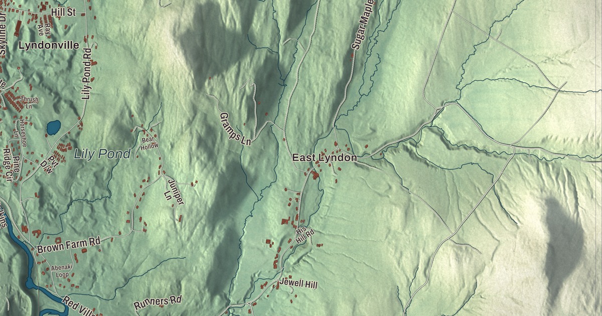
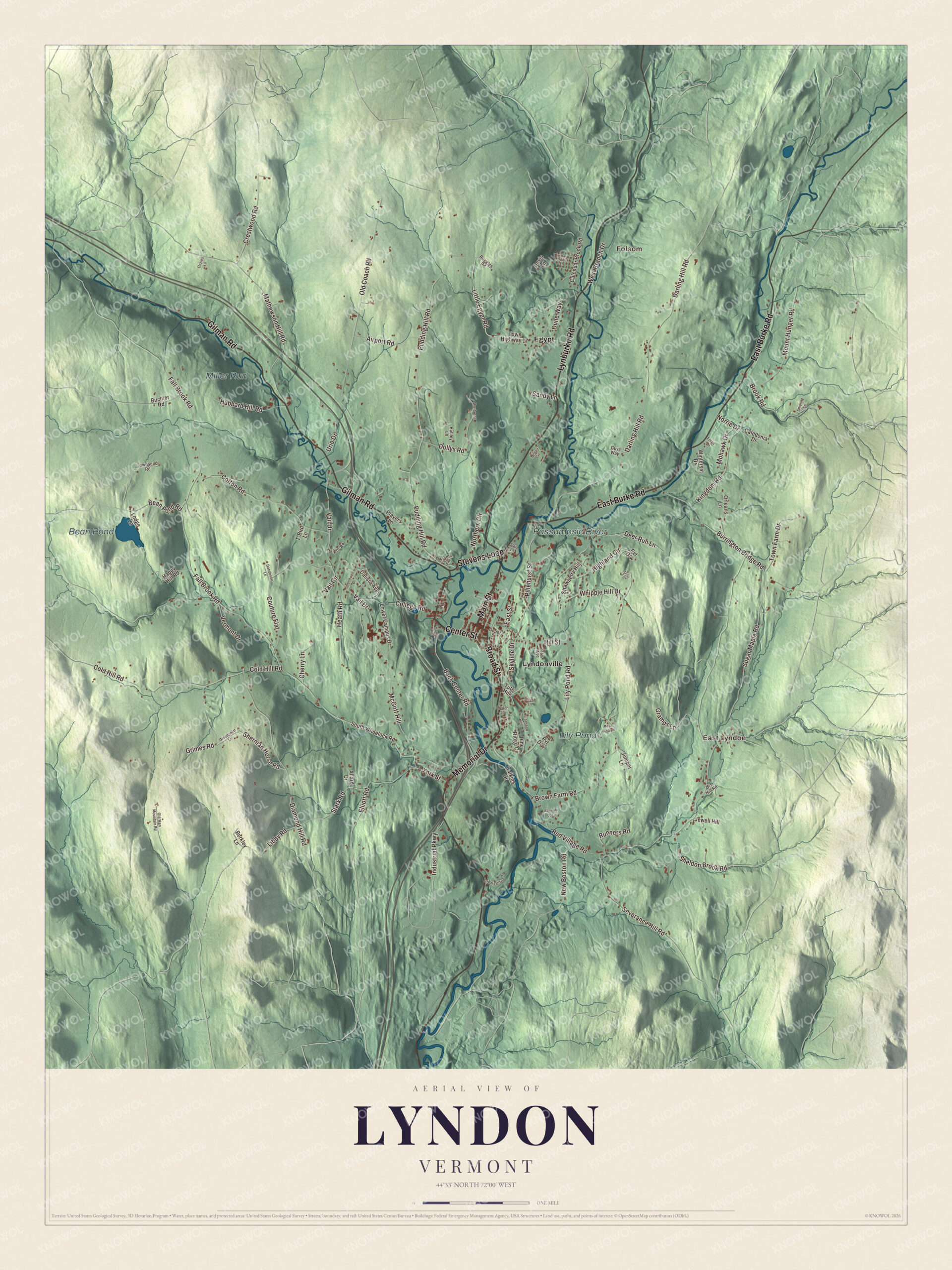
Lyndon is a town of five villages in the Passumpsic valley, and one of them, Lyndonville, began as a planned railroad village. This map prints Main Street, Broad Street, Memorial Drive, Gilman Road, East Burke Road and Lynburke Road, with Lyndonville, East Lyndon, Folsom and Egypt, the Passumpsic River, Bean Pond and Lily Pond.
Lyndon is a town in Caledonia County, Vermont.
KNOWOL made this map in 2026 from public survey data and gave it the look of an old county atlas, shading the hills from United States Geological Survey elevation data and drawing the roads and town line from the Census Bureau. The highest ground is Diamond Hill in the southwest, a little over 1,640 feet. Click here to purchase a print of this map for your wall.
A Rhode Island venture
The proprietors who secured the Lyndon grant came from Rhode Island, and many had served with the 2nd Rhode Island Regiment. Some held high rank, among them Jonathan Arnold and James Manning, president of Rhode Island College, later Brown University. Vermont granted the town on November 2, 1780, and Governor Thomas Chittenden signed its charter on November 20. The name likely honors Josias Lyndon, a former governor of Rhode Island and a friend of many of the proprietors. They took the grant as a business venture with no plan to live on it, and looked for settlers who would clear land in return for a share of it. Jonathan Arnold, Daniel Cahoon and Daniel Owen surveyed the town in 1781, settlement began in 1789, and by the 1790 census twelve families, 59 people, had made homes here. The town organized on July 4, 1791, and Daniel Cahoon Jr. went to the legislature in 1792.
The Passumpsic River runs through the middle of town and powered its early grist and saw mills. Lyndon Corner in the south incorporated as a village in 1792 and Lyndon Center in 1794, and the Hotel Lyndon went up at Lyndon Corner in 1807. About 1867 the Connecticut and Passumpsic Rivers Railroad passed both villages by, and business moved to Lyndonville. The town’s five villages today are Lyndonville, Lyndon Corner, Lyndon Center, Little Egypt in the north and East Lyndon in the southeast. The map labels the northern one simply Egypt.
Click to explore a larger preview. The digital watermark does not appear on printed maps.
Names on this map
These names are printed on this map.
Places: East Lyndon, Folsom, Bean Pond, Lily Pond, Miller Run, Passumpsic River, Egypt and Lyndonville.
Streets and roads: Main Street, Broad Street, Gilman Road, East Burke Road, Lynburke Road, Memorial Drive, Center Street, Stevens Loop, Stark Road, Elliott Road, Libby Road, Sheldon Brook Road.
More street names, A to Z
Abenaki Loop, Airport Road, Allard Drive, Back Center Road, Bean Pond Road, Bear Hollow, Berkley Lane, Boston Street, Brook Road, Brown Farm Road, Buchler Road, Burrington Bridge Road, Caledonia Drive, Calendar Brook Road, Calista Avenue, Calkins Drive, Cherry Lane, Cold Hill Road, College Road, Cotton Road, Couture Flat, Crestwood Road, Dandelion Lane, Darling Hill Road, Davis Lane, Deer Run Lane, Depot Street, Diamond Hill Road, Dollys Road, Dune Way, East Street, Fall Brook Road, Fiddle Lane, Forge Lane, Gramps Lane, Great Falls Drive, Greenpoint Lane, Grimes Road, Guys Way, Happy Hill Road, Harris Hill, Heath Road, Highland Circle, Hill Street, His Hill Road, Horseshoe Lane, Hubbard Hill Road, Hubley Lane, Industrial Parkway, Ingalls Lane, Jewell Hill, Juniper Lane, Kingdom Road, King Drive, Lily Pond Road, Little Egypt Road, Lodge Lane, Lower Campus Drive, Mathewson Hill Road, McGoff Hill, Mohawk Drive, Mount Hunger Road, New Boston Road, Norrie Drive, Northern Circle, Old Coach Road, Old Man Mountain Road, Orleans Lane, Ozzies Lane, Pinehurst Street, Pine Ridge Circle, Players Lane, Pudding Hill Road, Ralphs Road, Ray Avenue, Red Village Road, Ruggles Road, Runners Road, Sandy Lane, Severance Hill Road, Sherburne Place, Sherman Horse Road, Shieling Lane, Skyline Drive, Slate Lane, South Wheelock Road, Speedwell Drive, Strawberry Hill, Sugar Maple Road, T-Bird Lane, Thrush Lane, Town Farm Drive, Town Highway 17, Townsend Road, Tute Hill, Urie Drive, Vail Circle, Vail Drive, Vermont Drive, Vista Lane, West Branch Drive, Whipple Hill Drive, Wilson Circle, Winterset Drive, York Street.
See it on a wall
The Lyndon map as a framed print. Swipe for more.


Lyndonville
Lyndonville was founded in 1866, after a fire badly damaged the railroad’s buildings in St. Johnsbury and its officers moved those facilities up the valley, and it was planned as a railroad community. George Mathewson, who owned a sawmill and a small metal stamp factory, put up the Mathewson Block at 101 Main Street in 1869, the first brick commercial building in the village. It had tenants before it was finished and a hall for meetings upstairs, and its page says it’s the only major building downtown to come through two fires. On Depot Street, between Elm and Broad Streets, the brick Darling Inn was built in 1927 and 1928 to replace the Lyndon Hotel, which burned in 1924. A community fair has been held in Lyndonville every year since 1932.
Theodore Newton Vail, the first president of American Telephone and Telegraph, visited Vermont in 1883 and later bought a 1,500 acre farm in Lyndon, Speedwell Farms. Its page says the conferences held there culminated in the creation of AT&T. Vail built Vermont’s first paved road, from the railroad depot to his estate, according to the town’s page. In 1910 he founded the Vermont School of Agriculture on the campus of Lyndon Institute in Lyndon Center, which Free Will Baptists had opened in 1867, and as chairman of its trustees he saved the school from financial ruin in 1912. The teachers’ course that began at the Institute in 1911 became Lyndon State College, and in 1951 it moved into Vail’s empty estate, today the Lyndon campus of Vermont State University.
Five covered bridges
Lyndon keeps five 19th-century covered bridges built alike, with wide eaves, half-height siding and projecting portals. The Bradley Covered Bridge of 1878 carries Center Street over Miller Run just south of Gilman Road, and its page calls it the last of Vermont’s 19th-century covered bridges to carry a numbered state highway. The Centre Covered Bridge of 1872, one of three surviving Paddleford truss bridges in Vermont, was moved to its spot beside U.S. Route 5 north of Lyndonville in 1960. The Old Schoolhouse Bridge of 1871 is believed to be the only surviving 19th-century covered bridge with covered walkways on both sides, and the Burrington and Chamberlin Mill bridges complete the five.
Lyndon people
Elizabeth Rowell Thompson, born in Lyndon in 1821 to a farming family, went to work at nine as a maid for twenty five cents a week. After marrying the millionaire Thomas Thompson, she gave to temperance, women’s suffrage and science, becoming the first patron of the American Association for the Advancement of Science and paying for an observatory at Vassar College. Nicholas Baylies, a former justice of the Vermont Supreme Court, moved to Lyndon in 1835 and practiced law almost until his death. In the late 1930s and early 1940s the Lyndon Outing Club held a winter festival with dog sled races, ski jumping and sulky races on the cleared streets.
On the map, follow Main Street and Broad Street through Lyndonville, then take Memorial Drive, Gilman Road, East Burke Road and Lynburke Road. East Lyndon and Folsom are printed, and so is Egypt. The West Branch of the Passumpsic passes through Folsom Village on its way to meet the East Branch in Lyndonville. Bean Pond and Lily Pond are printed too. On Lily Pond Road stands Riverside, the Italianate estate built in 1866 for Dudley P. Hall, an owner of a lumber mill on the river. Lyndon dates to 1780.
This map of Lyndon is made for everyone who calls Lyndon home, and it shows the town as it looks today, from Lyndonville to East Lyndon. Hang it in an office, library or den, or use it to teach children the geography and history of their town. It’s printed on museum quality archival paper. Zoom in on the preview above to explore the details, then click here to get your copy of the Lyndon, Vermont map.

Sources
- Lyndon, Vermont, Wikipedia
- Town histories and representatives, L towns, Vermont Legislature
- Josias Lyndon, Wikipedia
- Lyndonville, Vermont, Wikipedia
- Mathewson Block, Wikipedia
- Darling Inn, Wikipedia
- Theodore Newton Vail, Wikipedia
- Lyndon Institute, Wikipedia
- Lyndon State College, Wikipedia
- Bradley Covered Bridge, Wikipedia
- Centre Covered Bridge, Wikipedia
- Old Schoolhouse Bridge, Wikipedia
- Burrington Covered Bridge, Wikipedia
- Elizabeth Rowell Thompson, Wikipedia
- Nicholas Baylies, Wikipedia
- Passumpsic River, Wikipedia
- Riverside (Lyndonville, Vermont), Wikipedia