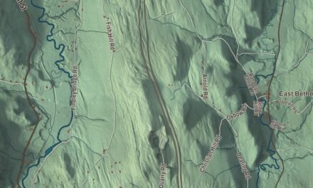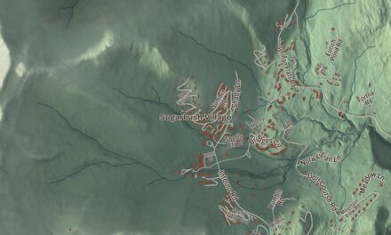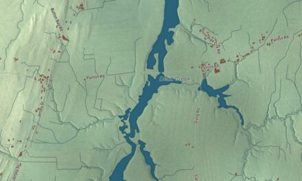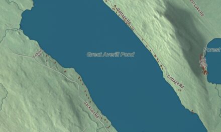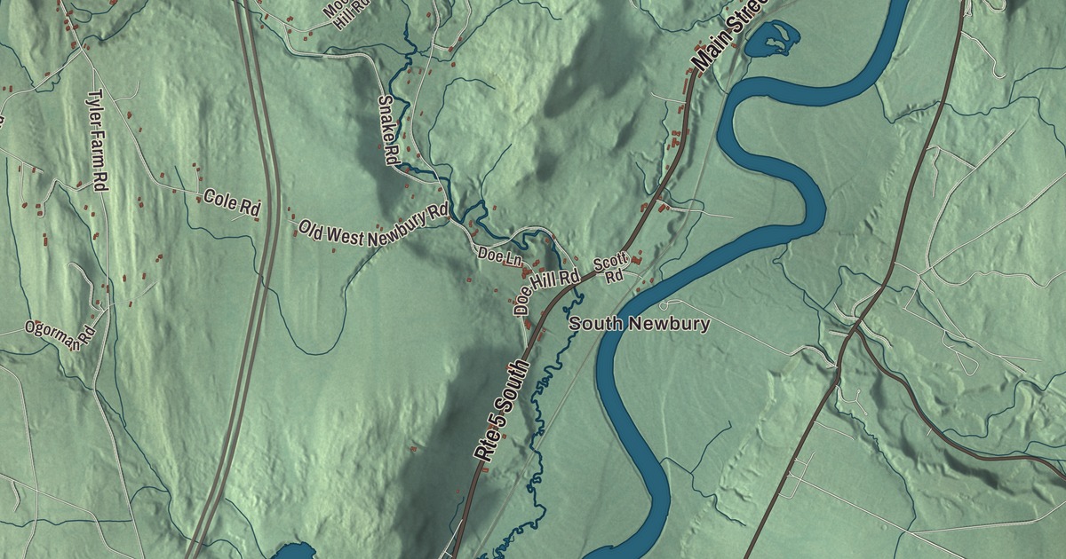
Newbury lies along the Great Oxbow of the Connecticut River, a big bend lined with rich farmland, and the town holds seven villages, from Wells River and Newbury on the river to West Newbury and Boltonville. This map prints Oxbow Road, Tyler Farm Road, Bowen Road, Scotch Hollow Road, Swamp Road and Leighton Hill Road, with South Newbury, Wells River, West Newbury, Newbury Center, Boltonville and Peach Four Corners.
Newbury is a town in Orange County, Vermont.
KNOWOL made this map in 2026 from public survey data and gave it the look of an old county atlas, shading the hills from United States Geological Survey elevation data and drawing the roads and town line from the Census Bureau. The town covers 64.4 square miles, and 2,293 people lived here at the 2020 census. Click here to purchase a print of this map for your wall.
Cowass and the Oxbow
Before English settlers came, the Pennacook had a village here called Cowass, or Cowassuck. In Abenaki the name means “place of pine trees,” and it was their name for the whole upper Connecticut valley; French Jesuit missions knew the village as Koés. The fertile intervale of the Great Oxbow was a favored place, with salmon in the river and trout in the brooks. In the fall of 1760, coming home from Montreal after the French and Indian War, Jacob Bayley and fellow officers John Hazen, Jacob Kent and Timothy Bedel found the Oxbow and chose it for a new home. They cleared fields the next summer, and Samuel Sleeper and his family were among the first settlers, in 1762.
On May 18, 1763, Governor Benning Wentworth of New Hampshire chartered Newbury to Jacob Bayley and 74 others, on the west bank of the Oxbow, and Haverhill, New Hampshire, on the east. Newbury was named for Newbury, Massachusetts, the hometown of Bayley and several of the others, and along with Haverhill it was the first colonial settlement on the Connecticut north of Charlestown, New Hampshire. Those first farmers had to carry their grain 60 miles by canoe to Charlestown to be ground into flour. Newbury was the southern end of the Bayley Hazen Military Road, whose southern 54 miles were built from 1776 to 1779 during the Revolutionary War. Bayley served as a brigadier general in the Continental Army, paid soldiers and war costs out of his own pocket, was never repaid, and died in Newbury in 1815, in his son’s house on Oxbow Road.
Oxbow Road and the river villages
The Bayley Historic District, along Oxbow Road about a mile north of Newbury village, holds some of the town’s oldest buildings, among them the son’s house of about 1785 and a district schoolhouse that the Daughters of the American Revolution bought in 1912. Along Route 5 in northern Newbury, the Oxbow Historic District keeps seven old farmsteads, six of them built before 1835, including a house Thomas Johnson built in 1775. Raising beef cattle and sheep and making wool and dairy goods were the main business of these meadows, and by 1859, when 2,984 people lived in town, Newbury also had two gristmills, a paper mill and a steam mill making mackerel kits.
Newbury village grew around its green as a market town and stagecoach stop, and it got a lift in the 1830s from the Newbury Seminary. The seminary first opened in Newbury in 1834, moved to Montpelier in 1868, and is the root of today’s Vermont College of Fine Arts, and Boston University traces its own roots to the Newbury Biblical Institute, a Methodist school founded here in 1839. The Newbury Village Historic District, 93 buildings on 73 acres around the green, includes the 1829 Methodist Church, the 1856 First Congregational Church, the Tenney Memorial Library of 1896 and the General Jacob Bayley Monument. Up the river, Wells River was first called Governor’s Right, for 500 acres granted to Wentworth himself. At the head of navigation on the Connecticut, it became a trading center, where boatmen poled canal boats downriver loaded with lumber, clapboards and shingles and came back with iron, salt, rum and molasses. The railroad reached it on November 6, 1848, and later lines made it a railroad junction across from Woodsville, New Hampshire.
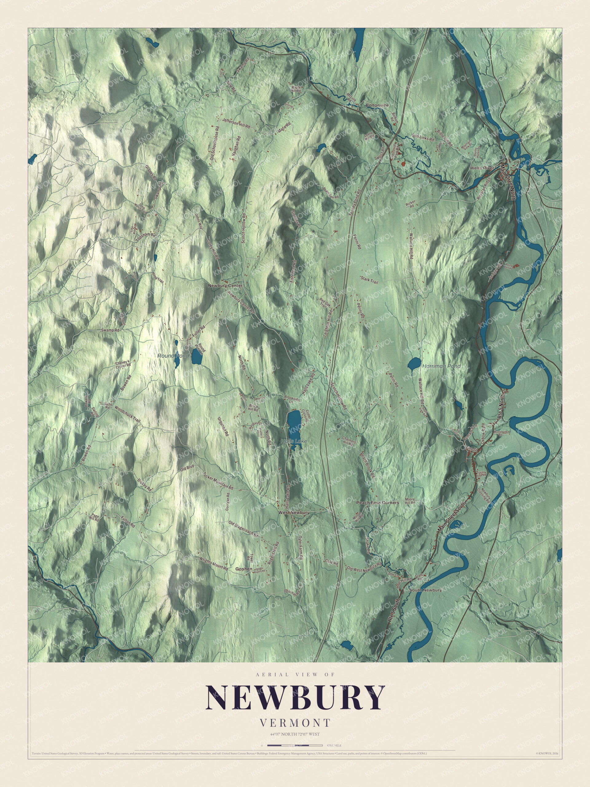
Click to explore a larger preview. The digital watermark does not appear on printed maps.
Names on this map
These names are printed on this map.
Places: South Newbury, Wells River, Halls Lake, Round Pond, Harriman Pond, Boltonville, Goshen, Newbury Center, Peach Four Corners and West Newbury.
Streets and roads: Main Street South, Route 5 South, Main Street North, Route 5 North, Oxbow Road, Tyler Farm Road, Bowen Road, Scotch Hollow Road, Swamp Road, Leighton Hill Road, Tucker Mountain Road, Wallace Hill Road.
More street names, A to Z
Bayley Hazen Drive, Bears Den Road, Bible Hill Road, Blueberry Hill Lane, Bolkum Road, Brock Hill Road, Brookside Lane, Cesari Road, Chalmers Hill Road, Cheney 4 Corner Road, Cole Road, Corey Hill Road, Corrigan Road, Critter Crossing, Darling Road, Deerfield Lane, Dempsey Lane, Dickey Road, Doe Hill Road, Doe Lane, Fish Pond Road, Fuller Road, Fulton Road, Gahn Road, Golf Links Road, Grapes Road, Halls Lake Road, Hood Trail, Industrial Park Road, Jefferson Hill Road, Jennings Lane, Johns Way, Ledger Road, Leete Hill Road, Lime Kiln Road, Mace Road, Maple Hill Road, McLure Road, Montebello Road, Moore Hill Road, Mountain View Drive, Newbury Center Road, Newbury Crossing Road, New Road, North Road, Ogorman Road, Old Boulevard, Old County Road, Old Farm Road, Old Schoolhouse Road, Old Stagecoach Road, Old West Newbury Road, Page Hill Road, Peach Brook Road, Perini Road, Pine Street, Powers Road, Putnam Road, Red Oak Trail, Ricker Road, Rogers Hill Road, Romance Lane, Round Barn Road, Round Pond Lane, Roystan Ridge, Saxie Welch Trail, Scott Road, Snake Road, South View Road, Stark Trail, Stevens Place, Tenney Pond Road, Thompson Road, Topsham Road, Tower Road, Trailer Park Road, Upper Rogers Road, Urquhart Road, Vaughan Road, Welch Road, Westgate Lane, Whitcher Road, Woodchuck Trail, Wrights Mount Road.
See it on a wall
The Newbury map as a framed print. Swipe for more.


Hill villages and the Town House
South Newbury, one of the first places settled in town, had its first mill on Hall’s Brook in 1764 and was a stop on the river stagecoach route until a new alignment of Route 5 passed it by. West Newbury, settled in the 1770s, grew up where Tyler Farm Road meets Tucker Mountain and Snake Roads, with a meetinghouse of 1833, Samuel Eastman’s store of 1841, and a district schoolhouse now owned by the local historical society. Near the middle of town, the Newbury Town House of 1839 stands on Scotch Hollow Road, midway between Fish Pond Road and Halls Lake Road, and it’s still used for elections. The Brock Hill Schoolhouse on North Road taught the upland children of District 8 until 1913, and Wildwood Hall, the shingled house locals call The Castle, has looked out over the valley from Moore’s Hill Road since 1895. Just over the line in Bradford, the Goshen Church of 1834 was built for a congregation founded by people of Bradford and Newbury who had broken away from stricter Calvinist Baptist congregations, and it still has no electricity. Camp Farwell, founded in 1889, is reported to be the longest-running girls’ summer camp in the United States.
Newbury people
The composer Jeremiah Ingalls led the choir at Newbury’s Congregational Church from 1791 to 1805, and people came from all around to hear it; his hymnbook The Christian Harmony came out in 1805, and a bicentennial edition was published for a Jeremiah Ingalls Society singing in Newbury. William T. Porter, born here in 1809, founded the sporting newspaper The Spirit of the Times in 1831. Henry W. Keyes, born in Newbury in 1863, became governor of New Hampshire and a United States senator, and he’s buried at the Oxbow Cemetery. Ernest N. Harmon, raised in West Newbury, rose to major general and in World War II reorganized the 1st Armored Division after the Battle of Kasserine Pass. Molly Gray, born in Newbury in 1984, served as Vermont’s 83rd lieutenant governor from 2021 to 2023, and the poet Sydney Lea, Vermont’s poet laureate from 2011 to 2015, lives in Newbury.
On the map, start at South Newbury and Wells River, then follow Oxbow Road, Tyler Farm Road, Bowen Road, Scotch Hollow Road, Swamp Road and Leighton Hill Road, and look out toward Boltonville, Goshen, Newbury Center, Peach Four Corners and West Newbury. Halls Lake, Round Pond and Harriman Pond are printed. Newbury dates to 1763.
This map of Newbury is made for everyone who calls Newbury home, and it shows the town as it looks today, from the Oxbow to West Newbury. Hang it in an office, library or den, or use it to teach children the geography and history of their town. It’s printed on museum quality archival paper. Zoom in on the preview above to explore the details, then click here to get your copy of the Newbury, Vermont map.

Sources
- Newbury (town), Vermont, Wikipedia
- Town histories and representatives, N towns, Vermont Legislature
- Jacob Bayley, Wikipedia
- Bayley Hazen Military Road, Wikipedia
- Bayley Historic District, Wikipedia
- Oxbow Historic District, Wikipedia
- Newbury (village), Vermont, Wikipedia
- Vermont College of Fine Arts, Wikipedia
- Wells River, Vermont, Wikipedia
- South Newbury Village Historic District, Wikipedia
- West Newbury Village Historic District, Wikipedia
- Newbury Town House, Wikipedia
- Brock Hill Schoolhouse, Wikipedia
- Wildwood Hall, Wikipedia
- Goshen Church, Wikipedia
- Jeremiah Ingalls, Wikipedia
- William T. Porter, Wikipedia
- Henry W. Keyes, Wikipedia
- Ernest N. Harmon, Wikipedia
- Molly Gray, Wikipedia
- Sydney Lea, Wikipedia